
Skip to content
Ghosts of DC

Ghosts of DC

  • The Best Of
  • Neighborhoods
    • Southwest DC
      • Waterfront
    • Maryland
      • Gaithersburg
      • Rockville
      • Bethesda
      • Hyattsville
      • Silver Spring
      • Bladensburg
    • Virginia
      • McLean
      • Falls Church
      • Alexandria
      • Vienna
      • Arlington
    • Southeast DC
      • Congress Heights
      • Navy Yard
      • Capitol Hill
      • Anacostia
    • Northeast DC
      • Trinidad
      • Woodridge
      • Deanwood
      • Brookland
    • Northwest DC
      • Tenleytown
      • Park View
      • Friendship Heights
      • Brightwood
      • Crestwood
      • Sheridan-Kalorama
      • The Palisades
      • Logan Circle
      • Petworth
      • Glover Park
      • Bloomingdale
      • Georgetown
      • Woodley Park
      • Dupont Circle
      • Columbia Heights
      • Cleveland Park
      • Adams Morgan
      • Mt. Pleasant
      • Chevy Chase
      • Cathedral Heights
      • Chinatown
    • Lost Neighborhoods
      • Hell’s Bottom
      • Swampoodle
      • Murder Bay
  • Notable People & Places
    • Places
      • Washington Monument
      • Library of Congress
      • The White House
      • The Capitol Building
      • Dulles Airport
    • People
      • Franklin D. Roosevelt
      • Calvin Coolidge
      • Officer Sprinkle
      • Dwight D. Eisenhower
      • Warren G. Harding
      • William McKinley
      • Abraham Lincoln
      • John F. Kennedy
      • Teddy Roosevelt
      • Woodrow Wilson

Transit

Long before Metro, Washington moved by streetcar, railroad, and horse-drawn carriage. These posts trace the history of how people got around the capital, from 19th century rail companies to the debates that shaped the modern transit system.

D.C. Must Have Subway System Eventually

May 11, 2026June 5, 2013 by ghostsofdc
November 25th, 1941 - Washington Post

The proposed subway would start near Key Bridge, running to Massachusetts Avenue at a point near Union Station and then eastward to the edge of the District.
Categories Lost History Tags 1940s, Transit 1 Comment

Why Is It Named Ballston? The Ball Family Behind Arlington’s Hub

May 21, 2026April 8, 2013 by ghostsofdc

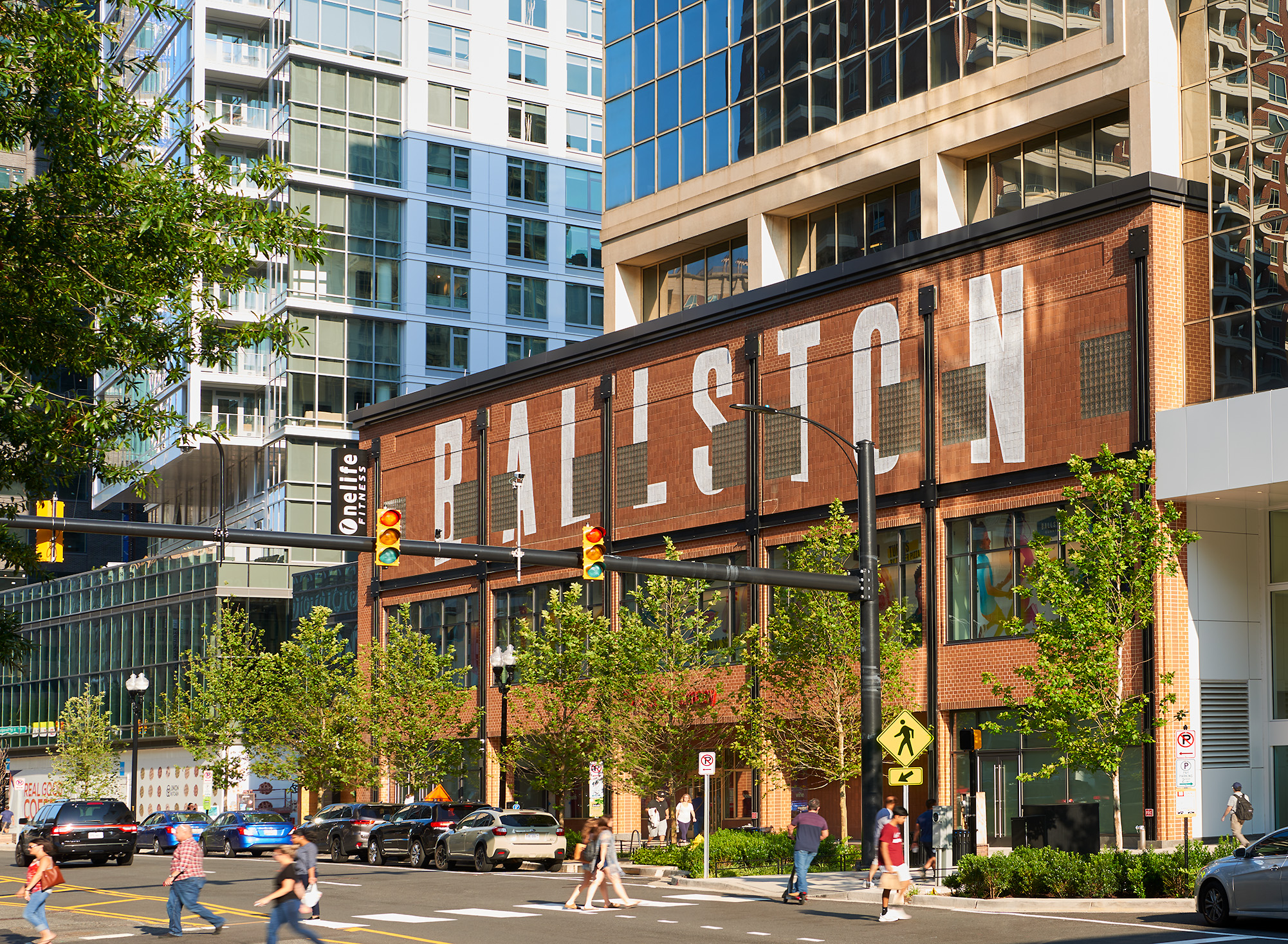
Before the towers and the Metro, Ballston was a log tavern at a dirt crossroads, run by a family George Washington called cousins.
Categories Why Is It Named...? Tags 1800s, Arlington, George Washington, Transit 15 Comments

Southern Railway Building: Fire, Then Federal Triangle

April 30, 2026March 25, 2013 by ghostsofdc
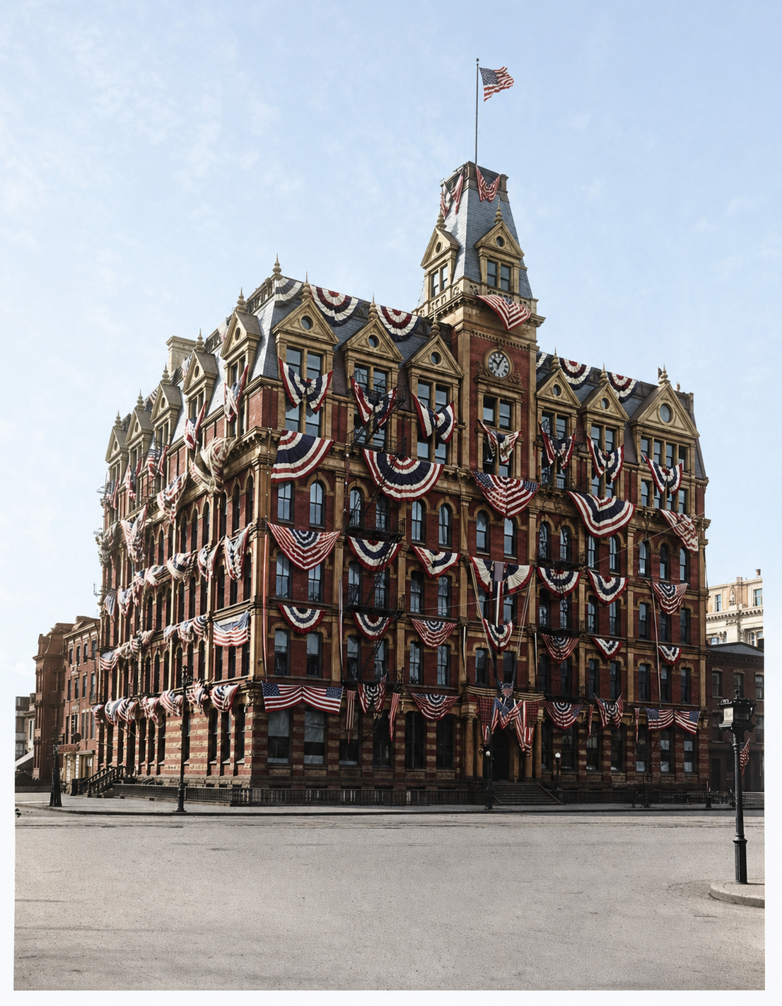
The Southern Railway Building at 13th Street and Pennsylvania Avenue NW, circa 1899-1916. The Library of Congress identifies the flags as probably for an inaugural event. This is the original Second Empire building, expanded in 1893 and 1899, that burned in April 1916. Library of Congress, National Photo Company Collection.

The Southern Railway Building stood at 13th and Pennsylvania for 50 years. Then it burned. Then the federal government paid $2.68 million to clear it for Federal Triangle.
Categories Lost History Tags 1910s, 1920s, 1930s, Architecture, Federal Triangle, Pennsylvania Avenue, Transit

Exploring the 1890 Baltimore and Ohio Railroad Route from Washington to Rockville

April 27, 2026February 27, 2013 by ghostsofdc
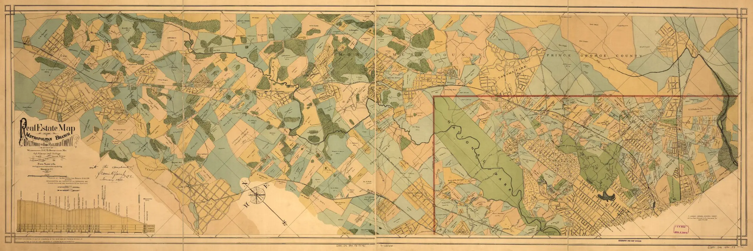
1890 B&O Railroad Map

Take a journey back in time with this 1890 map of the Baltimore and Ohio Railroad route from Washington to Rockville. Explore the history of this iconic railroad and its impact on the region.
Categories GoDCers Love Maps Tags 1890s, Transit

DC Metro Center Station: The 1969 Vision for the Subway Hub

May 6, 2026February 12, 2013 by ghostsofdc
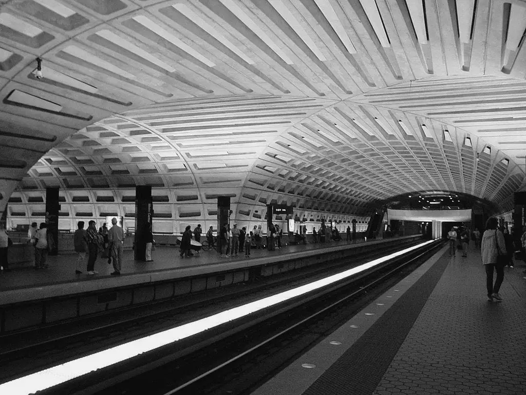
Metro Center today

In November 1969, the Washington Post detailed plans for Metro Center at 12th and G Streets NW: 31 escalators, a $15 million budget, and a 1972 opening. The actual opening slipped to March 1976.
Categories Historical Events Tags 1960s, Transit 1 Comment

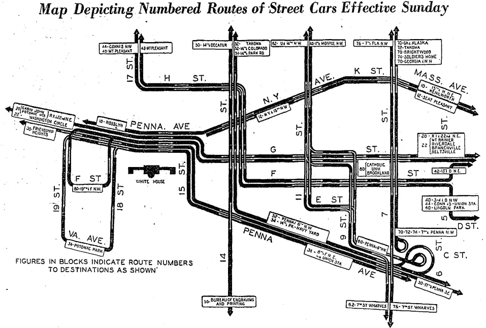
The 1936 Capital Transit Map That Ran Streetcars From Rosslyn to Beltsville

April 27, 2026January 29, 2013 by ghostsofdc
1936 streetcar map

A Capital Transit streetcar route schematic from 1936 shows 26 years before the last DC streetcar: routes to Rosslyn, Cabin John, Catholic U, Beltsville, and the 7th Street Wharves.
Categories GoDCers Love Maps, If Walls Could Talk, Lost History Tags 1930s, Key Bridge, Streetcars, Transit 3 Comments

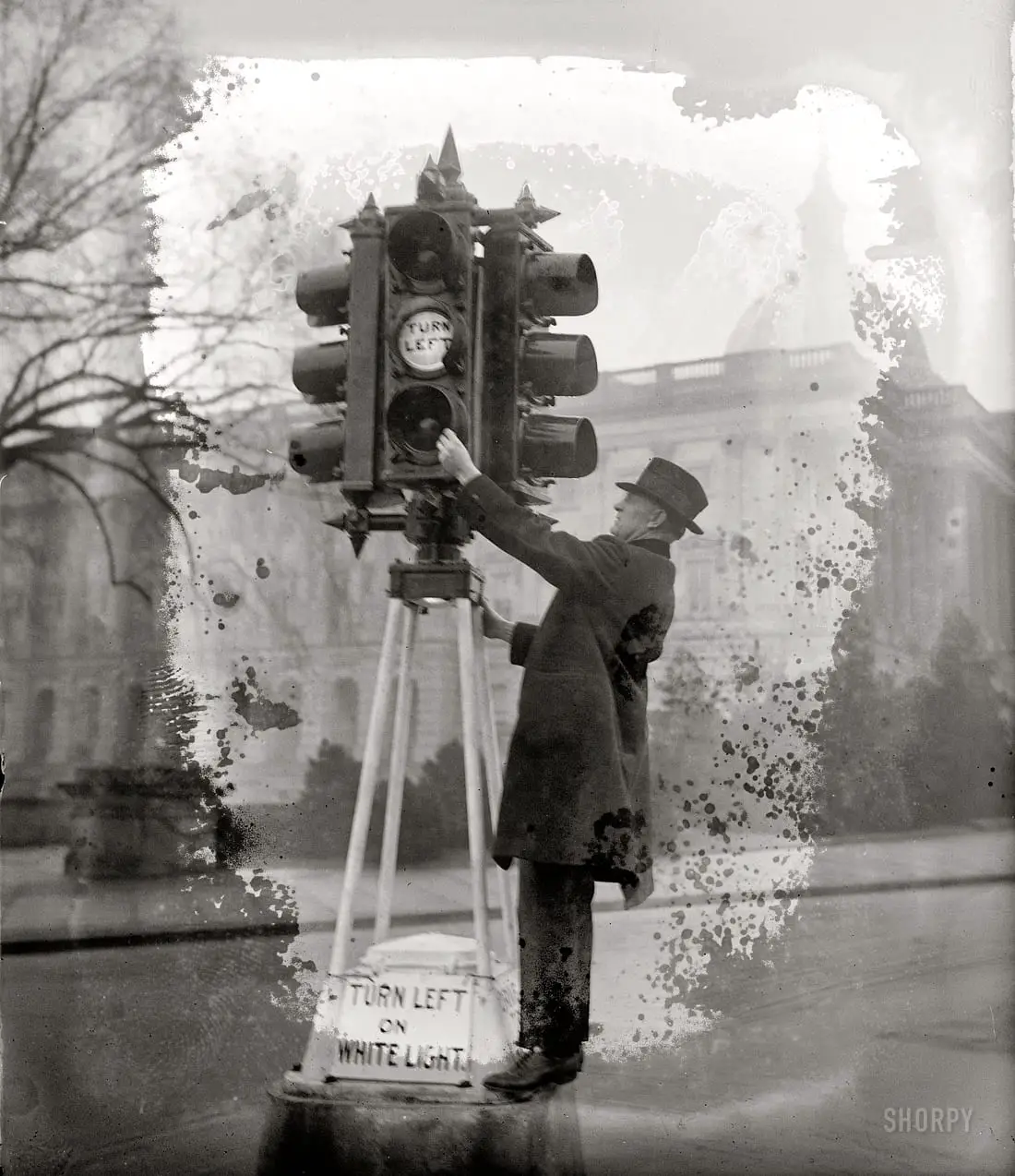
1920s Traffic Lights: How DC Killed the Amber-Before-Green

April 27, 2026January 28, 2013 by ghostsofdc
January 5, 1926. Washington, D.C. "Traffic Director Eldridge inspecting new lights." National Photo Company Collection glass negative.

In the 1920s, DC traffic lights flashed amber before green. By July 1927 drivers had ruined it, gunning their engines on amber. The District killed the cue.
Categories Lost History Tags 1920s, Cars, Politics, Transit 5 Comments

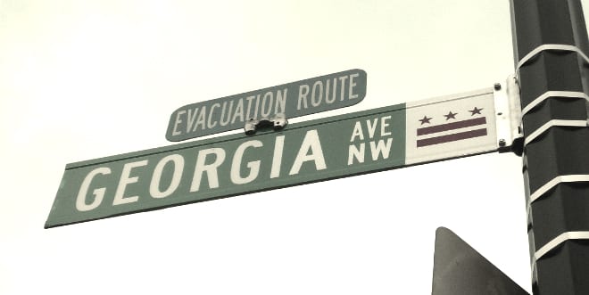
The Political Pressure behind Renaming Georgia Avenue in DC

April 27, 2026January 22, 2013 by ghostsofdc
Georgia Ave. street sign

Georgia Avenue was not always called Georgia Avenue. It was 7th Street NW until senators from Georgia and Wisconsin fought over L’Enfant’s city plan.
Categories Why Is It Named...? Tags 1900s, Congress, Politics, Transit 8 Comments

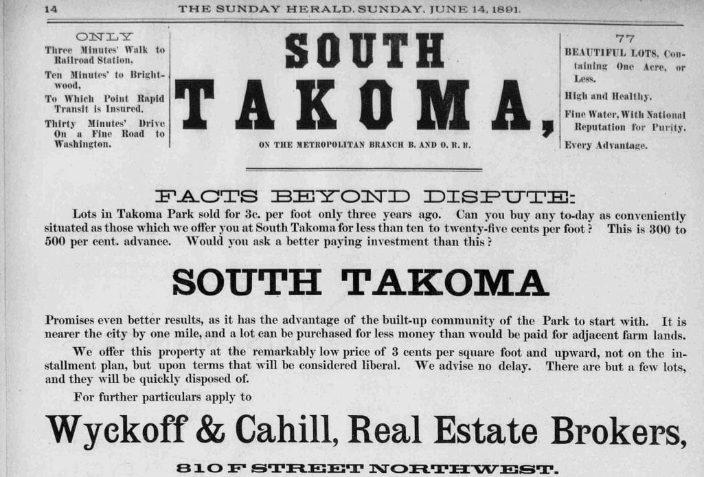
Exploring the History of Takoma Park (and Takoma), a Victorian Suburb of Washington, DC

April 27, 2026January 15, 2013 by ghostsofdc
Takoma advertisement in the Sunday Herald - June 14th, 1891

Discover the fascinating history of Takoma Park, a Victorian-era suburb of Washington, DC. Founded by Benjamin Franklin Gilbert in the late 19th century, explore the charming architecture and unique culture of this small neighborhood by the District line.

Categories Why Is It Named...? Tags 1880s, 1890s, Transit 3 Comments
Older posts
Newer posts
← Previous Page1 … Page4 Page5 Page6 Next →
Explore the Archive
The Best Of Old Ads & Classifieds Then and Now Lost History GoDCers Love Maps
From the Crazy Vault Faces & Places of Yesterday If Walls Could Talk Historical Events Notable People & Places
This Day in History Guest Posts Three Things… A Personal Story Why Is It Named…?
Ghosts of DC© 2012–2026 Ghosts of DC · AI Policy