The Big Chair in Anacostia: Lynn Arnold’s 42 Days in a Glass House
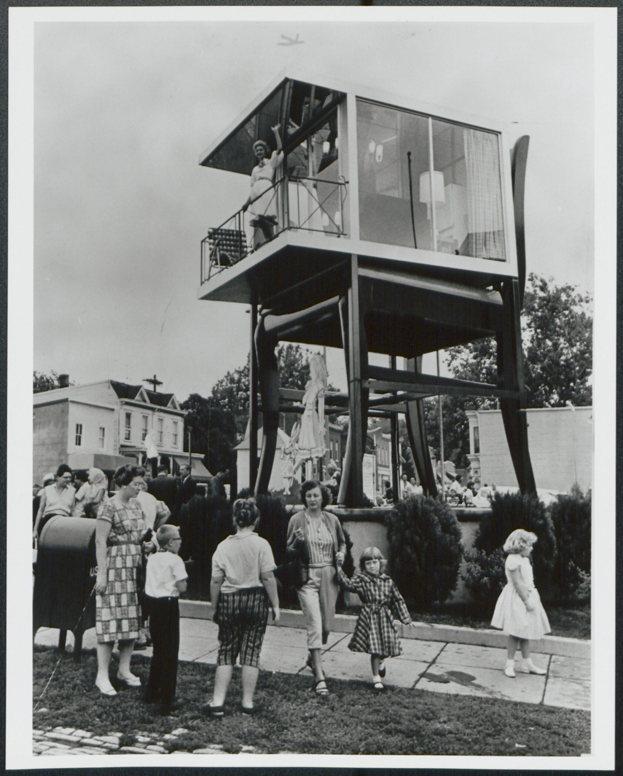
Charles Curtis had Bassett Furniture build a 19.5-foot mahogany chair outside his Anacostia showroom in 1959. A year later, model Lynn Arnold moved into a glass house on top of it for 42 days. The chair is still there.