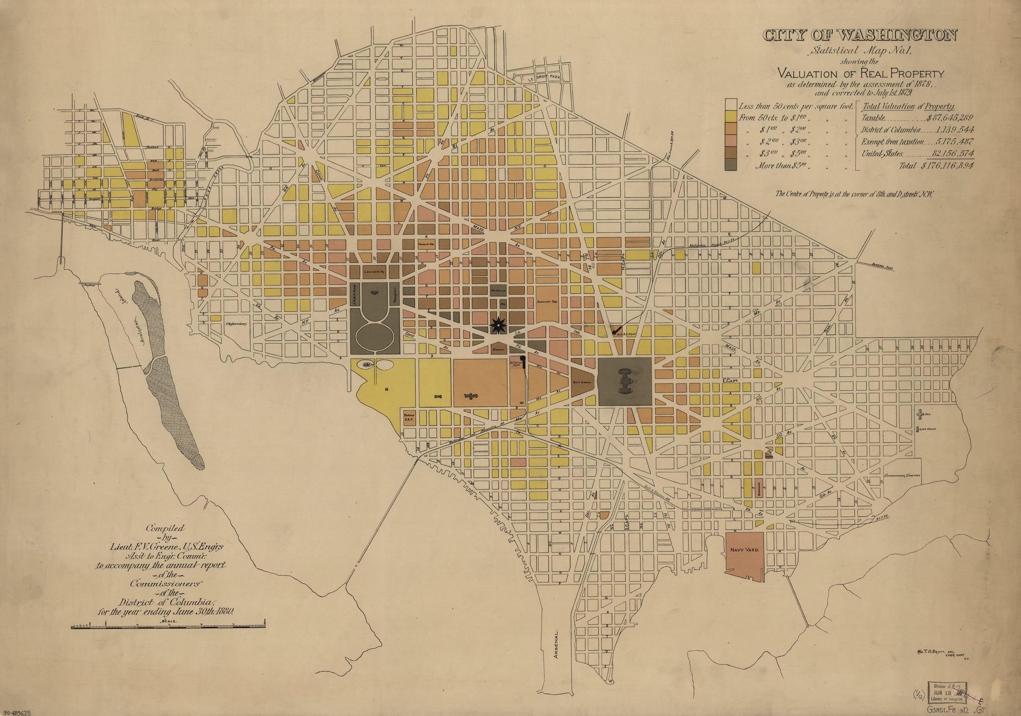
Interesting … it appears that property in Shaw and Mt. Vernon square is worth three to four times more that in Dupont Circle. This is a fascinating map and we know GoDCers love maps. Click the map for greater detail.
City of Washington, statistical maps / compiled by Lieut. F.V. Greene, assistant to the Engineer Commissioner, July 1st 1880 ; compiled by Lieut. F.V. Greene, U.S. Eng’rs … to accompany the annual report of the Commissioners of the District of Columbia for the year ending June 30th 1880 ; Wm. T.O. Bruff, del., Eng’r Dept., D.C.
This is another amazing piece from the Library of Congress.
4 thoughts on “Shaw, Mt. Vernon Square, and Dupont Circle: A 19th-Century Property Value Comparison”
Wow, it looks like the cumulative value of the land in DC in 1880 is equivalent to the cost to rent an 800 sq ft apartment on Capitol Hill today!
Dupont Circle was not developed until after the 1890’s.
Until the trolley went underground in the late 40 ‘s, the tracks went around the circle, on the west side, thanks to the wishes of Sissy Paterson. I was Ruth Crane’s cameraman on her “Modern Woman” program on WMAL-TV, channel 7, back in the day.
Miltw@
Never really noticed that the White House property, is so much bigger than where the US Capital sits.