
Why the Pentagon Has Five Sides: It’s Not What You Think
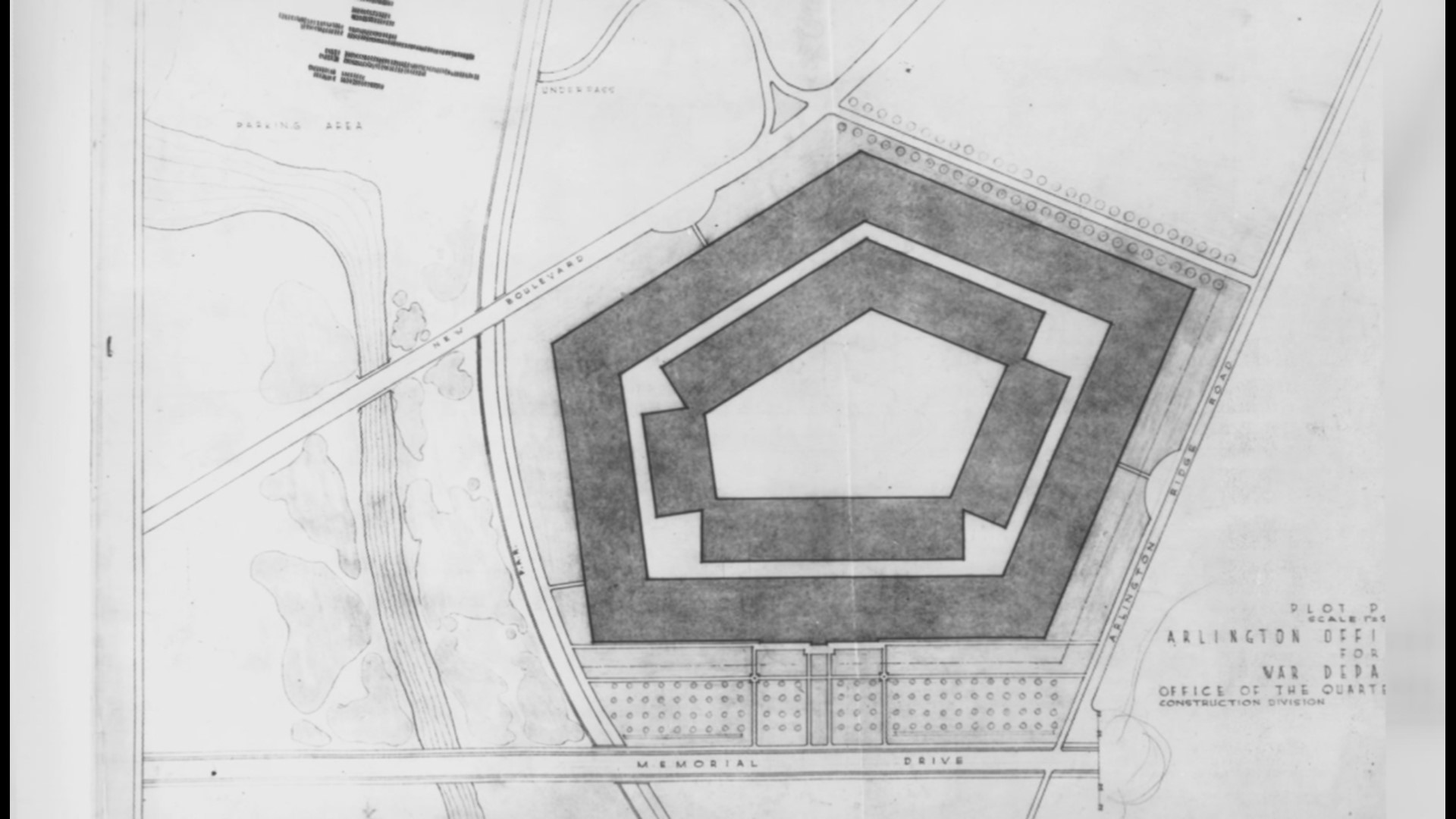
The Pentagon wasn’t designed to be five-sided. In 1941, architects had 72 hours to fit a building around a five-road intersection. The shape stuck.
Just across the Potomac from Washington, Arlington has its own history shaped by the Civil War, the growth of the Pentagon, and the transformation of Northern Virginia from farmland to one of the country’s most densely developed suburbs.
The Pentagon wasn’t designed to be five-sided. In 1941, architects had 72 hours to fit a building around a five-road intersection. The shape stuck.
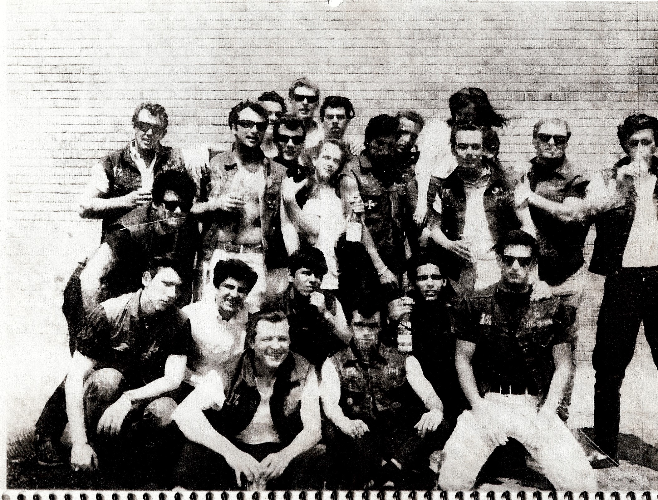
In June 1966, the Pagans and Avengers shot it out in broad daylight at the Lee Harrison Shopping Center in Arlington. Eleven bikers went to prison.
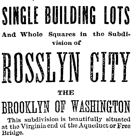
Explore the 1889 ambition of Rosslyn City, touted as the “Brooklyn of Washington,” and its emblematic journey of urban aspirations and challenges.
In 1792, landowners founded Centreville to be the geographic center point between Alexandria, Georgetown, and Leesburg.

Electric railways drove Arlington’s transformation from rural to suburban between 1892-1941. This history shows how rail paved the way for the county’s growth.
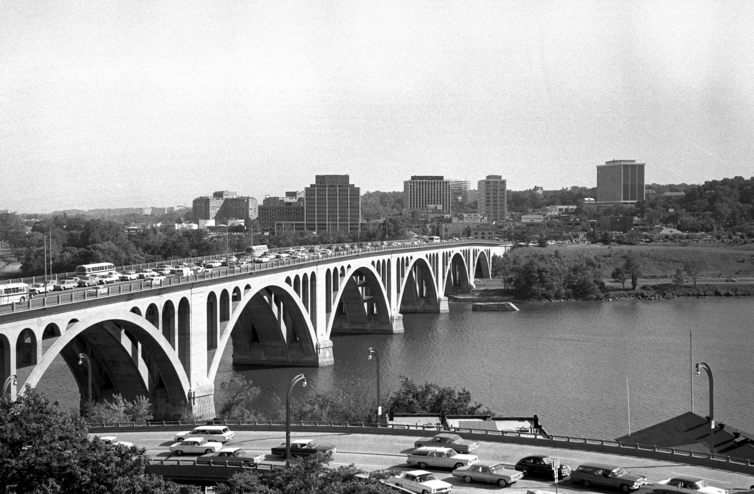
Take a journey back in time to 1964 with this photo of Rosslyn, DC, taken from Georgetown. Get a glimpse of what the city looked like over half a century ago.
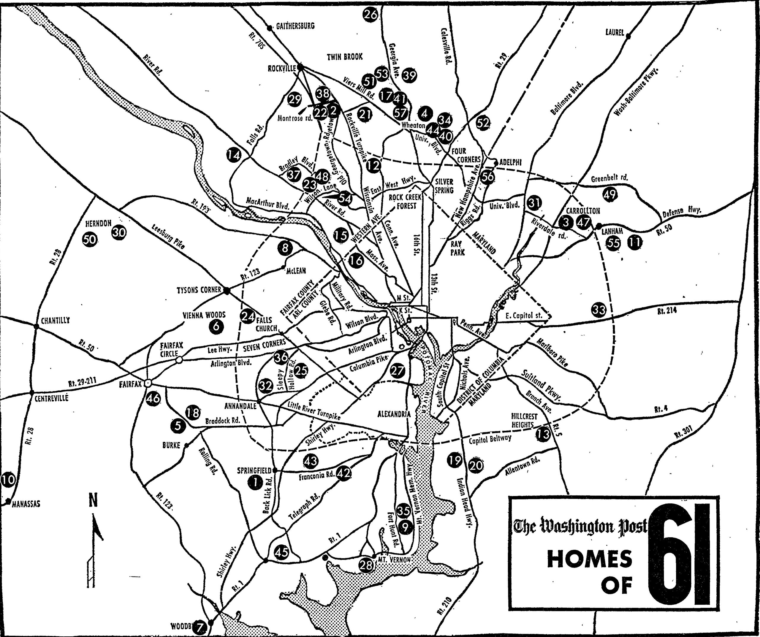
A 1961 Washington Post map plots every real estate subdivision ringing the city, capturing the postwar suburban explosion in Maryland and Virginia.
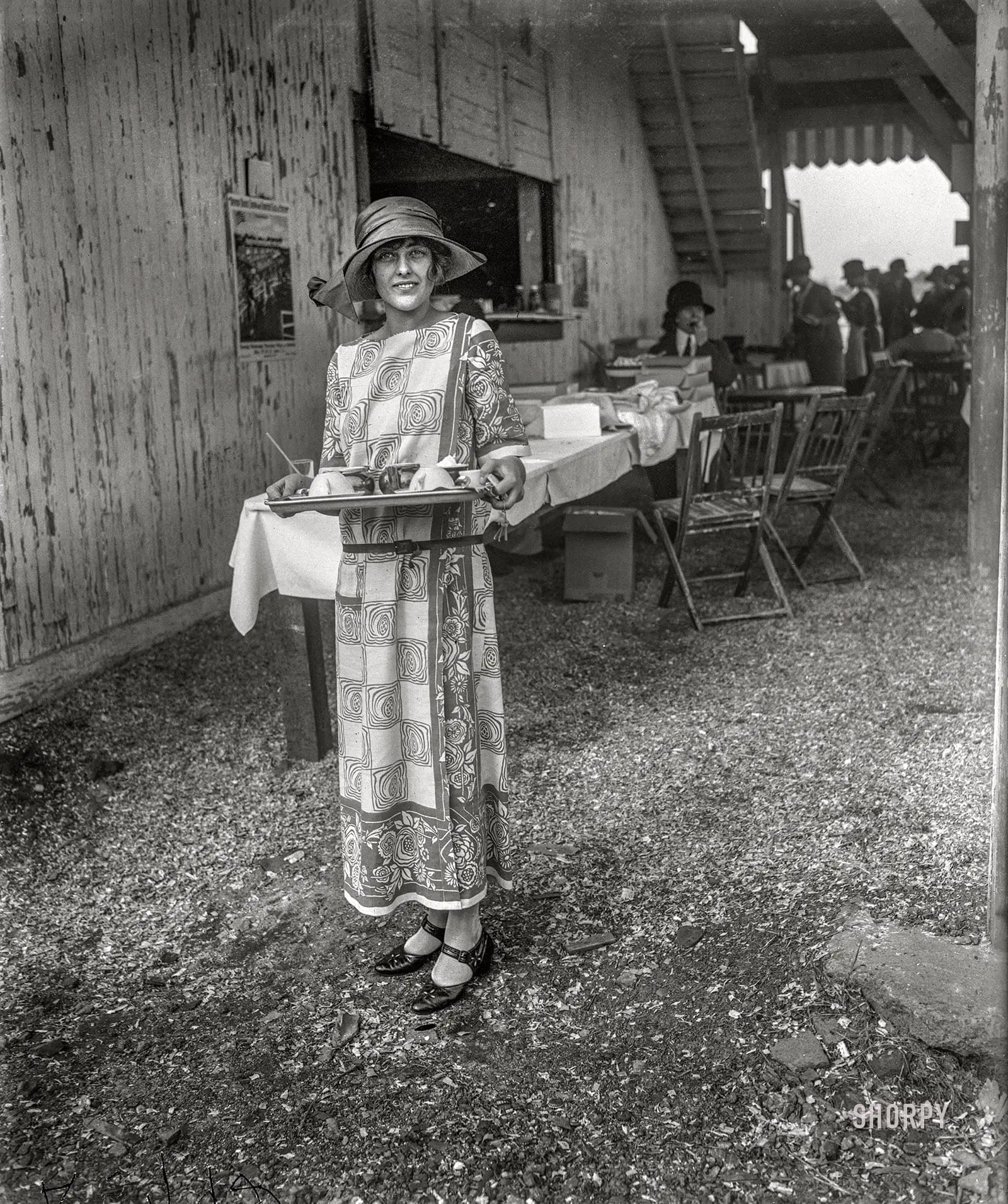
Young Evelyn Wadsworth was the daughter of the senator from New York and the granddaughter of John Hay, former personal secretary to Abraham Lincoln.
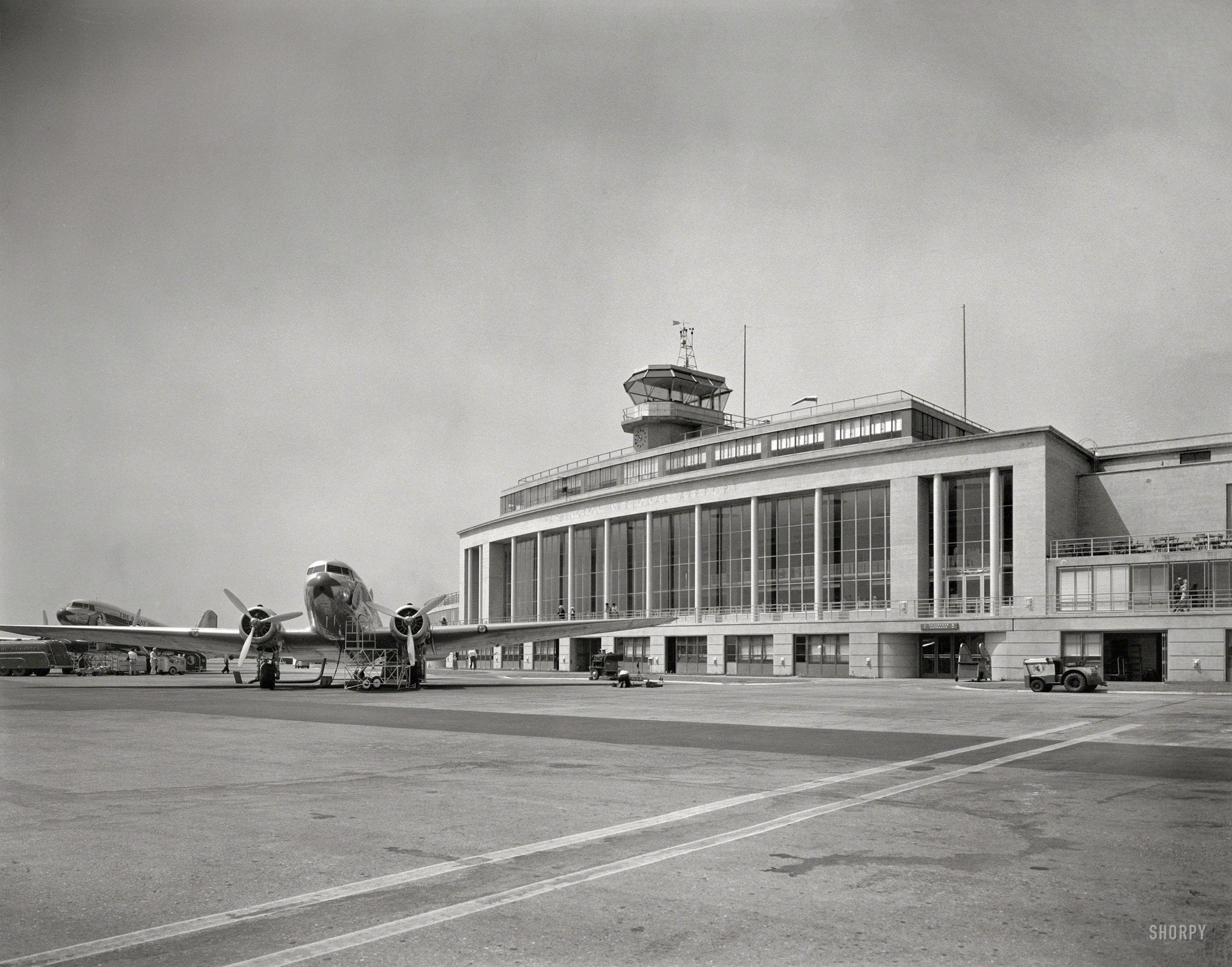
Discover the history of National Airport with a fascinating look back at the old terminal building in 1941. From its humble beginnings as Hoover Field to its critical role in World War II and subsequent expansion, learn about the changes that have shaped this important transportation hub in the heart of the nation’s capital.