-ad 189-

Posted In Arlington VA

028_1220_N_FILLMORE_ST_UNIT_609_255713_411772
Why Is It Named Clarendon?
Clarendon started as a development off of the Georgetown to Falls Church road (now Wilson Blvd.) and the Washington, Arlington, Falls Church Railway.
Screen Shot 2015-02-21 at 9.22
Explore Virginia in Unprecedented Detail with this Incredible Civil War Map
Discover an incredible Civil War map of part of Virginia from Alexandria to the Potomac River above Washington, D.C. Click on the image for a much larger version. Source: Library of Congress.
VIEW OF WASHINGTON MONUMENT FROM THE VICINITY OF CAPITAL OVERLOOK, 1932. - George Washington Memorial Parkway, Along Potomac River from McLean to Mount Vernon, VA, Mount Vernon, Fairfax County, VA
A View of the Washington Monument From the George Washington Memorial Parkway
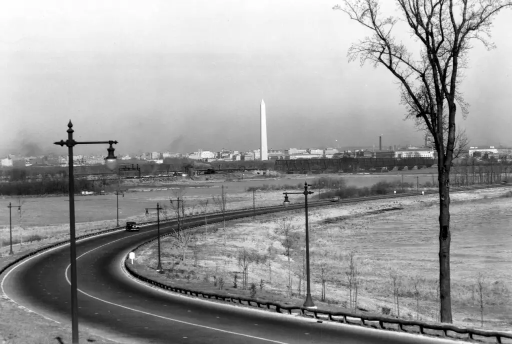
Take a look at this amazing view of the Washington Monument from the George Washington Memorial Parkway. What do you think? Check out GhostsofDC.org for more!
Screen Shot 2015-03-06 at 9.38
Exploring the History of Arlington County: A Look at an 18th Century Map
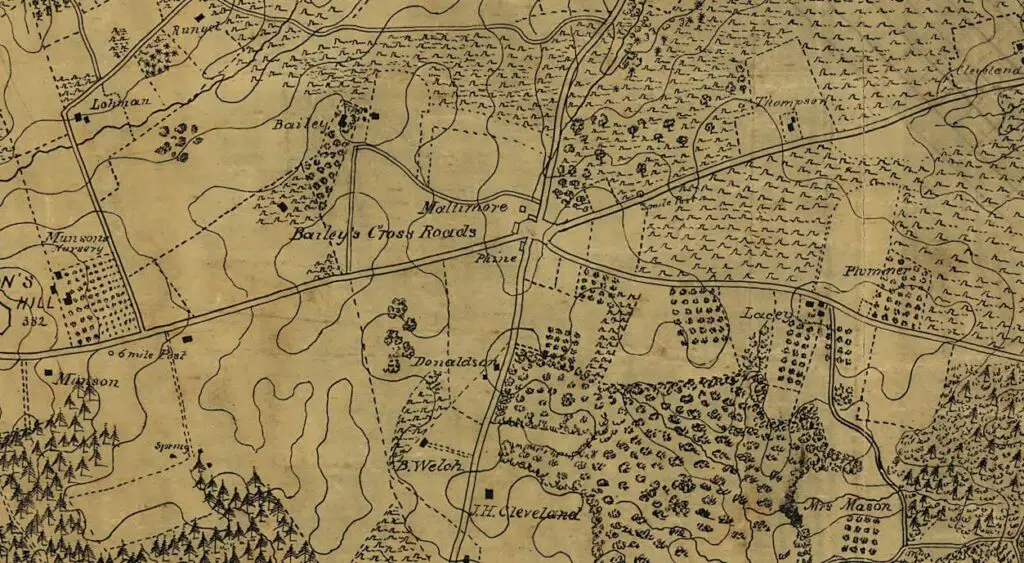
Take a look at this fascinating 18th century map of Arlington County and discover why it was named Arlington. Find out more about the history of the county with this interesting blog post!
AERIAL VIEW OF WEST/FRONT AND NORTH/SIDE FACADES, LOOKING SOUTHEAST (FROM LEFT TO RIGHT): VA-1272 Ball Building, 1437 N. Court House Road. VA-1273 Jesse Building, 1423-27 N. Court House Road. VA-1276 Jesse-Hosmer Building, 1419 N. Court House Road. VA-1275 Moncure (Adams, Porter, Radigan) Building, N. 1415 Court House Road. VA-1274 Rucker Building, N. 1403 Court House Road. - Lawyers' Row Block, North Court House Road between Fourteenth & Fifteenth Streets, Arlington, Arlington County, VA
A Trip Down Memory Lane - Exploring the "Lawyers' Row Block" in Arlington from the Early 1990s
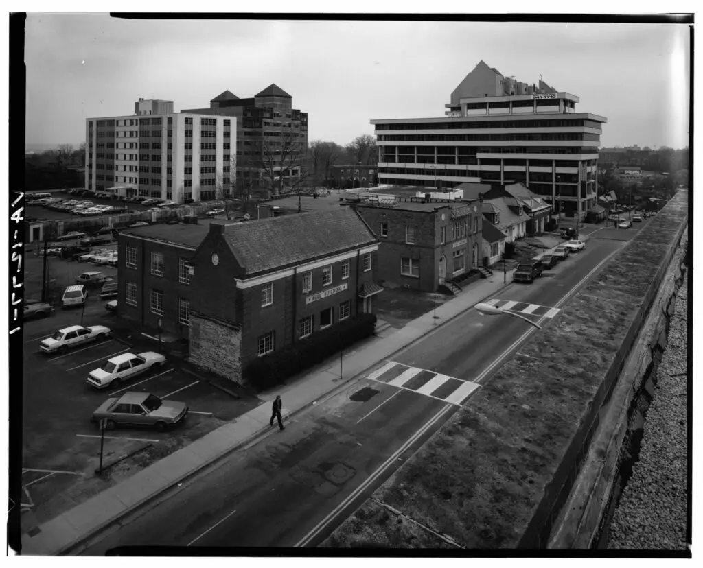
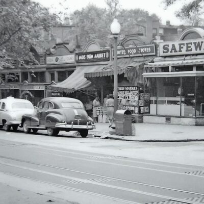
Take a virtual trip down memory lane and explore the "Lawyers' Row Block" in Arlington during the early 1990s. See how this area has changed from then to now with a comparison of images from the Library of Congress and Google Street View.
Washington & Lee High School
Take a Look at Washington & Lee High School in 1916
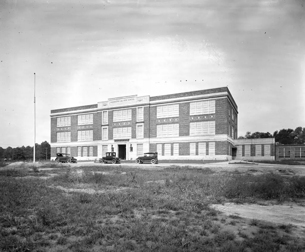
Take a look at this amazing old photo from 1916 of Washington & Lee High School. This school has some notable alumni including Sandra Bullock, Warren Beatty, and Shirley MacLaine. Visit our blog to learn more!
N. Moore & 19th - Source: rosslynva.org
Dead Man's Hollow: A Dark History of Rosslyn and Arlington
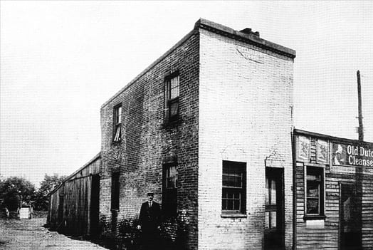
Discover the dark history of Rosslyn and Arlington, VA, in the late 19th & early 20th century, including the notorious Dead Man's Hollow. Learn about infamous murders, robberies and more in this blog post from Ghosts of DC.
Plat of Curtis & Burdett's subdivision of Carlin Springs, Alexandria County, Virginia : 260 ft. above sea level
Evolution of Carlin Springs Subdivision in Alexandria (Now Arlington County)
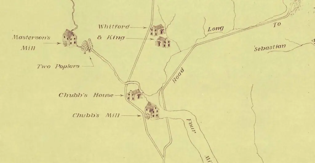
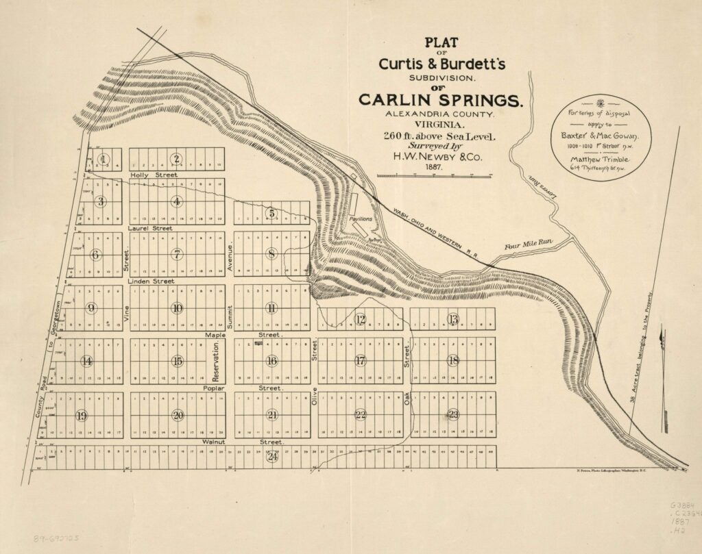
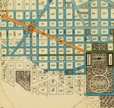
Take a look at the evolution of Carlin Springs Subdivision in Alexandria, now Arlington County. See a map from 1890 and compare it to a map from today. Visit the Library of Congress to learn more.
Glebe Rd. and 13th
Glebe Road: History of Modern Day Arlington County
Learn about Glebe Road. It dates back to the 1700s and initially was known as the "Road to the Falls" taking travelers from Alexandria to Great Falls.
Screen Shot 2014-01-17 at 10.19
Compare and Contrast: 1940s Aerial Photo of Washington and Google Map
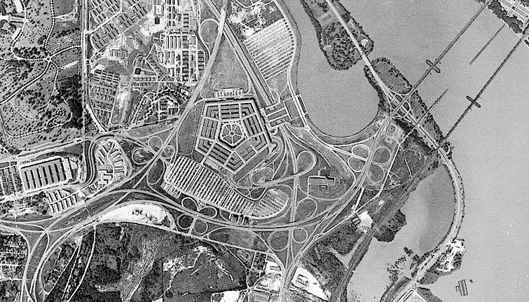
GoDCer Chris graciously shared an aerial photo of Washington from the 1940s. Compare and contrast it to the Google Map for a fascinating look into the past.

Enjoy daily

Ghosts of DC stories.