-
When a Rolling Stone Got Robbed at Washington Coliseum
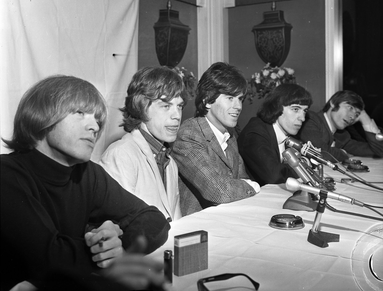
In 1966 a teenager from Chevy Chase reached through the window of a Rolling Stones equipment van behind Washington Coliseum and walked off with Brian Jones’s custom electric dulcimer. The recovery involved a letter to the Evening Star, a Bentley…
-
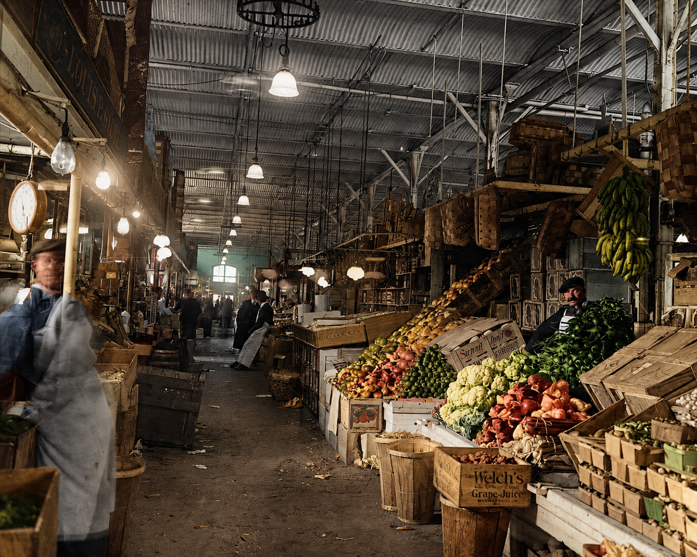
Center Market: Adolph Cluss’s 1872 Pennsylvania Avenue Hall That Became the National Archives
How a German-immigrant friend of Karl Marx designed the country’s largest market hall on Pennsylvania Avenue in 1872, why it ran for 59 years with 666 stalls and a refrigeration plant, and why the federal government tore it down in 1931 to build the National Archives.
-
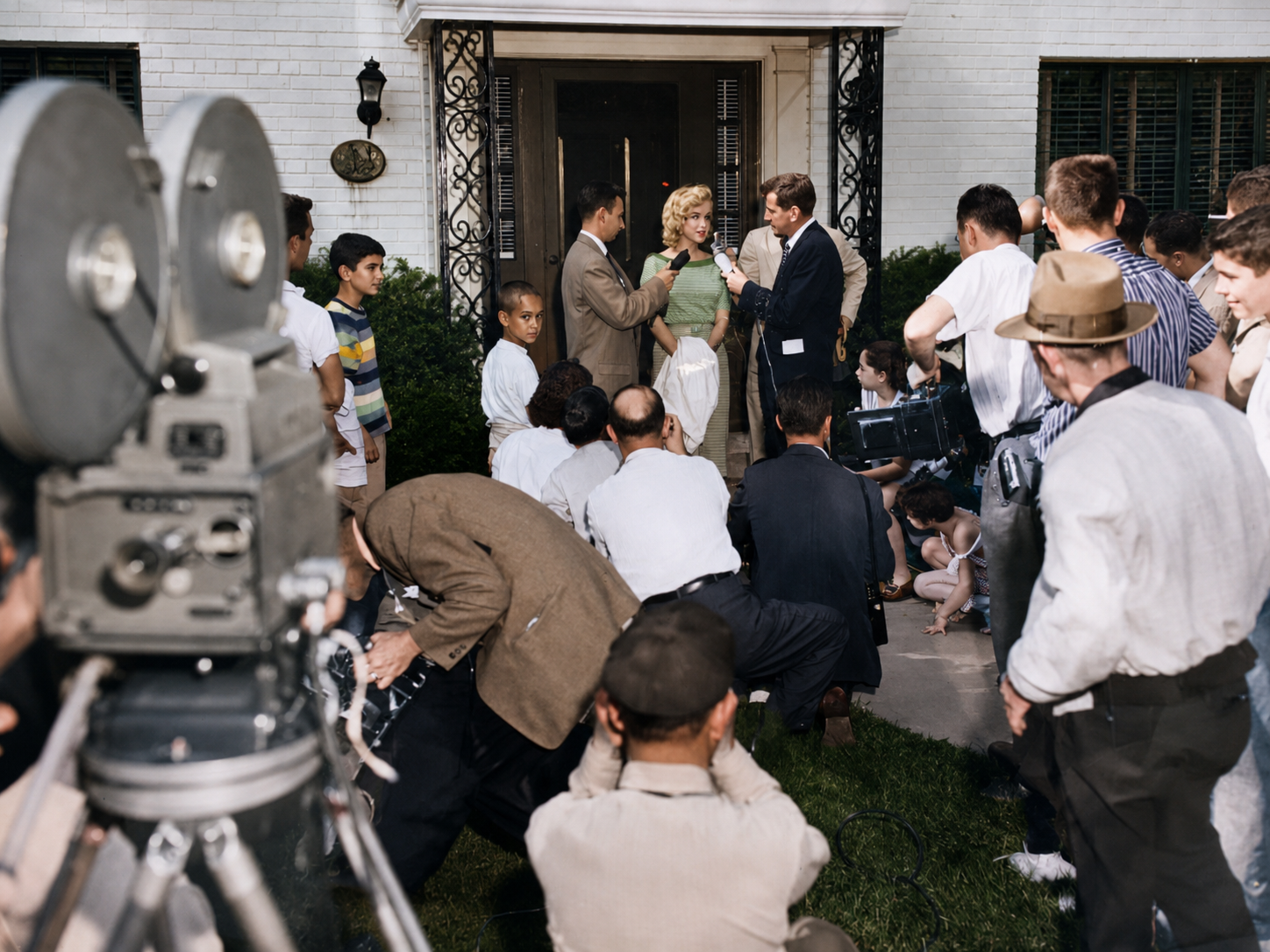
Marilyn Monroe’s Secret 1957 Visit to Forest Hills DC
In late May 1957, Marilyn Monroe slept on a sofa bed in a Forest Hills den while her husband Arthur Miller stood trial in Federal Court for contempt of Congress. She bicycled the neighborhood in sunglasses, sat by a backyard pool, and held one news conference on the front lawn at 3625 Appleton Street NW. For seven days, the biggest movie star in the world was a houseguest in Northwest DC.
-
Dallas Williams, the Bad Man of Swampoodle
On January 31, 1958, the Evening Star started calling Dallas O. Williams “the Bad Man of Swampoodle.” The nickname stuck through five trials, three vacated convictions, and a 1961 double murder that exposed the broken machinery of DC’s insanity defense.
-
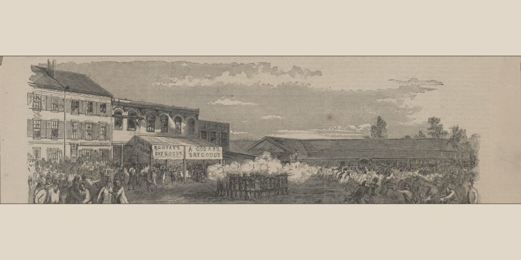
The 1857 Election Day Riot, When Marines Fired on a DC Mob
In 1857 the commandant of the Marine Corps faced down a rioters' cannon at a DC polling place, armed only with a cotton umbrella.
-

O. Roy Chalk and the Last Days of D.C. Transit
Just after 2 a.m. on January 14, 1973, WMATA condemned D.C. Transit and its suburban sister company out of existence. The owner was a New York lawyer named O. Roy Chalk, and he had run Washington's…
-
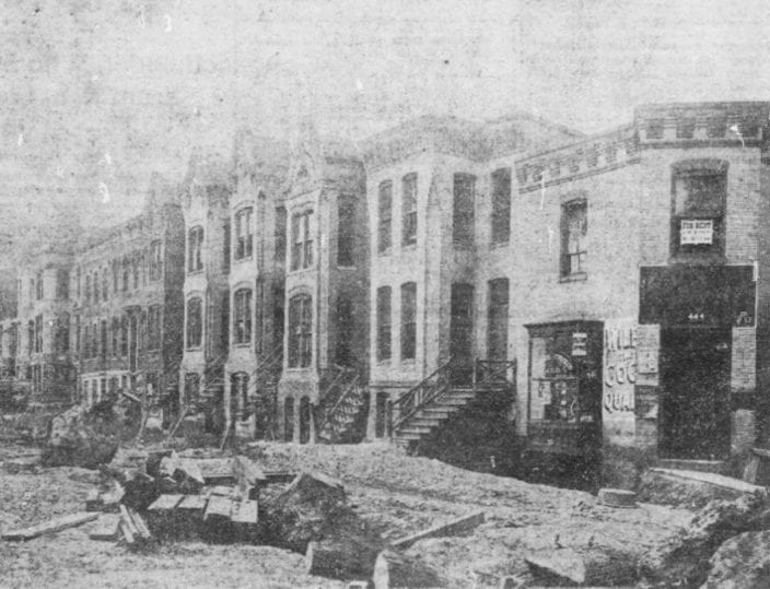
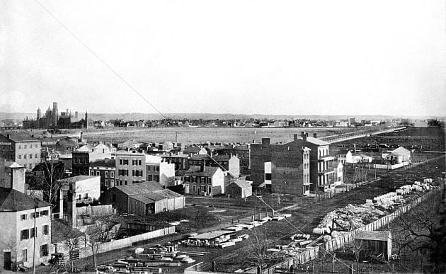
Swampoodle: The Lost Irish Neighborhood Union Station Erased
A rough, all-Irish neighborhood called Swampoodle once stood where Union Station is now. The railroad cleared it, and DC forgot.
Recently Updated
Refreshed from the Archive

Swipe for more