
The east side of the Anacostia River, June 5, 1663. A surveyor walks the woods of Charles County, Maryland, and ties off a 400-acre tract at a marked oak standing at the mouth of a small inlet. The tract has a name. The inlet has a name too.
The land is called Rome. The water is called Tiber.
Both names belong to a Maryland planter named Francis Pope, and his bounded oak stood somewhere underneath what is now the United States Capitol.
The 1663 Patent
The record sits in the Maryland State Archives in Annapolis, in the Land Office Patents, Liber 6, folio 318. It is short, dry, and improbable.
Lyd out for Francis Pope of this Province, Gent., a parcel of land in Charles County called Rome, lying on the East side of the Anacostian River… to a bounded oak standing at the mouth of a bay or inlet called Tiber.
Four hundred acres of woods and tidal flat, surveyed for one man, recorded in one paragraph, given two of the most famous place-names in Western civilization.
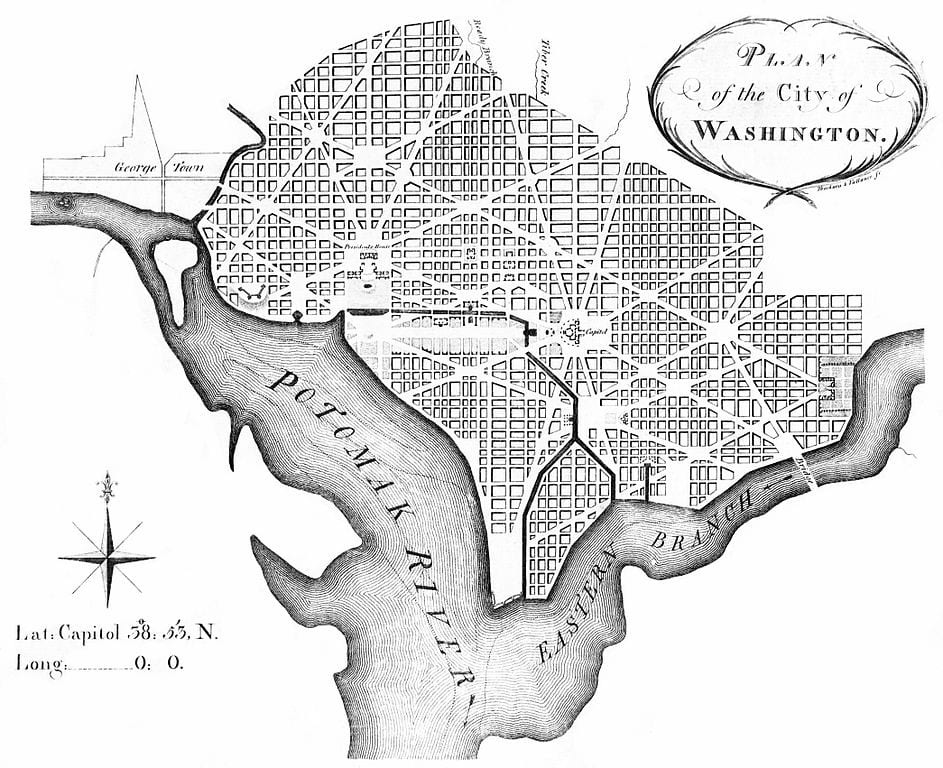
The 1791 L’Enfant Plan, drawn 128 years later when George Washington was siting the new federal capital, still labels the creek “Tiber.”
Who Francis Pope Actually Was
The internet record on Francis Pope is full of clutter. A few sites describe him as a Jesuit priest. The Maryland records say otherwise.
Pope was transported to the colony by 1635. His wife followed in 1649. He served in the Maryland Assembly in September 1642, and as a Justice of the Peace for Charles County in 1667 and 1670.
The 1912 Catholic Encyclopedia entry on Washington calls him “sheriff of Charles County” and “in all probability, a Catholic.”
He died around 1670. He never lived to see the land surveyed for a federal city, and there is no surviving record of why he chose the name Rome.
The best guess is the obvious one. A Catholic planter with a classical education looked at a quiet creek running through his estate, decided it ought to be a Tiber, and gave himself a small private joke. Pope of Rome, on the Tiber.
The Bounded Oak Stood on Capitol Hill
The patent describes the tract starting at a marked oak on the Anacostia, running north 200 perches to a bounded oak at the mouth of the Tiber inlet, then east 320 perches into the woods, then south to a bounded tree called Scotland Yard, then west along the Tyber.
Plot those bearings onto modern streets and the tract covers most of Capitol Hill. The Capitol itself. The Library of Congress. The Supreme Court. The residential blocks east toward Lincoln Park.
The traveler John Davis walked the same ground in 1799 and described it as woods.
From Tiber Creek to the Washington City Canal
Tiber Creek did not survive long as a creek.
When the federal city went up, the L’Enfant plan absorbed the Tiber into a planned waterway. The Washington City Canal opened in 1815, channeling Tiber Creek’s flow east-to-west across the foot of Capitol Hill and along what is now the National Mall and Constitution Avenue.
Boats could move goods from the Anacostia to the Potomac without rounding the marshes. For about twenty years, the canal mostly worked.
By the 1840s, it stopped working. The current was sluggish, the tides backed sewage into the channel, and the canal turned into an open trough of waste running past the front lawn of the federal government. One traveler called it “an offensive stream and a receptacle of filth.”
Buried Under Constitution Avenue
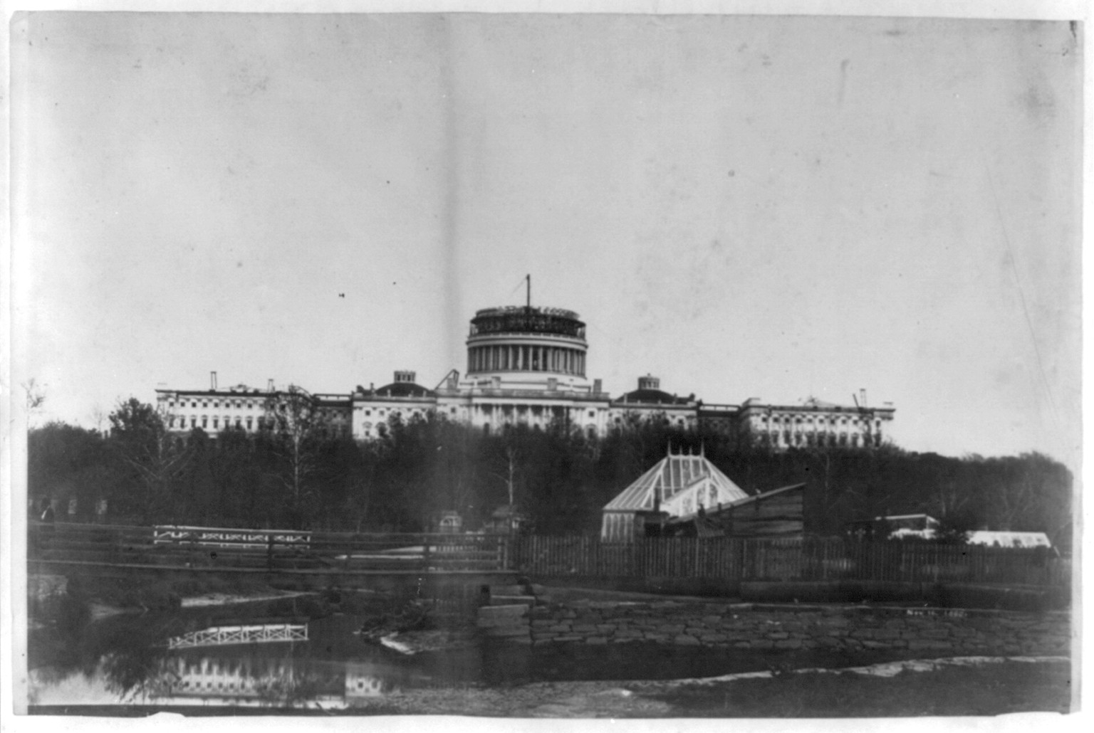
In 1871, Alexander “Boss” Shepherd’s Board of Public Works started filling the canal in.
The work ran through the 1870s. The old canal bed was paved over and became B Street North, which was renamed Constitution Avenue in 1931. The water did not stop running. It went into culverts, mostly arched brick tunnels built into the old canal channel and the original creek bed.
USGS Circular 752, “Washington D.C.’s Vanishing Springs and Waterways,” published by Garnett P. Williams in 1977, traces the underground course. Tiber Creek still flows beneath the IRS building, the National Archives, and the rest of the Federal Triangle.
The same water that brushed past Francis Pope’s bounded oak in 1663 is now a culvert under Constitution Avenue.
One More Pope
The little coincidence that made the rounds online in 2013: the man who renamed an inlet “Tiber” and his estate “Rome” was named Francis Pope. The first pope from the Americas, elected the same year, took the name Francis.
He is Argentinian, not American, and the conventional shorthand sometimes gets that wrong. Still, a Pope named Francis, a Rome on a Tiber, in the city that became the capital of the United States. The original Francis Pope would have appreciated the symmetry.
The bounded oak is long gone. The creek runs in the dark. The patent sits in Annapolis.
The names stuck.
Not to mention that the Capitol building (and “Capitol Hill”) was named after the Capitoline Hill in Rome (http://en.wikipedia.org/wiki/United_States_Capitol#Name)!
Our cute little protestant friends think this is a sign of the end of the world
Well isn’t that interesting… No wonder the a h*les in DC are such!
Pope John Paul II was the first pope to visit the “New World,” at least the United States. How about Pope’s Creek on Hwy 301? And just a bit north of Pope’s Creek high on the bluffs of the Potomac River with an awesome 180-degree view of the river, is the Jesuit Retreat?