

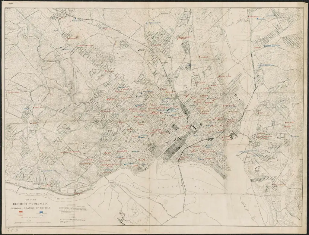
This is a fascinating map we did up thanks to the DC Library’s online collection. It shows all the schools in in the District of Columbia for 1915, separated by race.
Public schools were legally segregated going back to the Civil War, including two separate school board systems and governance. Brown v. Board of Education in 1954 opened the door to integration of all D.C. schools by law.
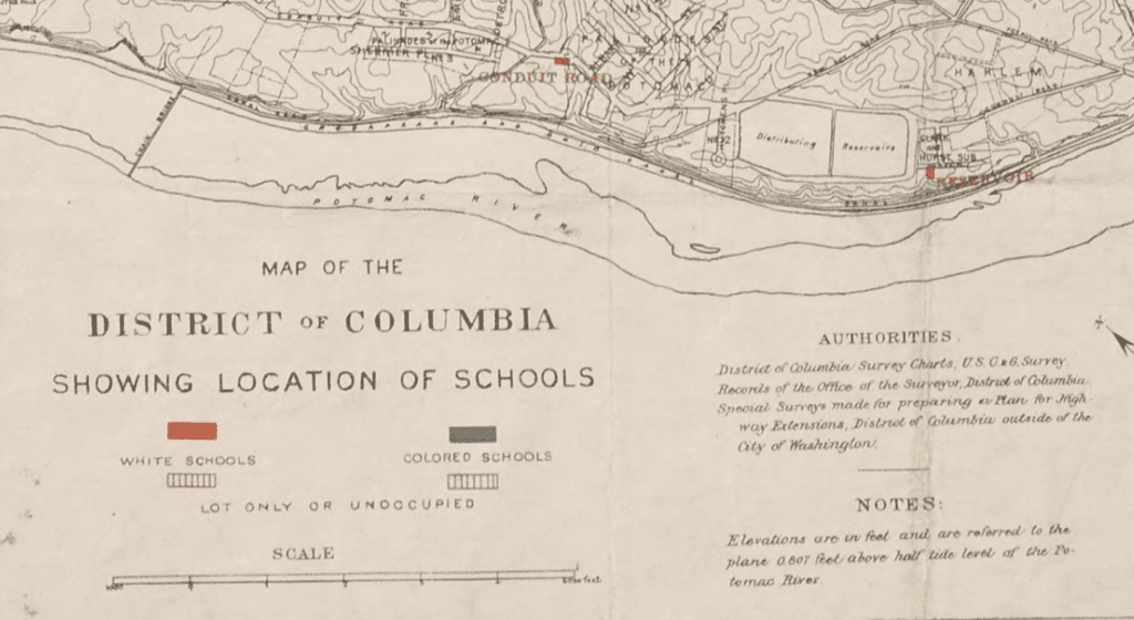
And here is the map legend.
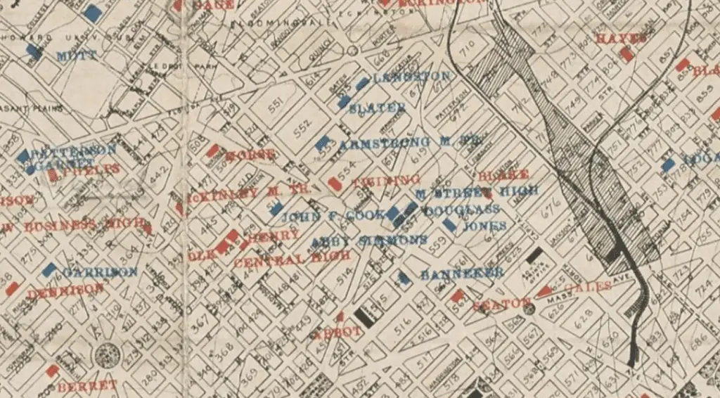
Now look at a close up of a cluster of colored schools. At bottom left you’ll see Logan Circle.
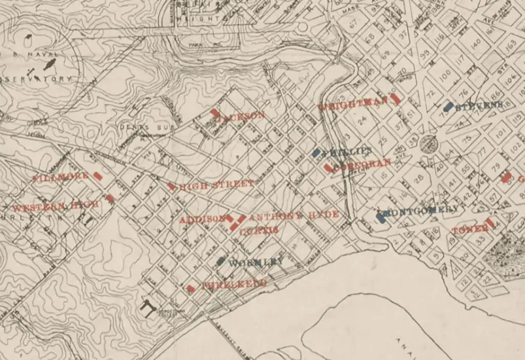
Here’s the close-up covering much of Georgetown and Foggy Bottom, including the Stevens School, which is currently undergoing renovations to become a child development center.
Chain Bridge Road School
One school on the map I’m very curious about, and know little of, the one on Chain Bridge Road. There’s a brief mention of it on Wikipedia and it’s listed as being at 2820 Chain Bridge Road NW. The original building was a one-room school house from 1862, built in then-Washington County, outside the city limits of Washington and Georgetown. A new building was opened near the site in 1923 to expand the facilities, but it was far from modern. It was still lit with oil lamps and heated with a coal furnace.
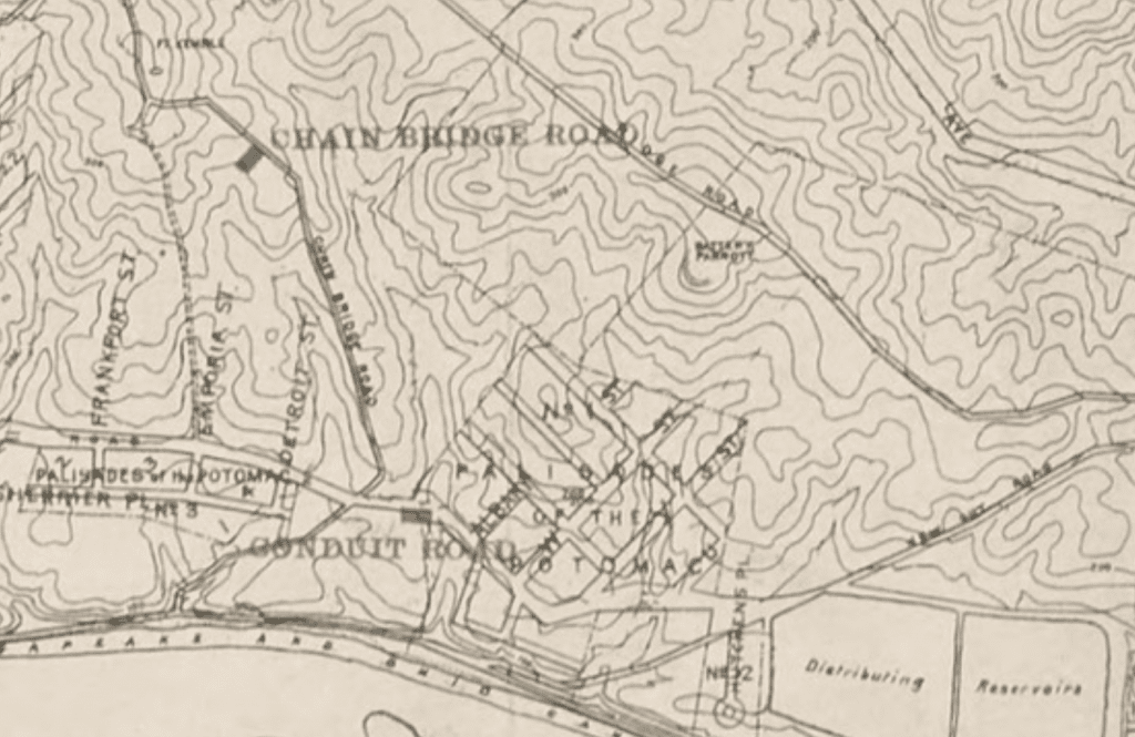
There’s a wealth of fascinating information in the application for National Register of Historic Places. Also, if you’d like to read more about the history of D.C. schools, segregation, and current diversity trends, check out the D.C. Policy Center.