

Ghosts of DC

Try an address, a neighborhood, a name or a year, like “14th and U” or “1968.”

Not sure where to start?
GoDCers Love Maps

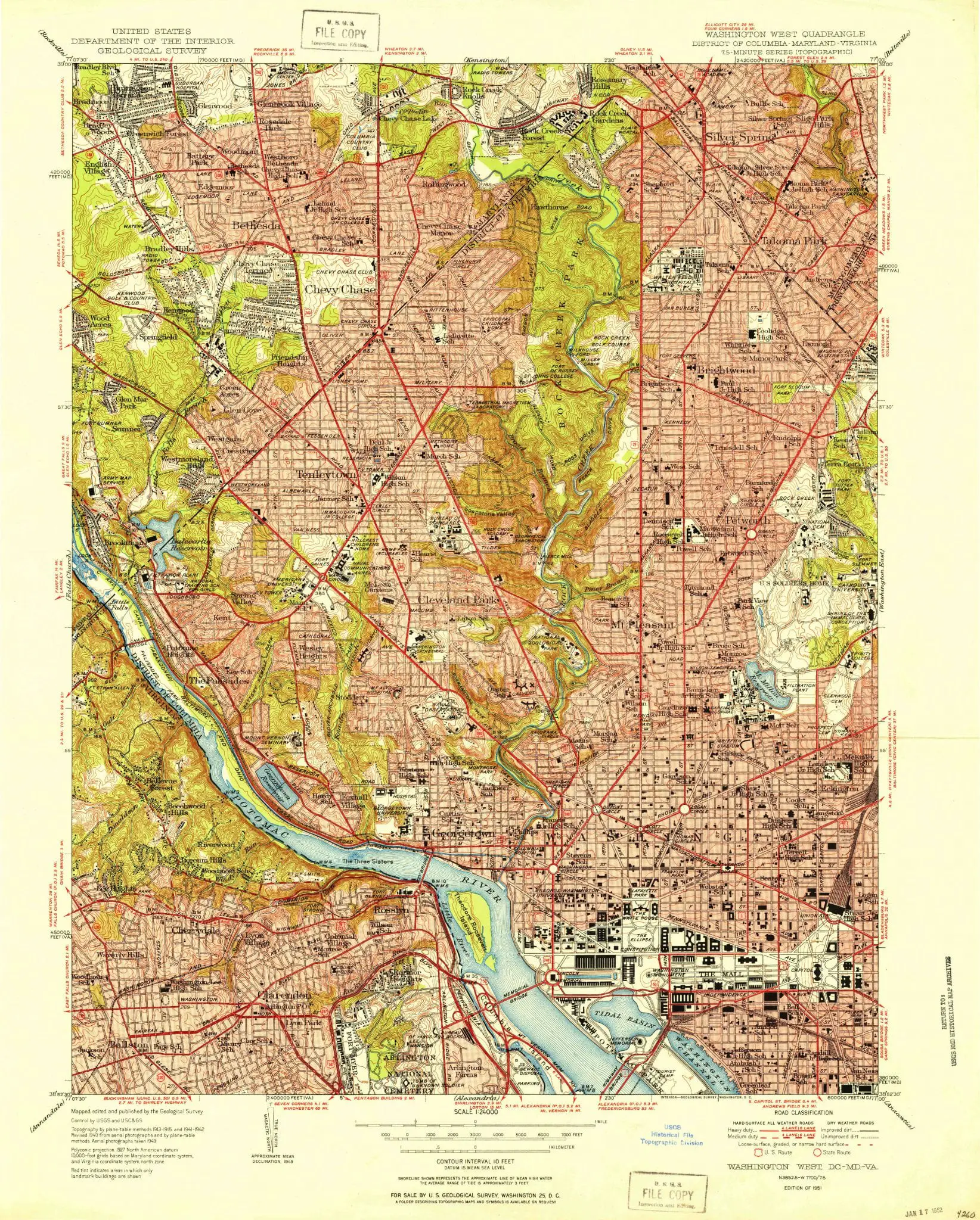
Washington, D.C. in 1951: The USGS Topographic Map

The U.S. Geological Survey published this topographic map of Washington, D.C. in 1951 — the year the city hit its all-time population of 802,000. Every neighborhood is packed. The highways that would displace tens of thousands of residents hadn’t been built yet.

1 min readUpdated

We came across a great archive of maps thanks to the U.S. Geological Survey. This one shows much of Washington and some of suburban Maryland in 1951.
Historical Topographic Map Collection

Some of our stories are researched and written with help from AI, and checked by a person before they run. Here’s how we use AI.

Filed underGoDCers Love Maps

Topics1950s

Like what you found here?

Get new Ghosts of DC stories by email.

More from the 1950s