
If you’ve ever driven I-395 north out of Virginia and felt the freeway just give up at New York Avenue, this map tells you why.
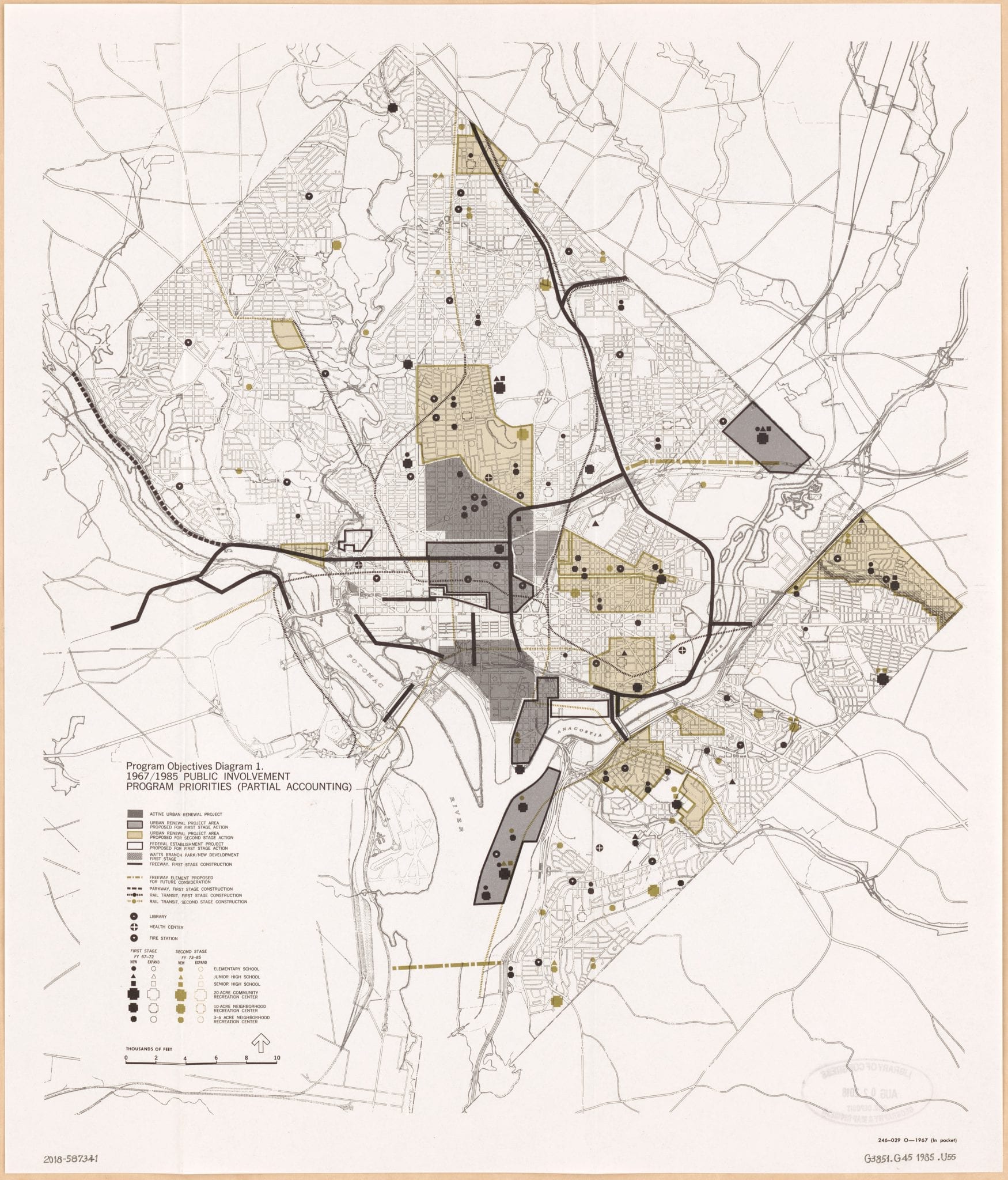
The plan was for the interstate to keep going. Up through Mount Vernon Square, east past Brookland, on to the Beltway. The 1967 National Capital Planning Commission program-objectives map lays out the whole network Washington was supposed to get: a K Street expressway tunneled down the middle of downtown, a Three Sisters Bridge over the rocks above Georgetown, the Center Leg and the North Leg knifing through L’Enfant’s grid, the North Central Freeway tracing the rail tracks past Catholic University.
Almost none of it got built. That’s the part that still surprises me.
The map
The sheet at the top of this post is filed at the Library of Congress under call number g3851g.ct010988. The catalog title is Program objectives diagram 1: 1967-1985 public improvement program priorities (partial accounting).
The National Capital Planning Commission drew it and published it in 1967. The Geography and Map Division has the original, pulled from a textual publication the catalog identifies only by the document control number 246-029 O–1967. The LOC’s item record lists it as free to use and reuse.
What got built
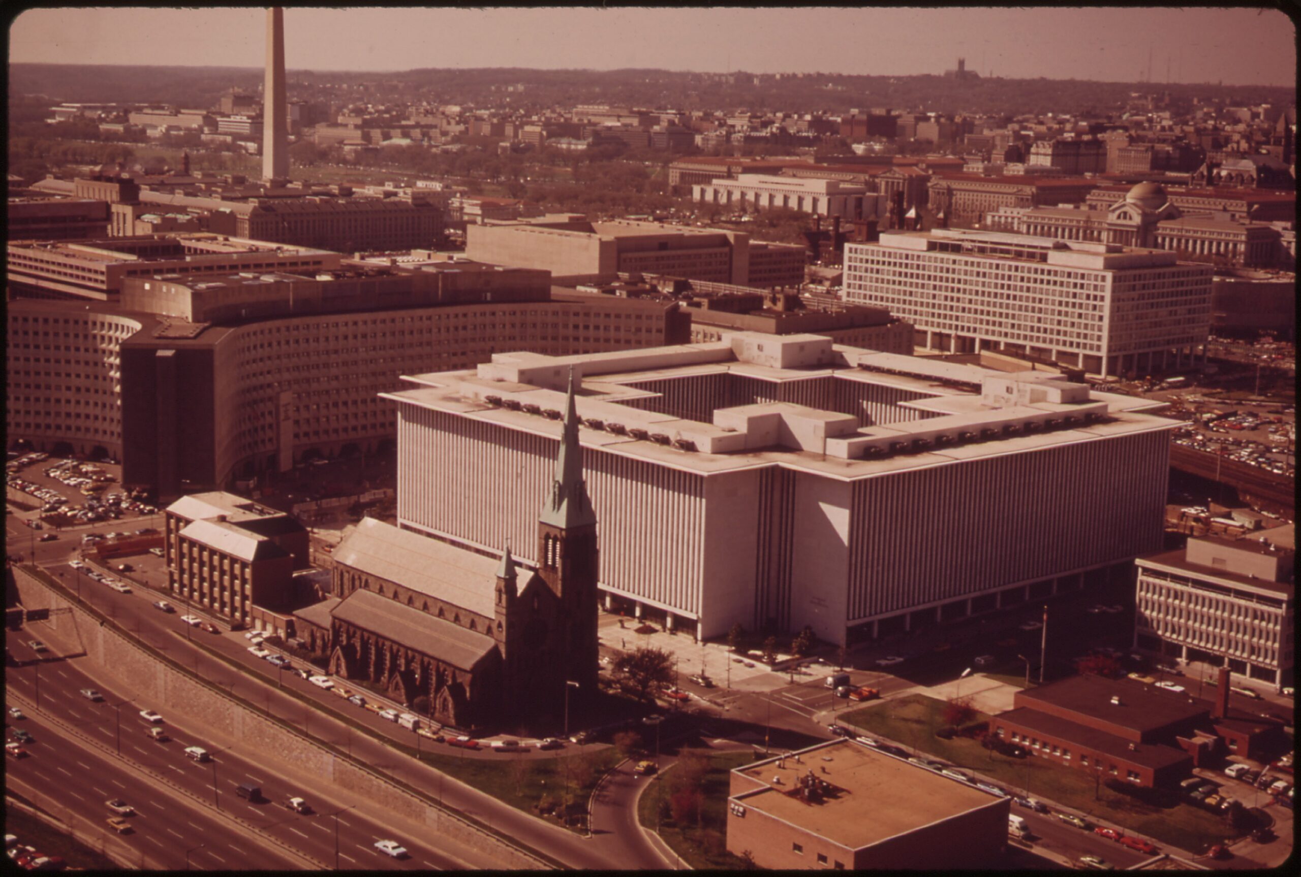
Pieces of it. The Southwest Freeway and the Center Leg got finished, threading I-395 from the 14th Street Bridge under downtown. The Whitehurst Freeway along the Georgetown waterfront had been up since 1949.
The cost was visible by the early 1970s. Most of old Southwest DC was leveled to make room for the freeway and L’Enfant Plaza, and the neighborhoods that came back are not the neighborhoods that were there.
What didn’t
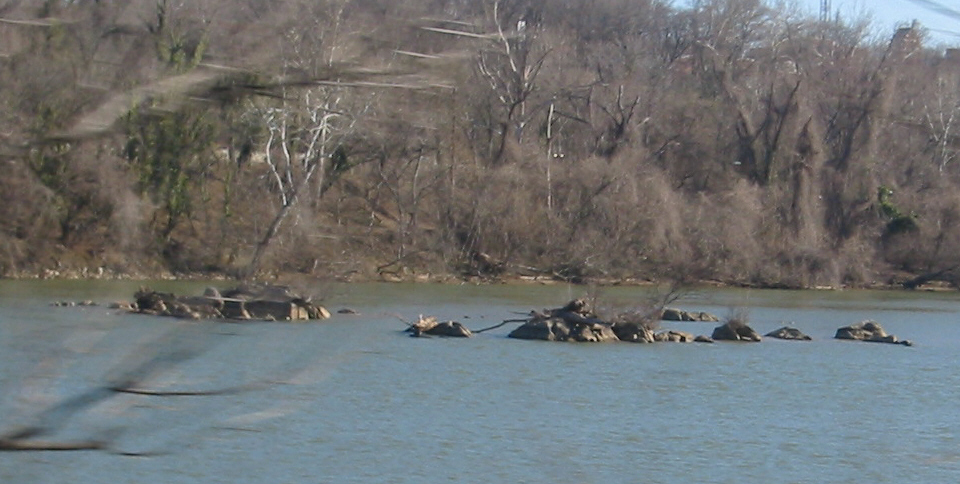
The Three Sisters Bridge was supposed to span the Potomac at those three granite islets just upstream of Key Bridge. We’ve covered the never-built crossing in its own post, and the rocks themselves have a centuries-old drowning legend worth mentioning.
Construction contracts were awarded in 1969. Piers went into the river. Then the lawsuits hit, and in June 1972 Hurricane Agnes swept the unfinished piers downstream. The contracts were cancelled two months later.
The North Central Freeway died too. So did the K Street tunnel. So did the I-95 North Leg that explains why the interstate just stops at New York Avenue today.
I-95 became I-395 in 1977 once everyone admitted the rest was never coming. DC was one of the few American cities that traded its planned freeway grid for a subway system, and the trade still looks like a good one.