
The Original 9:30 Club: F Street’s 1888 Atlantic Building
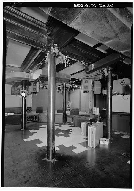
Inside the 1888 Atlantic Building at 930 F Street: the cast-iron columns Bad Brains leaned against and the eighth floor that founded the National Zoo.
Victorian Washington was booming in the 1880s. The decade brought the dedication of the Washington Monument (finally finished in 1884), the consolidation of Georgetown into DC, and a wave of grand Romanesque architecture that still defines many of the city’s neighborhoods. These posts explore Washington at its Victorian peak.
Inside the 1888 Atlantic Building at 930 F Street: the cast-iron columns Bad Brains leaned against and the eighth floor that founded the National Zoo.
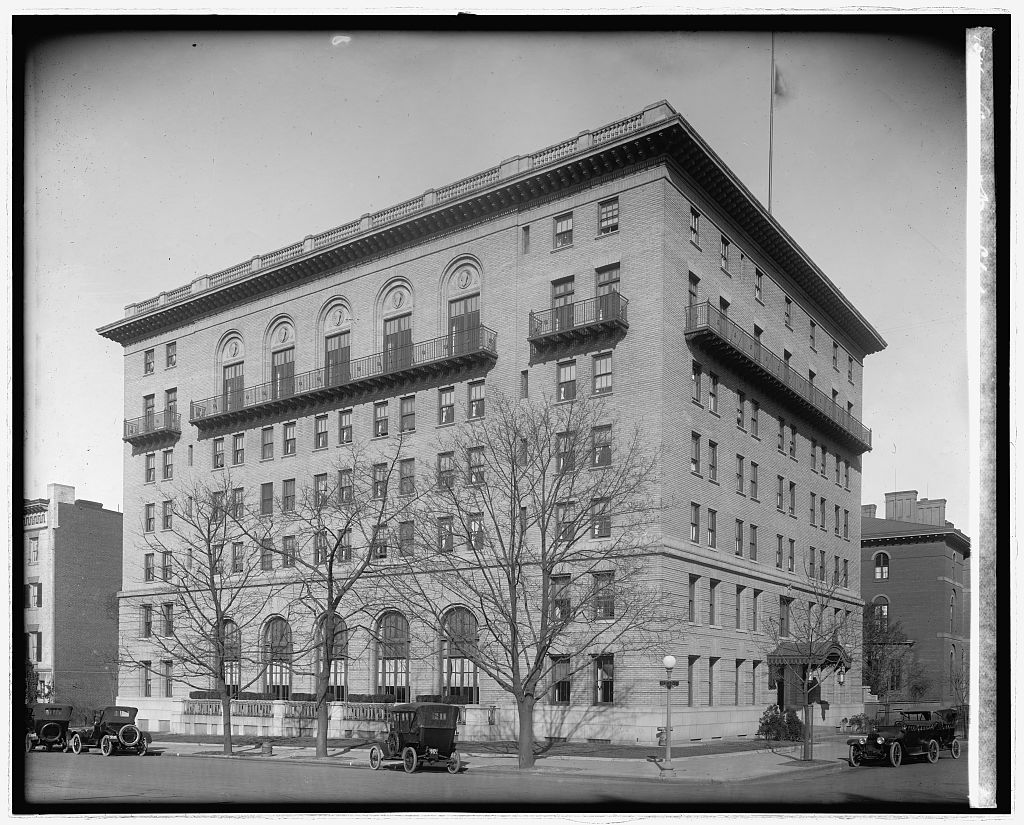
The Army and Navy Club has held the corner of 17th and I Streets NW since 1891, in a building that opened in 1912. In 1987 Shalom Baranes gutted everything behind that facade. The facade survived. Almost nothing else did.
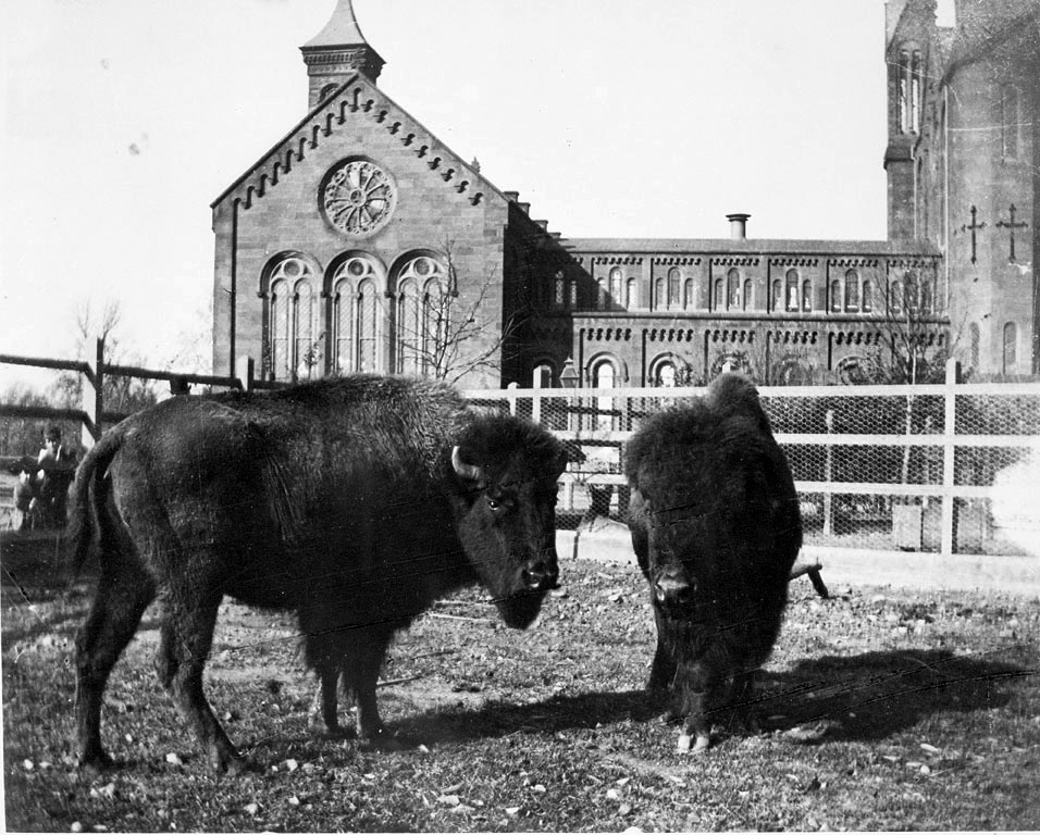
William Hornaday penned live bison behind the Smithsonian Castle in 1886 to save the species. The Mall menagerie became the National Zoo by 1889.
In 1931, gold-topped columns were killed for being too tall for airplanes. Now a 250-foot arch is proposed at the same spot. The full history since 1886.
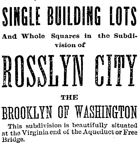
Explore the 1889 ambition of Rosslyn City, touted as the “Brooklyn of Washington,” and its emblematic journey of urban aspirations and challenges.
A series of 1880 maps showing property values, pavement conditions, public schools, railroads, and street sweeping schedules across Washington, D.C.
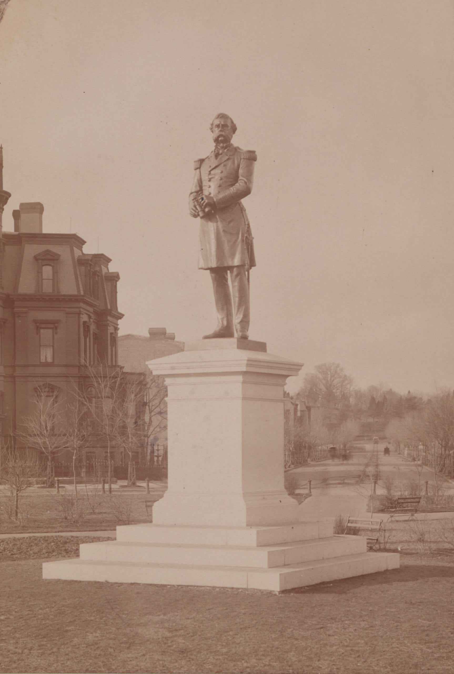
The original statue of Samuel DuPont sat for more than a generation at the center of Dupont Circle. Then it was removed because people thought it was ugly. Read the story to learn more.
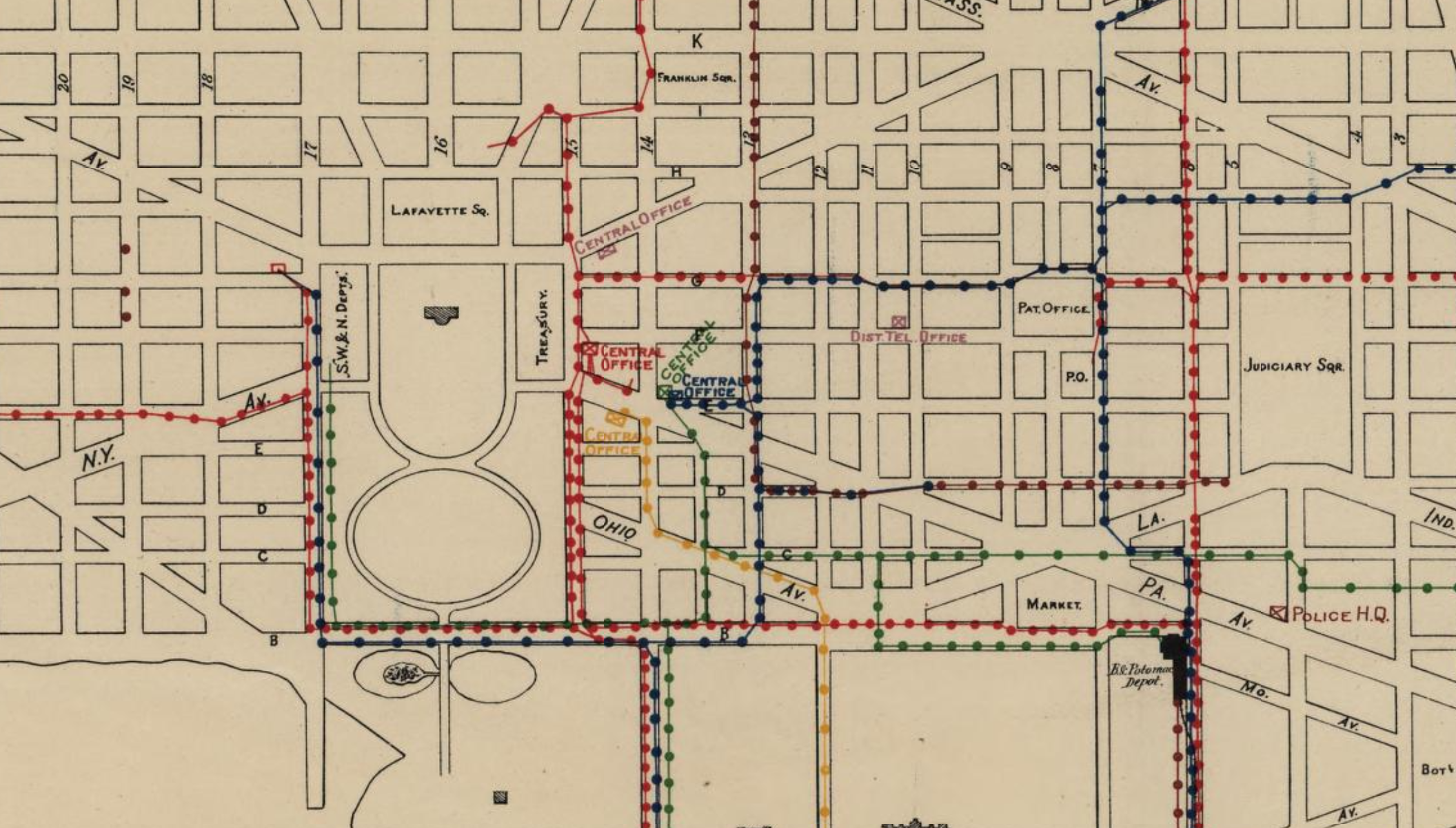
The first overland long-distance telegraph line in the United States was between Baltimore and Washington in 1843. This map shows all telegraph lines in Washington in 1880.
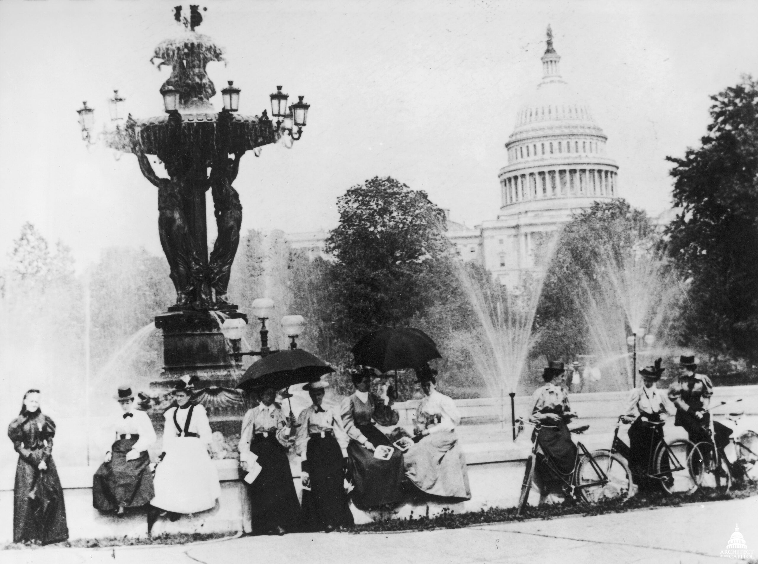
The Bartholdi Fountain on Capitol Hill was almost moved to Dupont Circle at the request of James Blaine. Until history intervened.