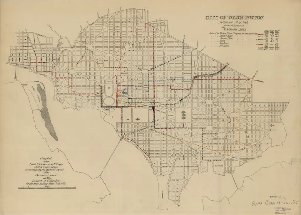
This is a fascinating old map of the old city of Washington, showing all of the telegraph lines and their routes through the city in 1880. The first overland long-distance telegraph line in the United States was between Baltimore and Washington, funded by Congress in 1843 with a $30,000 investment. The line was tested the following year by Samuel Morse with the biblical message “What hath God wrought“.
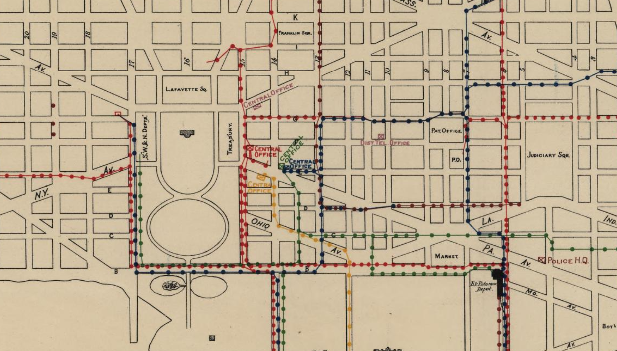
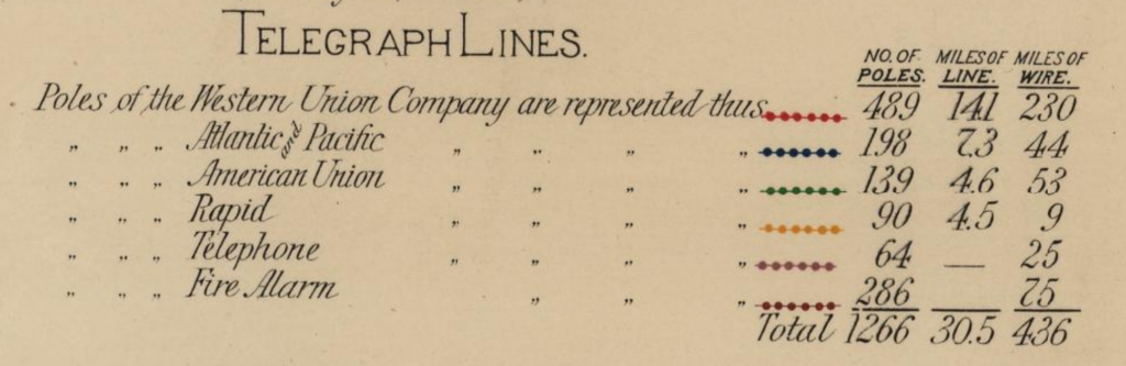
At the time, there were several companies running lines through the city, including Western Union Company, Atlantic and Pacific, and American Union. A total of 1,266 poles were in place, holding up 30.5 miles of line and 436 miles of wire (each line included many wires). Below is the zoomed in legend of the full map.
By 1880, telegraph communications were zipping around the city, and the lines followed many of the major streets, including 17th and 15th streets near the White House, B street (now Constitution Ave), 6th street past the old B&O railroad station on the mall (where President Garfield was shot by Charles Guiteau), Virginia Ave, H street as well as New York Ave.
Take a look at the map below for yourself to explore the different paths for telegraphs throughout the city.