1918 Aerial Photo Mosaic of Washington, D.C. by the U.S. Army Air Service
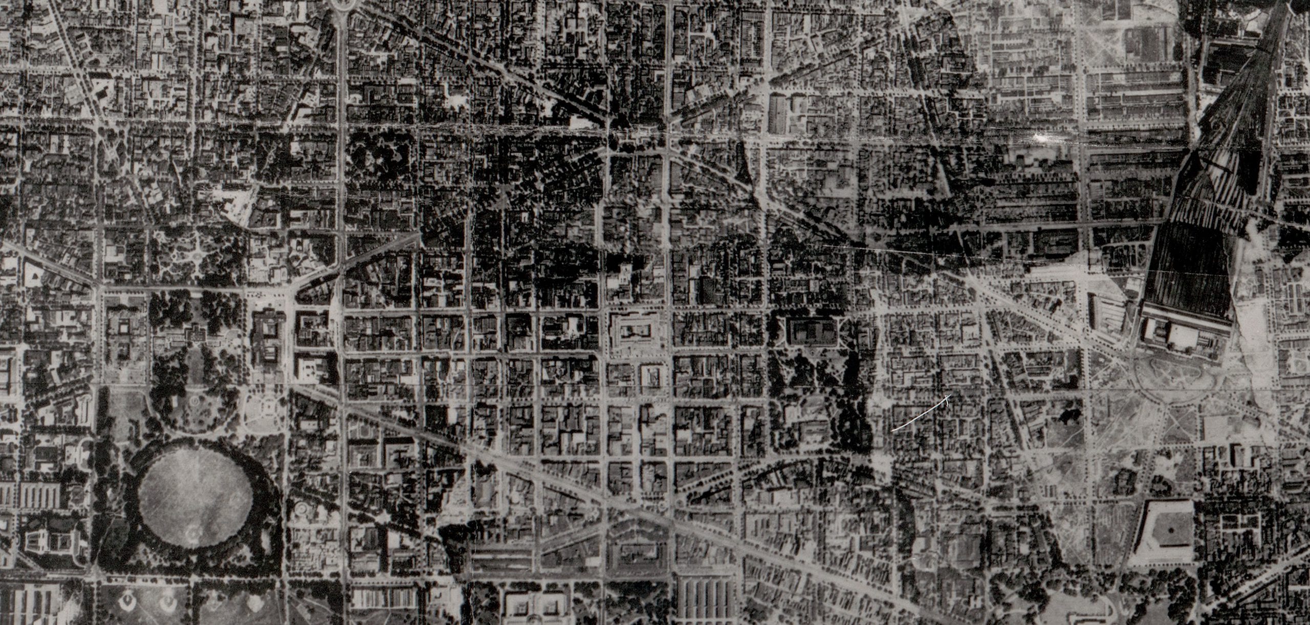
In 1918, the brand-new U.S. Army Air Service flew over central Washington with a camera bolted to the airplane and stitched the prints into a single photomosaic of the city. It is a portrait of a D.C. that no longer exists: no Federal Triangle, no Jefferson Memorial, a Lincoln Memorial still mid-construction.