
In 1918, the brand-new U.S. Army Air Service flew over central Washington with a camera bolted to the airplane and stitched the prints together into a single photomosaic of the city. The Library of Congress holds a copy. It is a stunning, weirdly-edged image, irregular at the borders because it is a mosaic of overlapping aerial frames trimmed and pasted together. And it is a portrait of a D.C. that no longer exists.
The mosaic is credited on the Library of Congress record to the Army’s “School of Aerial Photographic Reconnaissance,” a wartime training operation set up to teach Army photographers how to shoot and read pictures from a moving cockpit. The LC copy carries a back-of-print stamp noting it was made from a film negative in the Cartographic Branch of the National Archives, Record Group 18, the official record group for the Army Air Forces. That is as primary as a wartime aerial gets.
A bit of context on why this even existed. Until May 1918, military aviation in the U.S. Army was a wing of the Signal Corps, which is why every early Army aerial photo runs through Signal Corps schools. The Signal Corps opened a joint aerial-photography school with Eastman Kodak in Rochester that spring, and Cornell graduated its first aerial-photo class in March of the same year. Then in May 1918, aviation peeled away from the Signal Corps to become the Army Air Service, the unit credited on the Library of Congress catalog record for our mosaic. The technology and the institution were new at the same time, and Washington was a convenient subject to practice on.
What you’re actually looking at
Here is the full mosaic.
Click through to the full-resolution scan and the city starts giving up details. Pennsylvania Avenue runs diagonally as a thick scar across the upper-left. The radial spokes of L’Enfant’s plan are crisp around Dupont, Logan, and Thomas circles. The Mall is recognizable but unsettled, a long stretch of trees, dirt paths, and not-yet-built monumental ground.
There is no Federal Triangle. There is no Jefferson Memorial. The Lincoln Memorial is mid-construction at the far west end, four years from its 1922 dedication. The Tidal Basin is the Tidal Basin, but the south side of it is wide-open lawn.
Below are some areas worth zooming in on.
This is Southeast near the Anacostia River.
This view shows Union Station and the dense rowhouse neighborhoods to the east. Union Station itself opened in 1907, so it is the new building in the frame.
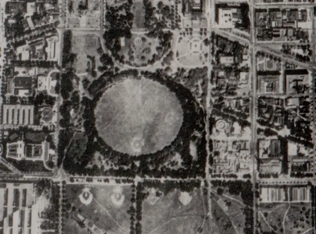
And here is the Ellipse south of the White House. The grounds look agricultural compared to today’s pristine lawn.
Where the planes came from
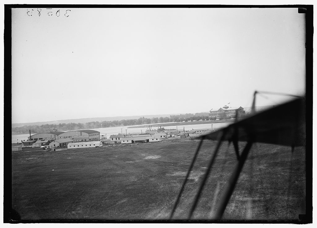
The Army Air Service didn’t need to go far for a field. Bolling Field had opened on July 1, 1918, on a stretch of low ground along the east bank of the Anacostia, the first proper Army airfield serving the capital. It was named for Colonel Raynal C. Bolling, the senior Army aviation officer killed in action in France, near Amiens, on March 26, 1918. Before Bolling existed by that name, the same site had been the Flying Field at Anacostia, set up in October 1917, and then briefly the Anacostia Experimental Flying Field in June 1918.
Harris & Ewing shot this view from beside a parked biplane on Bolling the year after the mosaic. The Anacostia Naval Air Station is across the river, and you can see the strut and wire of the airplane on the right edge of the frame.
The Army didn’t stop after the war. In September 1922 the Air Service’s 3rd Photo Section flew the city again, this time at 18,000 feet, with 215 exposures and a flying time of two hours and ten minutes, and produced a much larger and tidier follow-up mosaic. That one is also at the Library of Congress, and the 3rd Photo Section’s successor, Aerial Photo Section No. 3 at Bolling, came back to do it again in April 1928. The 1918 sheet is the first of the series. It is rougher, more obviously hand-assembled, and the most interesting of the three for that reason. It is the practice run that mapped the city.
The hard pleasure of looking at it now is finding what isn’t there yet. No Federal Triangle. No Jefferson Memorial. A Lincoln Memorial mid-construction. A Bolling Field of wooden hangars and a stretch of grass. A District where the Army Air Service was brand new.