

Old maps are the best. We just love cool old maps, and this one is a great one, showing Sixteenth Street Heights near the top of the District’s diamond. Along the outer edges of the map you’ll see notable buildings like the old French Embassy, The White House, and Henderson Castle.
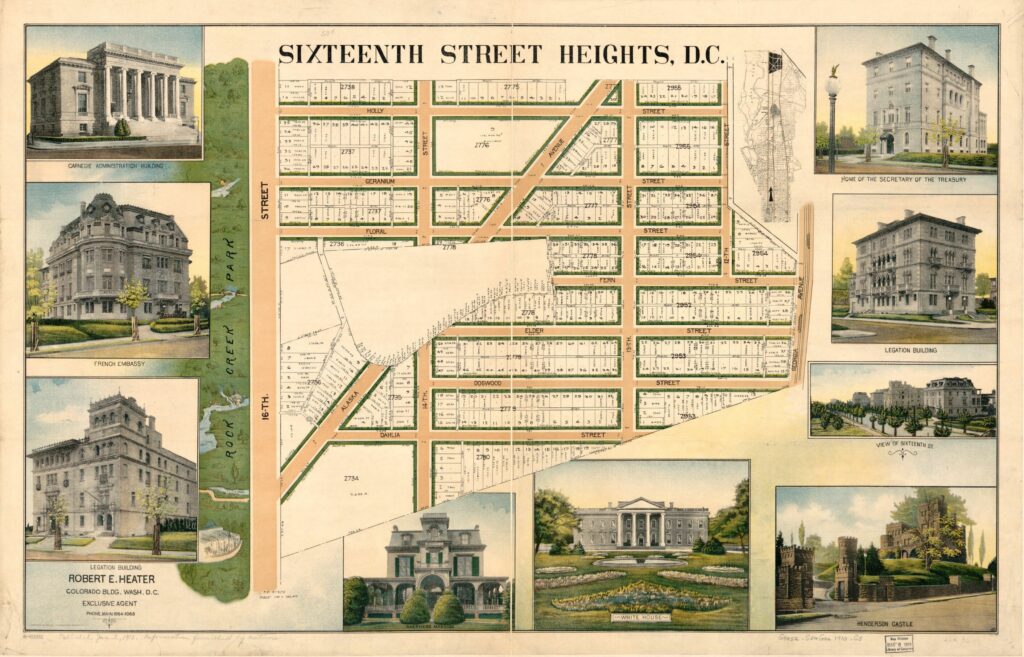
Take a look at the Google Map from today. Notice that some of the streets aren’t there due to Walter Reed. Dahlia St. is within the Walter Reed boundaries.
By the way, if you haven’t seen the development plans for the former military hospital, check it out. Pretty fascinating to see that part of town evolving and the amount of money being invested in transforming it.
Can someone tell me why people refer to it as Sixteenth Street heights (according to Wikipedia) and then we have 14th Street Heights, using the number?