
Georgetown in 1830: A Map Showing Street Names Before They Changed
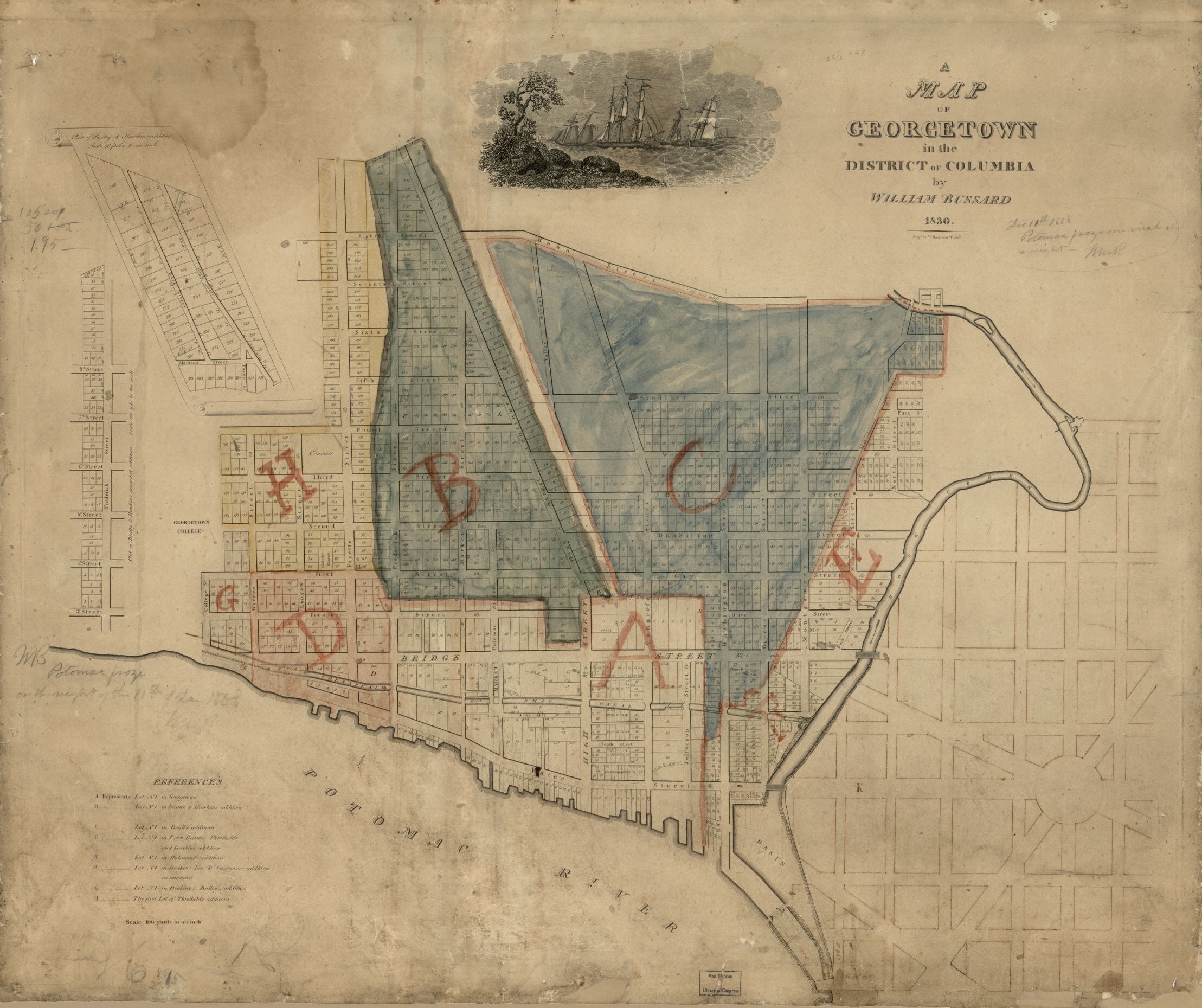
An 1830 map of Georgetown showing the original street names. Wisconsin Avenue was High Street and M Street was Bridge Street.
Historical maps of Washington, DC, from L’Enfant’s plan to twentieth-century plats. Watch the city draw itself in, block by block.
An 1830 map of Georgetown showing the original street names. Wisconsin Avenue was High Street and M Street was Bridge Street.
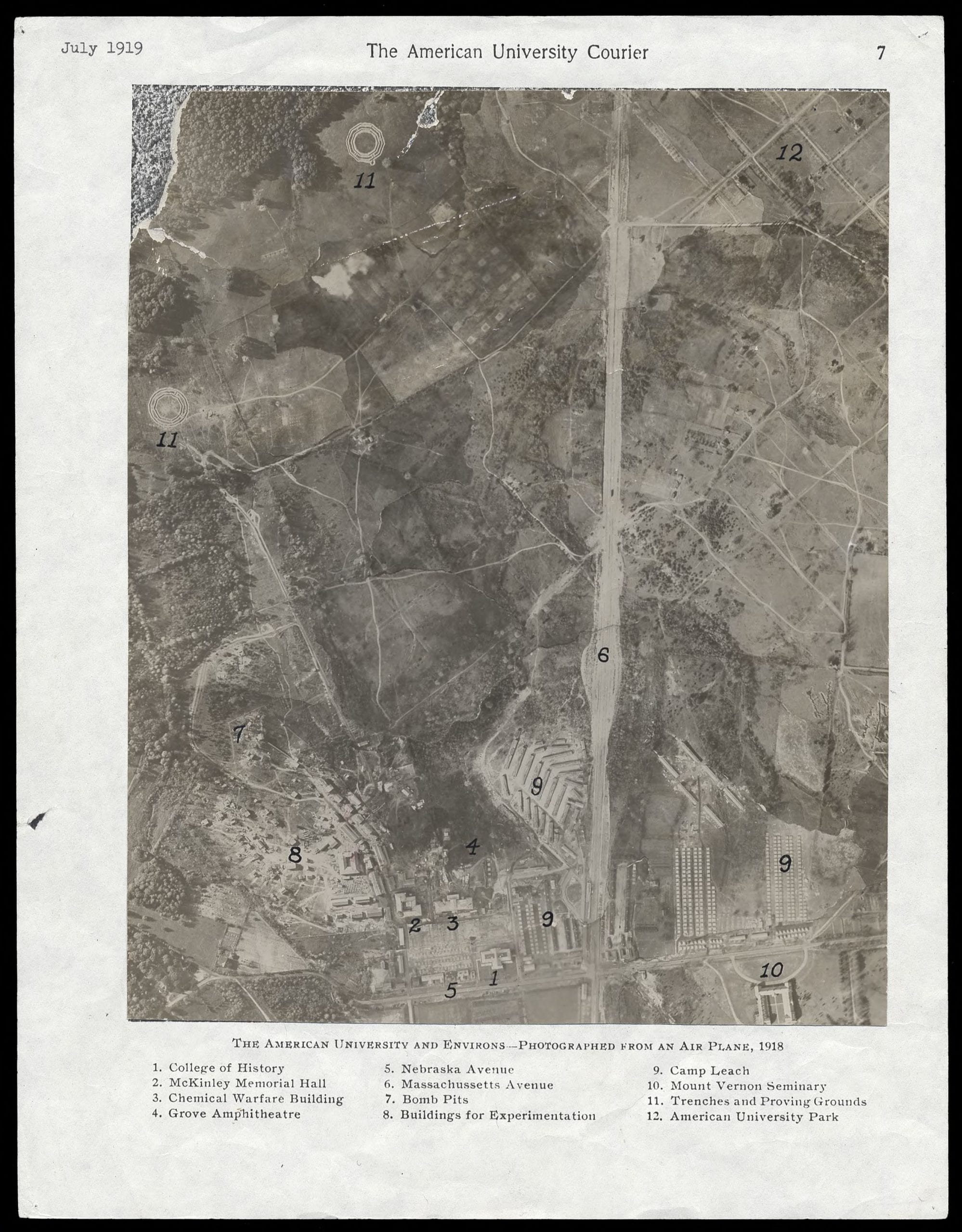
Discover the forgotten history of Camp Leach, America’s first military chemical weapons facility located on the grounds of today’s American University in upper northwest D.C. Nearly 100,000 employees worked here during World War I. Find out more about this historic site.
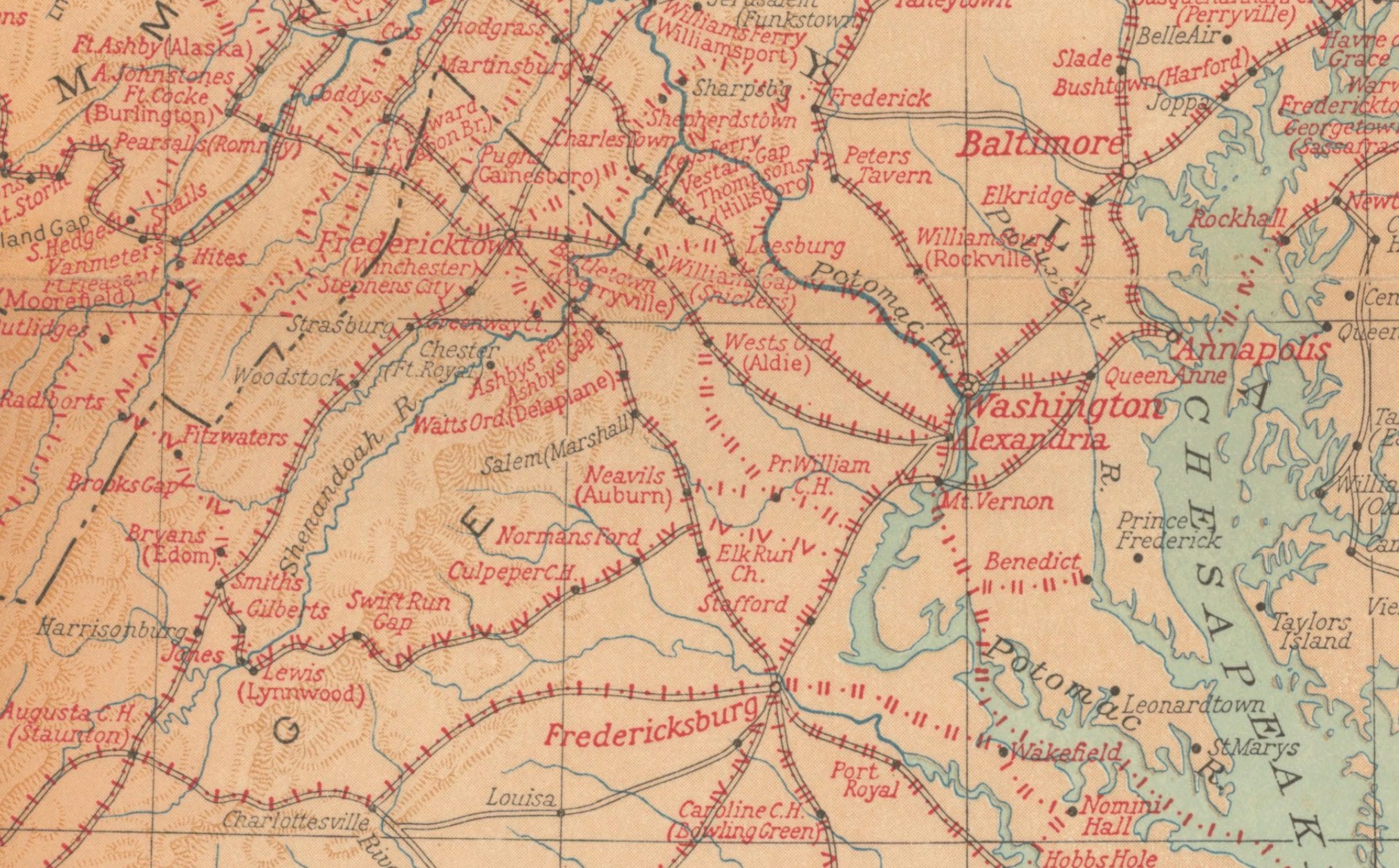
This is one of the more fascinating maps we have come across. It shows every single location George Washington visited during his life, all up and down the east coast. From Savannah in the south to Kittery, Maine in the north. The map below was done by the National Geographic Magazine in honor of the first president’s 200th birthday.
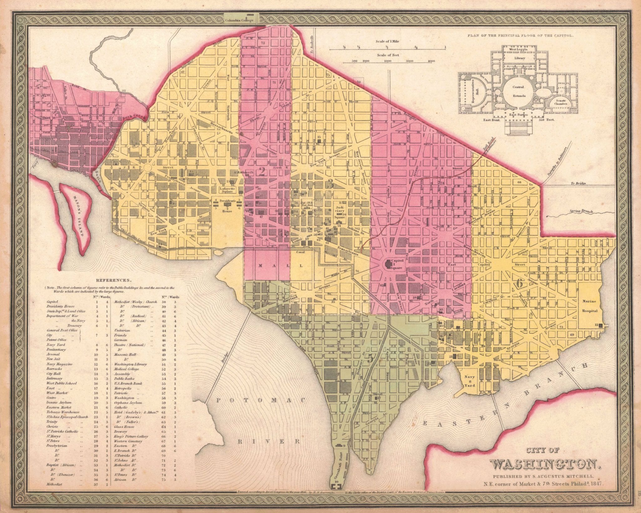
An incredible map of Washington well before the Civil War. Lovely details for you to study.
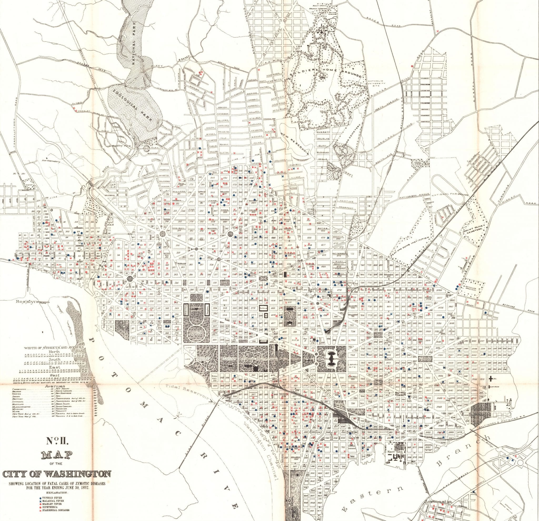
What is a zymotic disease? This is a map of deaths due to this disease in 1892. Find out what that means.
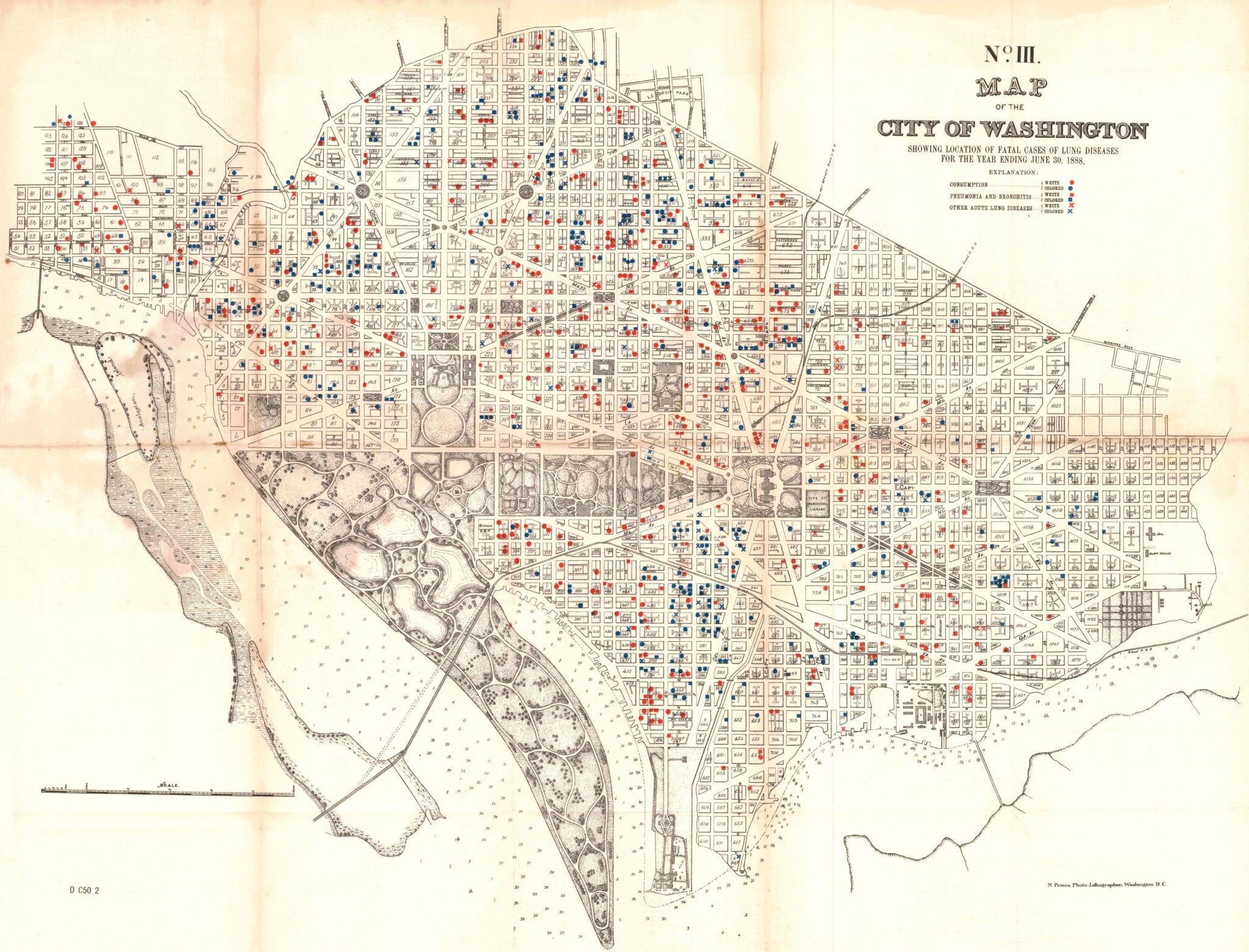
What a sad map of the District. This shows the deaths in Washington from lung disease in 1888.
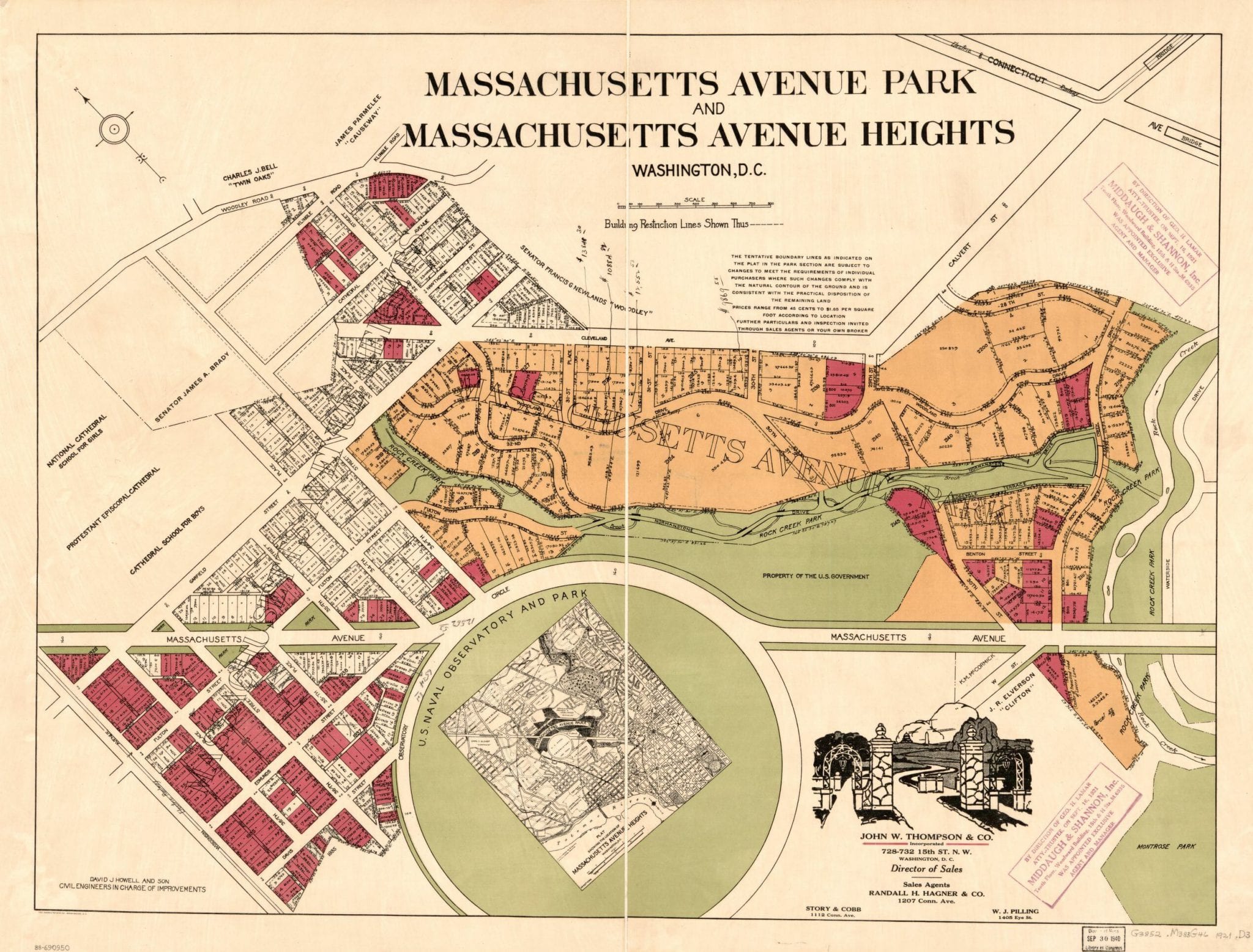
Explore the history of Mass Ave. Heights & Park, two early 20th century developments near Rock Creek Park and Observatory Circle. Learn about their current status as the Woodland-Normanstone neighborhood of lovely giant homes.
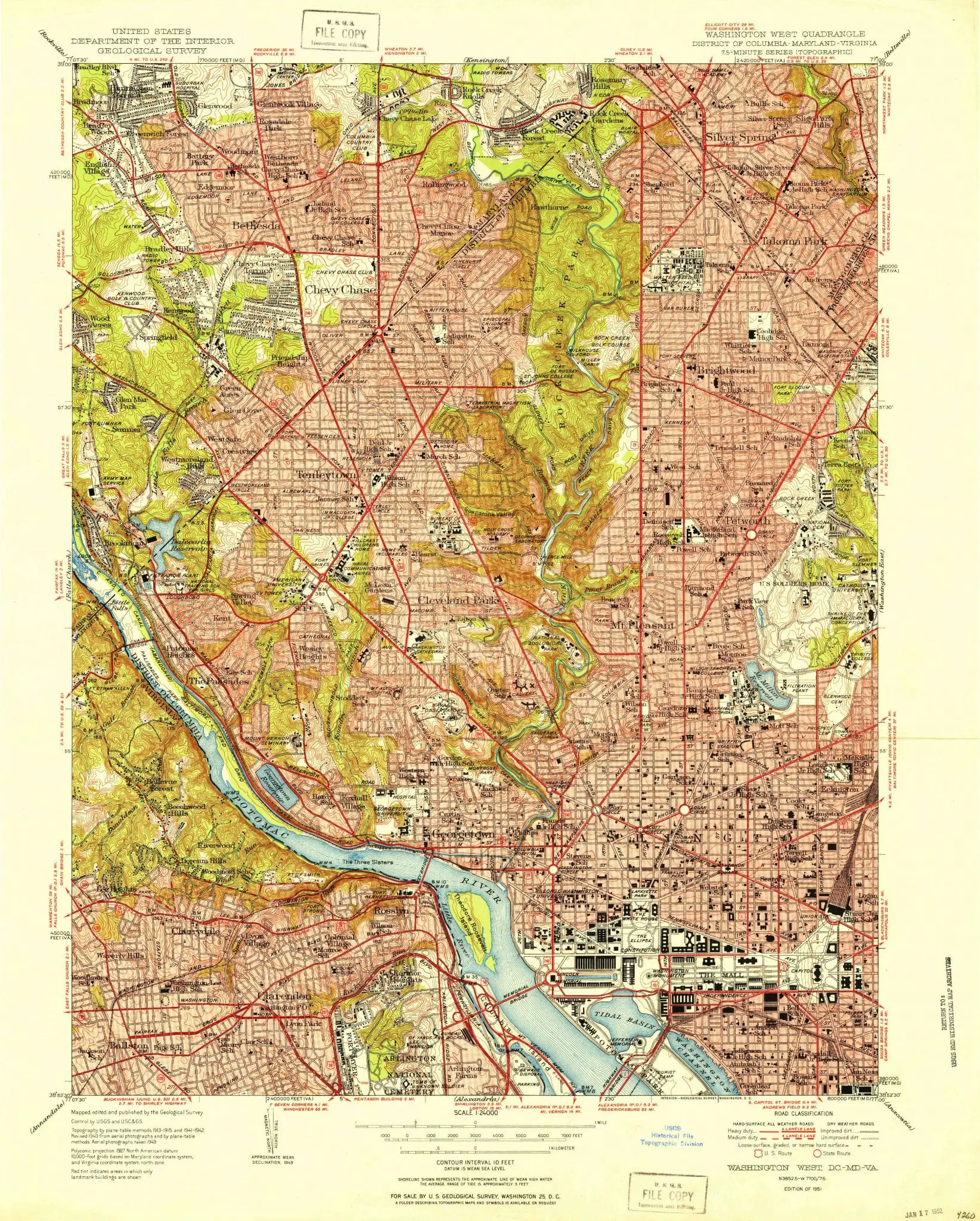
The U.S. Geological Survey published this topographic map of Washington, D.C. in 1951 — the year the city hit its all-time population of 802,000. Every neighborhood is packed. The highways that would displace tens of thousands of residents hadn’t been built yet.
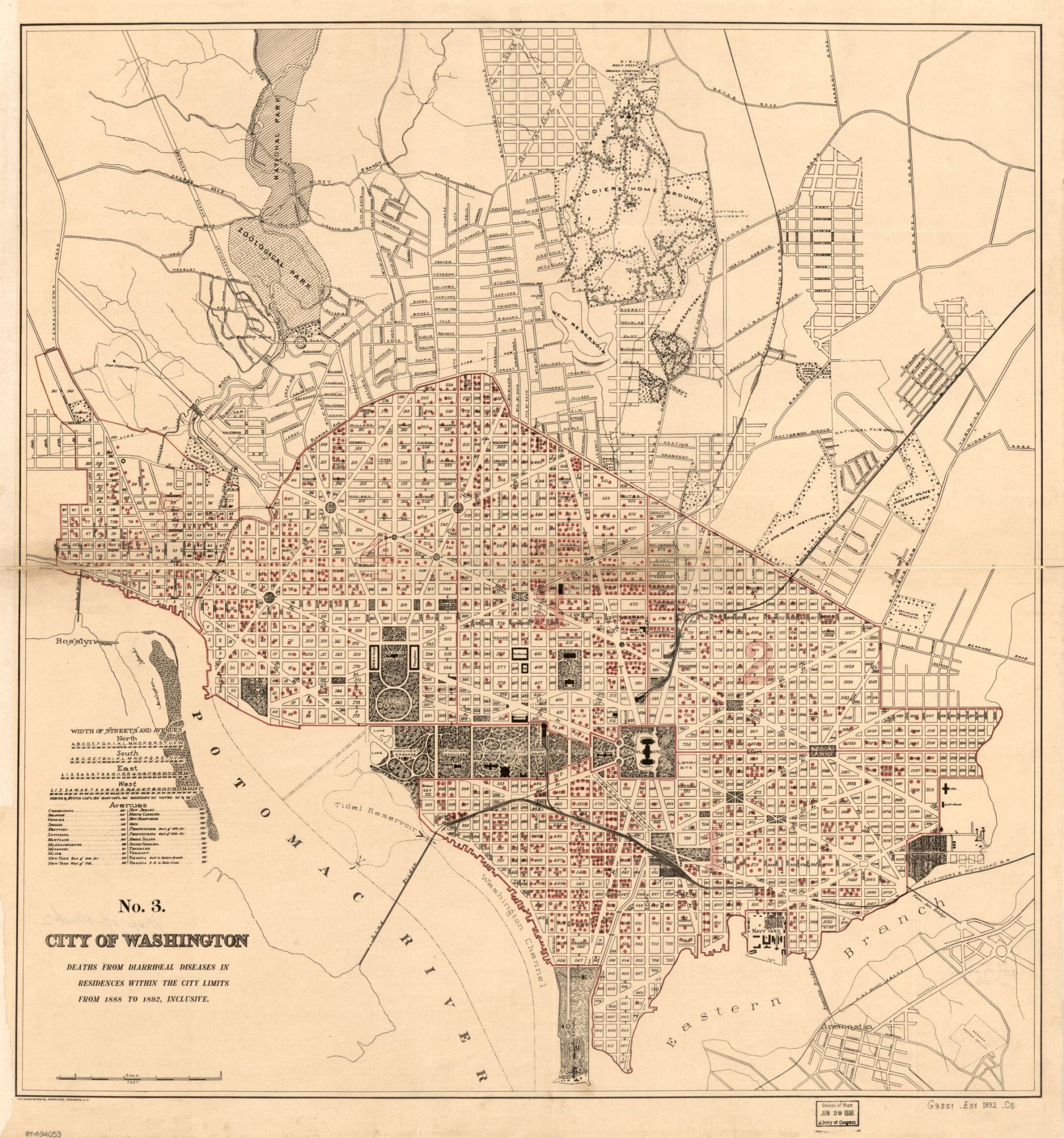
An 1890s map plots DC deaths from diarrhea by neighborhood, concentrated in Swampoodle and Murder Bay where sanitation was worst. One of the more unusual maps we have found.