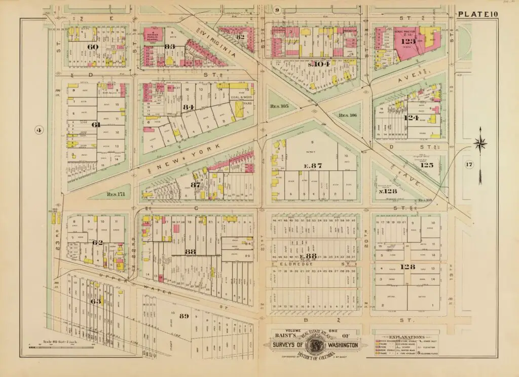
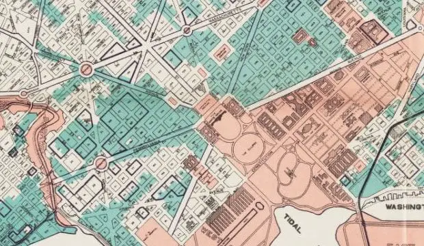
Take a look back in time to explore DC in 1903 with this map of the Department of State! See the dog pound at 23rd and C St. and the Herdic-Phaeton building at 19th and E St.
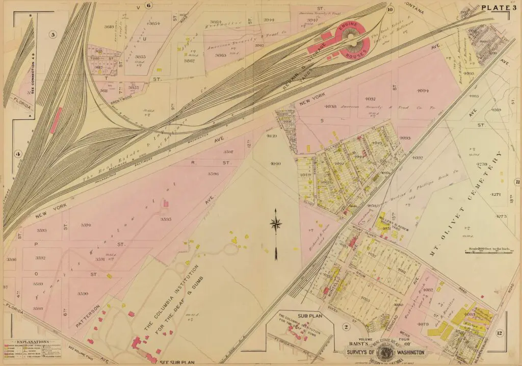
Take a journey back in time to 1907 with this map showing the area around Union Market and Gallaudet University. Learn more with this exploration of the past!
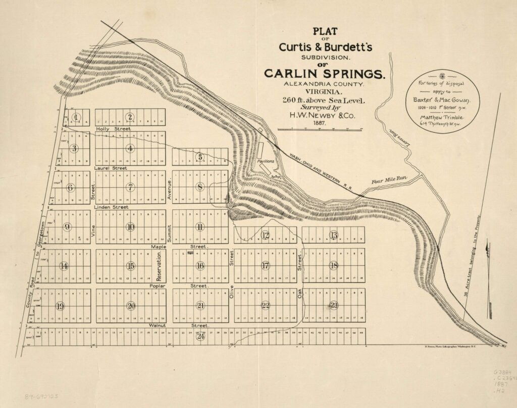
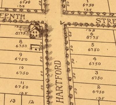
Take a look at the evolution of Carlin Springs Subdivision in Alexandria, now Arlington County. See a map from 1890 and compare it to a map from today. Visit the Library of Congress to learn more.
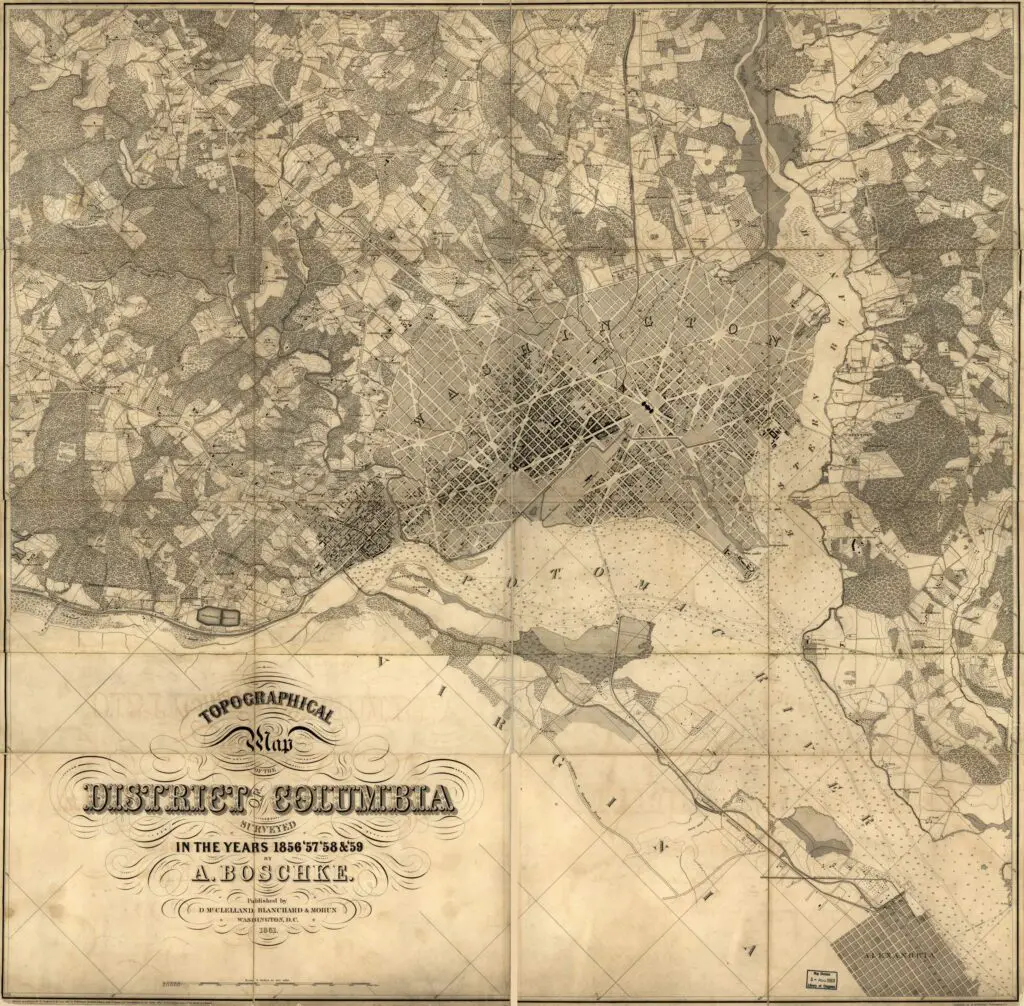
Take a journey back in time to 1850s Washington with this detailed map which marks all the buildings, roads, and rural property owners. Discover fascinating large plots of land outside Boundary Street with this map from the Library of Congress.
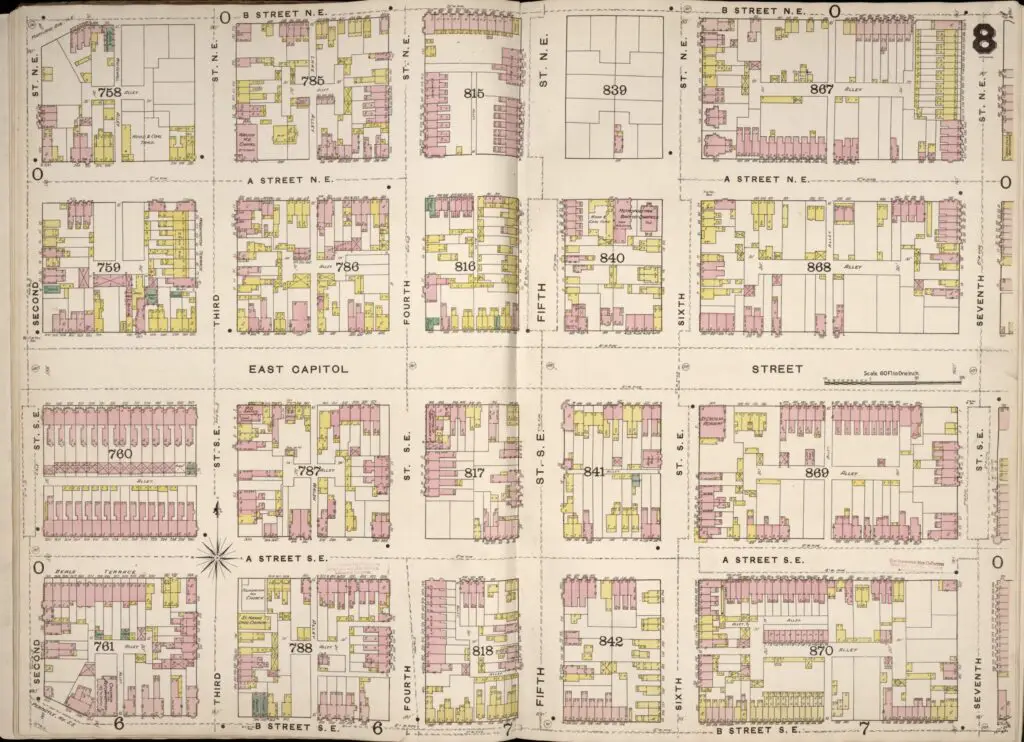
Explore East Capitol Street in 1888 with this historic map. Find wood and brick buildings from over a century ago. Discover a piece of DC history with this interactive map from the Library of Congress.
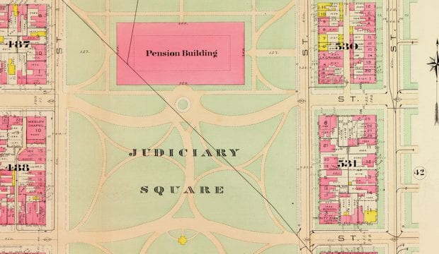
Welcome to Map Week! Every morning, we'll share a map with the GoDC community. Check out this great 1903 map of Judiciary Square, featuring the Pension Building and City Hall in the middle. Source: Library of Congress.
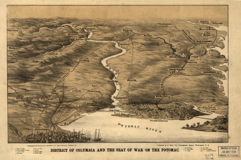
Explore a piece of history with a fascinating map from the Harvard University online archives. Take a look back to explore the District of Columbia in the late 1800s.
Take a journey back in time and explore Washington DC in 1901 with this map of the District of Columbia. See what's missing and what's still there! Click to explore!
Explore a rare map from 1795 showing the Territory of Columbia and the City of Washington surrounded by Maryland. Click to view a larger version and learn more about this piece of history.