Take a step back in time and explore what south of Dupont Circle and Farragut looked like in 1919, before the Mayflower was built. See the historic map from the Library of Congress.
Take a look at this amazing map of the Old Naval Hospital shared by a loyal GoDCer! We explore the history of this historic building and the proposed extension of New York Avenue that was never built. #GoDC #DCHistory #OldNavalHospital
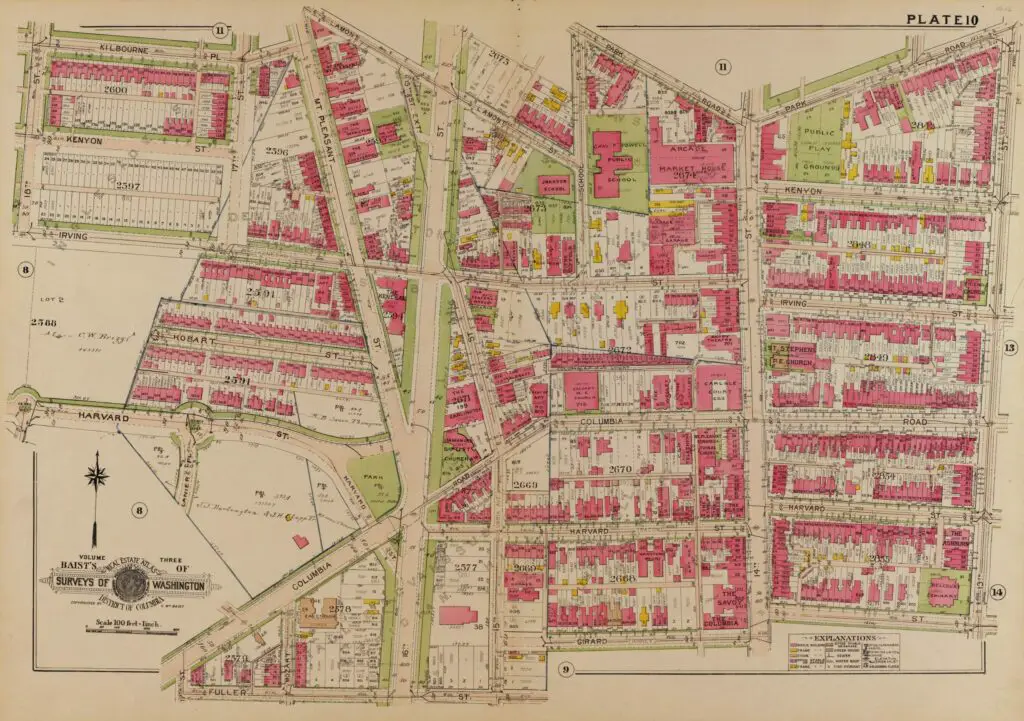
Take a journey back in time with this old map of Columbia Heights and 16th St. NW. Click on it for a larger version and explore to see what you recognize. Who knows, maybe you'll see your place. There are quite a few buildings still standing!
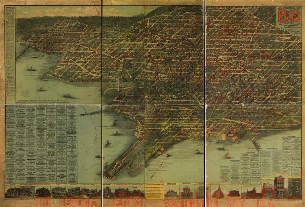
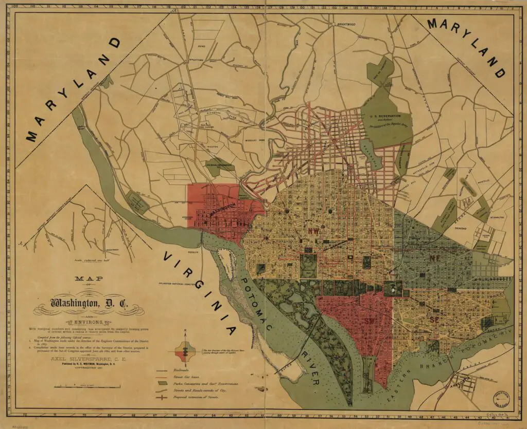
Check out this incredible old map of Washington, DC from 1887. See how the city and its environs looked over 130 years ago and explore the points of interest within a 20 mile radius of the Capitol.
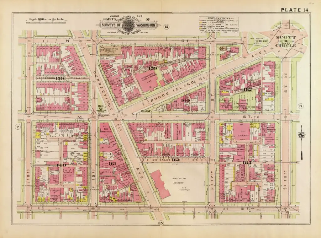
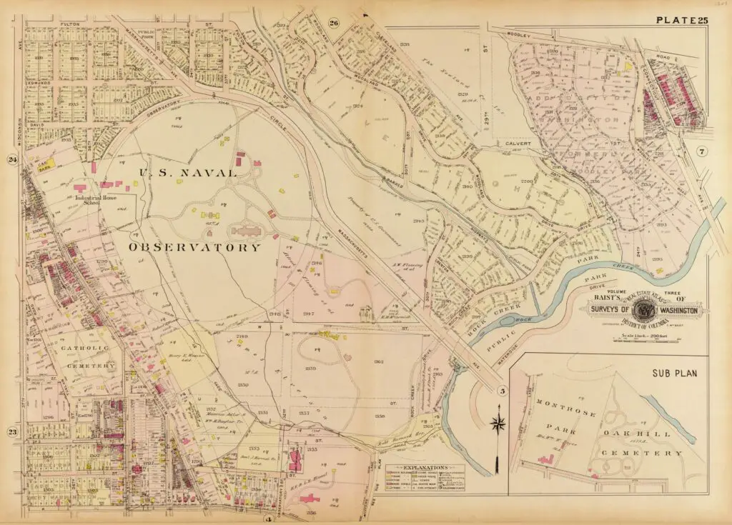
Take a look at this outstanding map of the area around the current Vice President's residence off of Mass. Ave. Get a glimpse into what the area looked like over a hundred years ago and explore the history of this unique area.
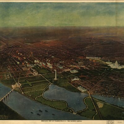
Discover the plan for the federal city with a terrific old map from the Library of Congress. Explore the projected layout of the city to gain insight into the history of the United States.
Explore Washington D.C. as it appeared in 1883 with this amazing map. Click on it for a larger version and learn more about the national capital from the Library of Congress.
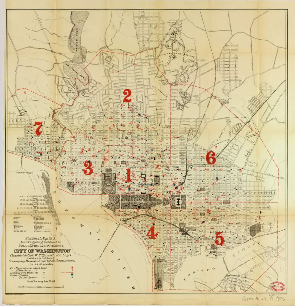
Explore an old map of Washington in 1880 and discover the exact locations of the fire stations and police stations. Learn about the history of the city through this fascinating map.
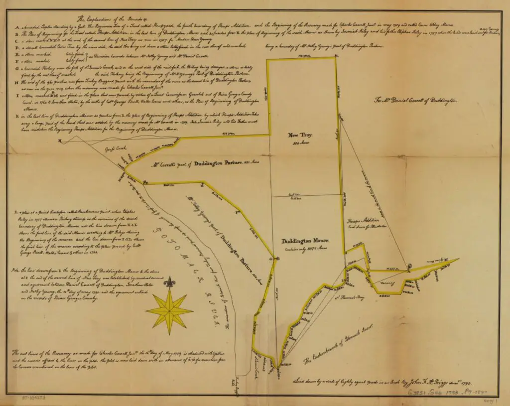
What did the land in and around Washington look like at the end of the 18th century? This map shows the Carroll family land in what would grow into DC.

![Map of Naval Hospital Washington, D.C. Showing Conditions on June 30, 1927. [includes hand-drawn "Proposed Extension of New York Avenue" and "Future Building Line"]. [map, Potomac Annex].Printed map, hand-colored with emendations. Marked "H.O. Misc. No. 7219" and "PW 2469". print 11x17 color. Navy Medicine Historical Files Collection - Facilities. [The New York Avenue extension was never built. Instead the North side of the base was cut off by an extension of Viginia Avenue, and the South side was truncated by the Institute of Peace.]](https://ghostsofdc.org/wp-content/uploads/sites/7/2014/07/14662497702_f69e69d69d_o-1024x614.jpg)
![Plan of the city intended for the permanent seat of the government of t[he] United States : projected agreeable to the direction of the President of the United States, in pursuance of an act of Congress, passed on the sixteenth day of July, MDCCXC, "establishing the permanent seat on the bank of the Potowmac"](https://ghostsofdc.org/wp-content/uploads/sites/7/2014/06/ct001333-1024x738.jpg)