-ad 189-

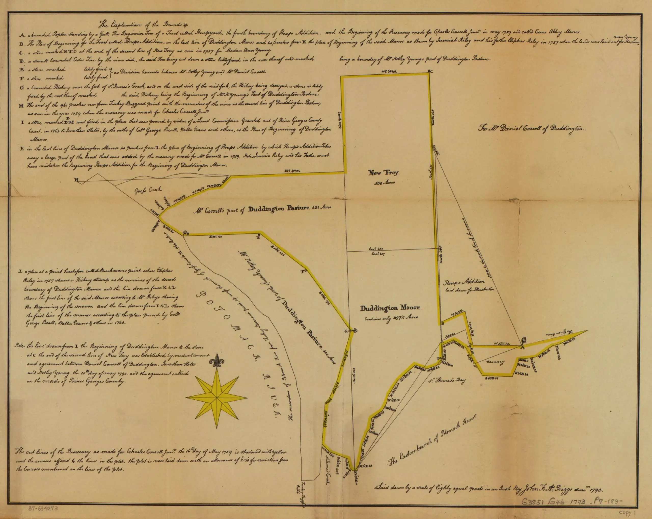
1793 Map of Carroll Family Land in Washington

Cadastral survey map of Charles Carroll Jr.'s land in central Washington D.C. in 1793
What did the land in and around Washington look like at the end of the 18th century? This map shows the Carroll family land in what would grow into DC.
-ad 188-
-ad 615-

This is a really old map of the Carroll family plot in Washington in 1793.

Cadastral survey map of Charles Carroll Jr.'s land in central Washington D.C. in 1793
Cadastral survey map of Charles Carroll Jr.’s land in central Washington D.C. in 1793

Source: Library of Congress

Today's Recommendation

-ad 617-

Suggested Reading

Can You Support Us?

If you enjoyed this post and can help support our blog, please consider subscribing. Thank you.

-ad 616-

Thanks for reading a few Ghosts of DC posts today.

Support Us

We rely on donations and a small amount of ad dollars to support our efforts. Are you able to chip in a few dollars today to help our site?

JOIN OUR EMAIL LIST

Enjoy daily

Ghosts of DC stories