-ad 189-

Posted In GoDCers Love Maps

Screen Shot 2014-11-30 at 1.15
Exploring 1887 Mt. Pleasant and Columbia Heights on an Incredible Old Map
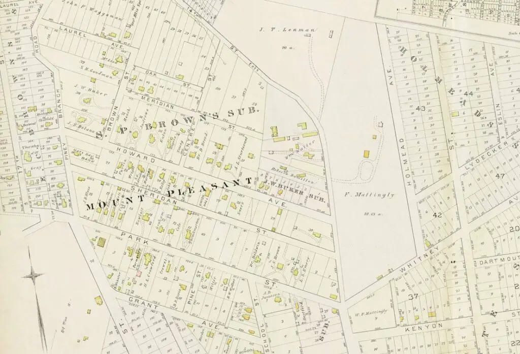
Explore an incredible old map from 1887 of Mt. Pleasant and Columbia Heights. See old street names and the Columbia College Subdivision. Click through to see greater details.
1907 map of Brightwood
A Rare Look at the Area Around Brightwood in 1907
Take a rare peek at Brightwood in 1907 by exploring this historic map. GoDCer Ian emailed us about this unique artifact. Enjoy!
1907 map
Exploring a 1907 Map of the Land Around the National Cathedral
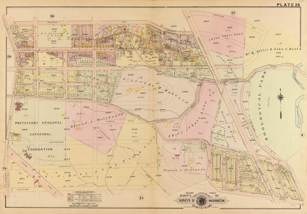
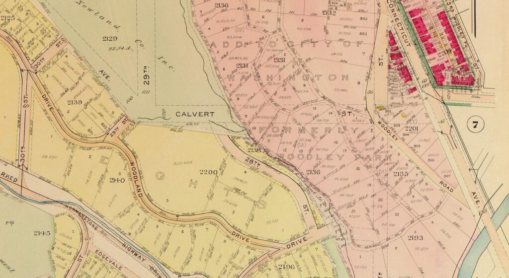
Check out this 1907 map of the land around the Washington National Cathedral. See how the land was owned by the Protestant Episcopal Cathedral Foundation, and notice the land owned by Francis Newlands of the Chevy Chase Land Company.
1864 map of the Washington Aqueduct
Exploring the Washington Aqueduct with a Civil War-Era Map
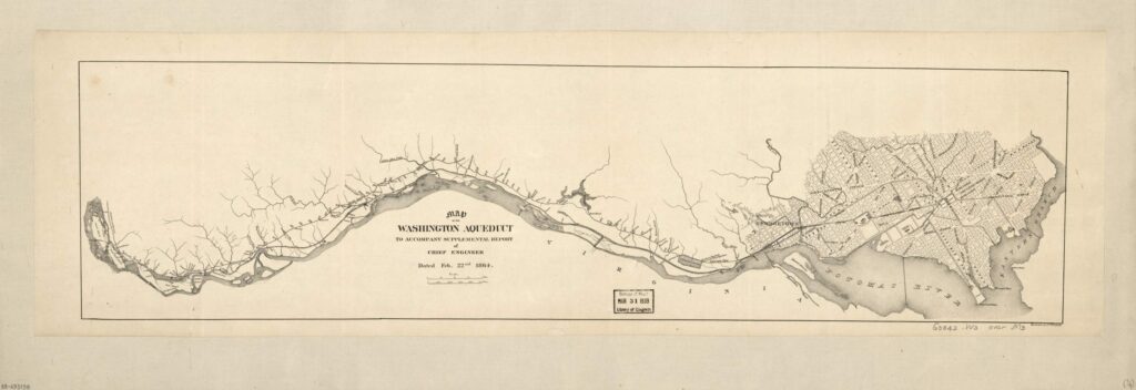
Check out this amazing Civil War-era map of the Washington Aqueduct. See how the Aqueduct and the C&O Canal looked in 1864. Source: Library of Congress.
1907 map of Chevy Chase area
Exploring the Rural Landscape of Chevy Chase in 1907
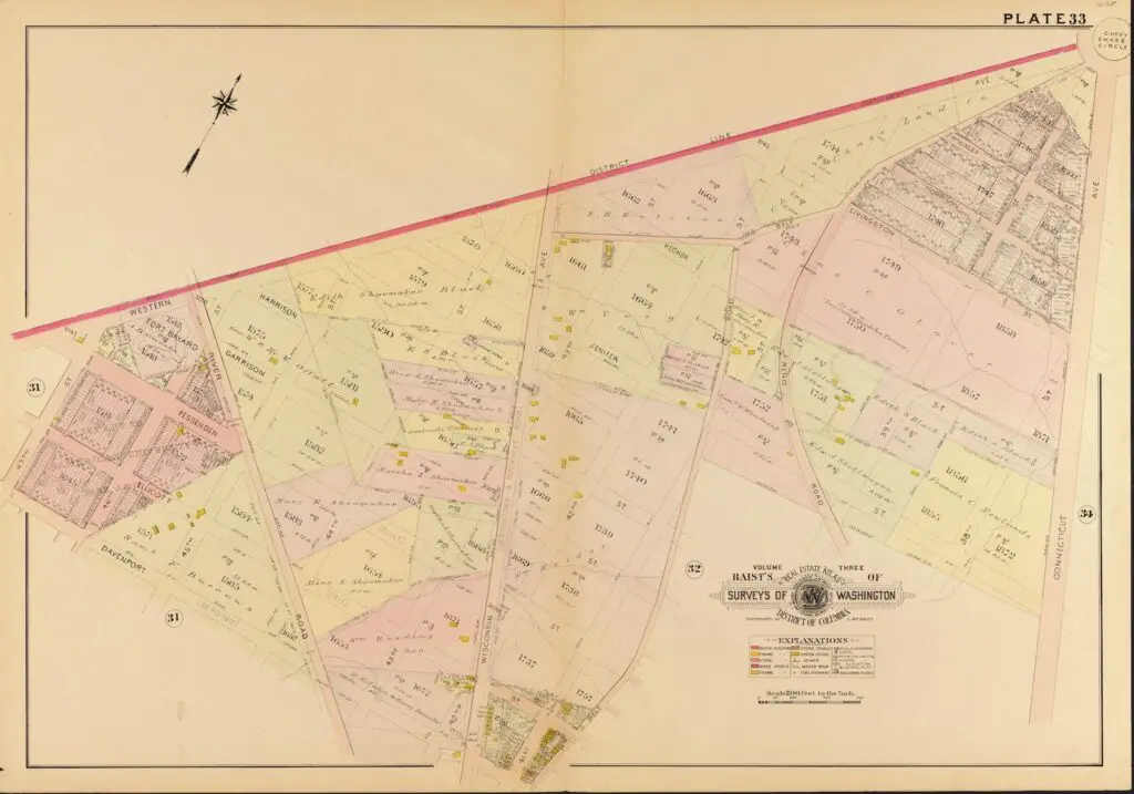
Explore a historic view of Chevy Chase, MD in 1907 with this map showing the area's rural landscape before development. It looks like the Shoemaker family owned quite a bit of land in the area back then.
Screen Shot 2014-10-25 at 7.33
Exploring Petworth in 1921: Take a Look at This Map
Take a look at this 1921 map of Petworth and recognize any of the places. Click on it for a detailed version and learn why it's called Petworth!
Screen Shot 2014-10-26 at 5.47
Taking a Look at Georgetown Maps from 1903
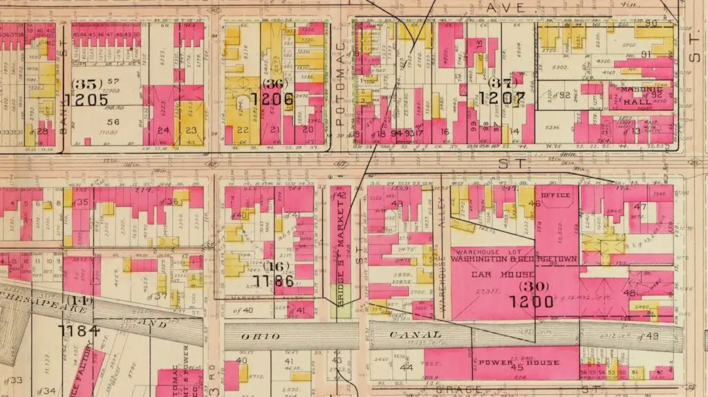
Take a journey through Georgetown's past with these detailed maps from 1903. Explore the buildings that still stand today and leave your comments below.
Screen Shot 2014-10-25 at 7.25
Exploring DC in 1913: Maps of Observatory Circle, Woodley Park and Glover Park
Take a look back at DC in 1913 with maps of Observatory Circle, Woodley Park & Glover Park. See what's changed and comment your observations below!
1892 map of Logan Circle
Exploring Logan Circle in 1892: An Amazing Old Map of Iowa Circle
Take a journey back in time and explore Logan Circle (back then known as Iowa Circle) in 1892 with this amazing old map. Source: Dig DC
1919 Dupont Circle
Explore Dupont Circle in 1919 with this Map
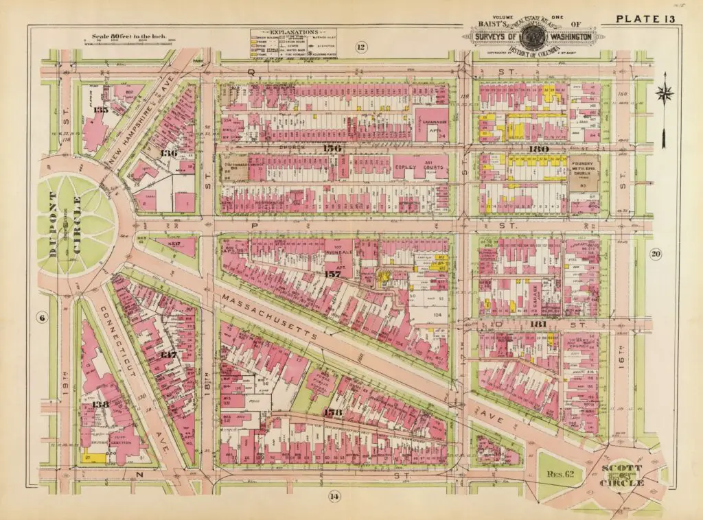
Take a journey through time and explore Dupont Circle in 1919 using this vintage map from the Library of Congress. See what used to be the British Embassy at the intersection of Connecticut and N St.

Enjoy daily

Ghosts of DC stories.