How cool is this old map of Columbia Heights and 16th St. NW? Click on it for a much larger version and start exploring to see what you recognize. Who knows … maybe you’ll see your place. There are quite a few buildings still standing.
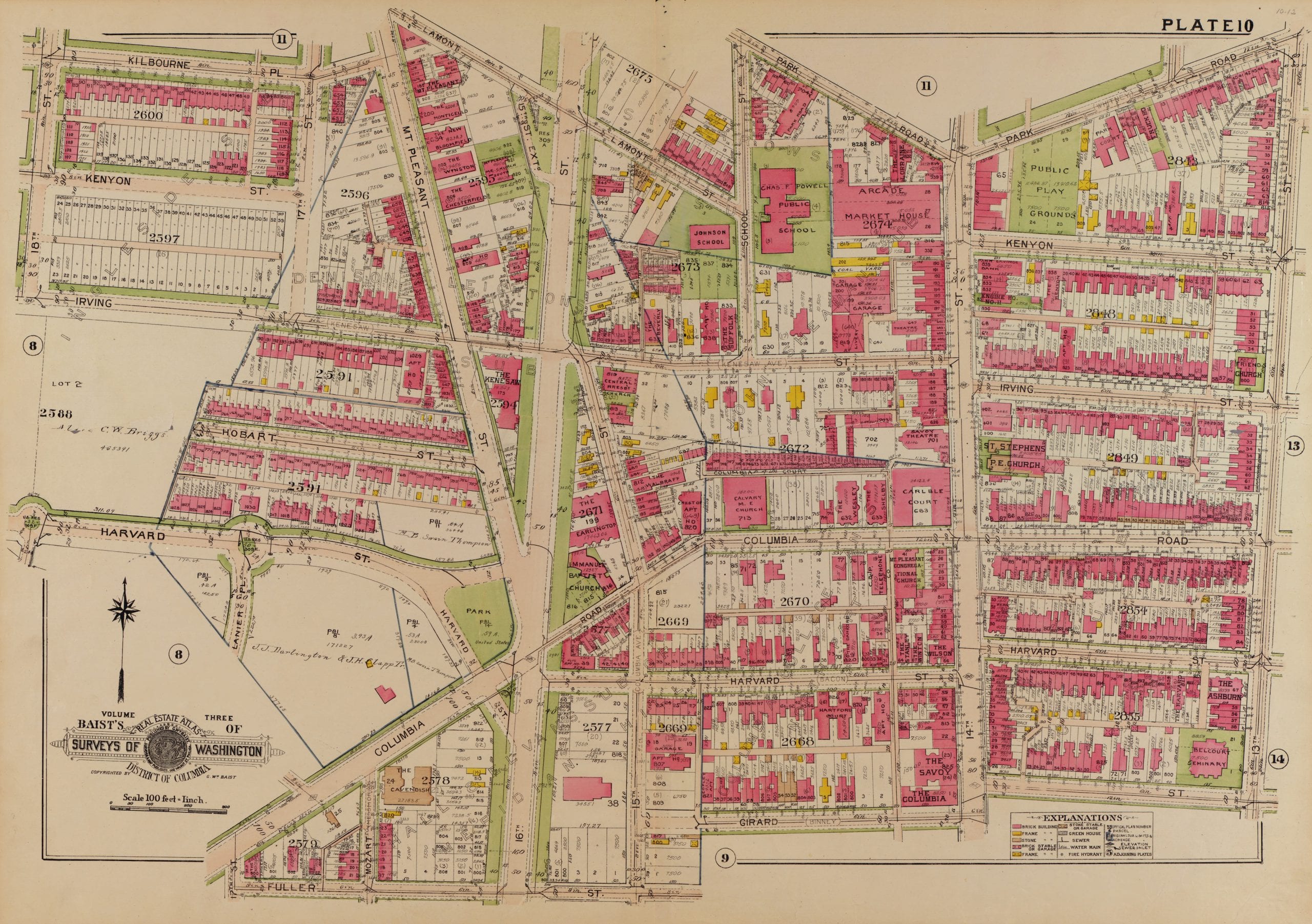
How cool is this old map of Columbia Heights and 16th St. NW? Click on it for a much larger version and start exploring to see what you recognize. Who knows … maybe you’ll see your place. There are quite a few buildings still standing.
Comments are closed.
This is sweet. Do you know where one could find adjacent sections? I’m on the southwest corner of Girard and 14th…right where this map ends.