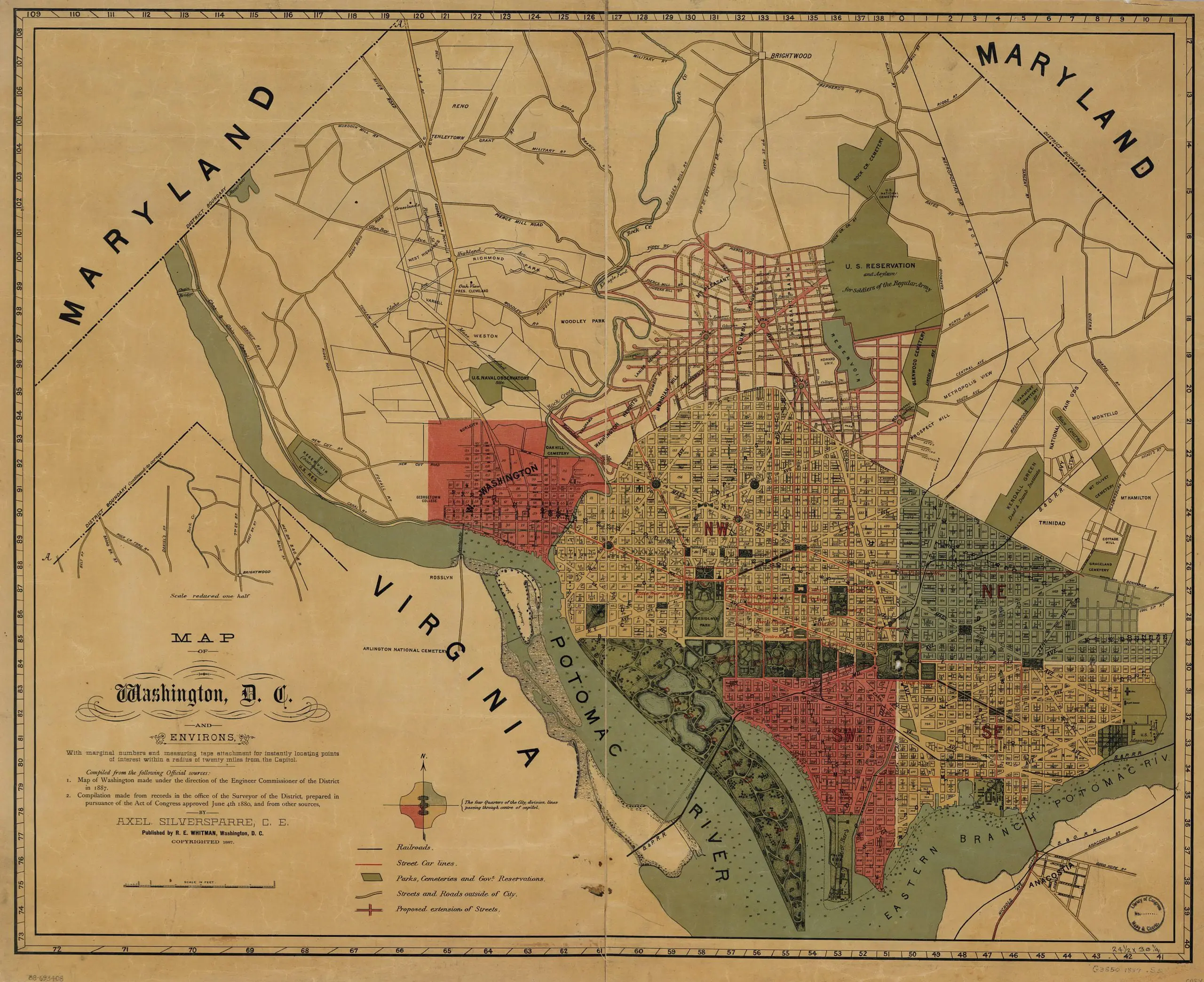
This is a terrific old map of Washington from 1887.
Map of Washington, D.C., and environs : with marginal numbers and measuring tape attachment for instantly locating points of interest within a radius of twenty miles from the Capitol /
3 thoughts on “1887 Map of Washington, DC and Its Environs”
Is this a map of what actually was, or a plan? I was under the impression that the Tidal Basin didn’t exist until after the McMillan Plan.
Nevermind, I took another look, and it reads “Proposed Park” over the East and West Potomac Parks.
This is a mix of existing and planned. Yellow roads were extant. All of the pink roads are marked as “proposed” and we can see grand ambitions for California and New Jersey Avenues (for example) that clearly were never realized. Grant and Logan Circles didn’t end up being where they were proposed here.
Given the Post’s feature on Frances Folsom Cleveland this past Sunday, it’s interesting to note their residence, Oak View on the map along with Pres. Cleveland’s name. I hadn’t realized that they lived here and gave the name to Cleveland Park.
Nearby, we also see Klingle Road, which is now a ghost, as well as plans for Highland Ave, which would become Porter St. Any idea why Highland has all the curving roads coming off of it, or what the plans were for it and the unbuilt Richmond Ave? It seems like someone had plans to build something impressive that never came to life.