
Happy Sunday, and welcome to map week! Starting now, going through the rest of the week, we’re posting a map each day, so get pumped. GoDCers love maps! And this is a great one to start with.
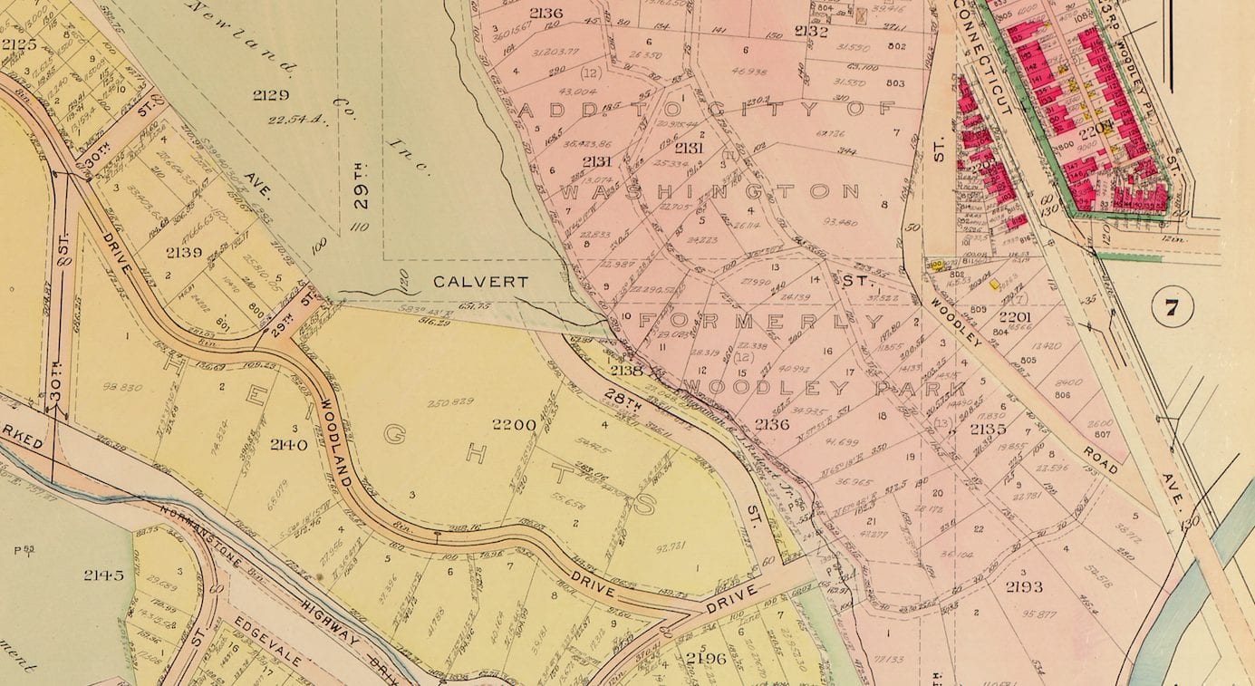
Here’s a map covering Observatory Circle, Woodley Park and some of Glover Park from back in 1913. Pretty cool stuff. You’ll notice a few different things, like Calvert St. wasn’t there, Whitehaven St. was W St., and a few more things.
Click on it for a much larger version and put your observations in the comments below.
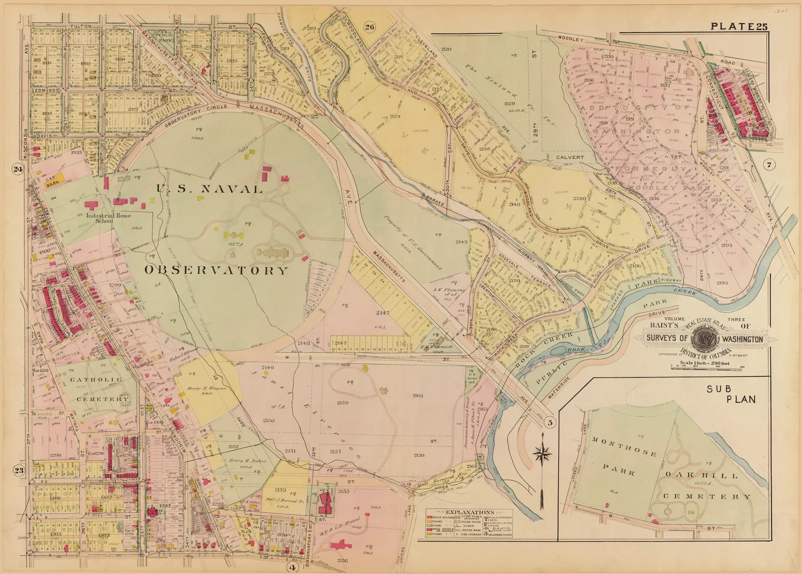
Source: Library of Congress
I’m never able to click on the map for a larger version. I don’t have adblock and am currently using chrome, but it doesn’t work in any other browsers either. Am I doing something wrong?