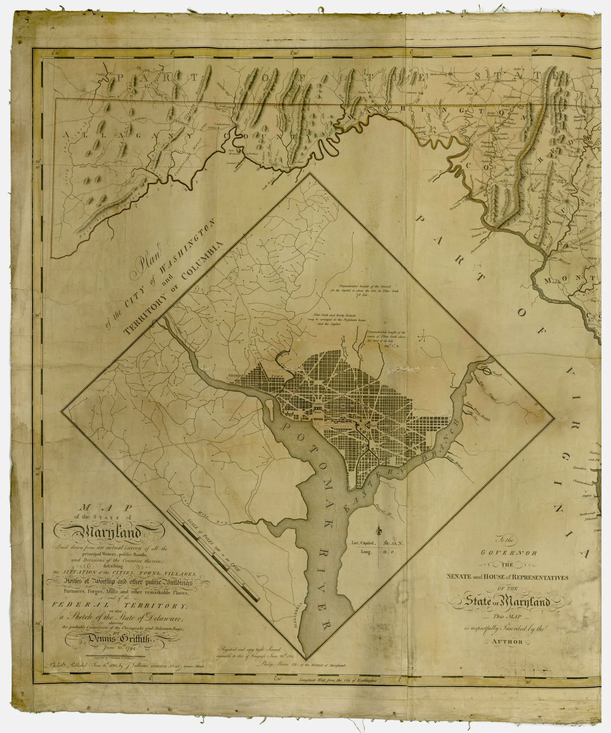
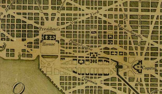
Here’s a map that we haven’t come across before. This shows the Territory of Columbia and the City of Washington surrounded by Maryland in 1795. Click on it for a much larger version.
Description Map of the State of Maryland, laid down from an actual survey of all the principal waters, public roads, and divisions of the counties therein, describing the situation of the cities, towns, villages, houses of worship and other public buildings, furnaces, forges, mills, and other remarkable places, and of the Federal Territory, as also a sketch of the State of Delaware shewing the probable connexion of the Chesapeake and Delaware Bays, June 20th, 1794. Relief shown pictorially; Hand colored; Engraved by J. Thackara & J. Vallance; Includes “Plan of the city of Washington and Territory of Columbia” and a dedication to the Governor, the Senate and House of Representatives of the state of Maryland.

As a Maryland I would love to see the rest of this map.
Is it just me, or is this map grossly wrong in that it says “Part of Virginia” to the northeast of DC, in what is clearly Maryland?
Ah, got it now. Just an inset under the western part of the state.