Skip to content
Ghosts of DC

Ghosts of DC

  • The Best Of
  • Neighborhoods
    • Southwest DC
      • Waterfront
    • Maryland
      • Gaithersburg
      • Rockville
      • Bethesda
      • Hyattsville
      • Silver Spring
      • Bladensburg
    • Virginia
      • McLean
      • Falls Church
      • Alexandria
      • Vienna
      • Arlington
    • Southeast DC
      • Congress Heights
      • Navy Yard
      • Capitol Hill
      • Anacostia
    • Northeast DC
      • Trinidad
      • Woodridge
      • Deanwood
      • Brookland
    • Northwest DC
      • Tenleytown
      • Park View
      • Friendship Heights
      • Brightwood
      • Crestwood
      • Sheridan-Kalorama
      • The Palisades
      • Logan Circle
      • Petworth
      • Glover Park
      • Bloomingdale
      • Georgetown
      • Woodley Park
      • Dupont Circle
      • Columbia Heights
      • Cleveland Park
      • Adams Morgan
      • Mt. Pleasant
      • Chevy Chase
      • Cathedral Heights
      • Chinatown
    • Lost Neighborhoods
      • Hell’s Bottom
      • Swampoodle
      • Murder Bay
  • Notable People & Places
    • Places
      • Washington Monument
      • Library of Congress
      • The White House
      • The Capitol Building
      • Dulles Airport
    • People
      • Franklin D. Roosevelt
      • Calvin Coolidge
      • Officer Sprinkle
      • Dwight D. Eisenhower
      • Warren G. Harding
      • William McKinley
      • Abraham Lincoln
      • John F. Kennedy
      • Teddy Roosevelt
      • Woodrow Wilson

Transit

Long before Metro, Washington moved by streetcar, railroad, and horse-drawn carriage. These posts trace the history of how people got around the capital, from 19th century rail companies to the debates that shaped the modern transit system.

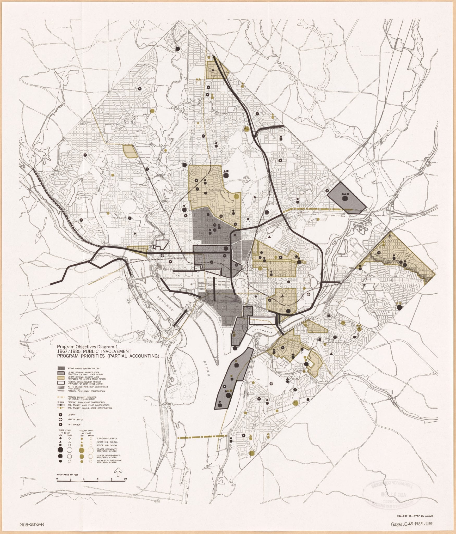
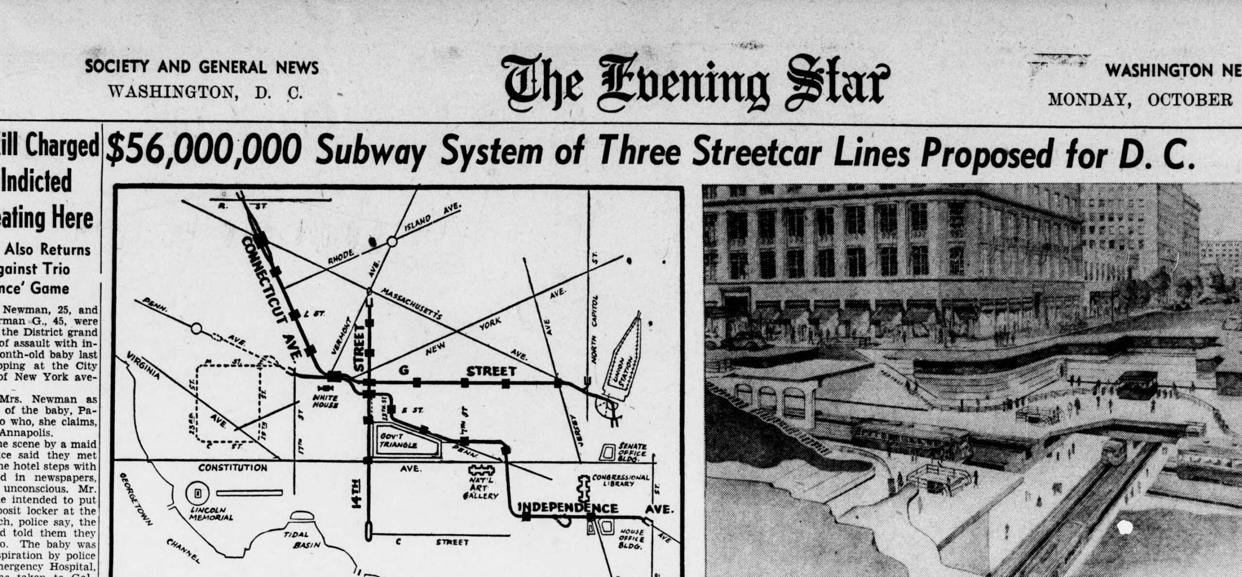
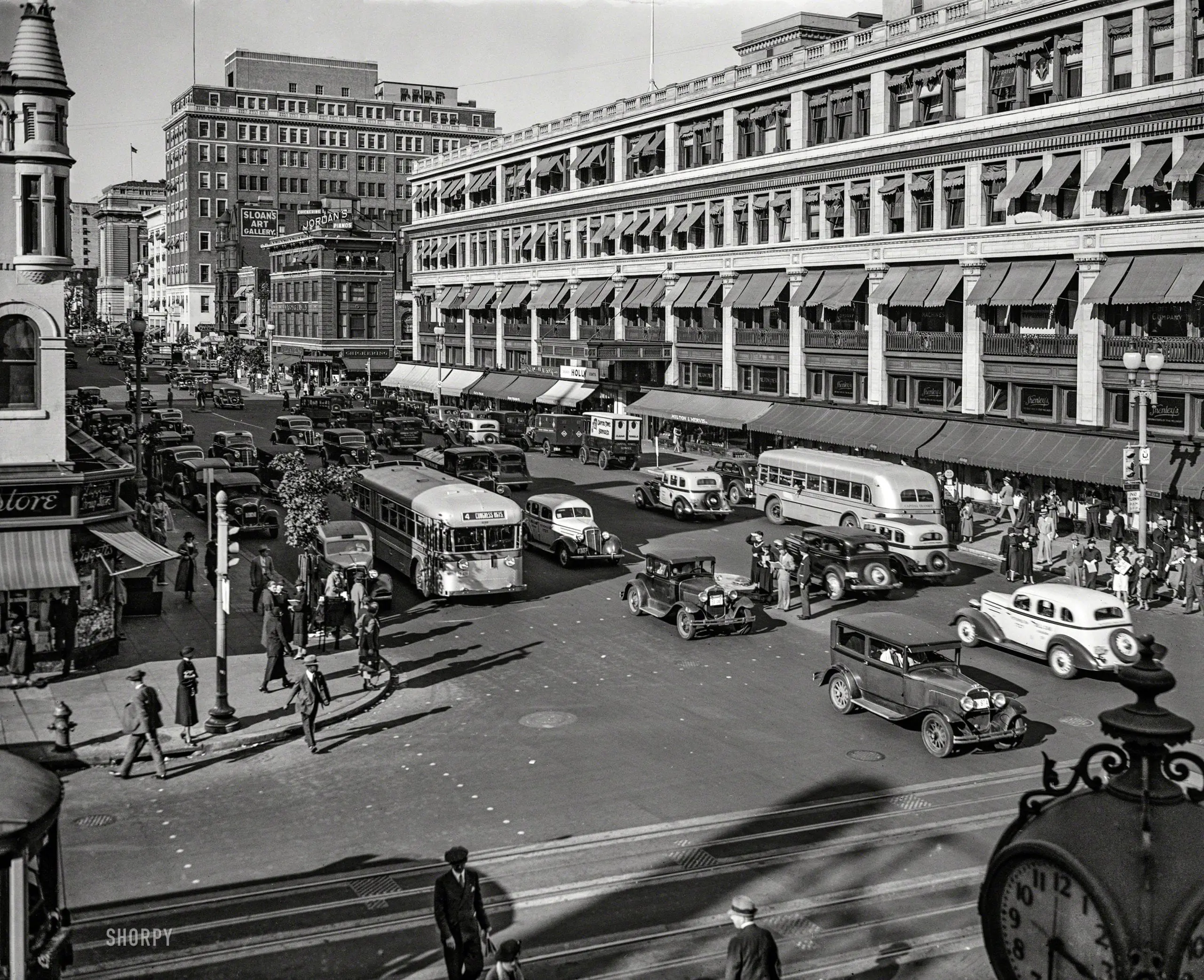
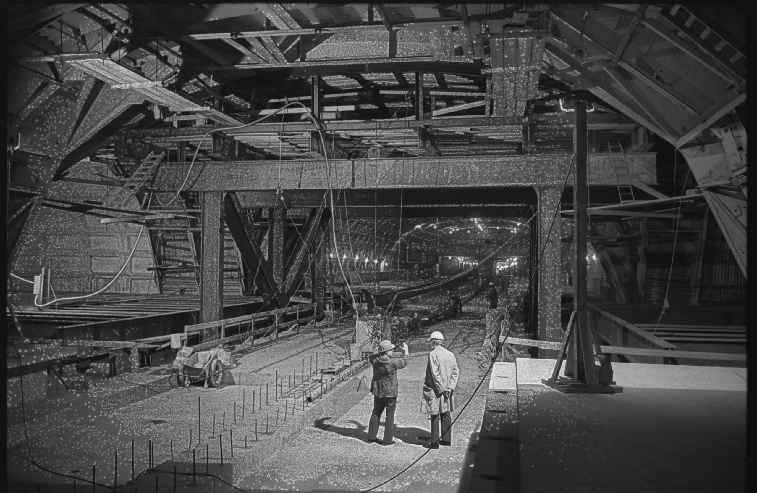
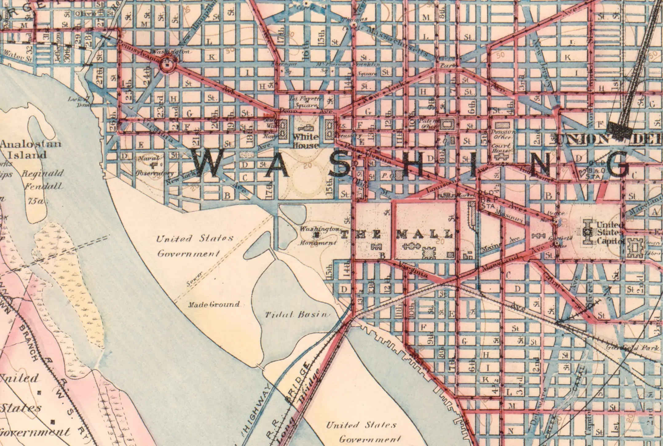
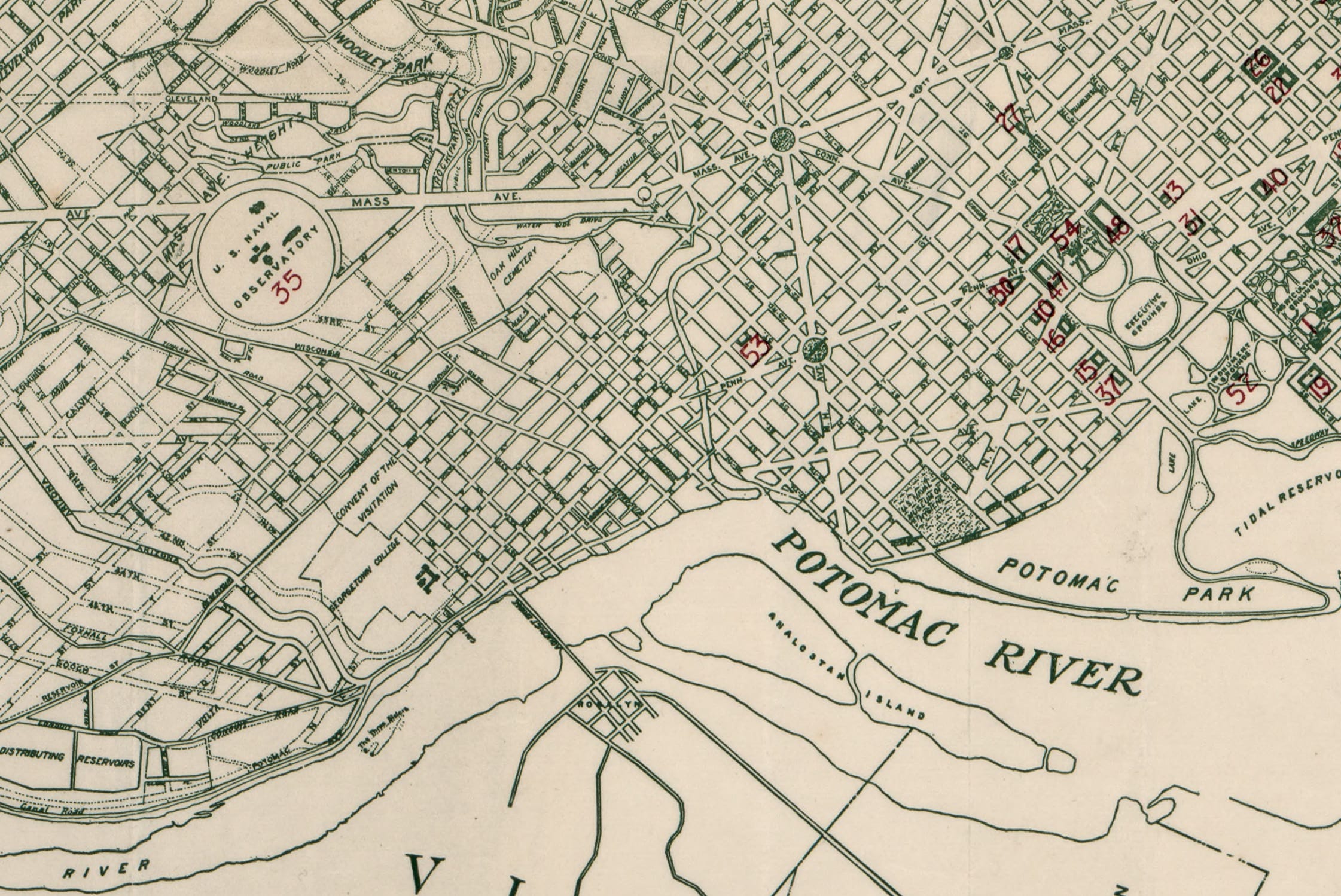
Mid-1960s Vision for Washington’s Metro System

May 11, 2026February 21, 2022 by ghostsofdc
proposed Metro map in 1966

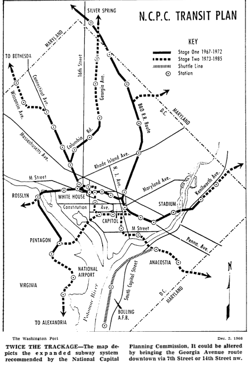
The proposals were published to convince transit officials that the 19-mile system authorized by Congress within the city – part of a 25-mile network extending into the suburbs -would be inadequate by 1985.

Categories Lost History Tags 1960s, Transit, Unbuilt Washington 2 Comments

Washington’s Railroads in the 1870s: Photos from Just After the Civil War

November 9, 2022April 22, 2019 by ghostsofdc

These photographs from the 1870s show Washington’s railroad infrastructure in the years just after the Civil War. Click through for the full detail.

Categories Lost History Tags 1870s, Transit

What’s a Herdic Cab? What Did They Look Like?

November 9, 2022March 19, 2019 by ghostsofdc

A herdic cab is a type of horse-drawn carriage, used as an omnibus, invented by Peter Herdic of Williamsport, Lycoming County, Pennsylvania in 1881.

Categories Faces & Places of Yesterday Tags 1880s, 1890s, Notable People, Transit

The 1967 Map of DC Highways That Were Never Built

May 17, 2026March 12, 2019 by ghostsofdc

In 1967 the National Capital Planning Commission mapped out the freeway grid Washington was supposed to get: a K Street expressway, a Three Sisters Bridge, an I-95 extension up through northeast. Almost none of it got built.

Categories GoDCers Love Maps, Lost History Tags 1960s, 1970s, Highways, Maps, Transit, Unbuilt Washington

Washington Almost Built a $56 Million Streetcar Subway at the End of World War II

May 24, 2026October 10, 2018 by ghostsofdc
Front page B-1 of the Evening Star, October 23, 1944, showing the proposed $56 million Washington streetcar subway, route map, and artist rendering

At the end of World War II, Washington came within a study of building a $56 million, 7.1-mile streetcar subway, which would have been the longest in the country. Here is the 1944 plan, the map, the artist renderings, and why it never got built.

Categories Lost History Tags 1940s, Congress, Transit, Unbuilt Washington

13th and F Street NW, Washington, DC in 1935

November 9, 2022March 1, 2016 by ghostsofdc
October 1935. Washington, D.C. "Capital Transit buses, F and 13th sts. NW." Just direct your feet to the sunny side of the street.

A 1935 photograph of the intersection of 13th and F Street NW in Washington, DC. Click through for the full-resolution version.

Categories Faces & Places of Yesterday Tags 1930s, Transit 1 Comment

Take a Look Back in Time: Photos of Metro Center Under Construction in 1973

November 9, 2022January 5, 2016 by ghostsofdc
Photo of Metro Center in 1973

Take a look back in time with these amazing photos of Metro Center under construction in 1973. Don’t miss these other great old Metro photos showing Dupont Circle!

Categories Faces & Places of Yesterday Tags 1970s, Transit

Washington DC Street Names: Why They’re Letters, Numbers, and States

April 27, 2026December 21, 2015 by ghostsofdc

DC’s diagonal avenues, named for states, all radiate from the Capitol. The prominent ones nearby honor the original thirteen colonies.

Categories The Best Of, Why Is It Named...? Tags 1890s, Architecture, Politics, Transit 5 Comments

Exploring the Historic Highways of Washington, D.C. in 1911

November 9, 2022October 20, 2015 by ghostsofdc

Explore the highways of Washington, D.C. in 1911 with this historic map from the Library of Congress. See roads, routes, and more from over 100 years ago.

Categories GoDCers Love Maps Tags 1910s, Transit
Older posts
Newer posts
← Previous Page1 Page2 Page3 … Page6 Next →
Explore the Archive
The Best Of Old Ads & Classifieds Then and Now Lost History
GoDCers Love Maps From the Crazy Vault Faces & Places of Yesterday If Walls Could Talk
Historical Events Notable People & Places This Day in History Guest Posts
Three Things… A Personal Story Why Is It Named…? Featured
Ghosts of DC© 2012–2026 Ghosts of DC · AI Policy