
1889 Cleveland Park Real Estate Ad
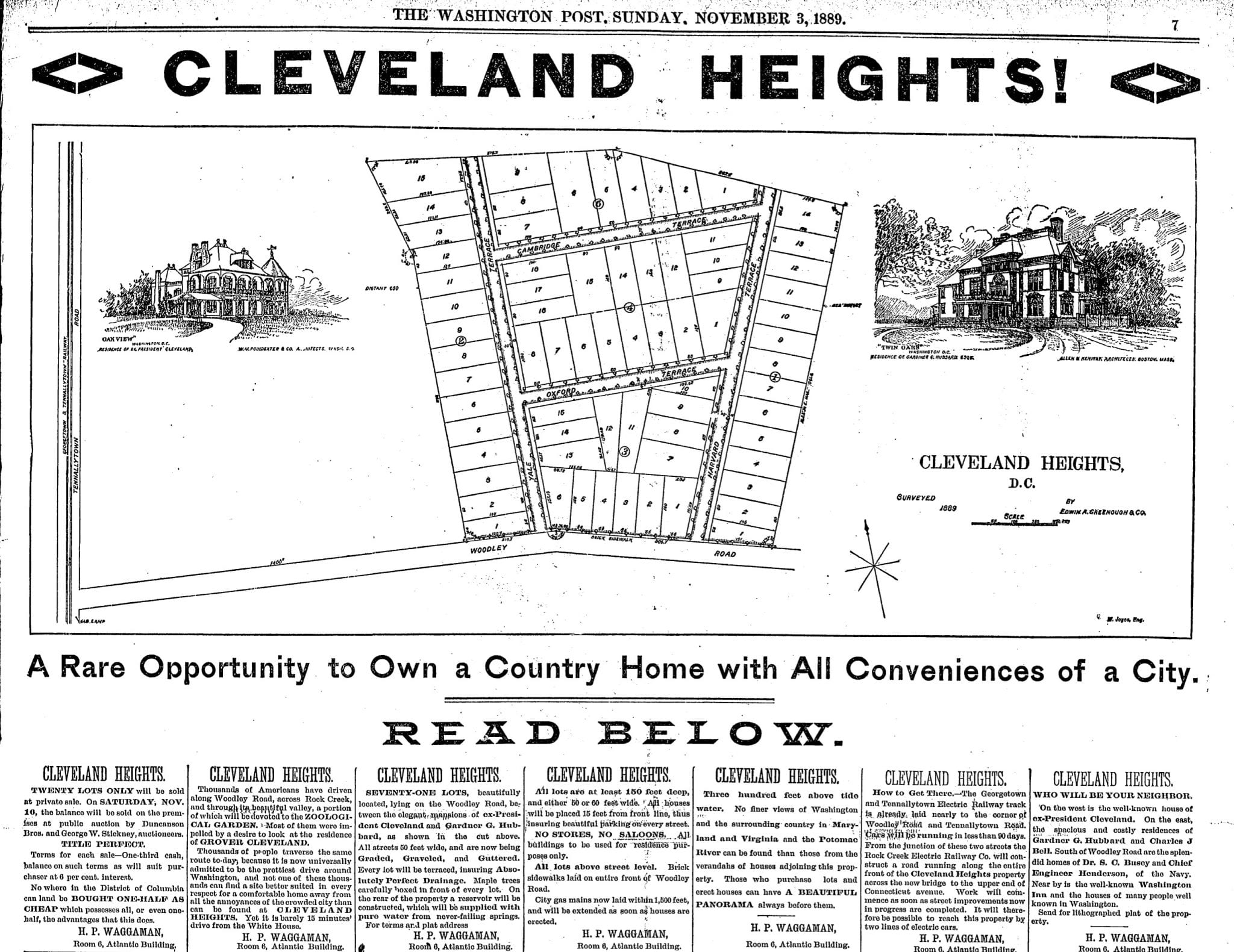
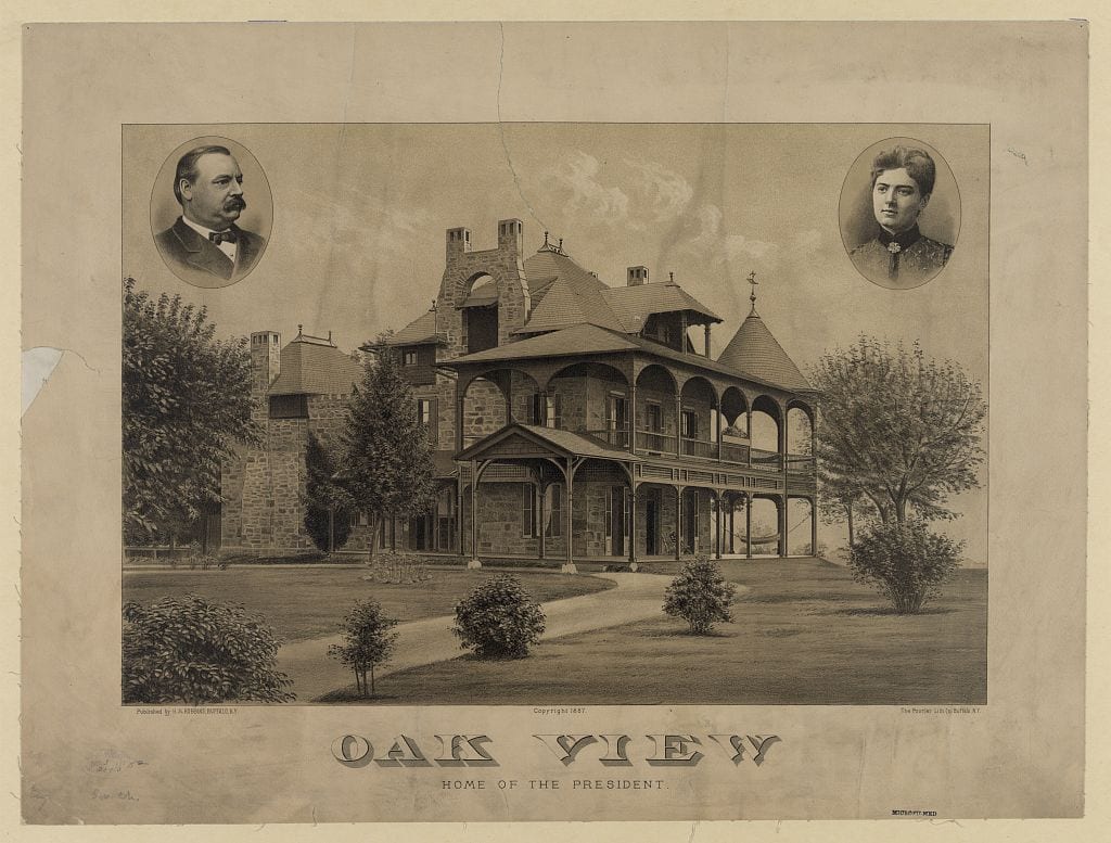
At the time, Grover Cleveland lived north of the city in a lovely old estate called Oak Hill. Eventually, the neighborhood that grew up around his home was named for him: “Cleveland Park”.
Victorian Washington was booming in the 1880s. The decade brought the dedication of the Washington Monument (finally finished in 1884), the consolidation of Georgetown into DC, and a wave of grand Romanesque architecture that still defines many of the city’s neighborhoods. These posts explore Washington at its Victorian peak.
At the time, Grover Cleveland lived north of the city in a lovely old estate called Oak Hill. Eventually, the neighborhood that grew up around his home was named for him: “Cleveland Park”.
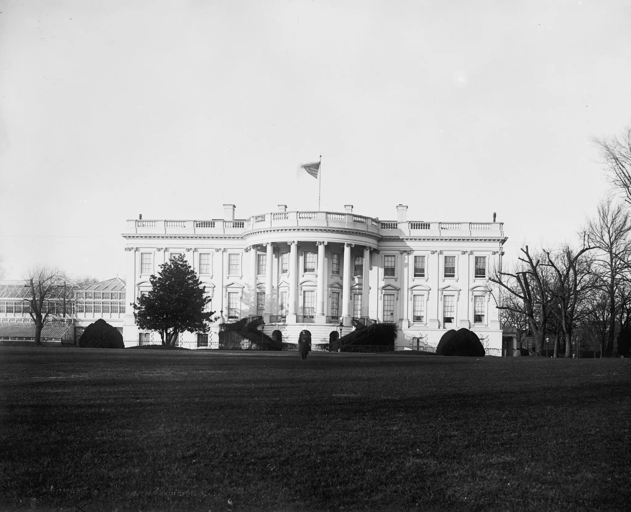
This photograph of the White House, taken from the south side in the 1880s, shows the President’s Mansion before Teddy Roosevelt gave it its official name and before the West Wing changed the building’s entire footprint.
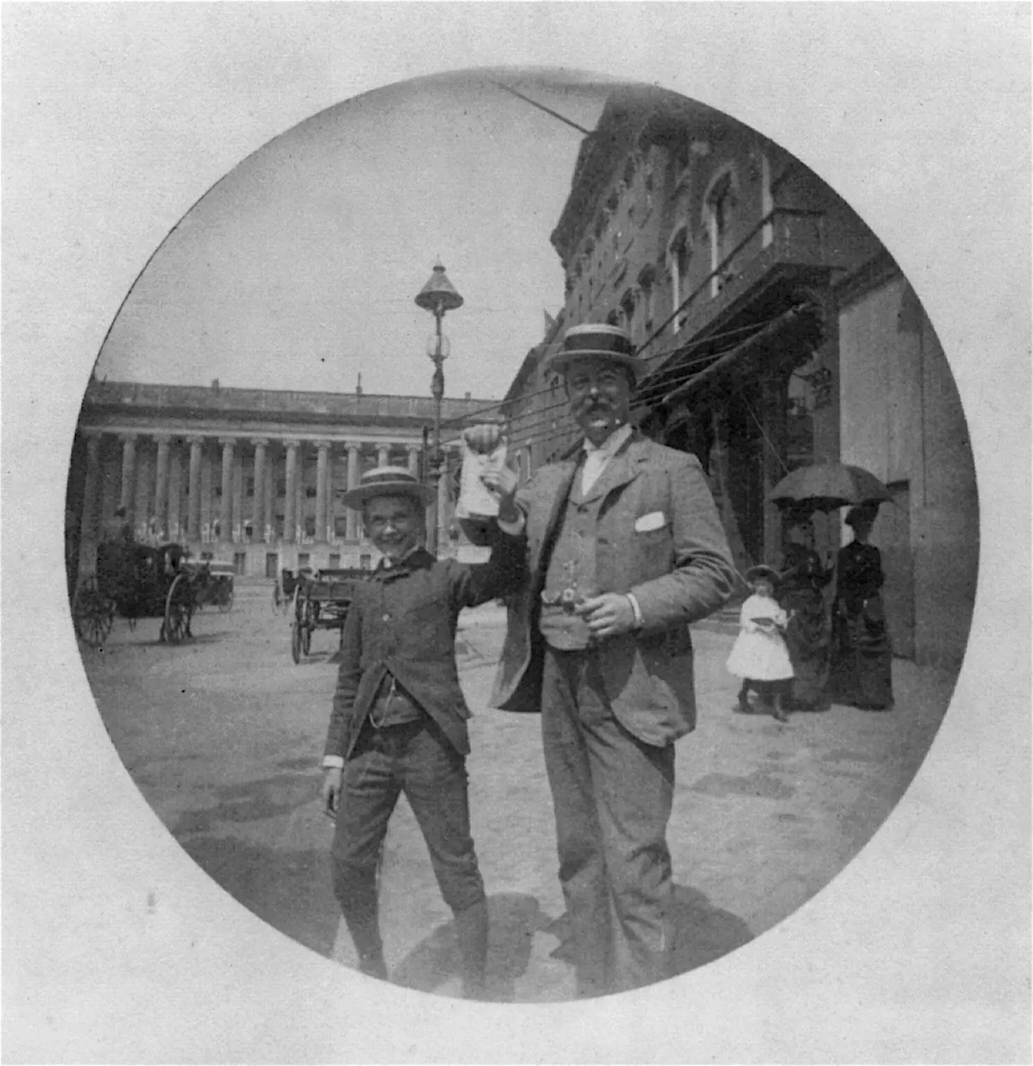
A Library of Congress photograph from 1885 showing a man and a boy in summer straw hats displaying unidentifiable papers on F Street in Washington, D.C.
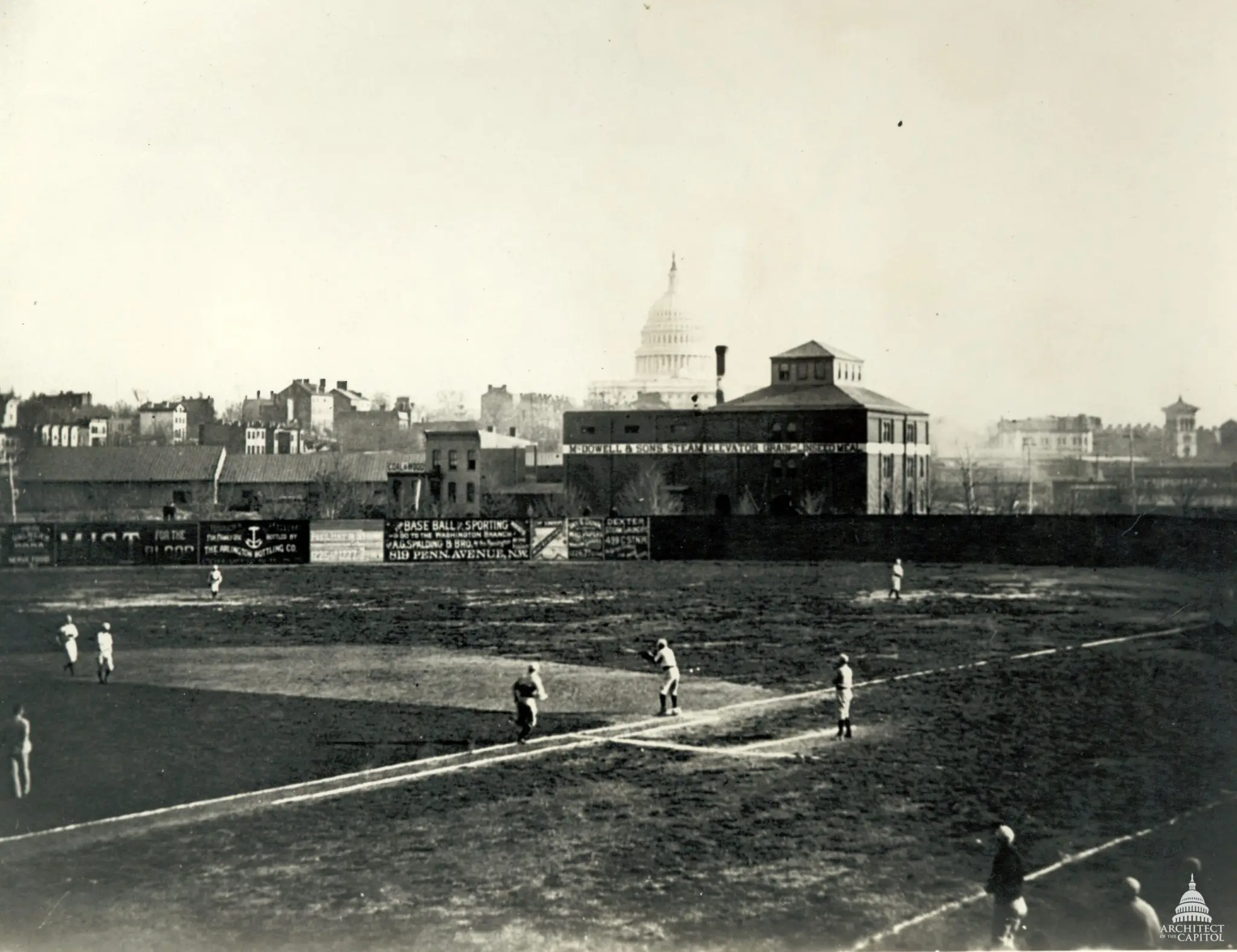
An 1880s photograph of the Washington Nationals playing at Swampoodle Grounds. Click through for the full-resolution version to pick out the details.
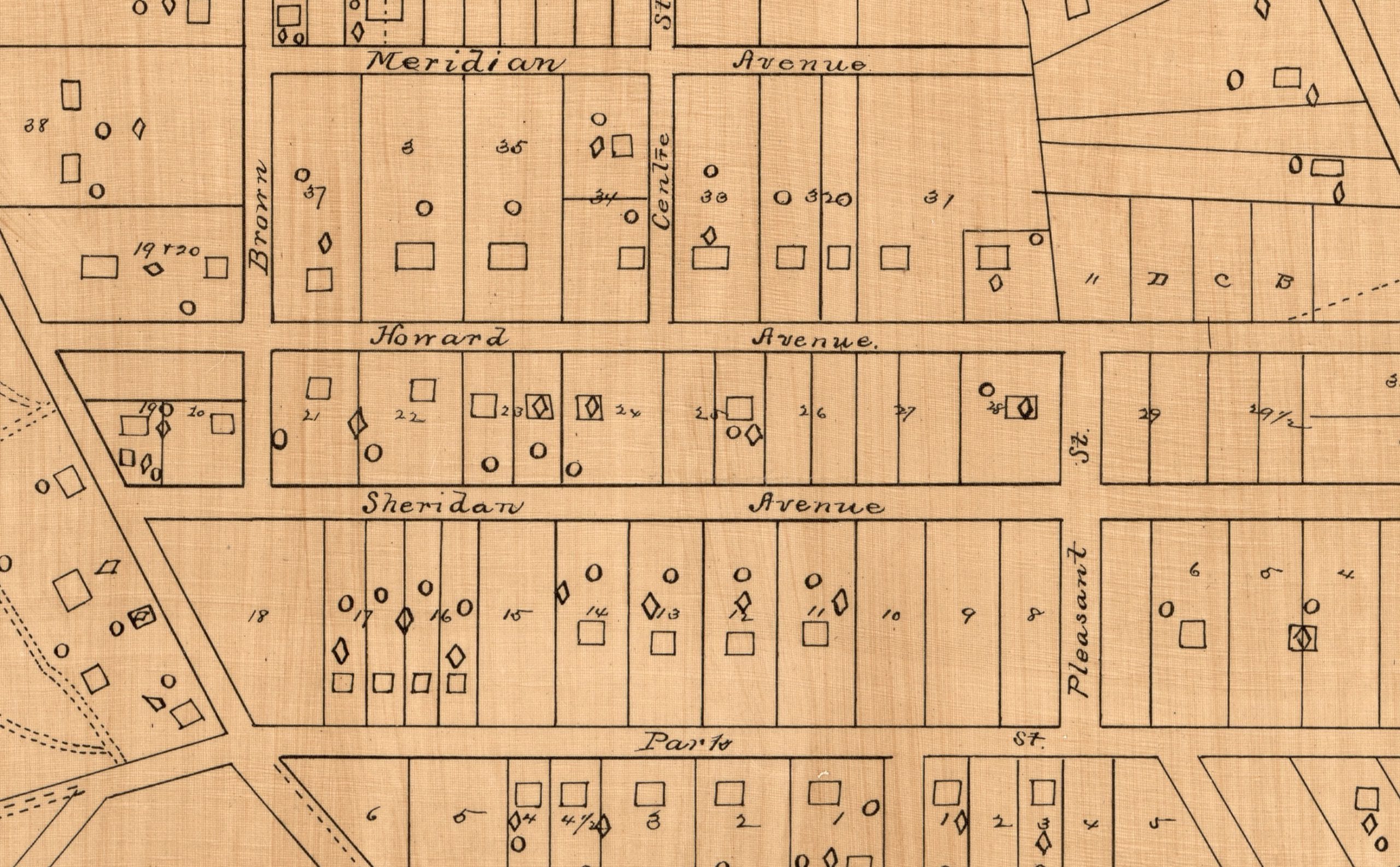
Discover the origins of Columbia Heights in this 1885 map. It shows what would become the northern part of Columbia Heights and points to the street name changes that took place. Click through to view the full-sized map!
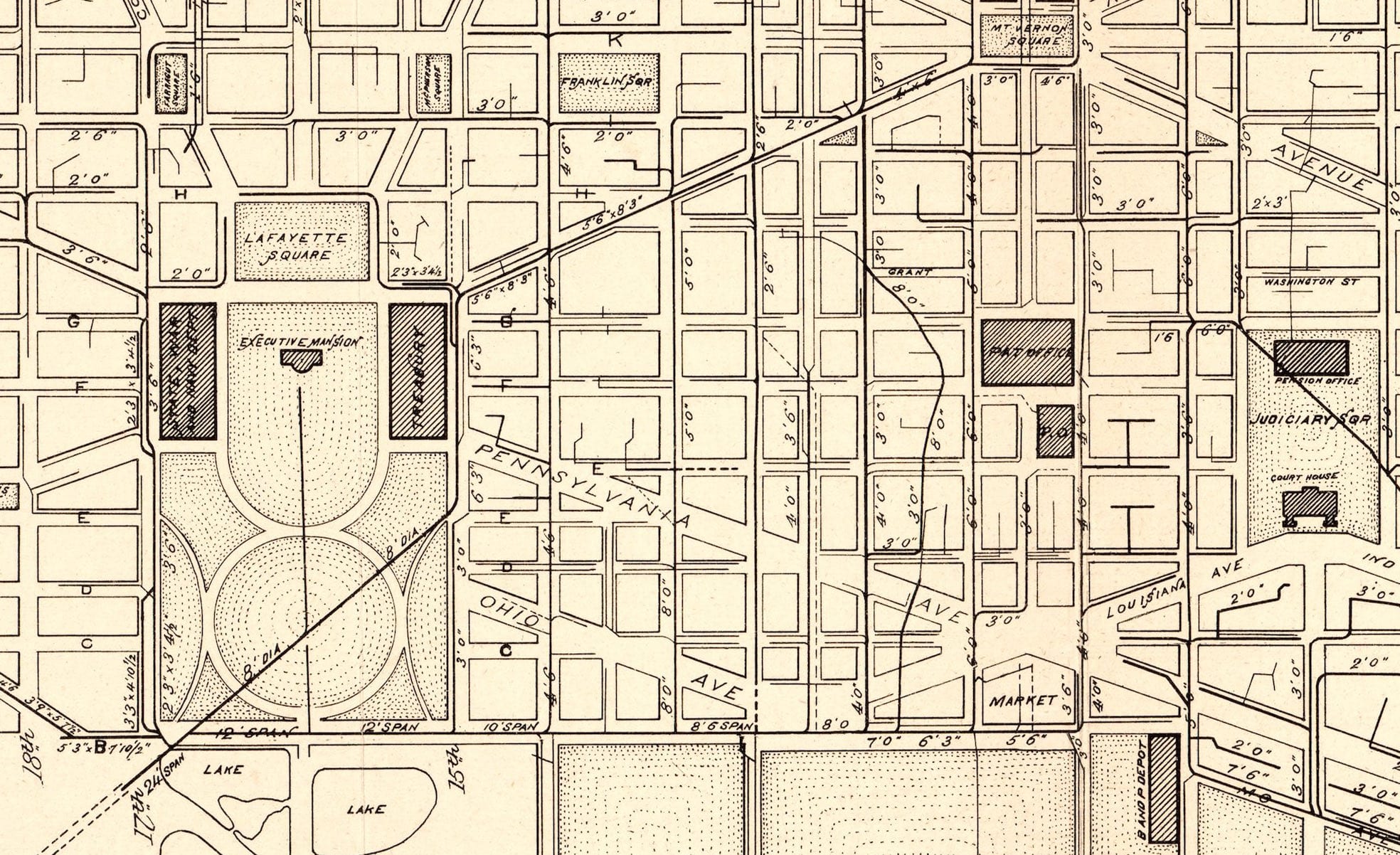
A series of 1885 maps of Washington, DC showing the sewer and water main systems. Click through for the full-resolution versions to see the detail.
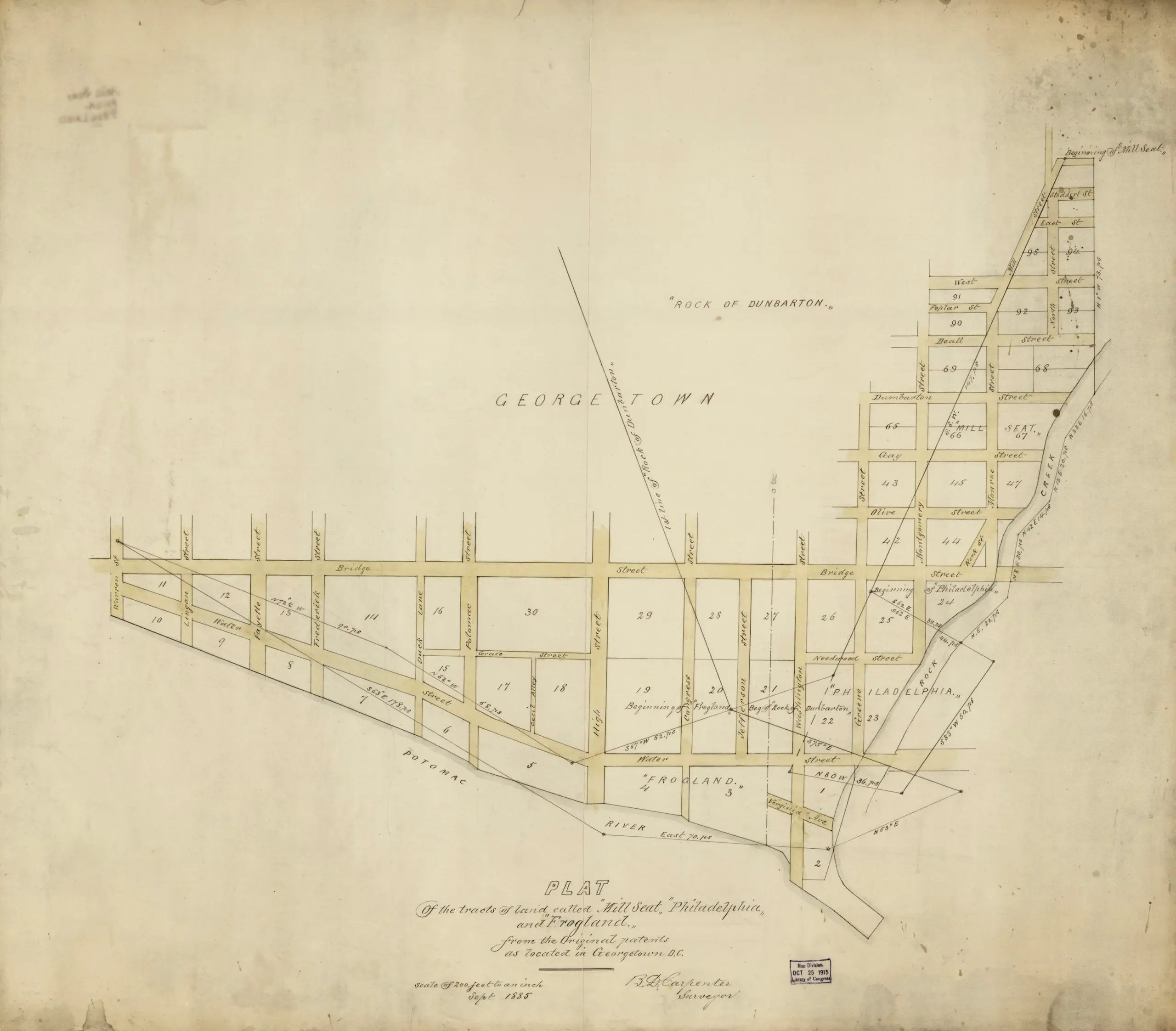
Take a journey back in time and explore the old Georgetown neighborhoods of 1885 with this map. Learn about the history of the area and discover the original patents of Mill Seat, Philadelphia, and Frogland.
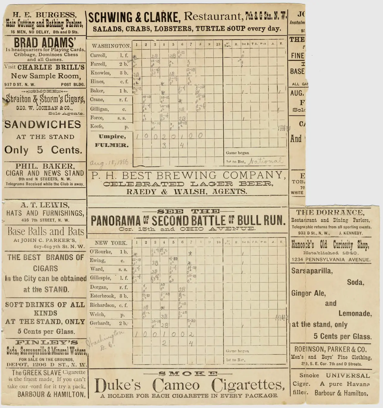
Take a look back at the 1886 Washington Nationals baseball season through three scorecards from games against the New York Giants, Boston Beaneaters, and Boston Beaneaters. See the advertisements, handwritten notes, and penciled notations on the scorecards.
In the late 1800s, Cleveland Park was a summer retreat for wealthy Washingtonians, elevated and breezy, far from downtown’s heat.