
Civil War Photos of Alexandria, VA: The Steam Frigate Pensacola in 1861
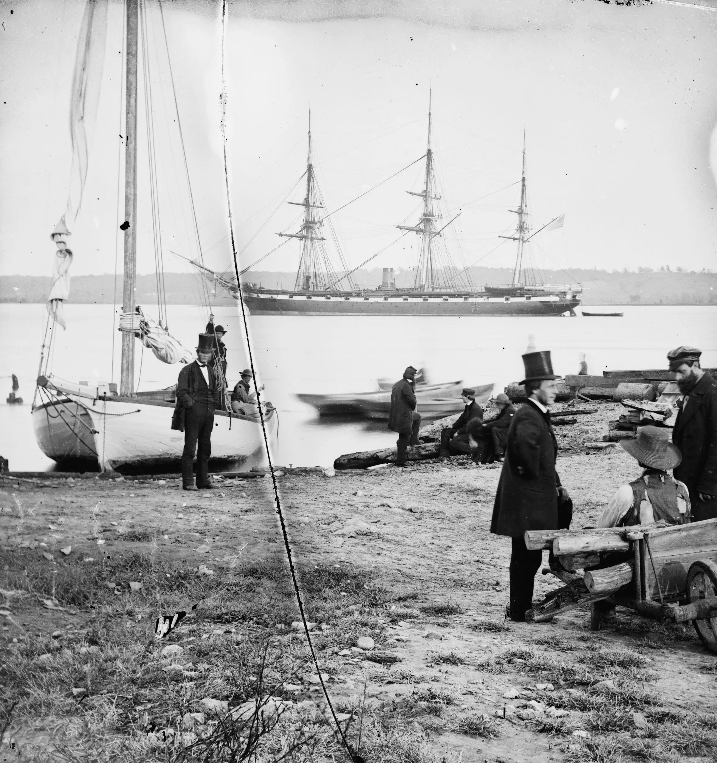
Civil War photographs taken in Alexandria, VA in 1861, featuring the steam frigate USS Pensacola docked along the Potomac.
Washington sat at the center of the Civil War, serving as the Union capital with Confederate territory just across the river. These posts cover the forts, hospitals, battles, figures, and everyday life that defined the city during the war years.
Civil War photographs taken in Alexandria, VA in 1861, featuring the steam frigate USS Pensacola docked along the Potomac.
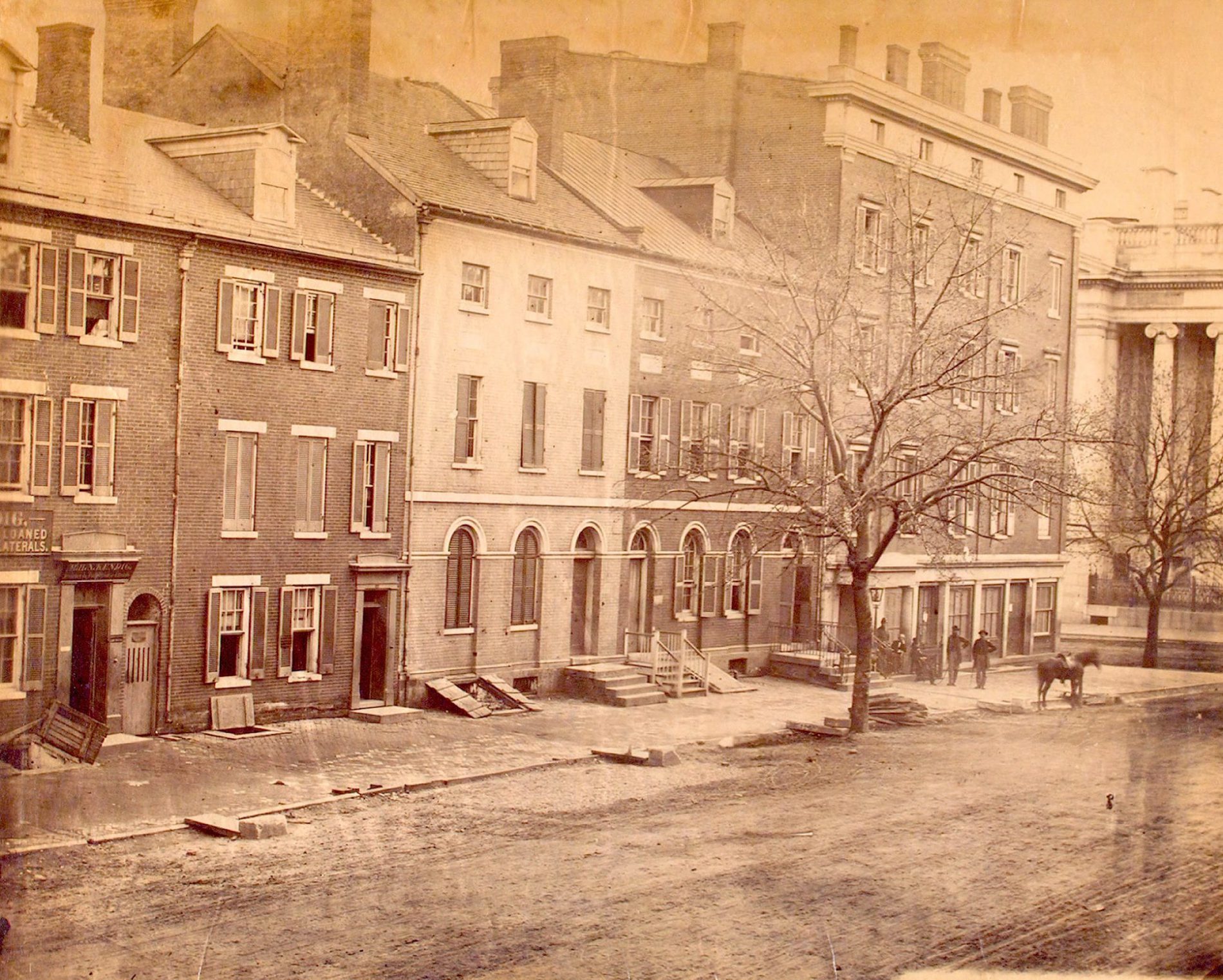
A Civil War-era photograph looking down F Street in Washington, D.C. Click through for the full-resolution version to pick out storefronts and landmarks.
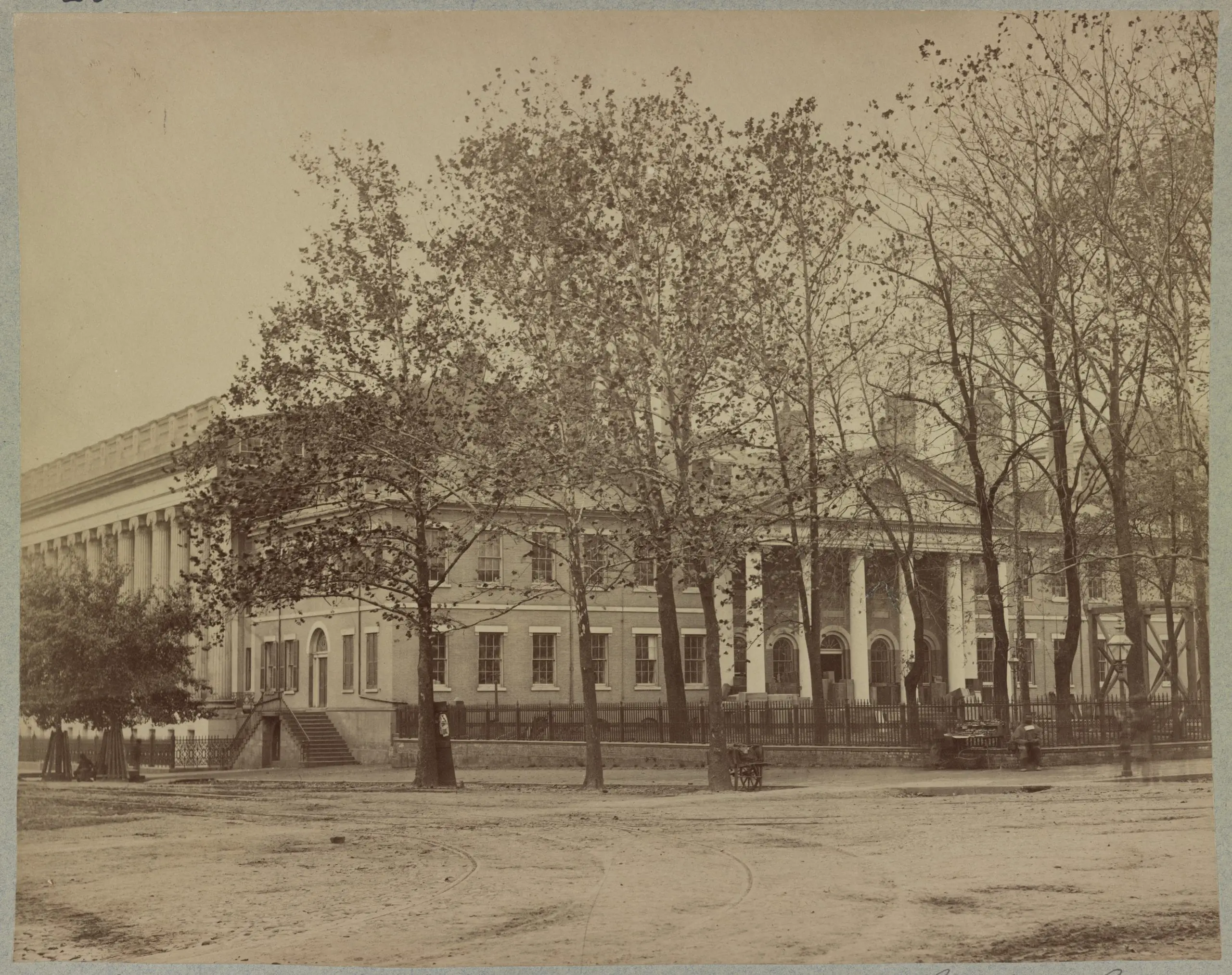
Get a better look at the Old State Department Building during the Civil War with this amazing photo. Click on it for some amazing details and find out why there are a large number of wooden boxes at the main entrance to the building.
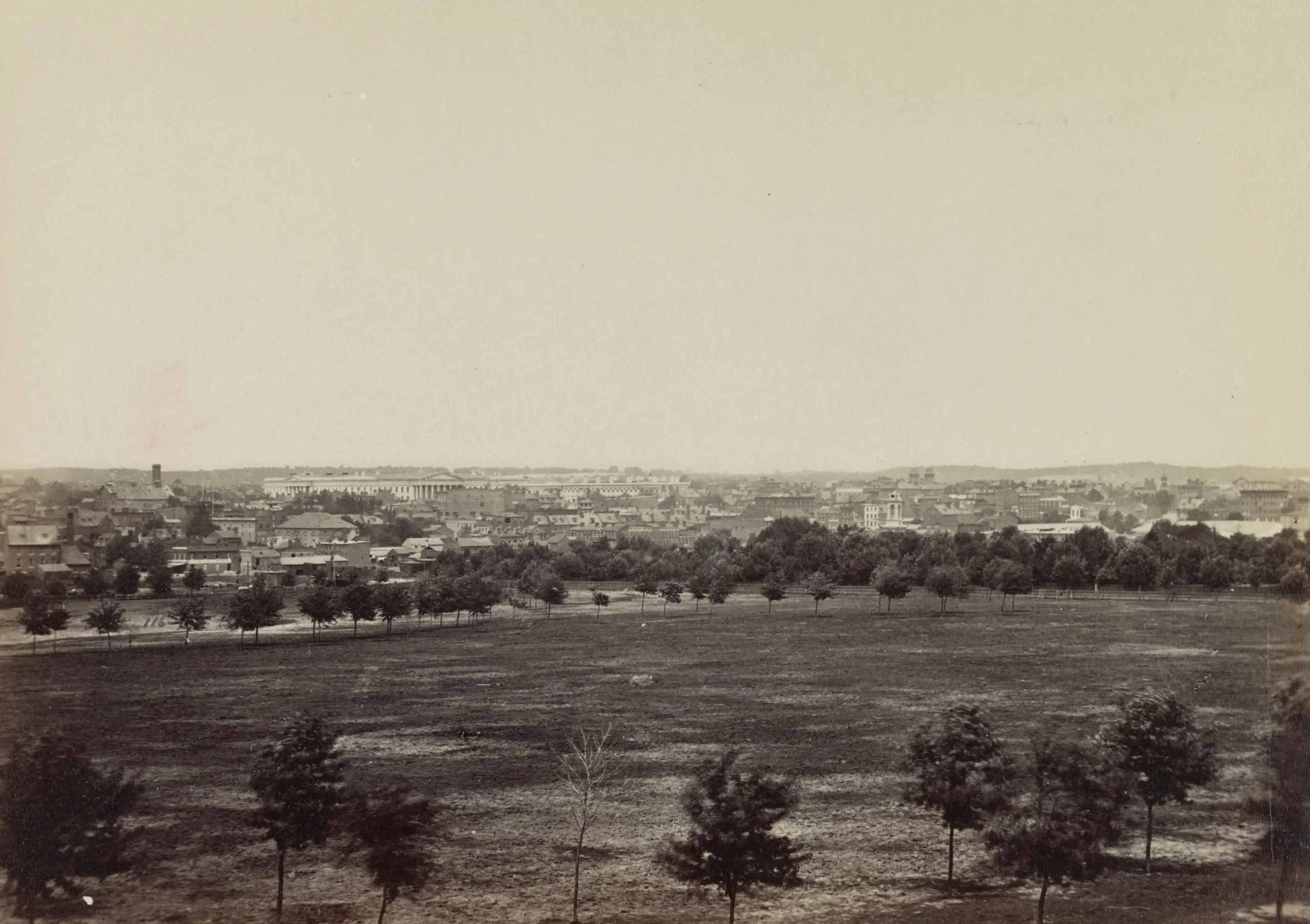
Take a step back in time with this 1861 photo of Washington, DC. Click on it for a larger version and marvel at the history of our nation’s capital
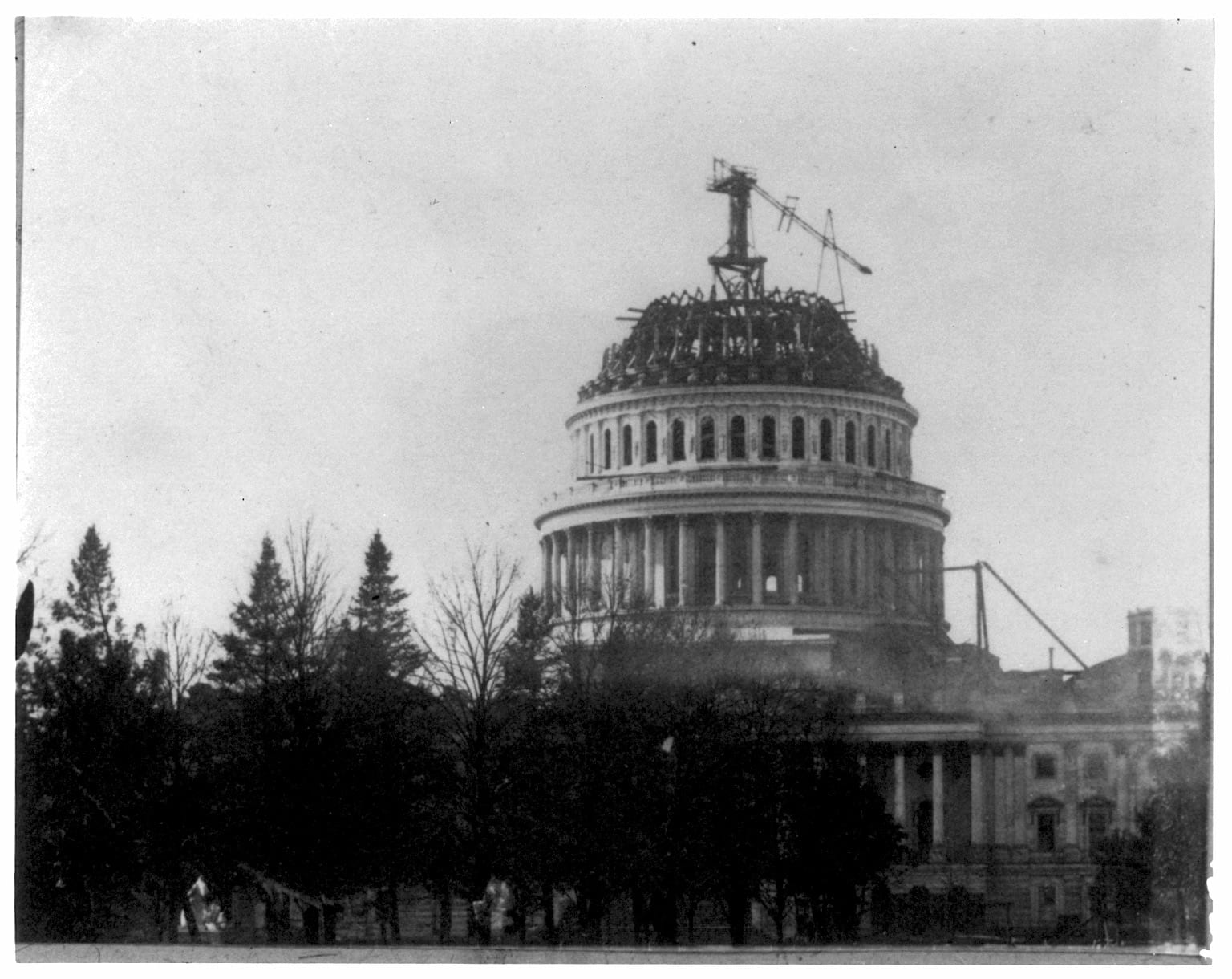
A rare photograph captures the Capitol’s cast-iron dome still half-built during the early days of the Civil War, scaffolding climbing into the sky.
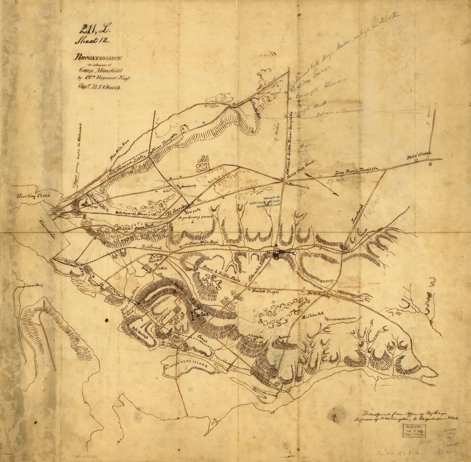
Explore the 1861 Civil War map of Arlington, a reconnaissance map created by Benjamin Church. View the unusual orientation of the map, with north being down and to the right. Click here to view a larger version and study it.
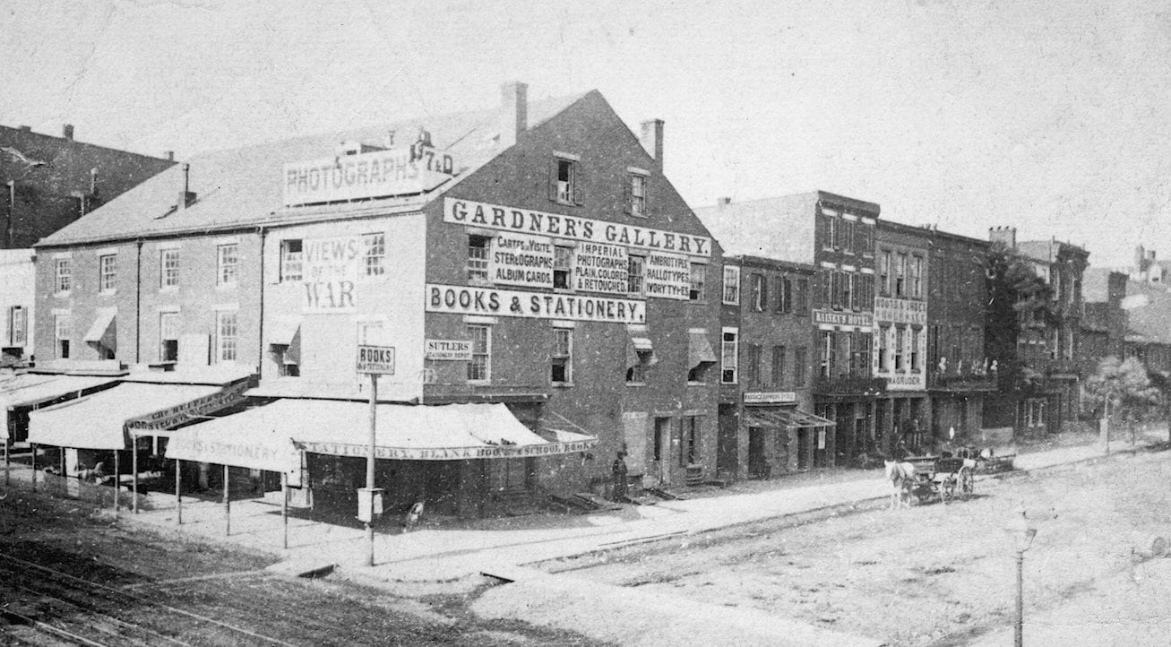
Take a look back in time to 1863 and explore Alexander Gardner’s Photographic Gallery in Washington, D.C. with this amazing old photo. Click the image for a detailed version.
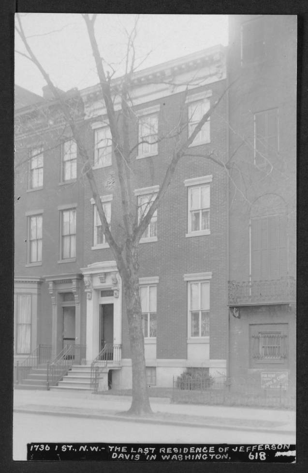
Where did Jefferson Davis live when he was a senator in Washington, DC?
Lincoln signed off on a naval hospital in 1864. By the time it opened on Capitol Hill in 1866, the war it was built for was already over.