
Here is a view almost nobody gets to see this way anymore: Washington, DC laid out below the windows of the Washington Monument, photographed again and again over half a century by people who hauled their cameras 500 feet into the air. Same spot, same windows, a wildly different city each time.
The monument opened to the public on October 9th, 1888, three years after it was dedicated and four years after the capstone went on. Visitors crowded into a slow steam elevator that took 10 to 12 minutes to grind up to the 500-foot observation level, and anyone in a hurry (or who did not trust the elevator) could take the 897 steps instead. An electric elevator cut the ride to five minutes in 1901. What waited at the top was the best seat in the city.
Stand up there and turn slowly. East, the National Mall runs toward the Capitol. North sits the White House and the Ellipse. West is the Lincoln Memorial and the Potomac. South is the Tidal Basin. Now watch fifty years go by, from 1894 to 1942.
1894: The Earliest View We Have
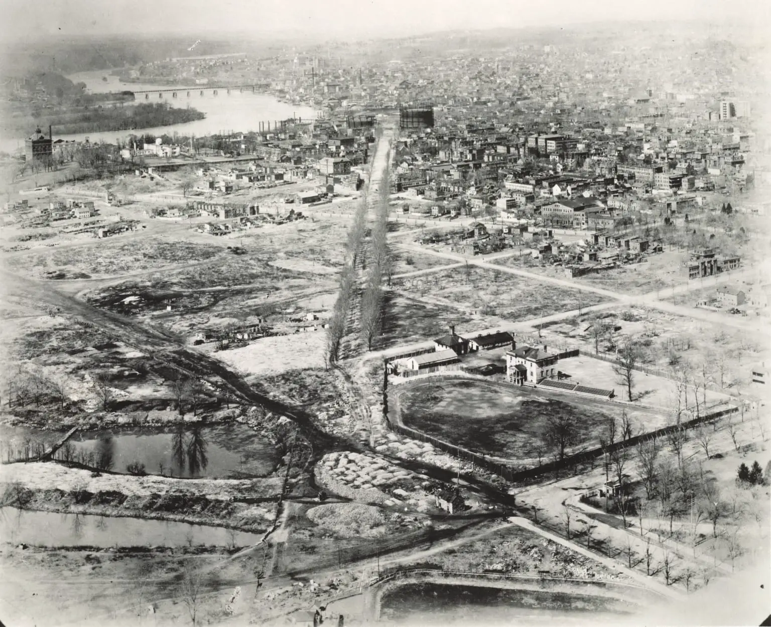
This is the oldest one we dug up, looking northwest from the monument in 1894. The city is low, brick, and spread thin. There is no skyline because there would not be one for decades, and the open ground stretching toward the horizon is land that downtown and the West End would eventually swallow whole.
The Mall Before It Was the Mall
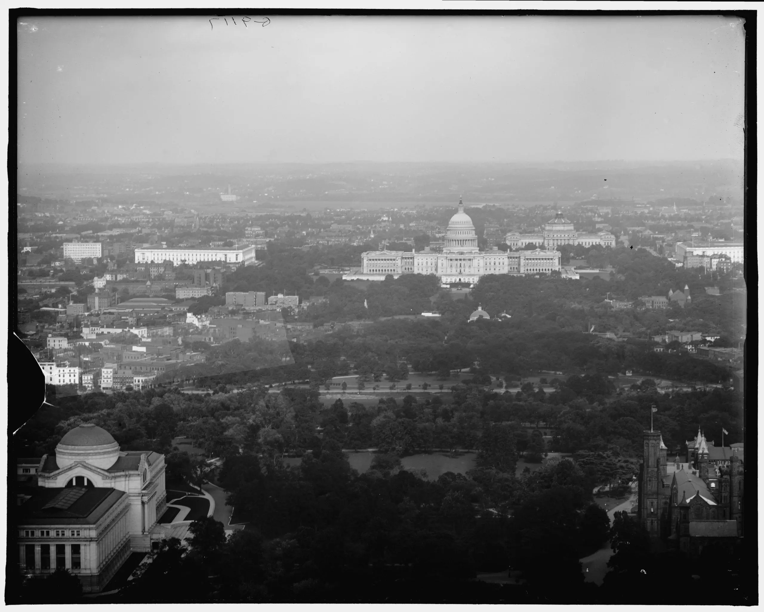
Turn east and look down the National Mall around the turn of the century and you will barely recognize it. Instead of the long open greensward we have today, the Mall was a thicket of winding paths and dense Victorian planting, with the old red-brick Department of Agriculture building and the Smithsonian Castle poking out of the trees and the Capitol anchoring the far end.
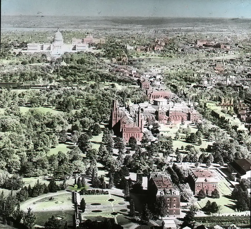
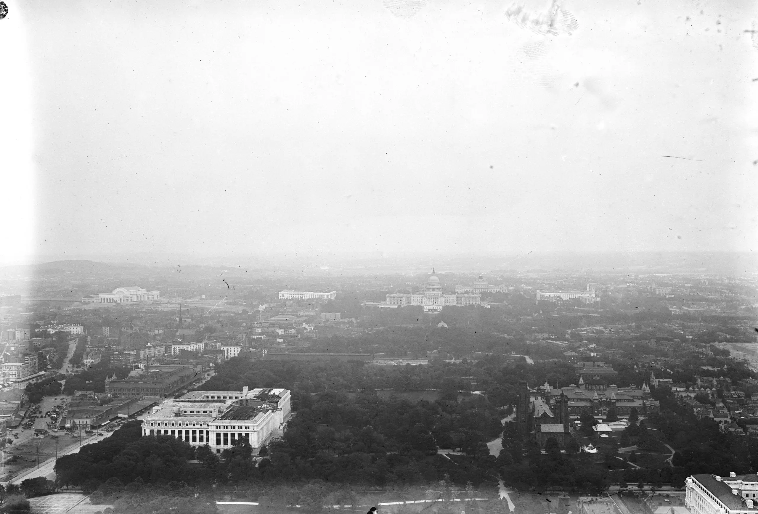
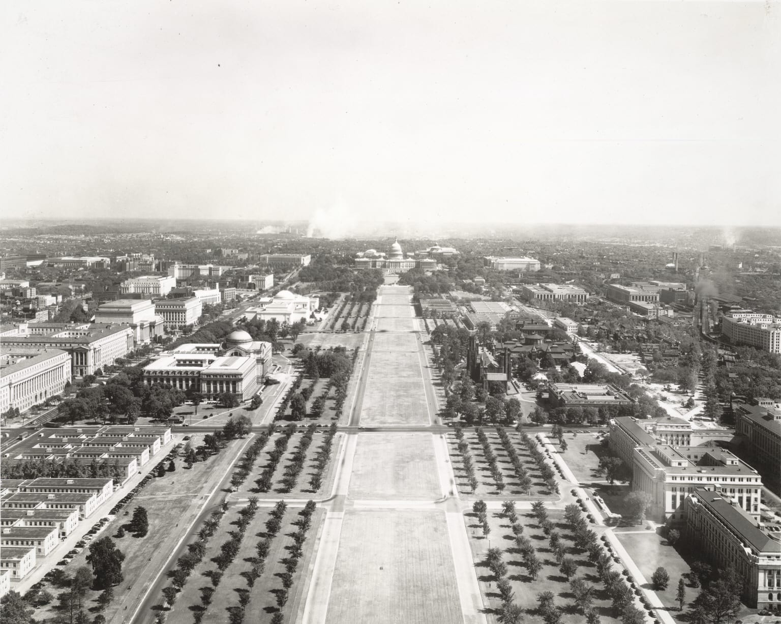
That tangle of trees was no accident, and neither was its removal. The 1901 McMillan Plan called for ripping out the romantic Victorian landscaping and replacing it with the wide, formal, tree-lined panel we know now. The next two photos, both shot from the monument in the early 1900s, catch the eastern view toward the Capitol as that transformation was getting underway.
1924: A City Between the Wars
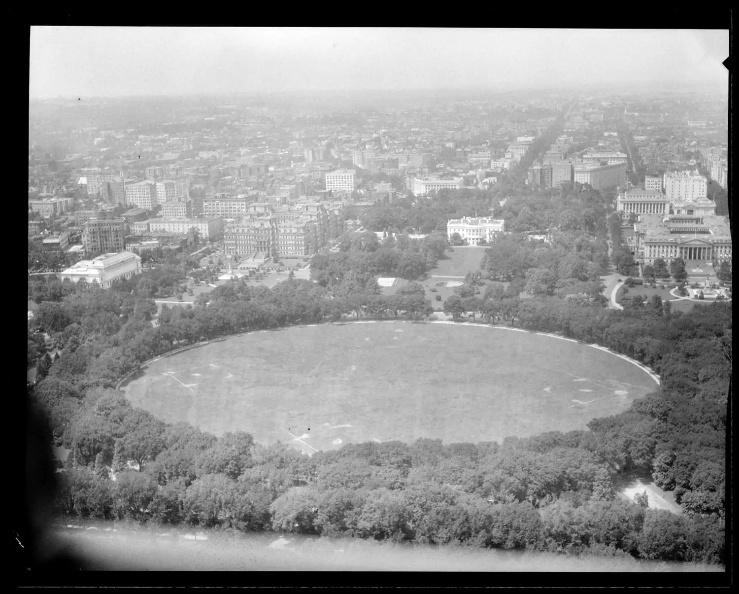
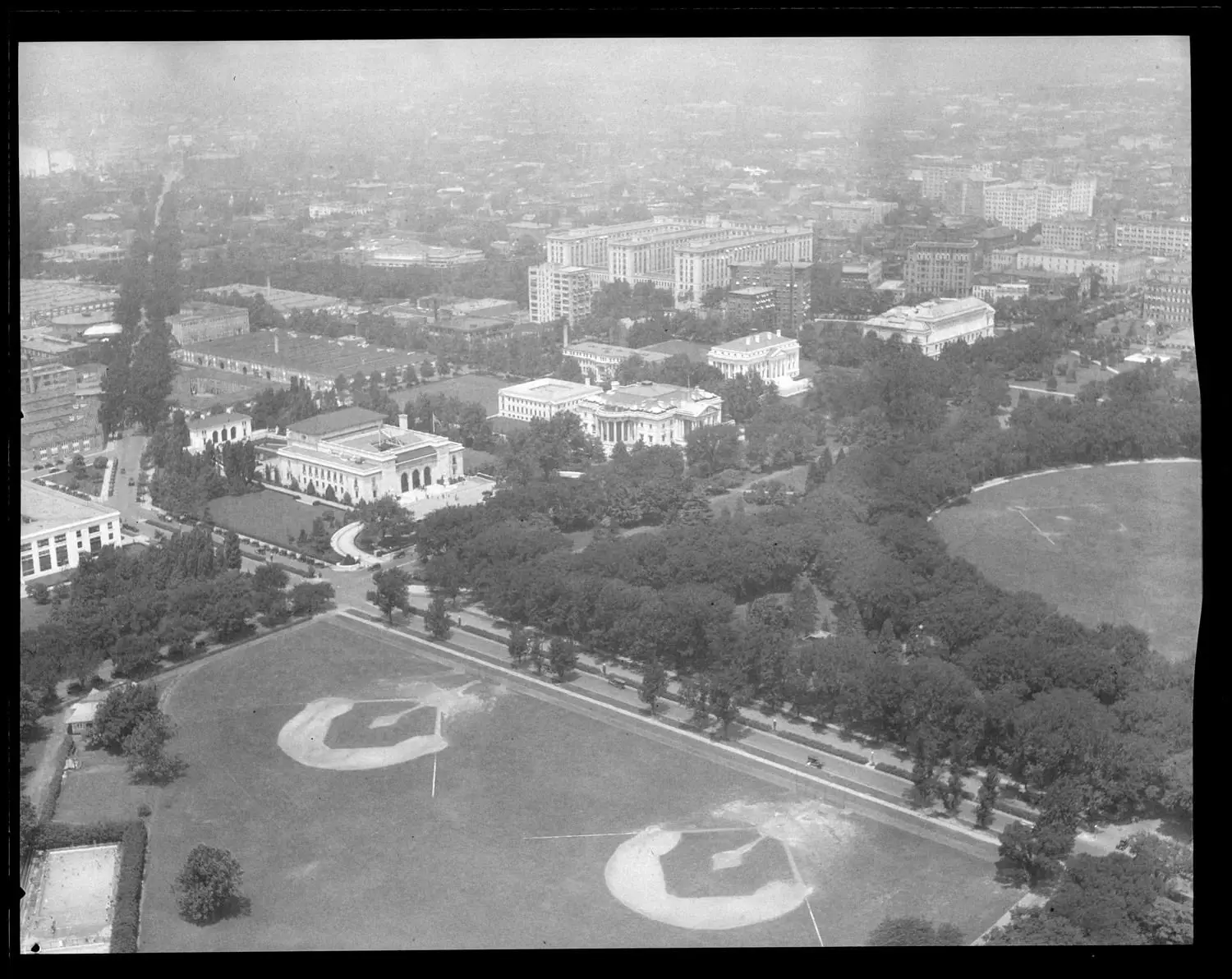
By 1924 the view had filled in. Turn north and the White House sits framed by the oval of the Ellipse, with the ornate State, War, and Navy Building (today’s Eisenhower Executive Office Building) crowding in beside it.
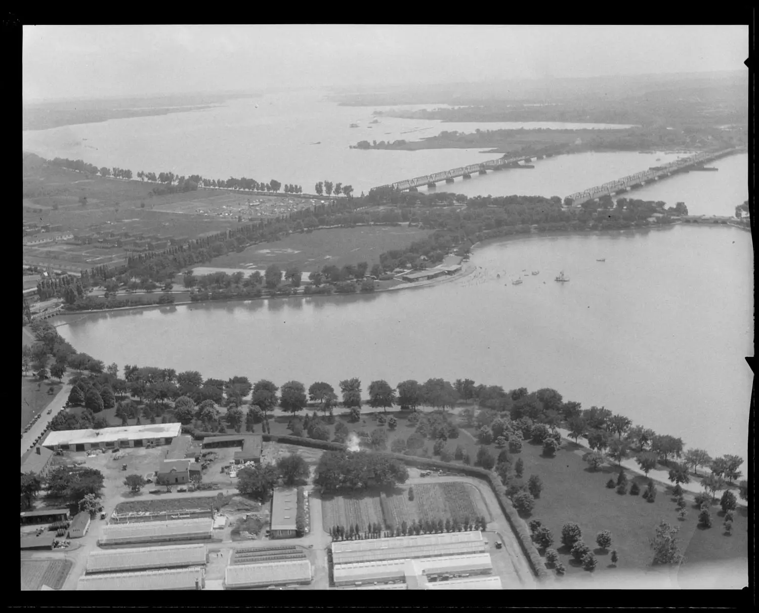
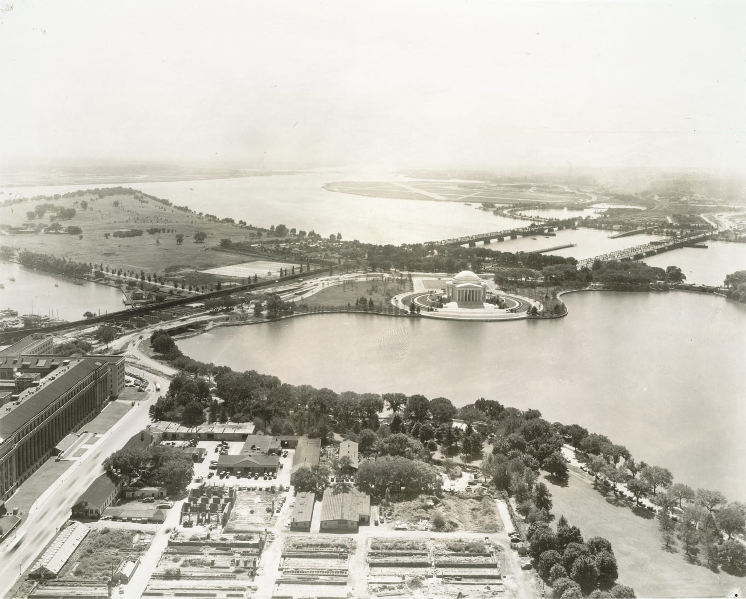
Swing southwest and you catch something that is gone today: the Tidal Basin Bathing Beach. That curved stretch of sand opened in August 1918 right about where the Jefferson Memorial stands now. It was a whites-only beach, and rather than integrate it Congress cut the funding and had it torn out in 1925, so this 1924 photo catches it in its final summers. Beyond it, the Potomac and the rail bridges run off toward Virginia, and in the foreground sit the long greenhouses of the Agriculture Department’s propagating gardens.
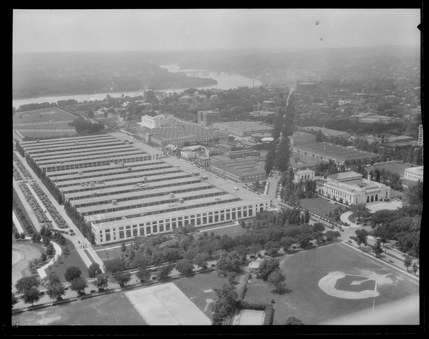
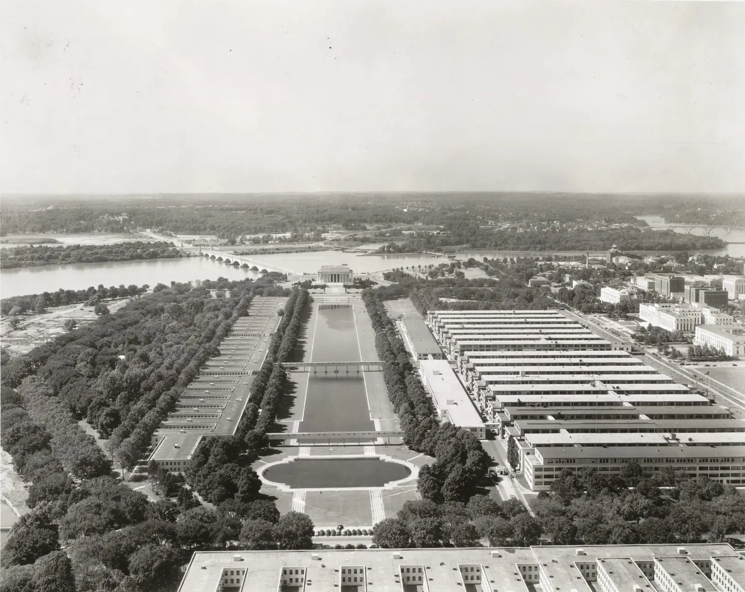
Now look west toward the river. Those enormous barracks-like blocks are almost certainly the Main Navy and Munitions Buildings, put up in 1918 as temporary wartime offices. “Temporary” turned out to be generous: they stood until 1970.
1942: A Capital at War, and a Memorial Rising
Fast-forward to 1942. The country is at war, and on the south side of the Tidal Basin, right where that bathing beach used to be, a new memorial is taking shape. Look south and you can see the Jefferson Memorial still unfinished. It would not be dedicated until April 13th, 1943, Thomas Jefferson’s 200th birthday.
Turn back east toward the Capitol and compare it to those turn-of-the-century shots. The Mall has been cleared and replanted along McMillan Plan lines, but look how young the new trees still are.
And finally, look west. The Lincoln Memorial, dedicated back in 1922, now closes the far end of the Mall above its long reflecting pool.
Same Windows, Fifty Years Apart
That is the magic of these photos. The vantage point never moves, but everything below it does. The Victorian Mall gives way to the formal one. A bathing beach becomes the Jefferson Memorial. Wartime “temporary” buildings come and go. A low brick city grows up around the obelisk that has been watching the whole time.
If you want the rest of the story, we have written about how the monument itself took 36 years to build, the Lincoln Memorial and the swamp it sits on, the fight over the Jefferson Memorial and the Cherry Tree Rebellion, and the lost Tidal Basin bathing beach. Anything up there you have been wondering about? Ask in the comments.
Nice view of the old Navy and Munitions Buildings – no idea there were walkways above the reflecting pool to other buildings on the other side of the pool. What are those buildings on the left, anyway?
Yet more tempos. My father spent his entire federal working career in ugly tempos like these, now long (and mercifully) forgotten.
amazing shots….. you can see those things (not sure what they are called) covering the 14th Street Bridge….