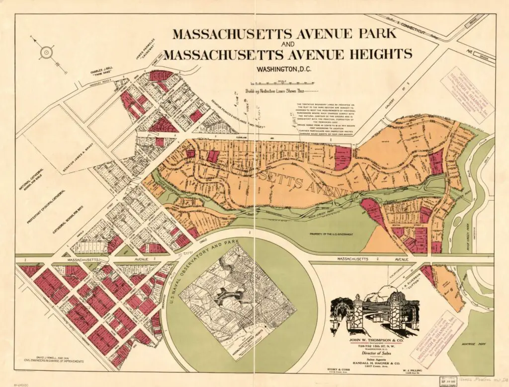
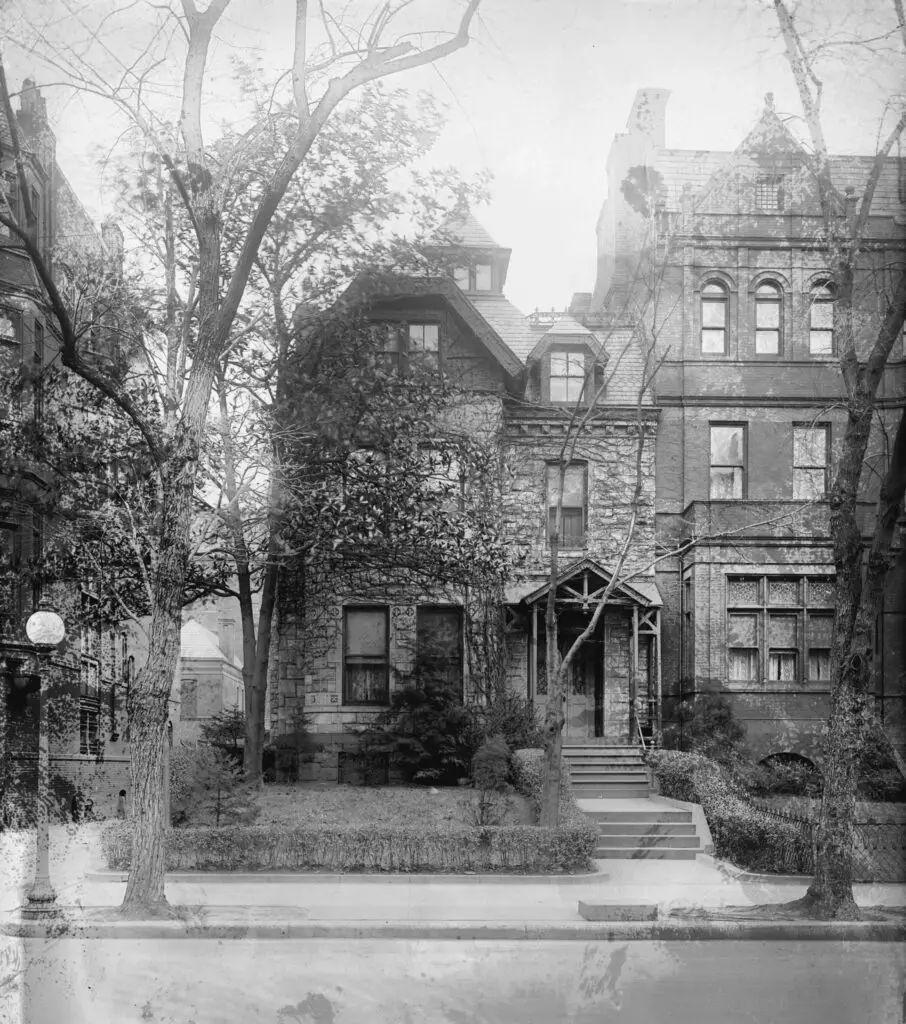
Explore the history of Mass Ave. Heights & Park, two early 20th century developments near Rock Creek Park and Observatory Circle. Learn about their current status as the Woodland-Normanstone neighborhood of lovely giant homes.
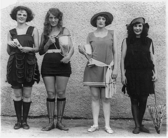
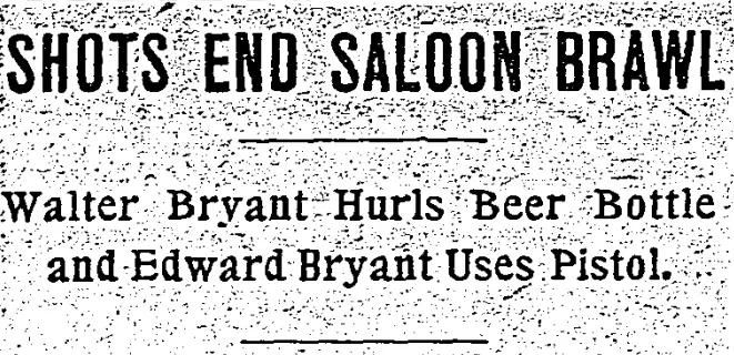
Digging up a wild story from The Washington Post in 1908, read about the beer bottle-hurling and pistol-wielding fight between Walter and Edward Bryant. Who do you think won?
At 16th and K St. NW, there once sat a three story Victorian town home, the site of corrupt political dealings within the Harding administration, This is its story.
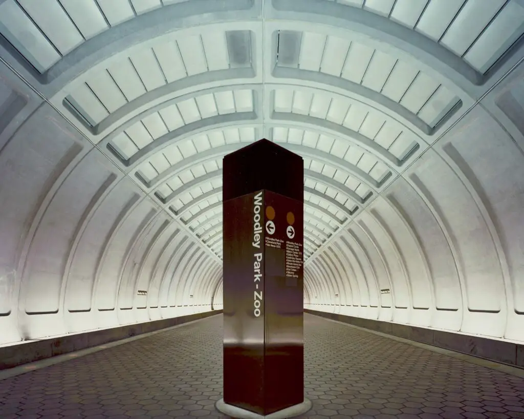
The namesake in England no longer stands as it was torn down in 1962, but the one in Woodley Park is still there. In 1950 it became the property of the Maret School and currently serves as a library and administrative building.
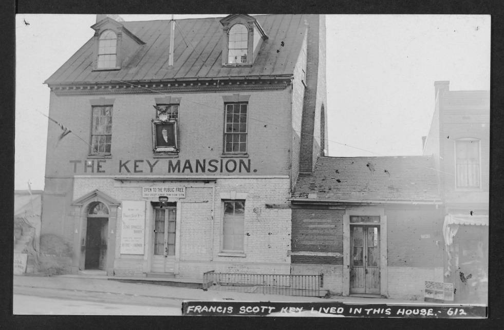
Take a look back at the Key Mansion, a two-story house located at 3518 M St. NW in Georgetown, Washington, DC. Learn more about the history of this house and its place in Georgetown today.
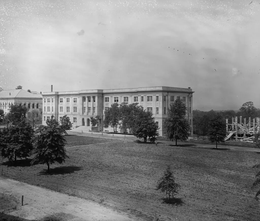
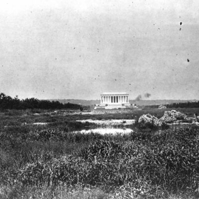
Take a look at this old photo of American University from 1916. Can you recognize where it is? View the image and find out where this historic campus is located. Source: Library of Congress.
In 1900, a college prank in Georgetown University nearly went wrong. Students attempted to scare a stable attendant, but a horse was stolen and the police were called. Read more about this bizarre incident on Ghosts of DC.
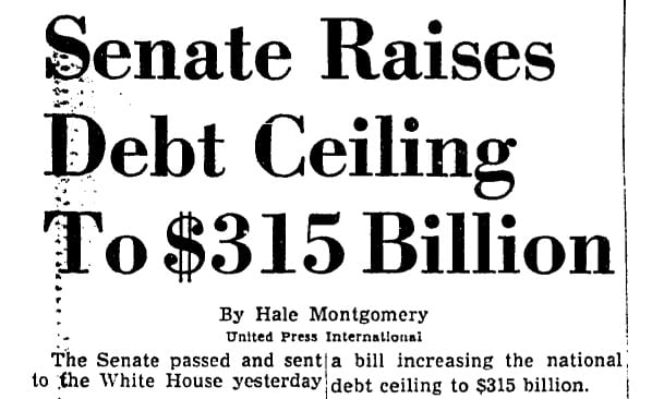
50 years ago today, this headline in The Washington Post was apropos. Though today's rancor over the debt ceiling is far worse, it's a reminder of where we came from. Our debt ceiling is now close to $17 trillion.
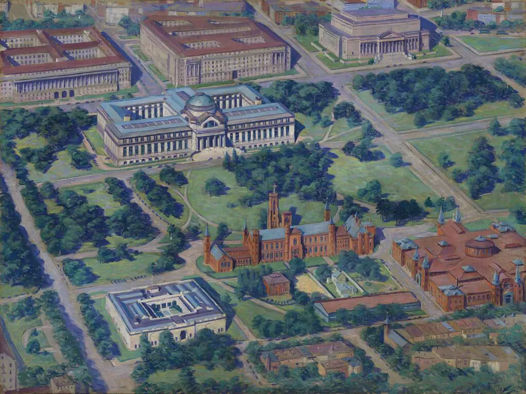
Explore the beauty of Garnet Jex's 1936 painting, an aerial view of the Smithsonian. See the stunning details and learn more about this amazing artwork.
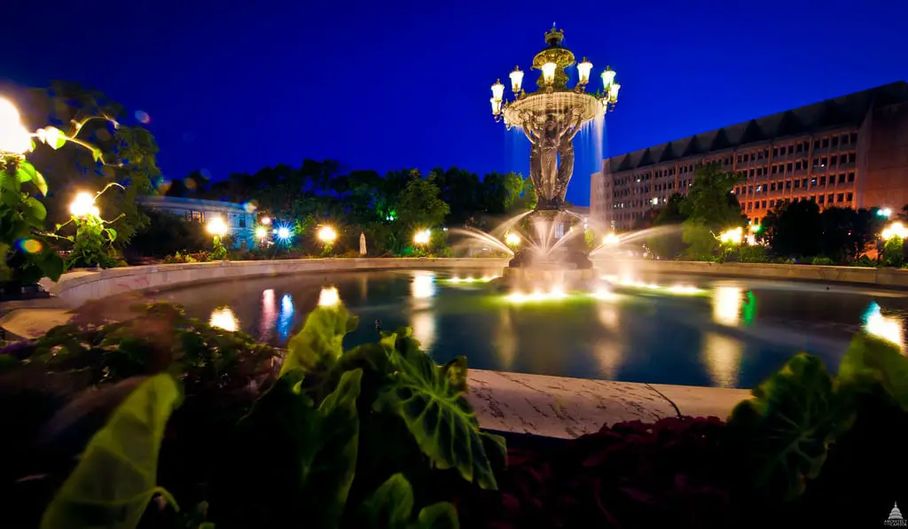
Explore the journey of Frederic Auguste Bartholdi's "Fountain of Light and Water" from the 1876 Centennial Exposition in Philadelphia to its current home in Bartholdi Park. Learn how the fountain became a popular nighttime destination in Washington D.C.
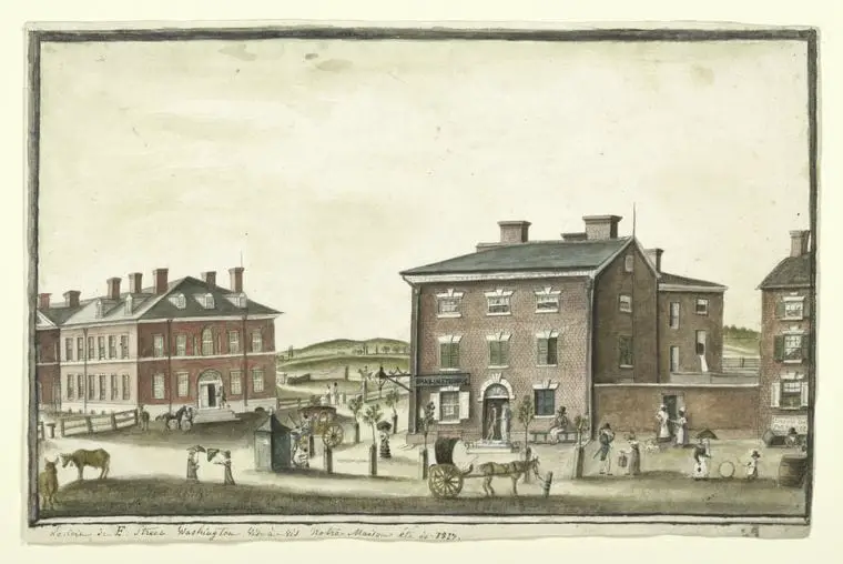
Take a step back in time and explore a French drawing from the early 19th century. See a glimpse of the past and marvel at the differences from modern day life. Don't miss the J. Crew!
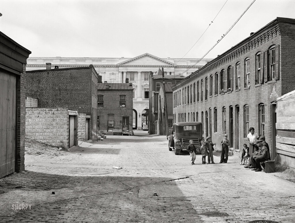
Come take a look at this incredible black and white photograph of the Capitol. We hadn't come across it before and it's certainly stunning. Source: Shorpy.