
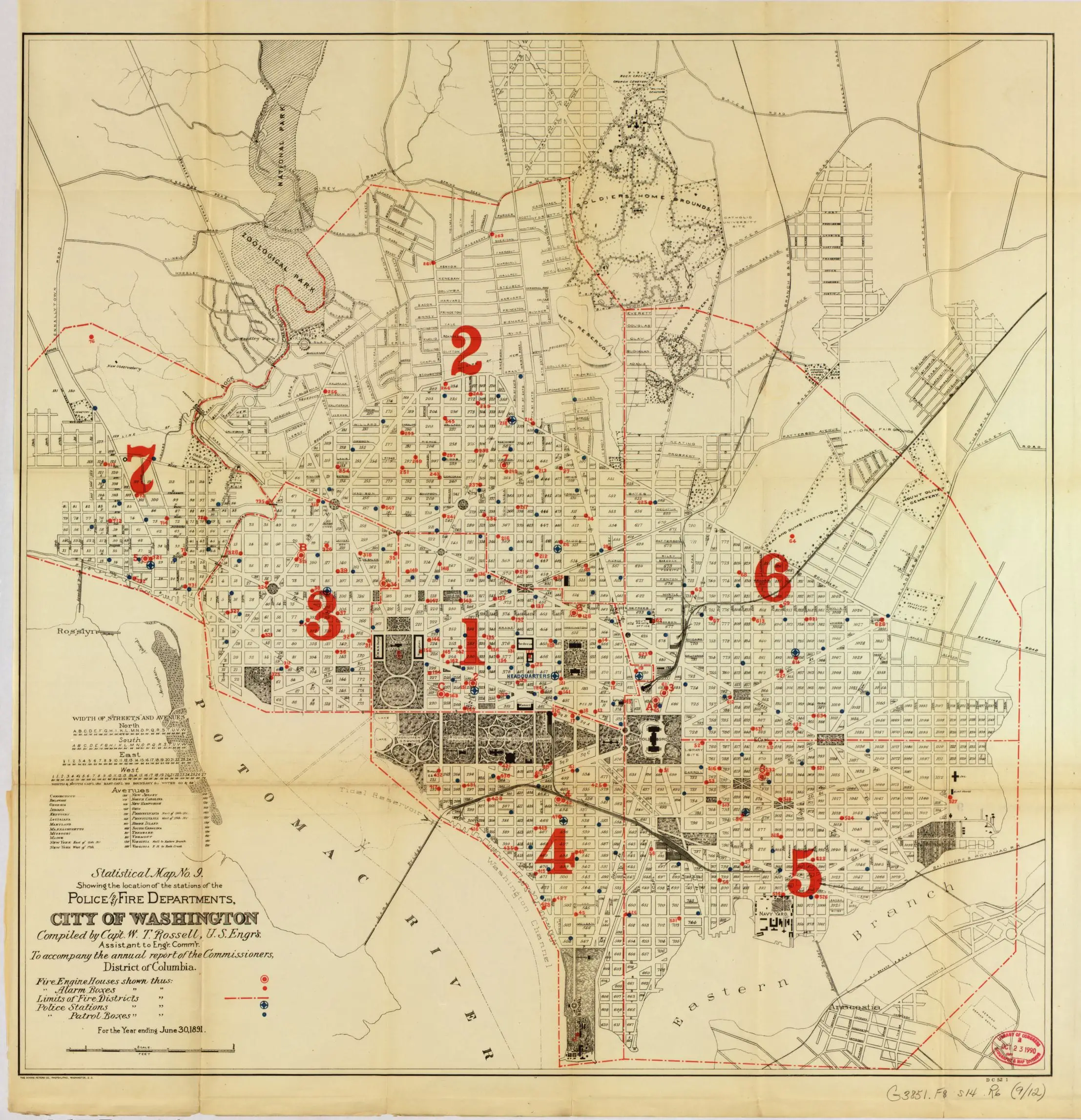
Where were the police and fire stations located in Washington back in 1880? Check out this great old map.
Source: Library of Congress
This was done by the same people that did the great 1880 property values map, street sweeping schedule map, and the streetcar lines map.
Ghosts: Anacostia’s Engine Company 15 didn’t open until 1905. First DCFD east of the river. But Anacostia did have a MPD station / substation that isn’t on the map.
You can tell by where stations are and aren’t how developed an area was. I live just south of Lincoln Park and I don’t that that area and east of me had house but there weren’t as many of them as there started to be in the teens and twenties.
Damn. Looks like Mt. Pleasant Street didn’t even exist! I live right where it intersects with 16th and my building was built in 1930.
And in Dupont Swann St. used to be called Oregon St.
in 1880 the plan for extending the streets beyond Florida Ave which we have today was not even a glimmer on the horizon. 1888 to 1908 saw the planning of our current street system.