
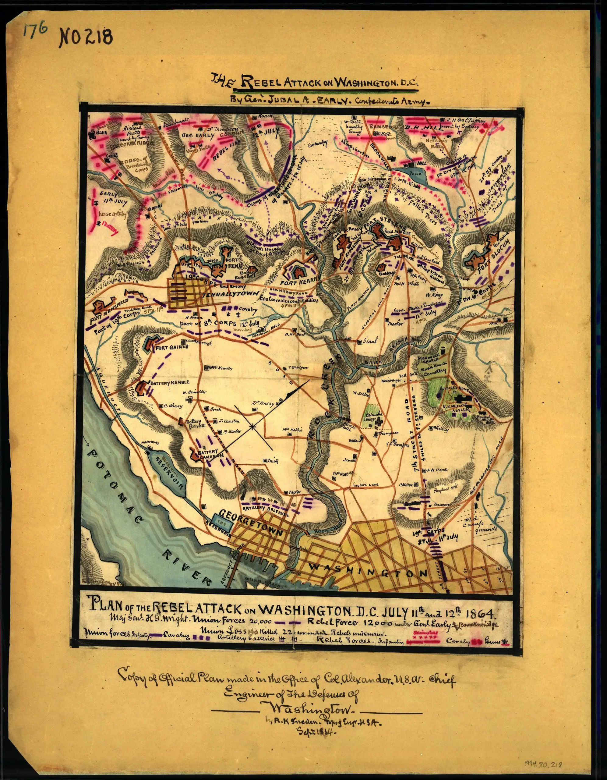
Here’s a great old map that we found, showing Jubal Early’s Rebel attack on Washington.
Source: Library of Congress
Here’s a great old map that we found, showing Jubal Early’s Rebel attack on Washington.
Source: Library of Congress
Comments are closed.
I’m curious about the little resevoir, right where Georgetown begins.
That looks like it would be somewhere along Canal Road – between the Canal Rd. entrance to the University and the Exxon gas station.
I’ve seen several photographs from that era (a couple decades later, of course) and nothing that indicates the presence of a resevoir.
Curious.