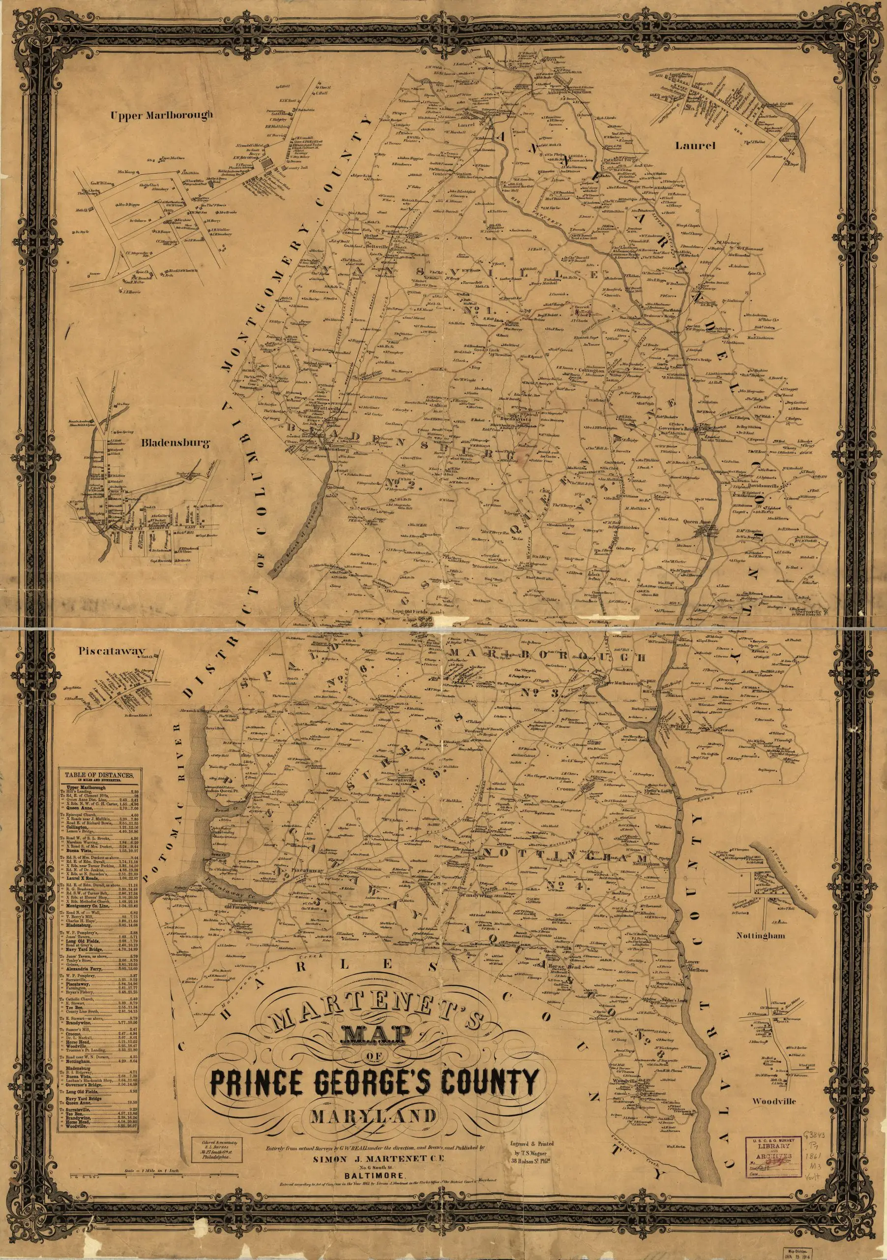
Detailed 1861 Map of Prince George’s County Published July 3, 2013Updated November 4, 20211 min readby ghostsofdc Here is a great old map of Prince George’s County, done in 1861. Martenet’s Map of Prince George’s County, Maryland Source: Library of Congress
I have a similar map of Montgomery County by Martenet framed and hanging in my office. If I knew how to scan a huge framed map, I would scan it for you.

I have a similar map of Montgomery County by Martenet framed and hanging in my office. If I knew how to scan a huge framed map, I would scan it for you.