
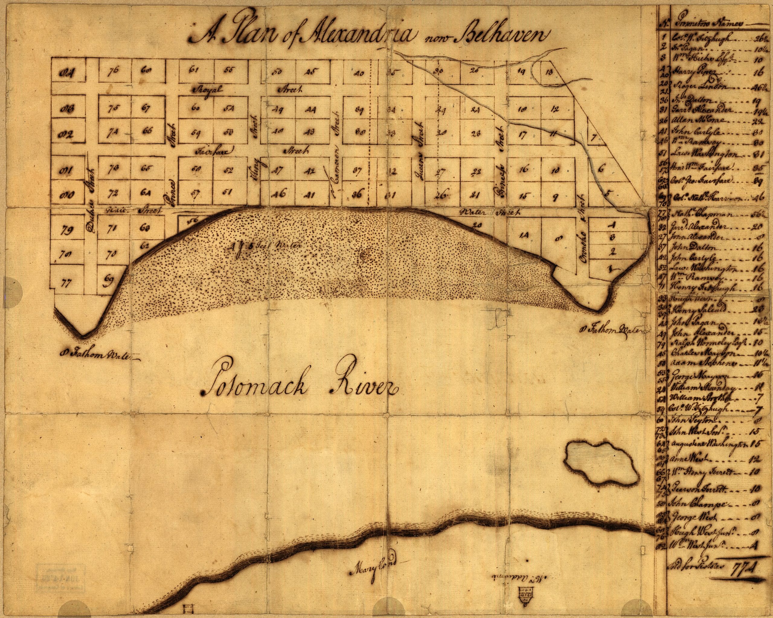
Amazing find on the Library of Congress website. This is a map of Alexandria done by George Washington somewhere around 1749.
Amazing find on the Library of Congress website. This is a map of Alexandria done by George Washington somewhere around 1749.
Comments are closed.
Love this map. What’s so fascinating is that the two old warehouses that stored newspaper roll for the Post, owned by the Robinson Terminal, lie on those two points you see. The one on the right is West’s Point, basically the roots of the seaport were planted there. Point Lumley saw a lot of activity too.
When the two points are re-developed, they will include interpretive markers. This will be such a bonanza for history buffs and tourists.