It’s sad to think of all the nice homes that were bulldozed to make way for the “modern” Southwest quadrant.
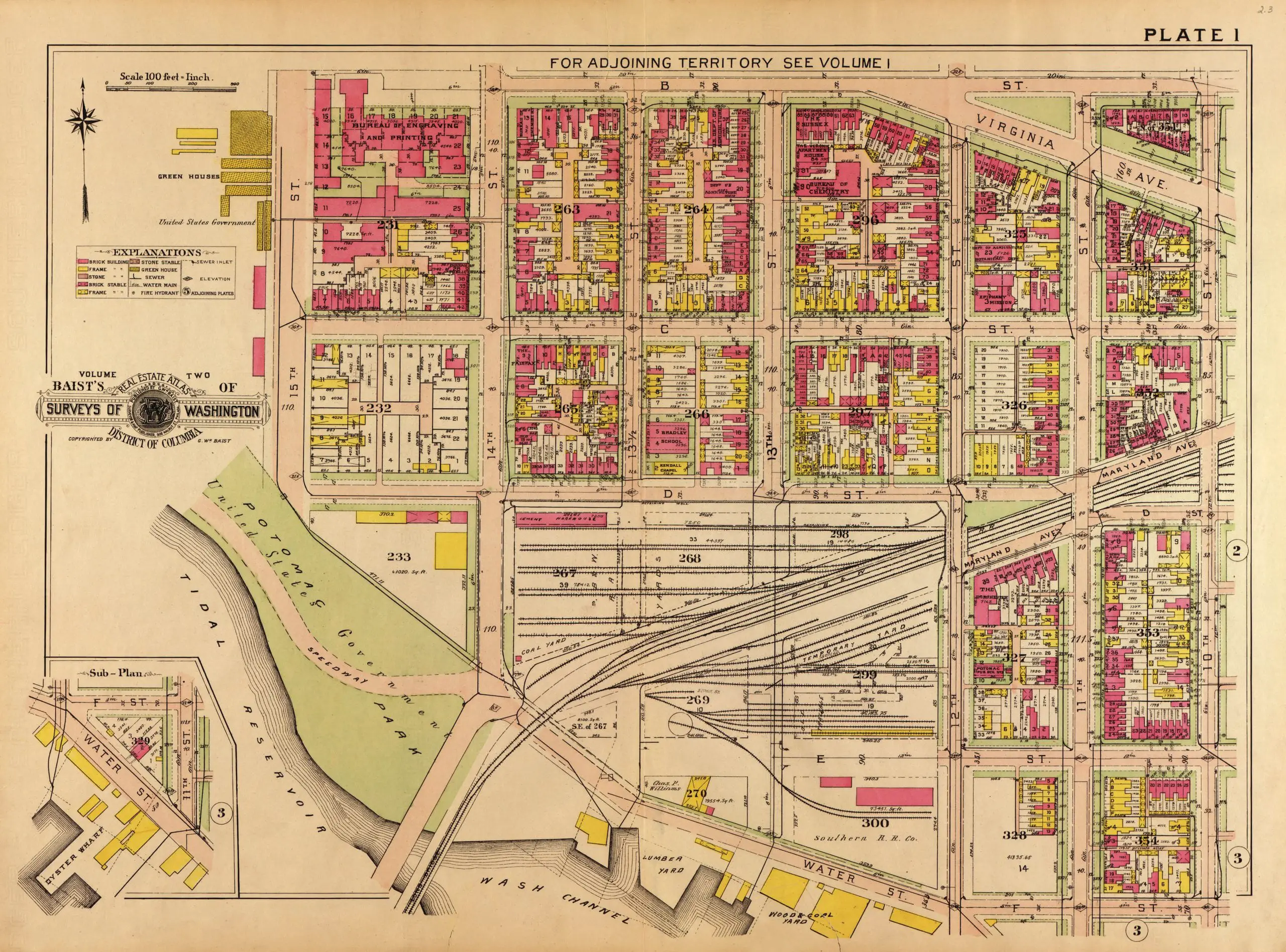
map of SW in 1909
2 thoughts on “Remembering the Homes Lost During the Redevelopment of the Southwest Quadrant”
This is helpful – it explains why the Dept of Agriculture building doesn’t come to the corner at 12th & Independence – they must have been accounting for Virginia Ave, which was later eliminated. I’ve been curious about this, since the building is so regular and symmetrical otherwise. (The cutaway corner later made a perfect location for the entrance to the Smithsonian Metro station.)
Thanks!
This plate covers an area that must have been bulldozed long before the 1960s-era “urban renewal” or “slum clearance” projects that we associate with “the ‘modern’ Southwest quadrant” — USDA South, Bureau of Engraving and Printing buildings and a variety of other US Government buildings are among what occupy these blocks today. Echt “modern Soouthwest” — most of the residential buildngs (both town houses and apartment blocks), Waterside Mall and most of L’Enfant Plaza — are in blocks to the east and southeast of this plate.