
For those of you living in upper northwest, you’re going to like this. It’s the Baist map of parts of Spring Valley and American University Park in 1903. I already know a couple GoDCers, living up that way, who are going to dig this.
Check out how many large properties there were up there, prior to subdividing it.
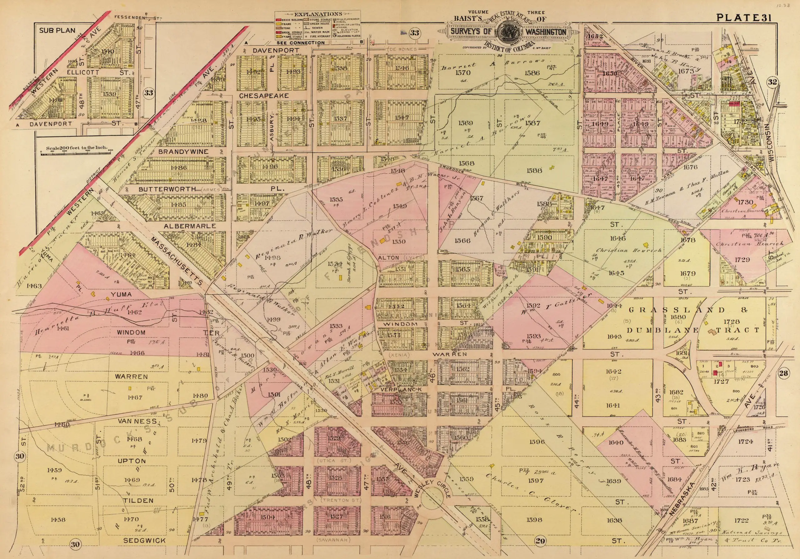
According to this map, I live on the former property of Harriet Burrows and it looks like there used to be a stream right under where my house sits now… Hmmm.
Great map, thanks for posting. It’s very faint on the map, but notice that the names of several streets are followed by their old names in parentheses (Des Moines for Davenport, Xenia for Warren, Utica for Upton, etc.). Interesting that the mapmaker still felt the need to include the old names two years after DC Commissioners decreed the name changes in 1901.
Too bad this map didn’t list the locations used as chemical weapon testing areas and dumps during the just-ended World War I.