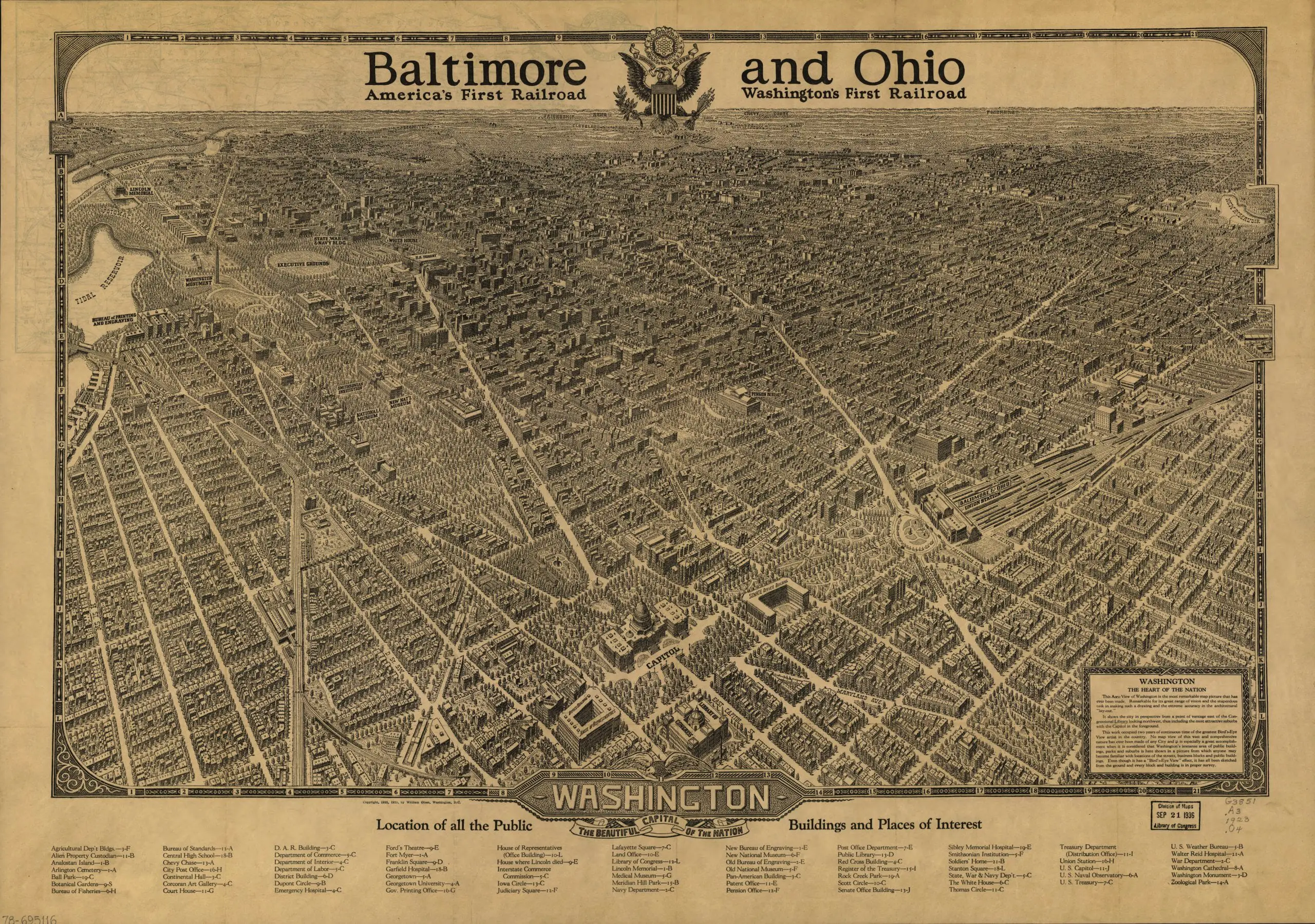
This. Is. So. Cool. Check out this map of Washington, done by the Baltimore & Ohio Railroad.
1921 B&O map of Washington, DC
4 thoughts on “The Coolest Map of Washington, DC Ever: A 1921 Baltimore & Ohio Railroad Map”
I purchased one of these from The Old Print Gallery in Georgetown. It is absolutely amazing. There’s a time table of some sort on the back of mine too. Unfortunately I forgot to look carefully at what that was before it was framed.
Wow when I first say this, I thought that it looked and a whole lot like the one I have framed in my basement. I wonder if this one is based on the one I have or from an Original Lithographic Stone. The one I have dates back to 1920 and has Union Station, but not the one Saying Baltimore & Ohio Union Station. Mine is entitled “The Beautiful Capitol of the Nation 1920.” Mine says it was Lithographed by the Columbia Planograph Company 52 L St NE
I think it is interesting that the map lacks any mention whatsoever of the Pennsylvania Railroad. The PRR was the B&O’s direct competitor in this city and some would say they had fierce battles over freight and passenger markets. In fact the B&O had successfully monopolized the market in DC until the PRR managed a back door entry into DC by purchasing the charter of the Baltimore & Potomac RR. The rails listed as “Southern Railway” are actually PRR rails, except for one industry in the first yard immediately east of the Potomac River and the “Long Bridge” which was indeed a Southern Rwy customer. the “Baltimore and Ohio Union Station” is actually just “Union Station”. It was named this because it was jointly owned -equally- by the B&O and the PRR. The station was operated by a railroad called the Washington Terminal Company and it was also jointly owned, with shares owned by the B&O, PRR and many southern railroads including the Southern Rwy, Richmond-Washington Line, and Chesapeake and Ohio. (and possibly the Seaboard Air Line or Atlantic Coast Line). It does not surprise one to see that a railroad (the B&O) would refuse to acknowledge the presence of it’s fiercest competitor (PRR) when producing promotional material.
Dave: Thanks for the backstory!