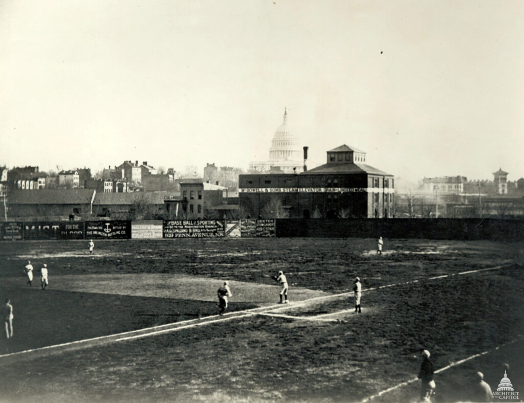
A fatal pitch during a 1912 church baseball game at 14th and A Streets NE claimed the life of George S. Hiett. This forgotten tragedy unfolded against a backdrop of neighborhood games, citywide injuries, and the shadow of the Titanic.
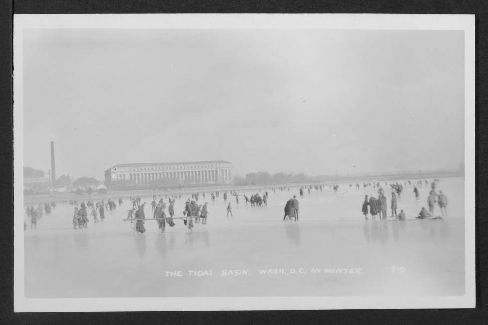
Discover the frozen Tidal Basin of the past with this fascinating historical photo. See the Bureau of Engraving and Printing in the distance, and learn about the history of ice skating and walking on the Tidal Basin. Read on to learn more.
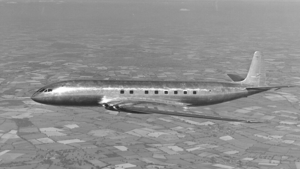
Take a look at the predictions made by Glenn Martin in 1953 for the future of aviation. See how different today is from what he envisioned, including atomic-powered planes, helicopters, and fully automatic flight operations.
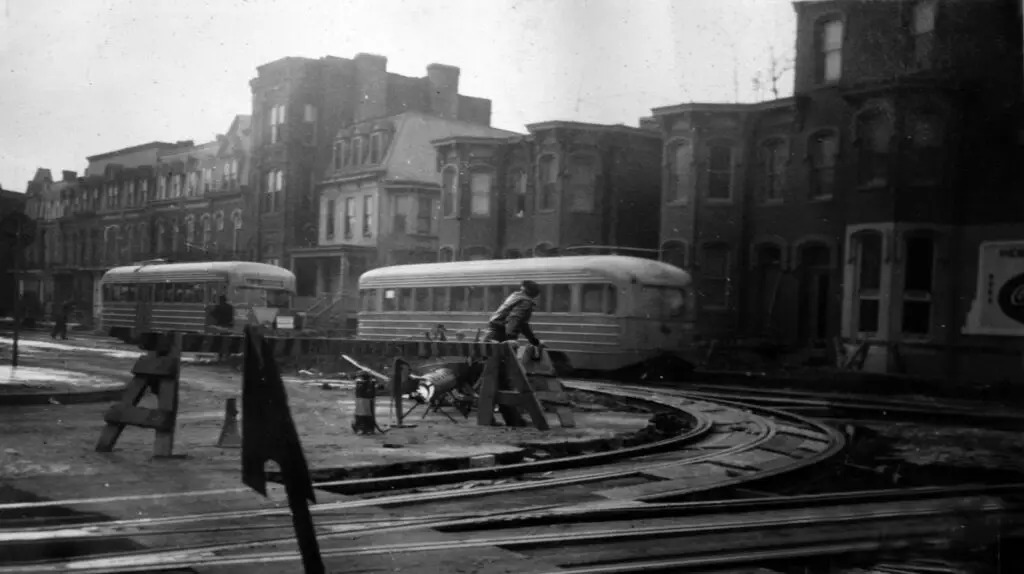
Take a look at the Federal Aviation Administration's headquarters on DC's Independence Ave. SW and compare it to what the block looked like in 1941 on the eve of World War II. See how the landscape has changed in this comparison.
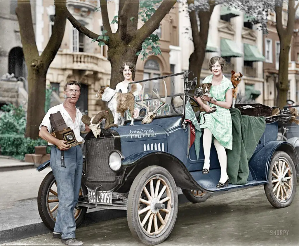
Discover two new colorized photos from 1927. See if you can identify the buildings in the background and pinpoint the location! Spend at least an hour of your morning on this awesome image from Pinterest.
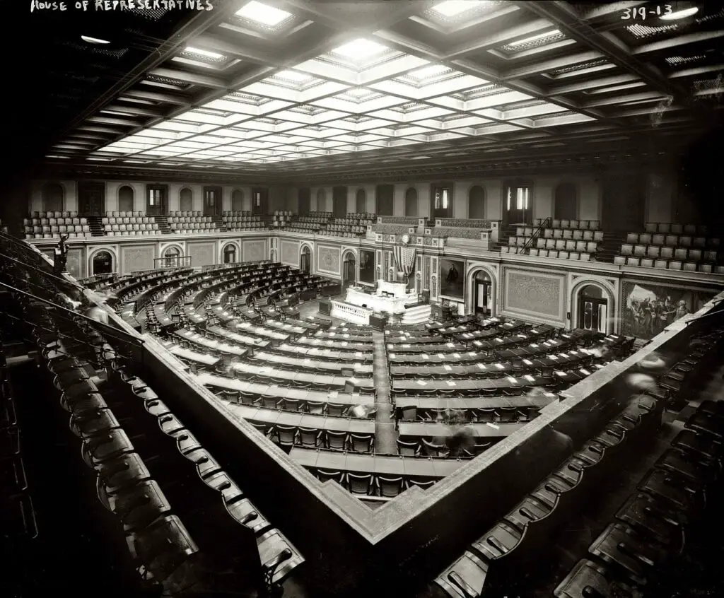
Take a look back into history with this unique photo from 1908 of the United States House of Representatives. Learn about the laws passed, senators debating, and the socializing in the evening.
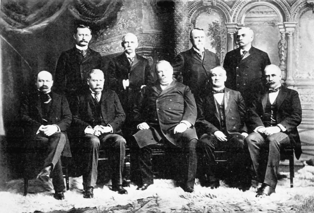
Discover the fascinating directory from the 53rd Congress, which features Grover Cleveland's second cabinet. We mapped their homes on Google Map. Learn more about the President's cabinet and why it's named Cleveland Park.
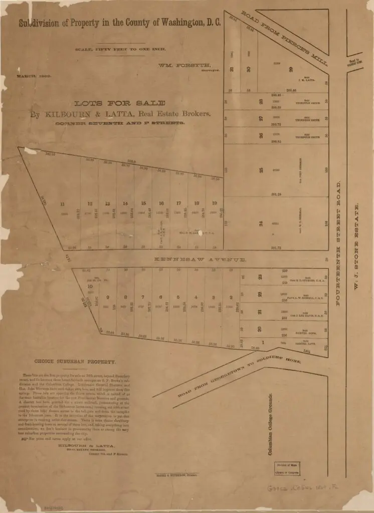
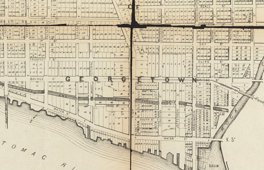
Take a look back in time and explore Columbia Heights in 1869 with John Sherman's Subdivision. This property map is full of interesting details, like old street names and the location of Pierce's Mill. Click to learn more!
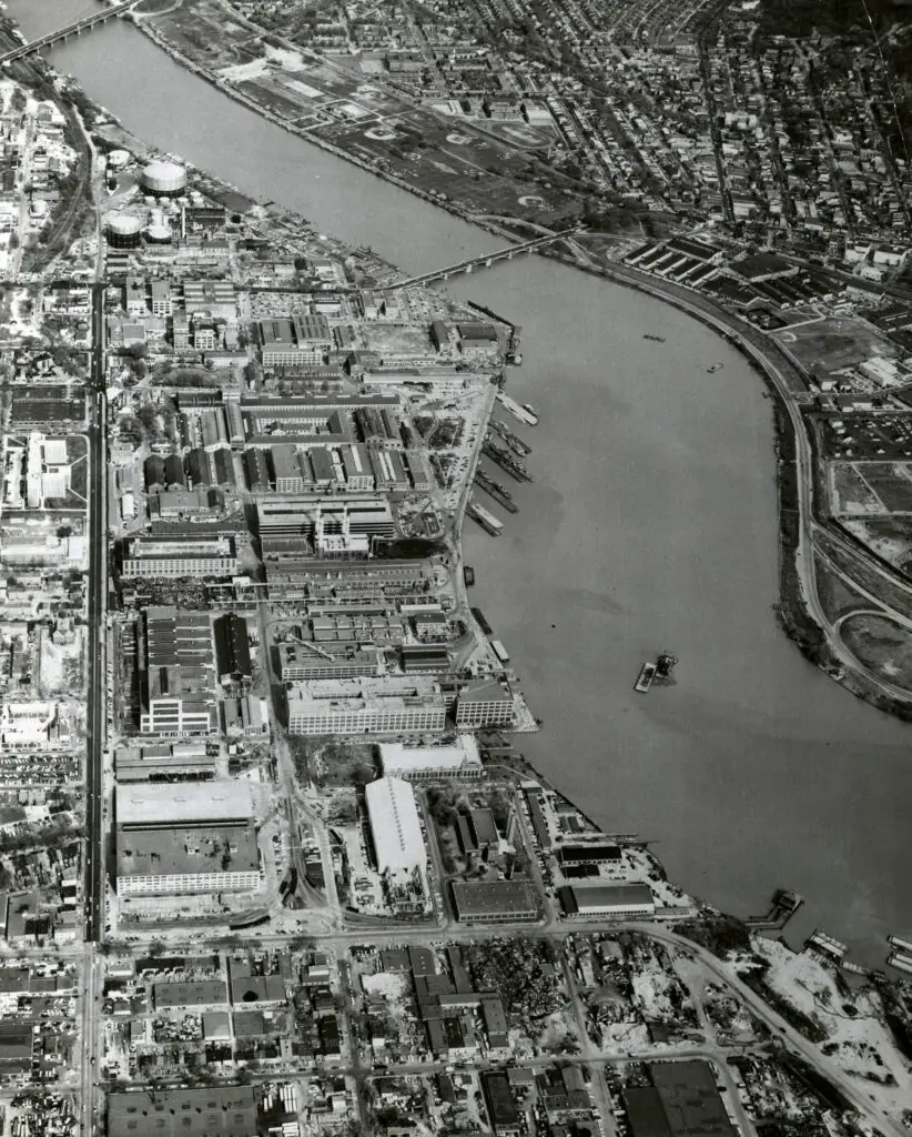
Take a look at the Washington Navy Yard before, during, and after President Kennedy's assassination with these aerial views from the 1960s, 1970s, and 1980s.
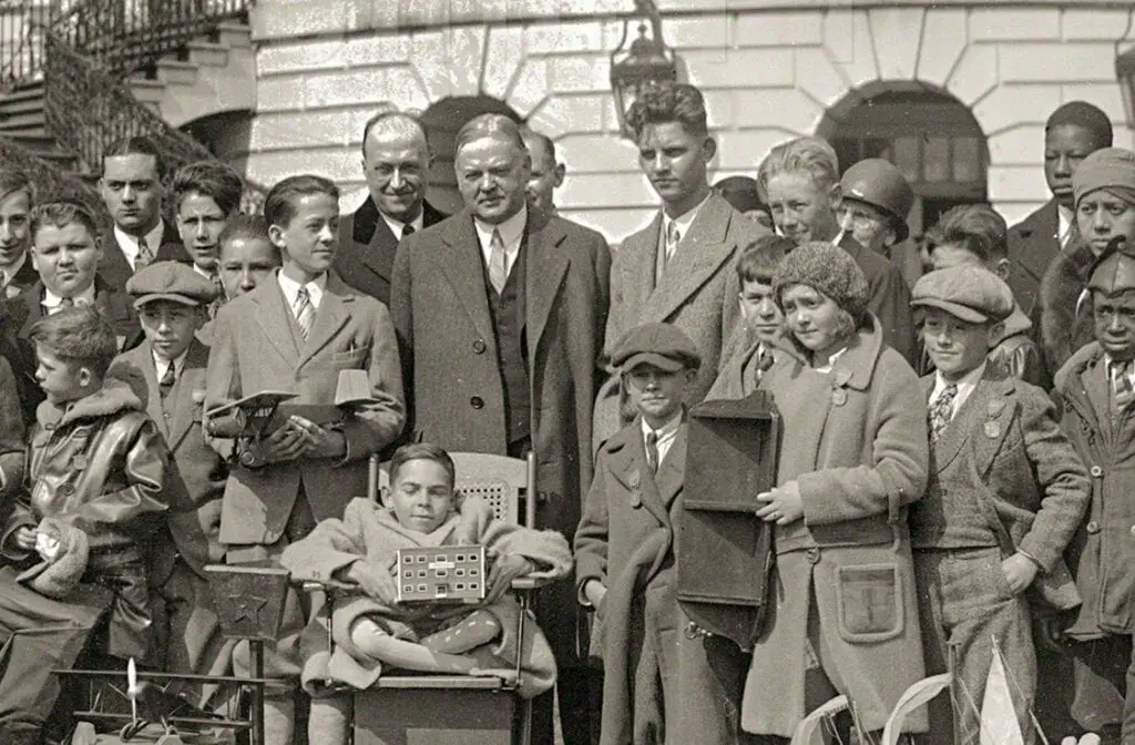
Take a look back in time with this cool old photo showing President Herbert Hoover with a large group of boys and girls at the White House. Source: Shorpy.
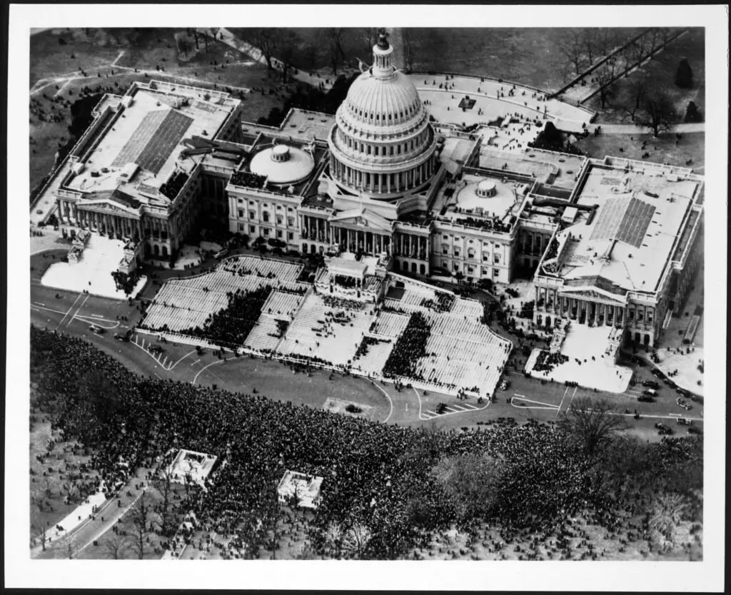
Take a look back at history with photos of historic inaugurations of Franklin Delano Roosevelt, Dwight Eisenhower, and Barack Obama. See how the ceremonies have changed over the years!
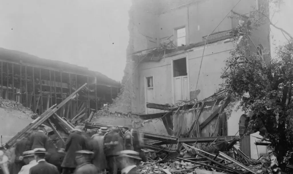
On November 17th, 1927 a large tornado ripped through the area, destroying over 200 homes in D.C. and 300 structures in Alexandria. Read about the damages and see the photos from library of Congress on Ghosts of DC.
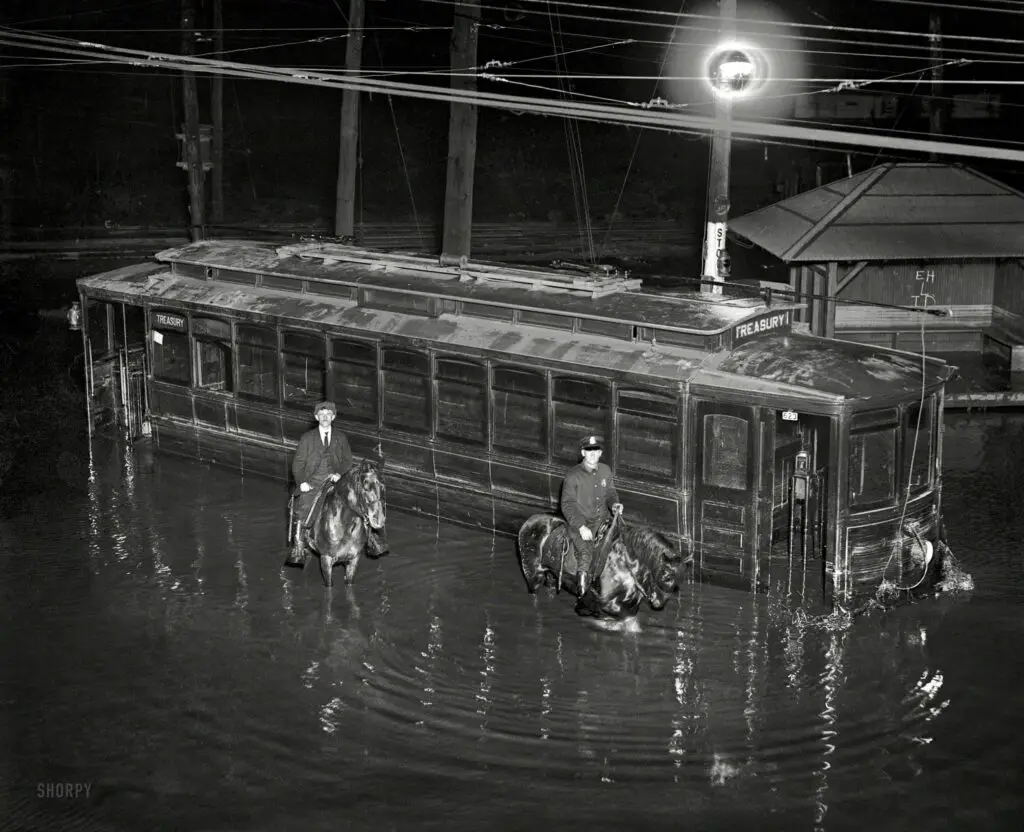
In April 1923, Washington, D.C. experienced a major flood. This blog post takes a look at the aftermath with a photo of the flood and a streetcar that's seen better days. Learn more about this historic event here.