
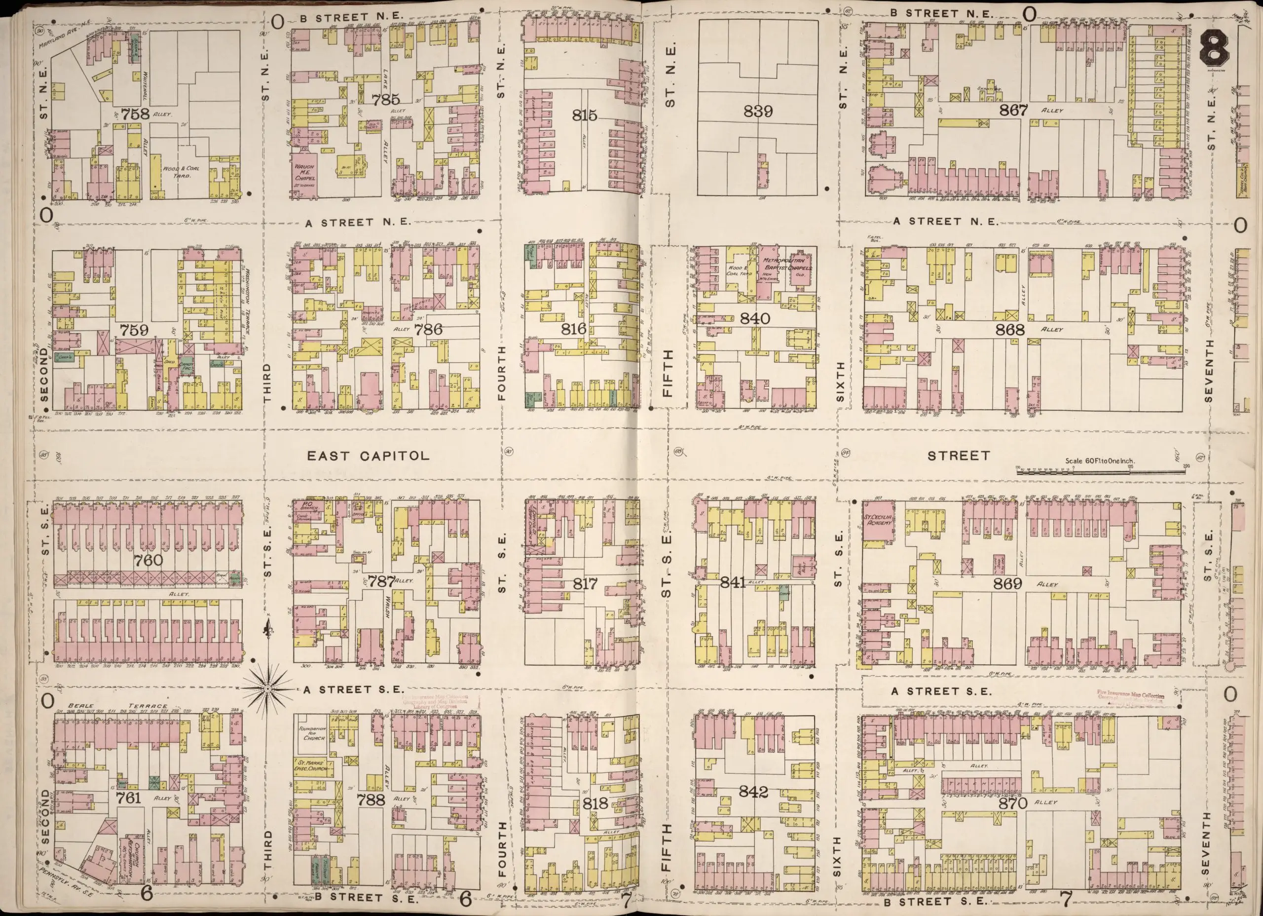
If you live east of the Capitol, check out this map and see if you can find your house. The pink buildings are brick structures and the yellow are wood frame buildings. I’m guessing that a large number of these buildings are still standing.
Source: Library of Congress
Fascinating. We live in the 600 block of Independence (called “D Street” on the map), and our building (finished in 1901) isn’t on the map, but many others are. Fascinating.
I was born at 330 11th St. SE and believe it or not that house was and probably still haunted. I was so little that I don’t remember living there but was told by several people in my family. Plus wa lived at 1108 SoCarolina Ave SE. So close,but far enough away. Loved living in that neighborhood. Still friends with some of the people. Love what you do and enjoy your book HAUNTED DC. Keep up the good work and I will send you some pics. Thanks again. Joan
11/09/2017