
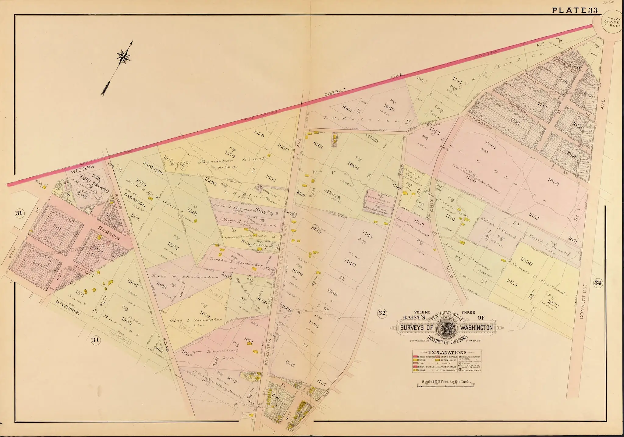
We found this cool 1907 map of Chevy Chase, showing a much more rural, pre-developed area. It looks like the Shoemaker family owned quite a bit of land in the area back then.
Source: Library of Congress
We found this cool 1907 map of Chevy Chase, showing a much more rural, pre-developed area. It looks like the Shoemaker family owned quite a bit of land in the area back then.
Source: Library of Congress
Comments are closed.
Couple interesting details on this 1907 map of Chevy Chase, in the portion west of River Road that today is in AU Park. The house lots shown on 46th are narrow ones for row houses originally envisaged for that street, but eventually single family homes were put in, each covering a double lot. And you can just barely see the old street names in parentheses after the new ones that were derived from a 1901 decision of the District Commissioners who tried to bring some order to upper Northwest streets; i.e., Des Moines for Davenport, Erie for Ellicott, Flint for Fessenden, etc.