
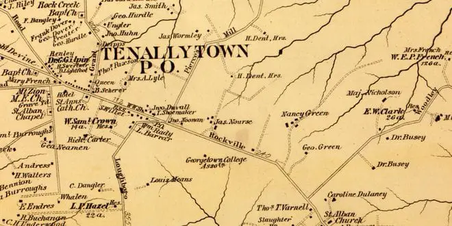
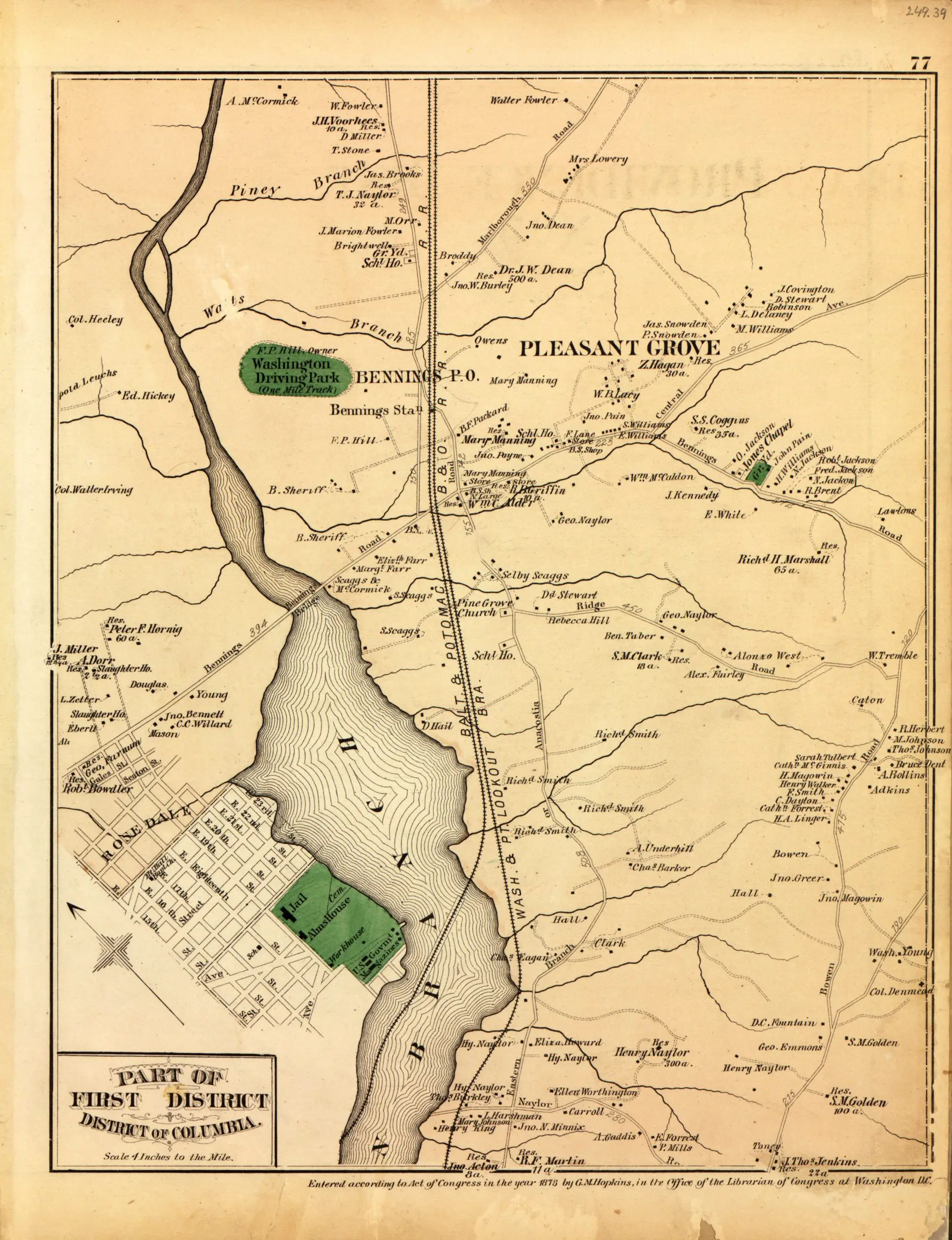
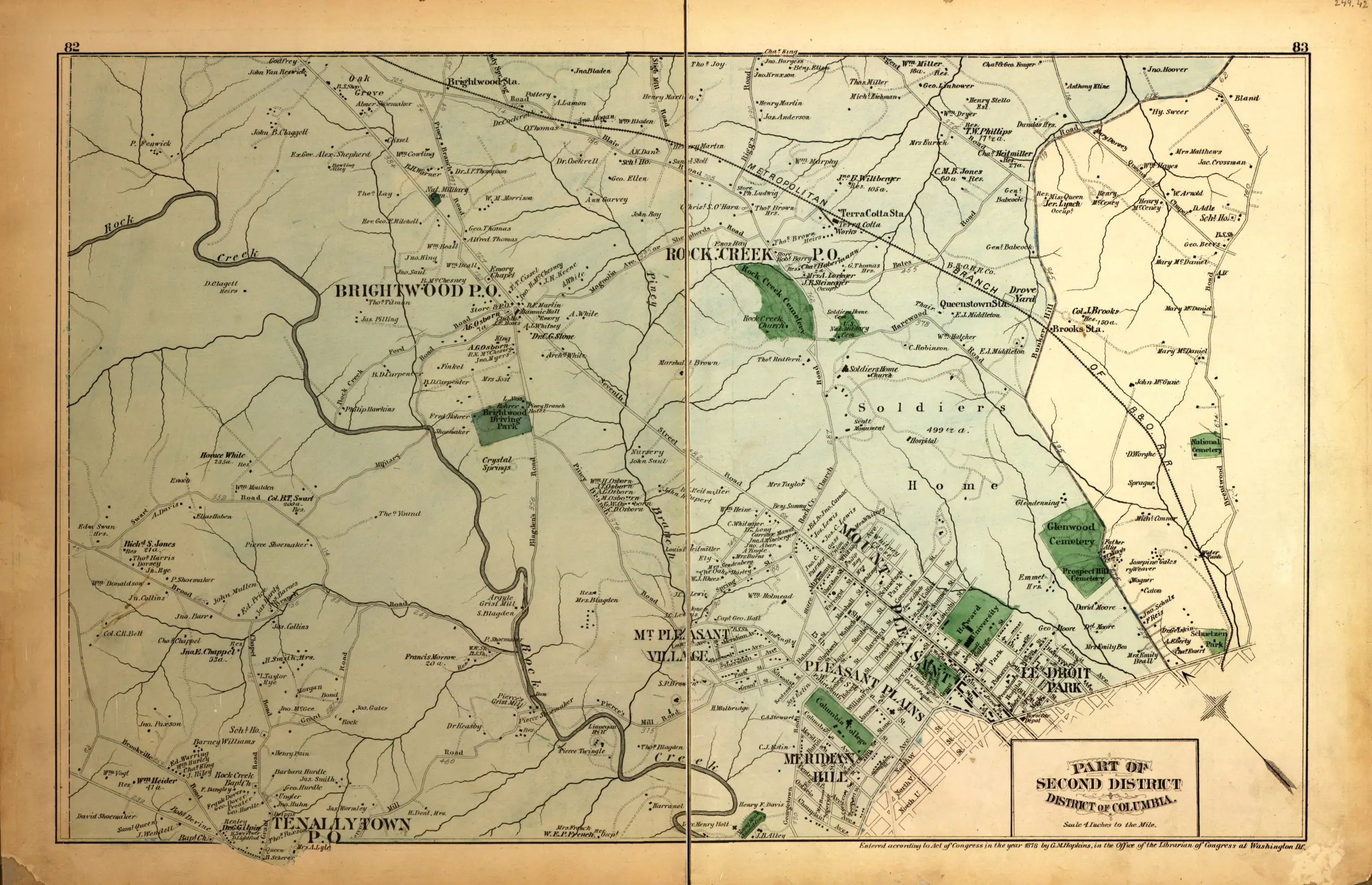
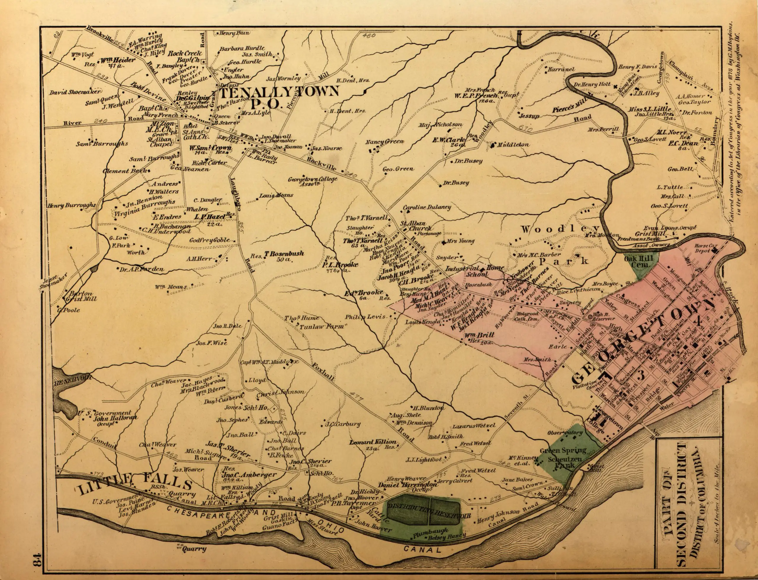
Did I get too excited with that title? These are so cool. It’s hard to believe that much of the District was rural at any point, but checking out this map, you can see that much of our city, outside of Boundary Road (Florida Ave.) was rural, dotted with little towns and neighborhoods. So, enjoy your pre-lunch time suck.
Best thing ive ever seen on ghostsofdc! And ive seen a lot!
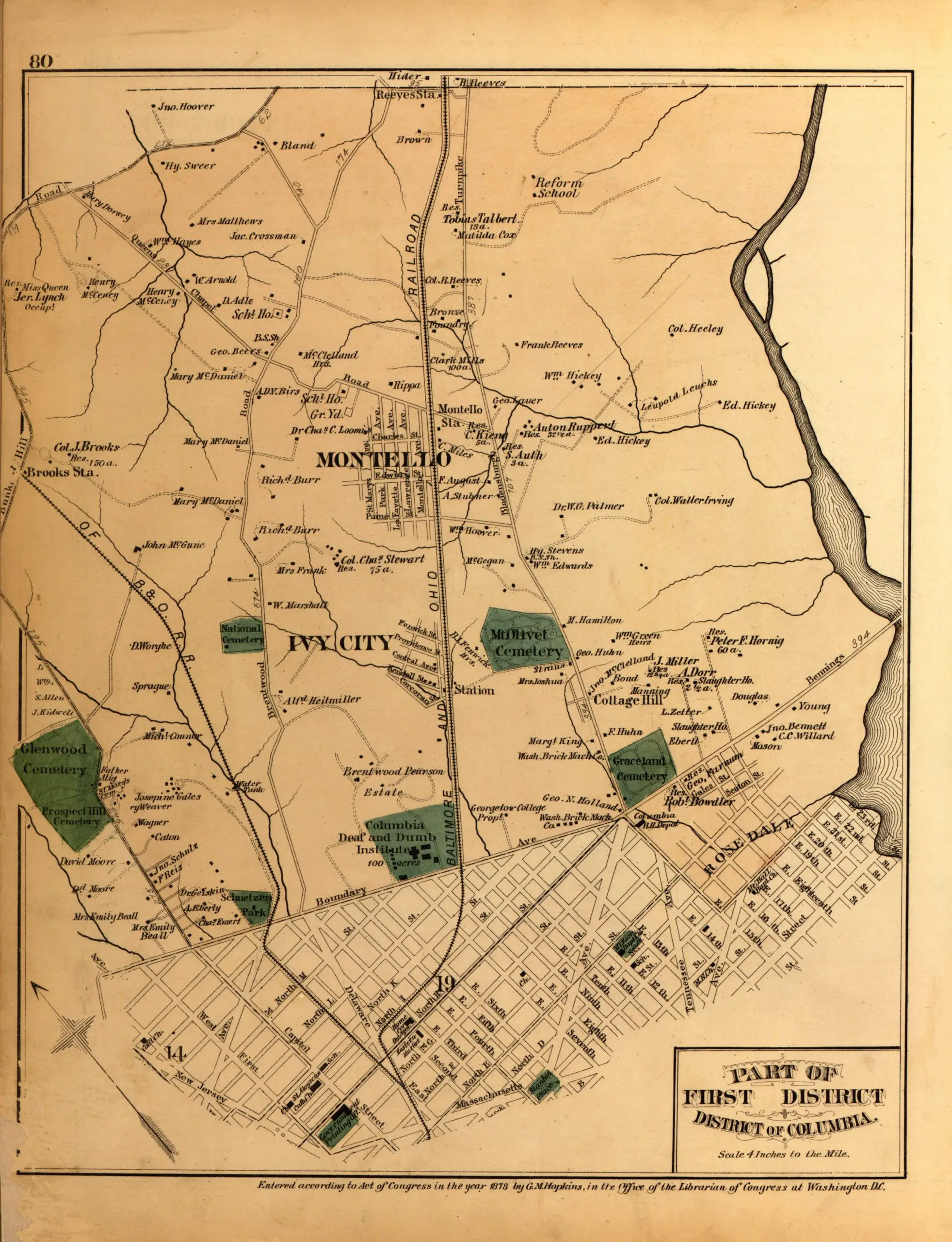
So if I’m reading “the part of first district – District of Columbia (1879)” map (first map listed), West Virginia Avenue used to be the B&O Railroad line. North of New York Avenue the line still exists but it’s been removed south of there. Also, it appears as if several of the Ivy City houses on the map are still standing, albeit significantly altered. Montello appears to be obliterated, although a couple of the street names still exist.
These old maps are simply amazing!
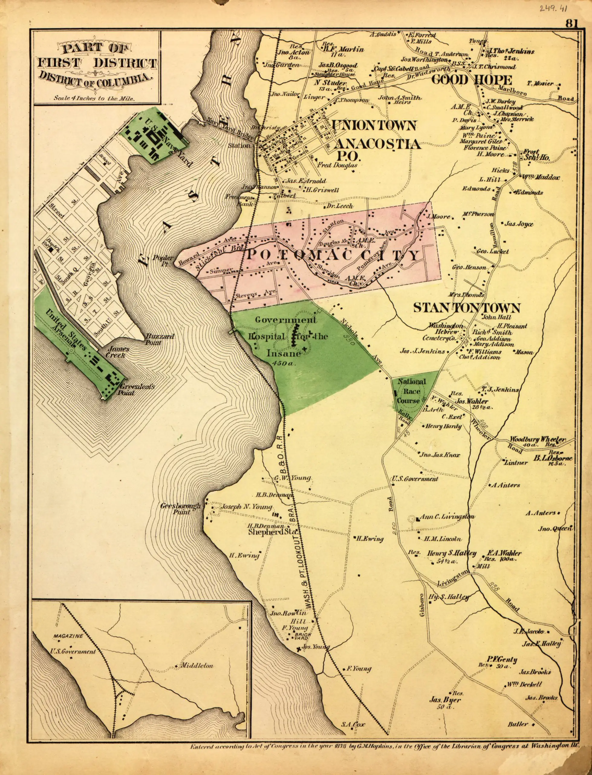
So cool, one of the maps shows where Saint Elizabeth Hospital is and Barry Farms! Very cool indeed!
these really make me wish i could spend 24hrs living in 1879 and seeing what life was really like then.