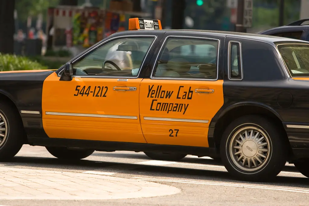
For 70+ years, DC taxis used zone fares, but proposals for meters instead sparked endless debates. This history explores DC's zone system, the battle over meters vs. zones, and how meters finally replaced zones in 2008.
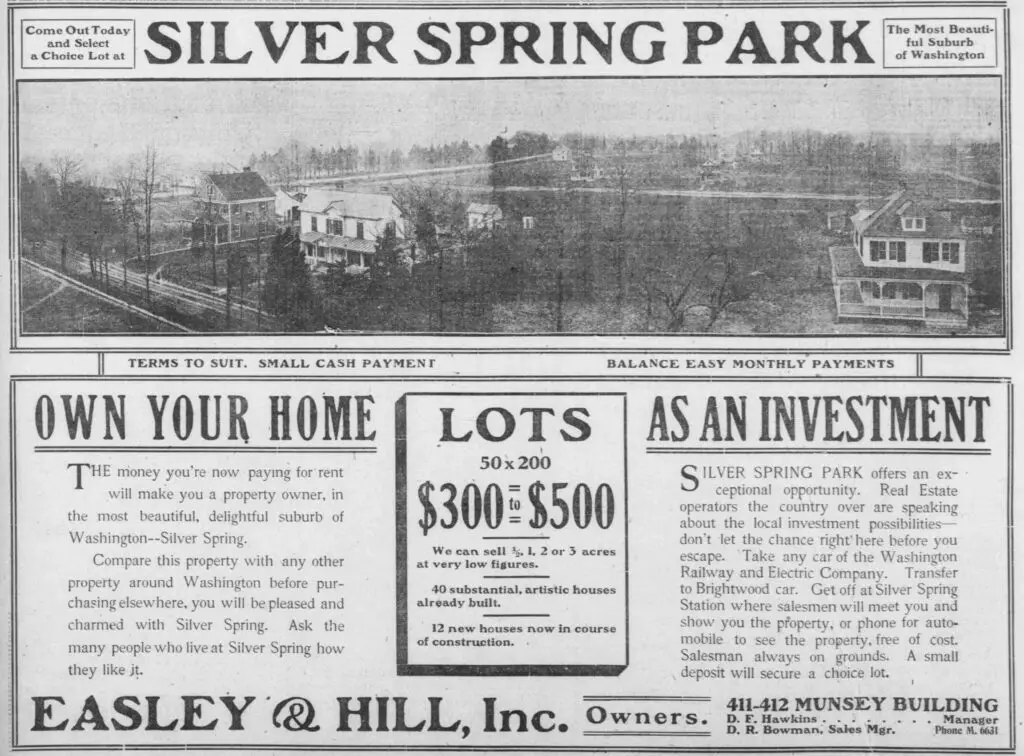
Take a look back to 1907 with this advertisement for Silver Spring Park, printed in The Washington Times. See the history of the park and its attractions and offerings in this vintage ad.
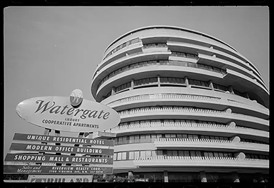
Here are three other notable things that happened at the Watergate. The Reagans had to exit the building by candlelight because the power went out. There were bomb threats and a major protest of the Chicago Seven trial.
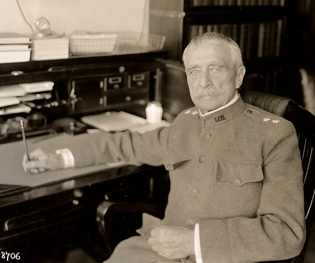
Hains point is named for Peter Conover Hains, a prominent Major General in the U.S. Army and served in the Civil War, Spanish-American War and World War I.
At the time, Grover Cleveland lived north of the city in a lovely old estate called Oak Hill. Eventually, the neighborhood that grew up around his home was named for him: "Cleveland Park".
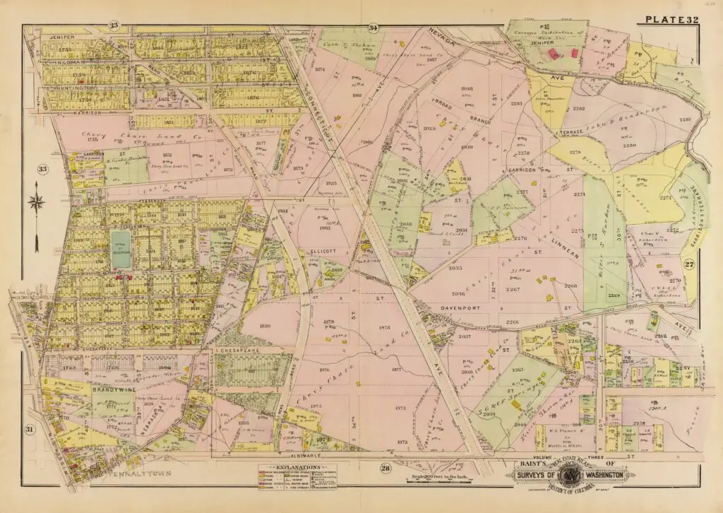
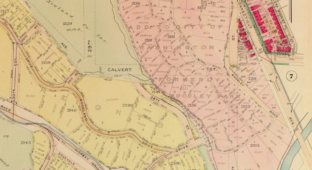
Explore the past and take a look at this old 1913 map of Chevy Chase, DC. Discover the history of this iconic Washington, DC neighborhood with this beautiful vintage map.
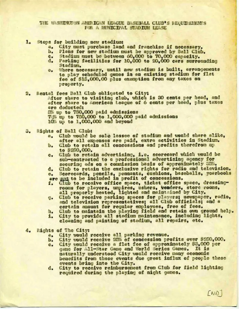
Learn about the lease requirements for a new baseball stadium in D.C., as revealed in a document from the 1950s. Follow the history of the Washington Senators and the legacy of Clark Griffith in this fascinating story.
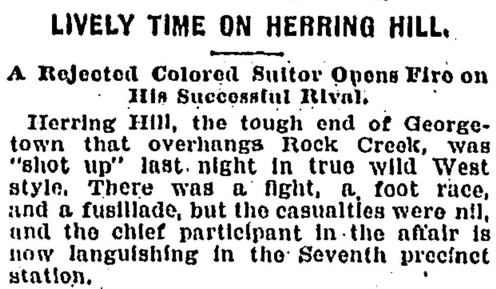
Take a journey through the lost neighborhood of Herring Hill in Georgetown, DC. Learn about its history, including an interesting story from 1895, and explore the area with a Google Map!
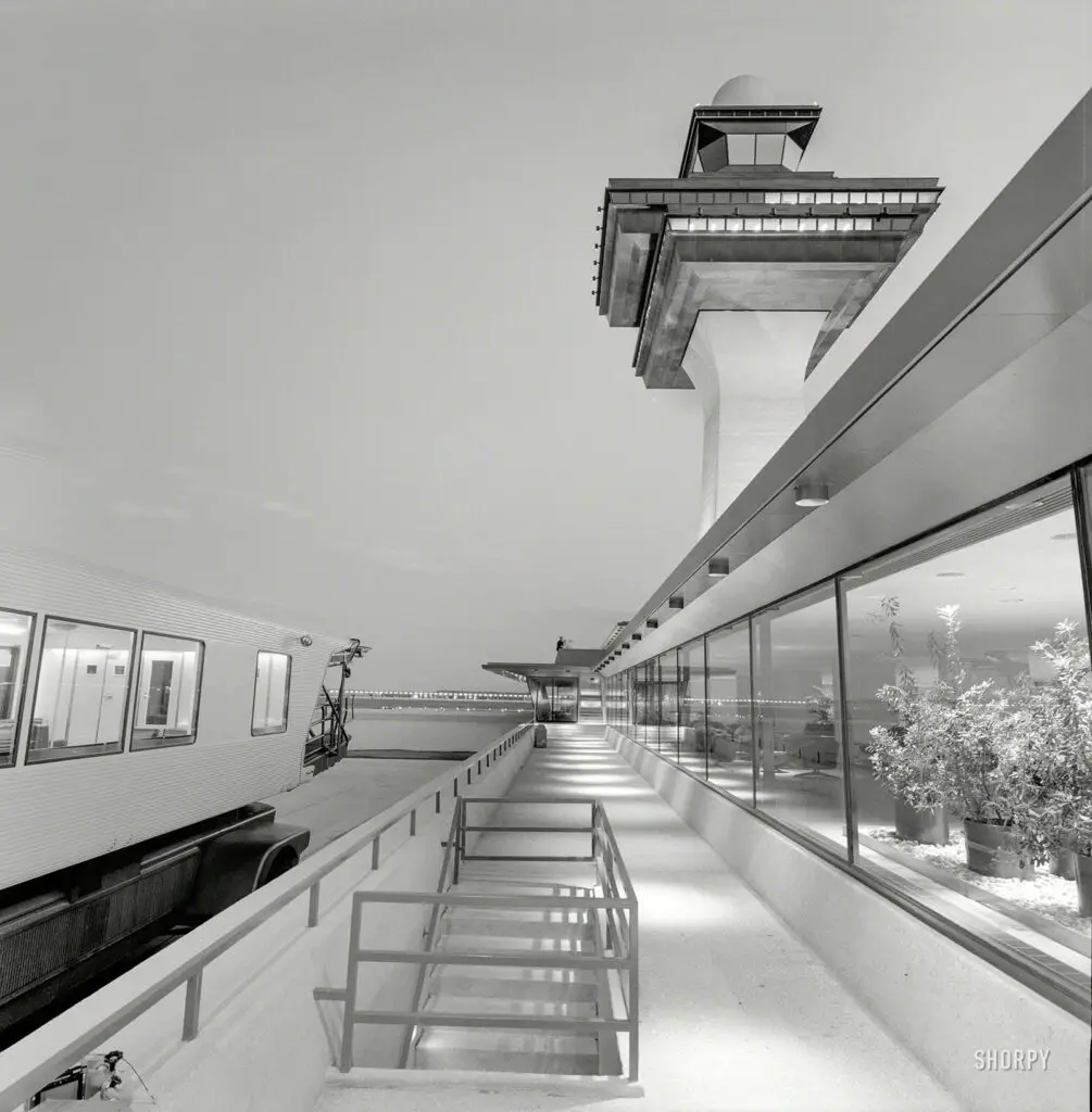
Take a trip back in time to the elegant and romantic Dulles Airport of the 1960s. Explore the mobile lounges and control tower in photos taken by Balthazar Korab.
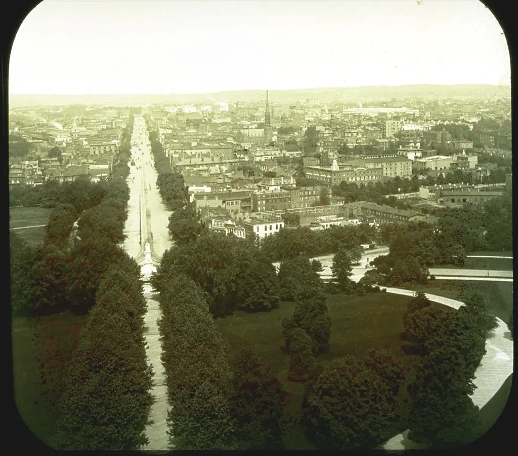
Can you help date this photo of Pennsylvania Avenue and the White House? It appears to be the view down the street from the Capitol Dome, but was not properly labeled. Take a look and see if you can help solve the mystery!
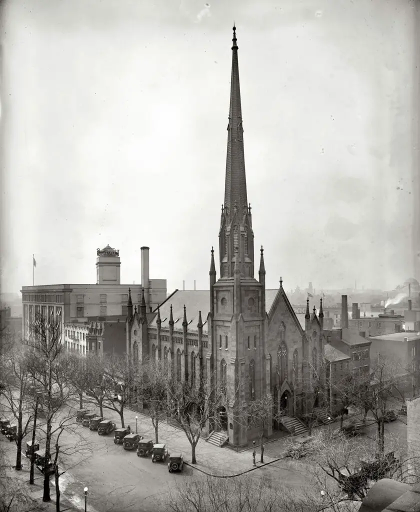
What a sad tale of progress - a beautiful old church, destroyed in the name of progress. Read the story of how this once grand building was lost forever, and the impact it had on its community.
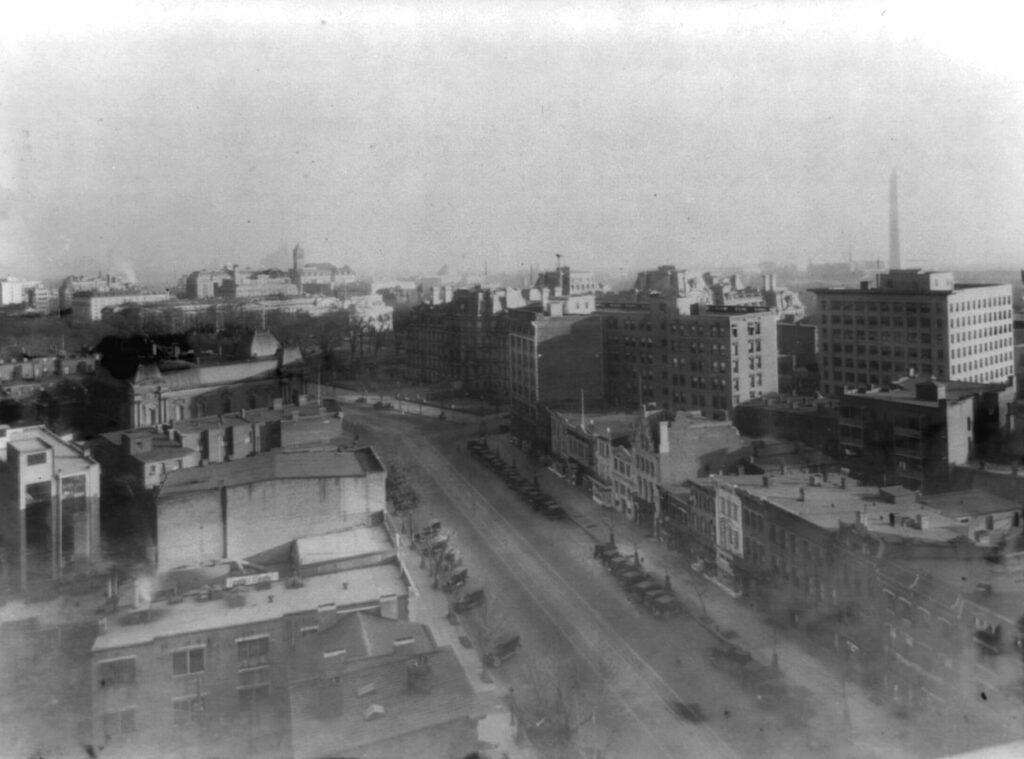
Take a look back in time with this stunning view of Pennsylvania Avenue in the 1920s. See the amazing photo from the Library of Congress and learn more about this historic street.