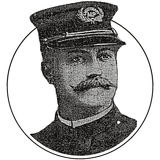

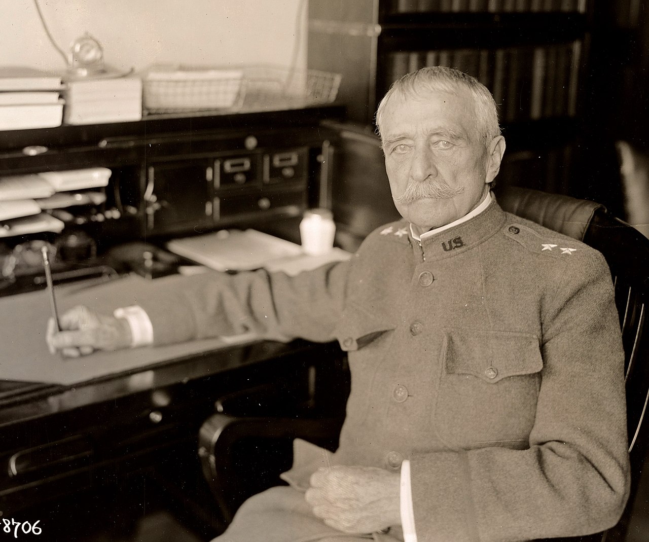
Hains Point is named for Peter Conover Hains, and not because he owned it or fought there. He was the Army engineer who started building it out of the river.
In 1880, the southern tip of East Potomac Park didn’t exist. It was river and mud flat. Starting in 1882, Hains ran the Army Corps of Engineers project that dredged the Potomac and piled the muck into the Potomac Flats, building the land that became East and West Potomac Parks, the Tidal Basin and the long spit of park that ends at Hains Point.
The name took hold in 1917, while Hains was still alive. Here’s how a mud flat became the place Washington goes to catch a breeze, play nine holes, ride the loop, and watch the river rise.

The Potomac Flats
For most of the 1800s, the Potomac below Georgetown was a mess. The river spread out over a soft, shallow bed of mud and silt, and the city’s sewage and runoff settled into it. Mud flats crept toward the White House.
In 1867, Army engineer Nathaniel Michler was sent to scout sites for a new presidential mansion, far from what one account called the “pestilent flat on which a large portion of the sewerage of the city [was] cast to fester in the sun.”
What finally moved Congress was a flood. On February 12, 1881, ice jammed against the piers of the Long Bridge and dammed the river. Within hours, about 254 acres of the city were under water, most of the area south of Pennsylvania Avenue.
Congress ordered a survey that March. A board led by Lt. Col. Quincy A. Gillmore of the Corps of Engineers drew up a plan. On August 2, 1882, Congress appropriated $400,000 to start the work, and Maj. Peter C. Hains was put in charge.
How You Build a Park Out of a River
Hains split the job into three sections. He started with the worst of it, the flats due south of the White House between Easby’s Point and 17th Street. The area south of the railroad bridge, then called the Harbor Flats, would become East Potomac Park.
Contractors dredged the river bottom from scows. At first, laborers loaded the muck onto rail cars that rolled across the flats on wooden trestles and spread it out. Retaining walls went up along the new channel to keep the fill from sliding back into the river.
By 1883 there were 8,000 linear feet of wall. In 1884, the contractors Benson and McNee brought in a hydraulic dredge that sucked mud off the bottom and sprayed it over the flats as slurry. It was cheaper and faster, and it needed far fewer trestles.
Hains ran the project from 1882 until he was transferred in 1891. By then, according to the Historic American Buildings Survey’s report on the park, the groundwork for East and West Potomac Parks was firmly in place. His successors kept pumping for another twenty years.
The last load of dirt was dumped on East Potomac Park on August 30, 1911. The new ground stood 14 feet above mean low tide in the middle and 11 feet at the edges. In total, East Potomac Park covers almost 330 acres.

What to do with all this brand-new land? Some engineers wanted to sell it off for development, the way Boston built its Back Bay.
Banker Charles Carroll Glover pushed for a park instead. He won. On March 3, 1897, Congress declared the reclaimed flats and the tidal reservoir Potomac Park, to be held forever “for the recreation and pleasure of the people.”
Then there was the question of who owned it. In 1886, Congress told the Attorney General to sue everyone who claimed a piece of it. Heirs and claimants fought back in court, saying the riverbed was theirs.
The Supreme Court settled it in the Potomac Flats case, Morris v. United States, on May 1, 1899. The land belonged to the federal government.
How Hains Point Got Its Name
On September 12, 1917, the Evening Star ran a front-page summary of the annual report of Col. William W. Harts, the engineer officer in charge of public buildings and grounds. Near the bottom:
It is again suggested that the tidal basin in West Potomac park be named “Twining Lake,” and that the extreme southern point of East Potomac park be named “Hains Point.” The plan for the tidal basin originated with Maj. Twining of the Corps of Engineers and was executed by Col. Hains of the same corps.
Notice the word “again.” Harts had made the suggestion before. This time, half of it stuck.
“Twining Lake” never caught on. You still call it the Tidal Basin.
“Hains Point” stuck. The Historic American Buildings Survey’s report on the park dates the name to 1917.
Within a few years, the Evening Star was using it like any other place name. On November 9, 1921, the paper told readers how to get “to Hains point, at the lower end of Potomac Park” to watch the cruiser Olympia steam up the river carrying the Unknown Soldier. Hains had died two days earlier.
Who Was Peter Conover Hains?
Hains was born in Philadelphia on July 6, 1840. He graduated from West Point in June 1861, in time for the first big battle of the Civil War. At Bull Run, according to his Washington Post obituary, he fired the signal gun that opened the battle.

He moved over to the engineers and served as chief engineer of the 13th Corps at Vicksburg, where he was brevetted major. After the war he built lighthouses and harbor works, then came to Washington for the Potomac Flats job.
In the Spanish-American War he was a brigadier general of volunteers in Puerto Rico. He sat on the Nicaragua Canal Commission, which studied the rival route, and on the Isthmian Canal Commission that picked the Panama route. He retired in 1904, then served on the commission that began building the canal, from 1905 to 1907.
Then World War I came. In September 1917, at 77, Hains was back on active duty as engineer of the Norfolk harbor district. The Evening Star said he was believed to be the oldest officer in the service.
He died at Walter Reed hospital on November 7, 1921. The next morning, the Washington Post put him on the front page under the headline “Maj. Gen. Hains, 81, Officer in ’61, Dead: Fired Signal Gun Starting Battle of Bull Run.” It began:
Maj. Gen. Peter C. Hains, U. S. A., retired, died yesterday morning at the Walter Reed hospital, after an illness of several weeks. He was 81 years old.
That’s an officer in three wars, the last one in his late 70s.
The Evening Star‘s obituary that same day added the line that matters most here: “Hains Point, in East Potomac Park, was named after him.” It also gave his home address, 818 18th Street NW, near Farragut Square.

A Family Tangent: The Bayside Yacht Club Shooting
That grandson in the census has a story behind him. The general’s sons were not quiet men.
On Saturday afternoon, August 15, 1908, Capt. Peter C. Hains Jr. of the Coast Artillery and his brother, Thornton Jenkins Hains, a writer of sea stories, waited at the Bayside Yacht Club in Queens for William E. Annis to bring his racing sloop in. Hains Jr. believed Annis had been involved with his wife.
Here’s how the Evening Star described it the next day.
Then Thornton Hains held the crowd back with a revolver while his brother fired six shots from a magazine pistol into the body of Annis. Then the two men gave up their revolvers. Sitting down on the veranda of the yacht clubhouse, they waited for policemen to come.
Annis died that evening. On the way to the police station, the captain wired his father, addressing the telegram to the general at Fort Hancock, New Jersey: “Have shot Annis. Come to Flushing police station. PETER.”
Thornton was tried first and acquitted in January 1909. Peter Jr. was convicted of first-degree manslaughter that May.
On May 17, 1909, he was sentenced to eight to sixteen years at hard labor. New York Gov. John A. Dix signed his pardon on September 30, 1911.
The grandson living with the general in 1920 was Peter C. Hains III, born in Winthrop, Massachusetts, in 1901. He went to West Point, competed in the modern pentathlon at the 1928 Amsterdam Olympics, and retired a major general, like his grandfather.
The Speedway, the Camp and the Ferry
Back to the point. The 1902 McMillan Plan, the same plan that gave us the Lincoln Memorial Reflecting Pool, set aside the long southern spit for recreation. The commission imagined a stadium, a swimming pool and athletic fields.
The first thing built was a road. Congress paid for it in 1912, and by 1916 crews had laid a macadam drive around the edge of the island.
Everybody called it the Speedway, a name borrowed from an old racing track on the Monument grounds. Some families called it the Breezeway. It’s Ohio Drive SW today.

World War I filled the park with soldiers and clerks. Forty-one wooden buildings went up on 15 acres near the railroad embankment for troops guarding Washington. Another 57 barracks housed War Department clerks on the Washington Channel side.
Boy Scouts planted corn in war gardens.
After the war, the barracks site became a six-acre automobile tourist camp in 1921. Visitors could pull in and sleep in a cabin or a tent, with hot showers, a gas station and a commissary on site.
We’ve written about the tourist camp at East Potomac Park before. It lasted until 1963, when the National Park Service built its regional headquarters on the spot.
For a few years around the end of World War I, from 1919 to 1921 by one account, you could even take a ferry. A boat carried visitors from 7th Street across the Washington Channel to Hains Point.
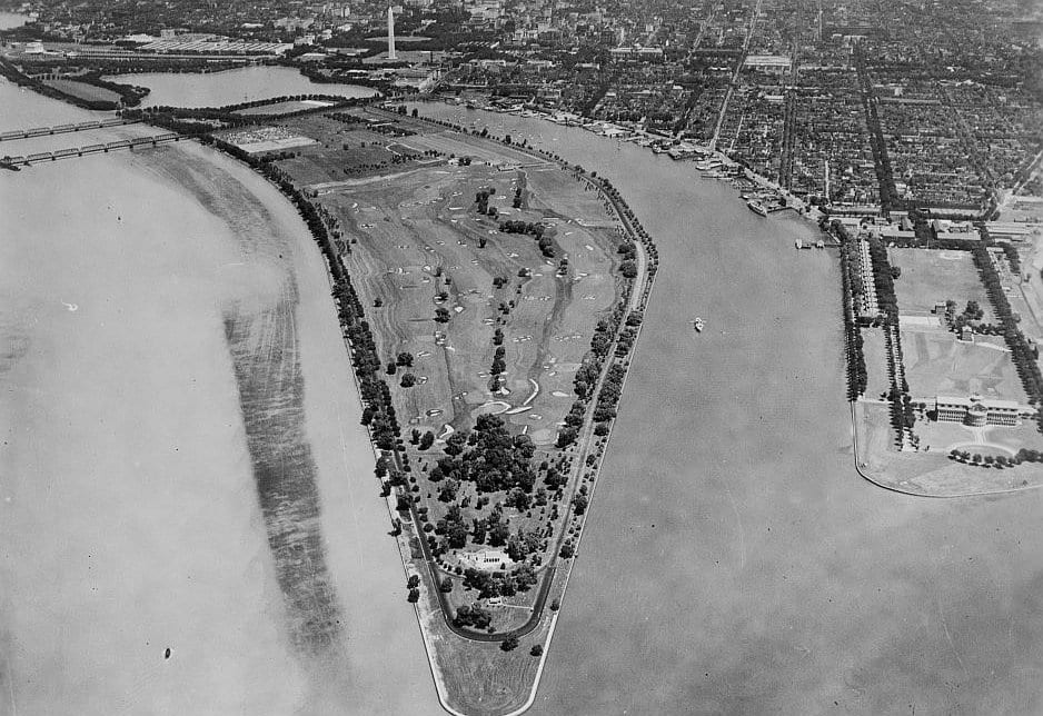
The Historic American Buildings Survey’s report says 60 acres of the park were divided into garden plots in 1921. That may be the striped patch in the middle of the 1922 aerial at the top of this post.
The Girl Scout Tea House
In the early 1920s, the point was about three miles from the nearest park comfort station. In 1920, the Girl Scouts of the District of Columbia got a permit to serve tea and refreshments from a temporary shelter at the point.
It was a hit. The Office of Public Buildings and Grounds built a proper pavilion with a comfort station in 1923 and 1924, a long, low stucco building with a Mount Vernon style portico and a Chinese Chippendale railing on the roof. In September 1924, the Girl Scouts moved into three rooms and opened a tea house.

The Scouts didn’t get to keep it long. Lt. Col. U.S. Grant III, the new director of public buildings and parks, let their concession expire on December 31, 1925. A parks concessioner took over.
The building kept serving sandwiches, dinners, wine and beer for decades. It closed during World War II because driving to the point wasted gas and tires. It became the Hains Point Inn in 1950 and the Cherry Blossom Inn in 1957, served its last meal in 1962, and spent its final years as Park Service offices and a lab.
It flooded too often and drew too much traffic for anyone to save it. The Historic American Buildings Survey documented it in 1987, and the Park Service tore it down.
The East Potomac Golf Course
Much of East Potomac Park is golf course, and has been for a century. Walter J. Travis laid out the first eighteen holes in 1917.
The first nine opened to the public on July 8, 1920, with a field house designed by Horace W. Peaslee. A round cost a quarter.
It was packed from day one. In April 1921, President Warren G. Harding showed up unannounced, paid his quarter and played a round. The back nine were finished by the summer of 1923, and more nine-hole courses followed in 1925 and 1931.
It was also whites only. So was the bathing beach at the Tidal Basin next door. Black golfers in Washington were pushed to a nine-hole course built on a former dump along Kingman Lake, the Langston Golf Course, which opened in 1939.
In the summer of 1941, Black golfers pushed back. On July 13, forty Black golfers were barred from the field house. Six days later, on July 19, 1941, Interior Secretary Harold Ickes ordered all federally owned golf courses desegregated.
When the River Takes It Back
Hains Point is made ground, barely above the river, and it floods. When the hurricane of August 1933 pushed the Potomac over its banks, the Evening Star reported on August 24 that “early today Hains Point still was inundated.”
The great flood of March 1936 was worse. On March 19, the Star‘s Thomas R. Henry flew over the river and reported that “Hains Point is no longer to be seen.”
He went on: “One building stands out solitary. The East Potomac golf course is a morass of yellow ponds and puddles.”
The land also sinks. The 1973 National Register nomination for the park noted “the necessary and recurrent dumping of dredged mud onto Hains Point because of constant settling.”
Bikes, Cherry Trees and a Buried Giant
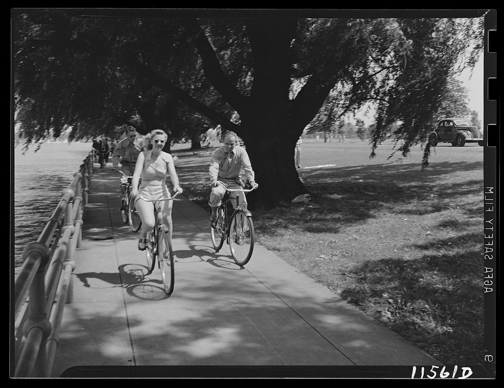
The promenade came slowly. A concrete walk with a pipe-rail fence along the seawall was started in 1919, and the four-mile loop wasn’t finished until 1931. During World War II, a bicycle rental in the park did big business with the new crowd of wartime workers.
The cherry trees along the drive at the point are newer than the ones at the Tidal Basin. Between 1966 and 1968, about 1,800 cherry and other flowering trees were planted on both sides of Ohio Drive around Hains Point. Friends of President and Mrs. Lyndon B. Johnson gave them to honor the Johnsons’ beautification campaign.
Then there was the giant. In 1980, J. Seward Johnson’s “The Awakening,” a 70-foot aluminum figure in five pieces clawing his way out of the ground, went up at Hains Point for a citywide sculpture exhibition.
It was only on loan to the Park Service. It stayed for more than a quarter century.
In April 2007, word came that developer Milt Peterson had bought it from the Sculpture Foundation for $725,000. In February 2008, crews dug it up and trucked it south to National Harbor in Prince George’s County, where it was buried again in the sand of a new beach.
Today the old Speedway loops about three and a half miles around the park, mostly one way, clockwise. Cyclists and runners treat it as a training loop. The willows and the seawall are still there.
The golf course is changing: in October 2026, President Trump announced it would close on November 15 for about 15 months to be rebuilt as a championship course, while a lawsuit from preservationists is still in court.
Stand at the tip and look downriver. Everything under your feet was river bottom or mud flat when Peter Hains showed up in 1882.
We use AI to help research, write and edit stories across our sites. Here’s how we use AI.Suggest a correction