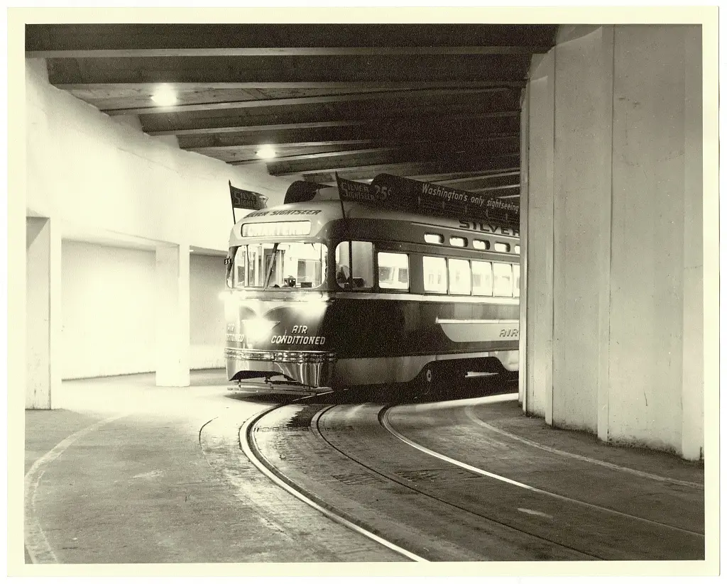
The Silver Sightseer streetcar gave cool, narrated tours of Washington D.C.'s famous landmarks in the late 1950s. Read about this one-of-a-kind, air-conditioned trolley that was specially decorated before it tragically burned down years later when the streetcar system closed.
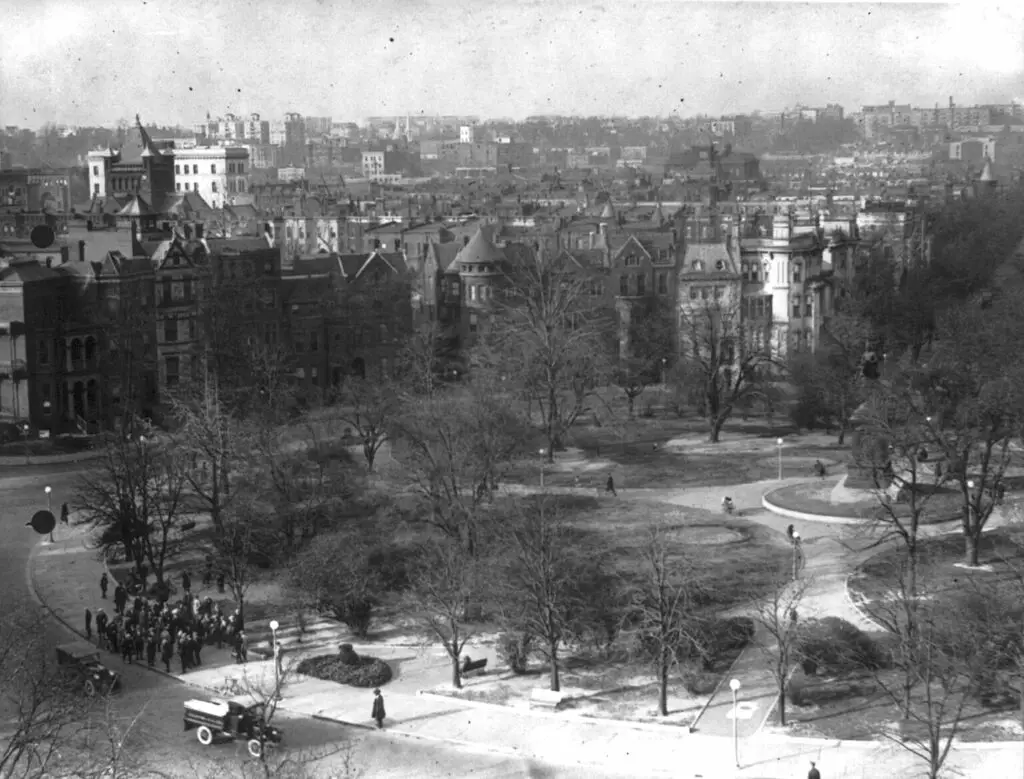
Take a look back at Logan Circle in the 1920s with this photo from the Library of Congress. Learn more about the history of Logan Circle with Ghosts of DC.
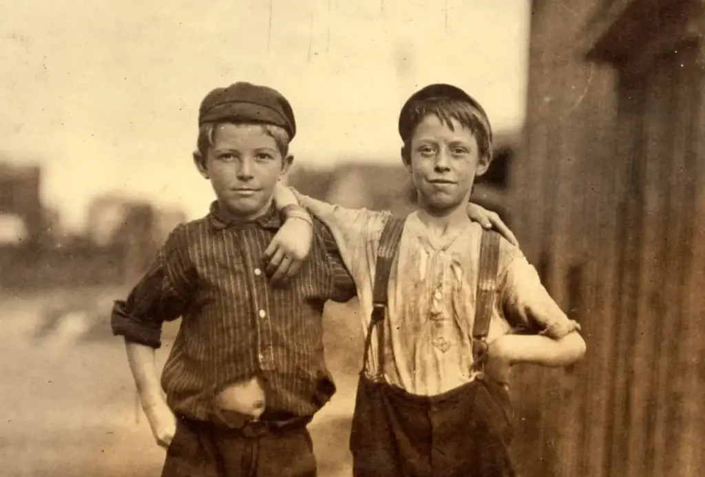
Explore the lives of young boys working at the Alexandria Glass Company in the 1910s through a series of photographs taken by Lewis Hine. Learn more about one of the boys through a fascinating history page.
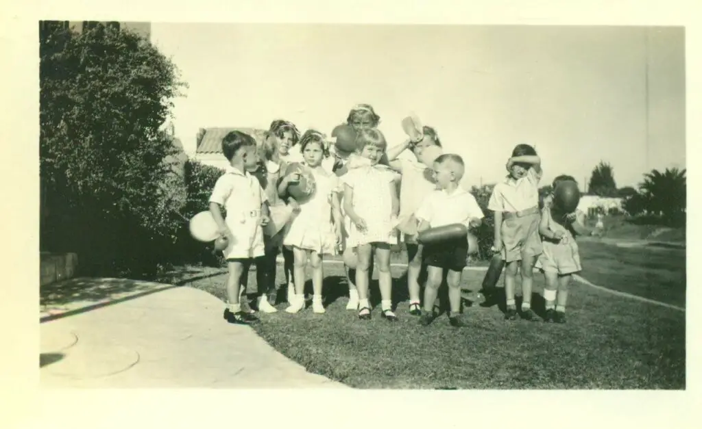
Discover the fascinating history of balloon selling on the streets of Washington D.C. in the 1930s, including how much money vendors like Joe the Greek could make in an afternoon.
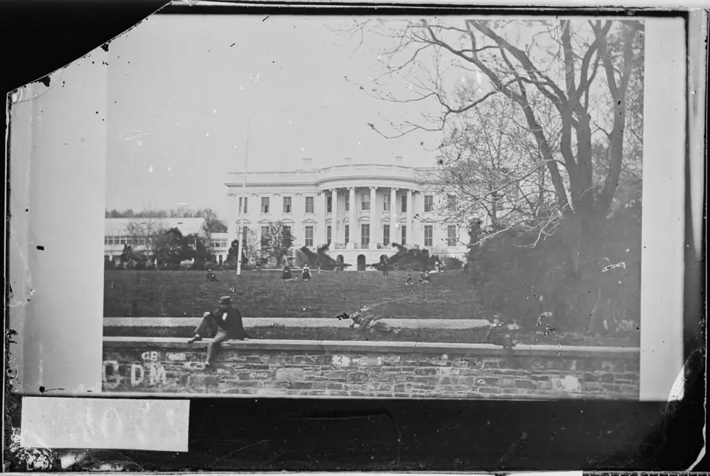
Take a look at this unbelievable photo of the South Lawn of the White House during the Civil War. Unbelievably, there are people sitting on what appears to be a low stone wall on the south side of the White House. Take a look at this incredible photo from the National Archives.
This is an unexpected and disappointing article from 1977 about a small group of sixth-graders and a third-grader smuggling marijuana and liquor to and from an elementary school in Montgomery County. Interestingly, this occurred just a few days before President Jimmy Carter implemented the first civil rights law for people with disabilities.
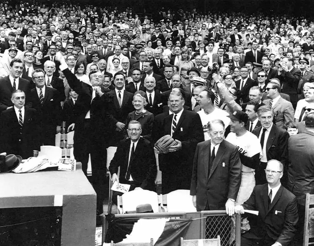
We're way late on this, but better late than never. Here's a terrific photo shared with us by old GoDC friend Phil of President Lyndon B. Johnson throwing the first pitch at the 1967 Senators vs. Yankees game. See the full list of people in the photo.
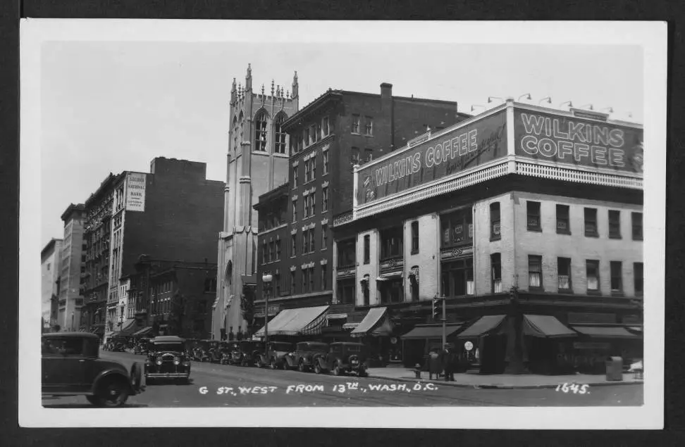
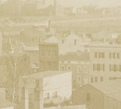
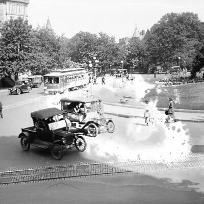
Take a look back in time at this photo of the Metro Center area in Washington, D.C. in 1930. Don't miss the Wilkins Coffee sign and a photo of Robert DeNiro's doppelganger from the same era.
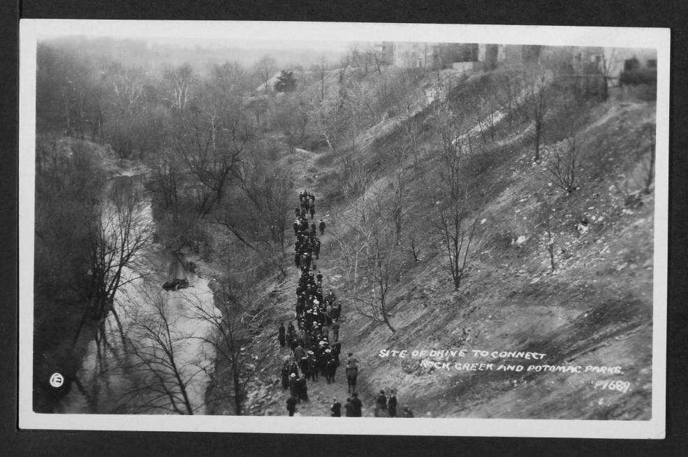
Take a journey through history with us and explore the historical entrance to the National Zoo in Rock Creek Park. Learn more about the area and its past with us today.
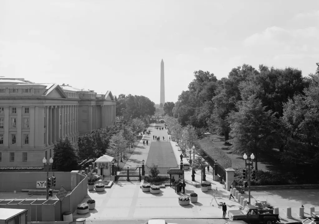
Take a look back in time at the Washington Monument in the early 1980s with this incredible view from the Library of Congress. See the iconic monument as it was in the 1980s!
Digging through old newspaper archives and the U.S. Census, uncover the tragic tale of Rudolph and Mary Scheitlin that was printed in The Baltimore Sun in 1905. Learn the story of their rocky marriage, her dalliances and the fateful night that ended in murder.
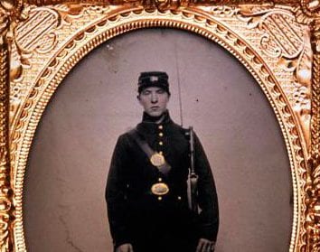
At least 400 women disguised themselves as men to join the Civil War, fighting for their side in the only way they could. Learn about one of them, Rosetta Wakeman, and her incredible story in Wild Women of Washington.
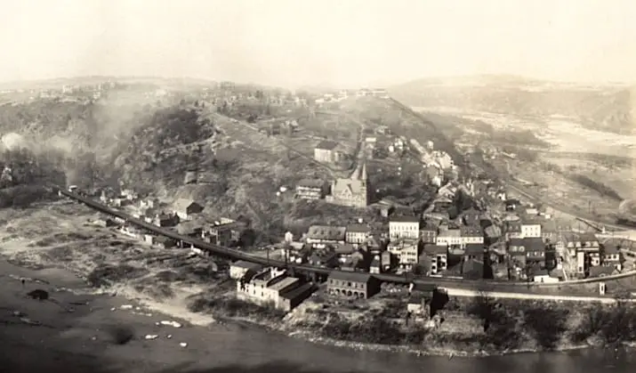
A fun article from the Washington Post in 1914 offers directions to Harpers Ferry. Read the article to learn more about the town and its unrivaled scenic beauty. Plus, don't miss our awesome 1865 photo of the town!
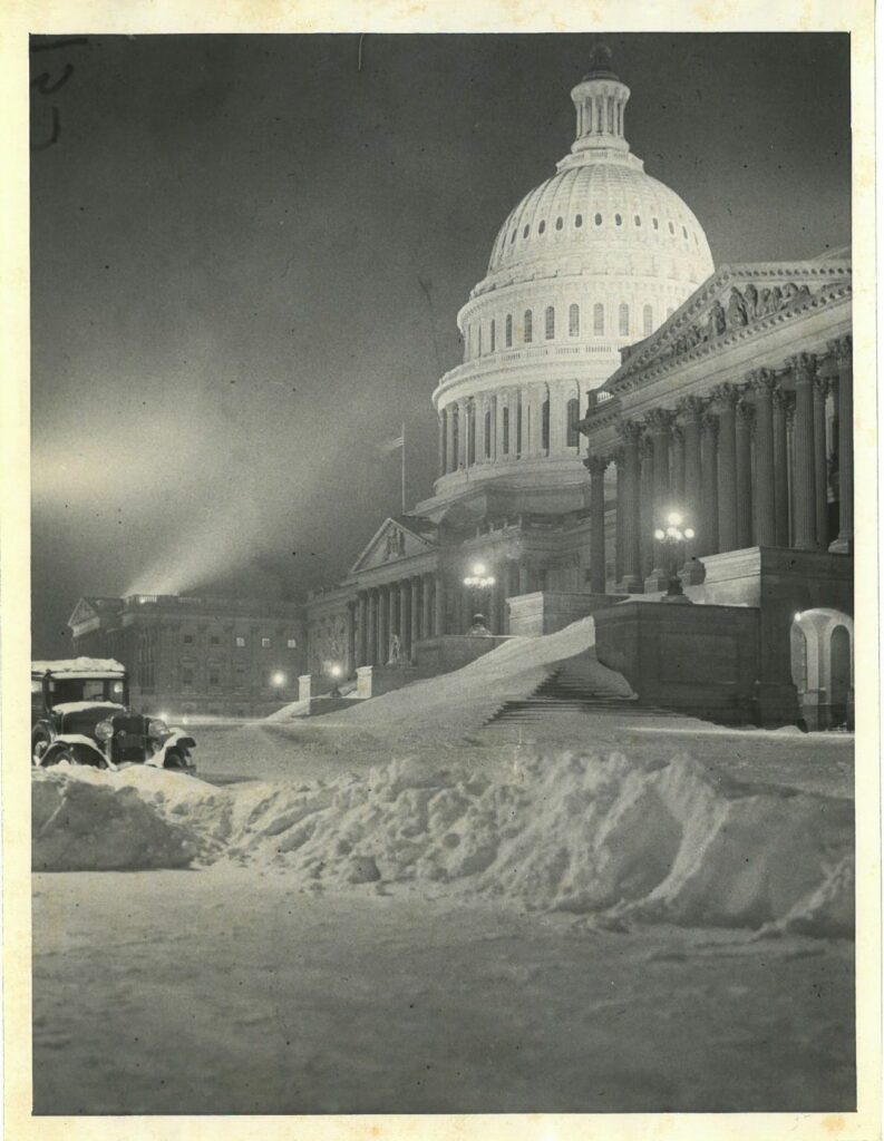
Check out this rare photo of the US Capitol Building from the 1920s! Thanks to GoDCer Mollie for sending this in. It's an amazing look at the Capitol during that time.
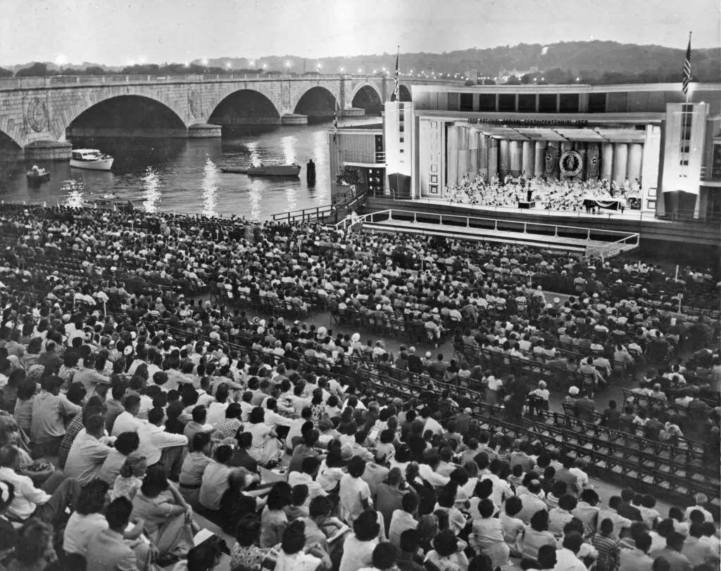
Relive the past with this incredible photo from the 1950s, showing a crowd on the Watergate steps watching a performance on a barge at the edge of the Potomac River.