
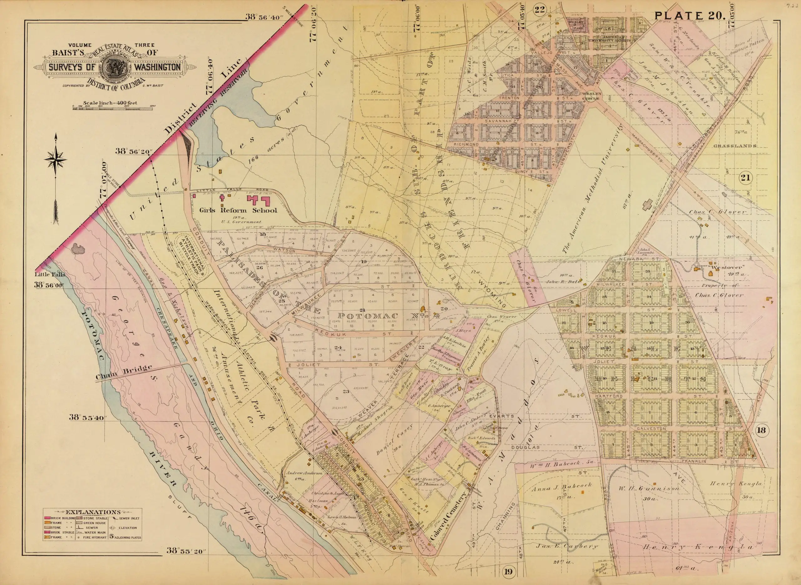
We haven’t posted a good old map in a while, so here is one from 1903, showing the Palisades.
Source: Library of Congress
We haven’t posted a good old map in a while, so here is one from 1903, showing the Palisades.
Source: Library of Congress
Comments are closed.
Interesting to see AU referred to “The American Methodist University.” As an alumni, I’ve never heard that name, only American U and The American U.
Girls Reform School?! No Ward Circle?! And a lot of street names that were later changed, perhaps when Miller started Wesley Heights and Spring Valley developments. Great map, thanks!