Explore the history behind Washington, D.C.’s indoor smoking ban—from smoky bars and political battles to the 2007 law that cleared the air. Discover how health advocacy, public support, and city council debates transformed the District into a smoke-free capital.
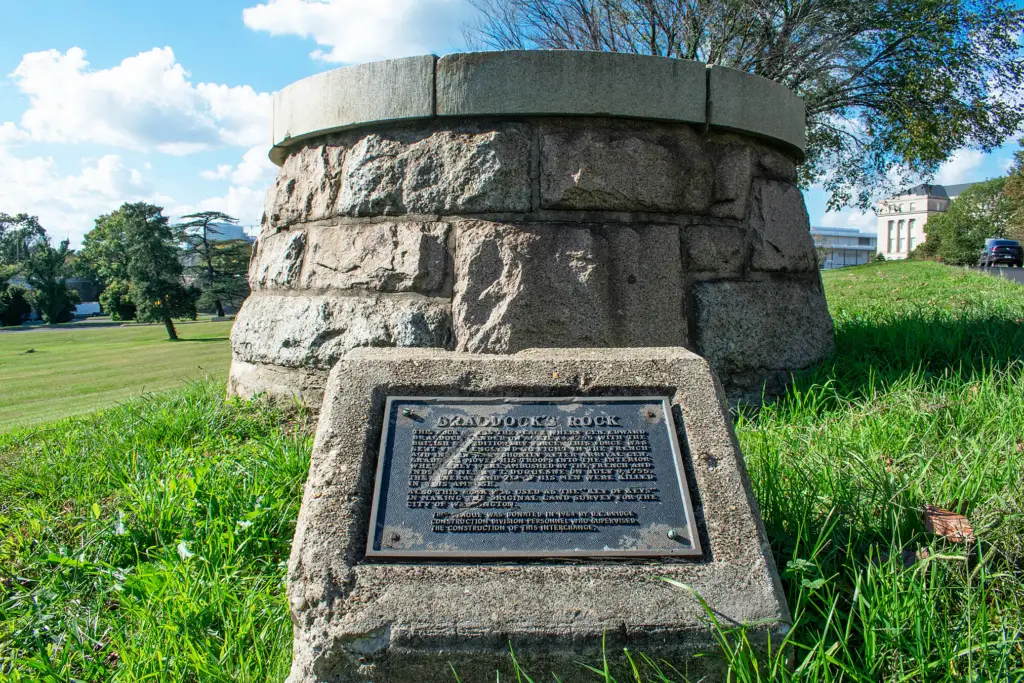
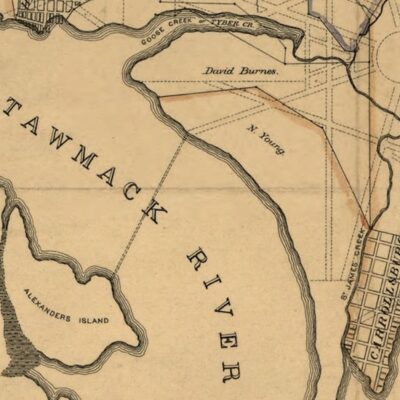
Uncover the forgotten history of Braddock’s Rock – a 7-foot Potomac landmark from Colonial America that was conquered by Washington D.C.’s urban expansion only to vanish underground. Rediscover this site tied to key figures like George Washington and Edward Braddock which blazed the trail for the future capital’s surveyed beginnings despite modern obscurity.
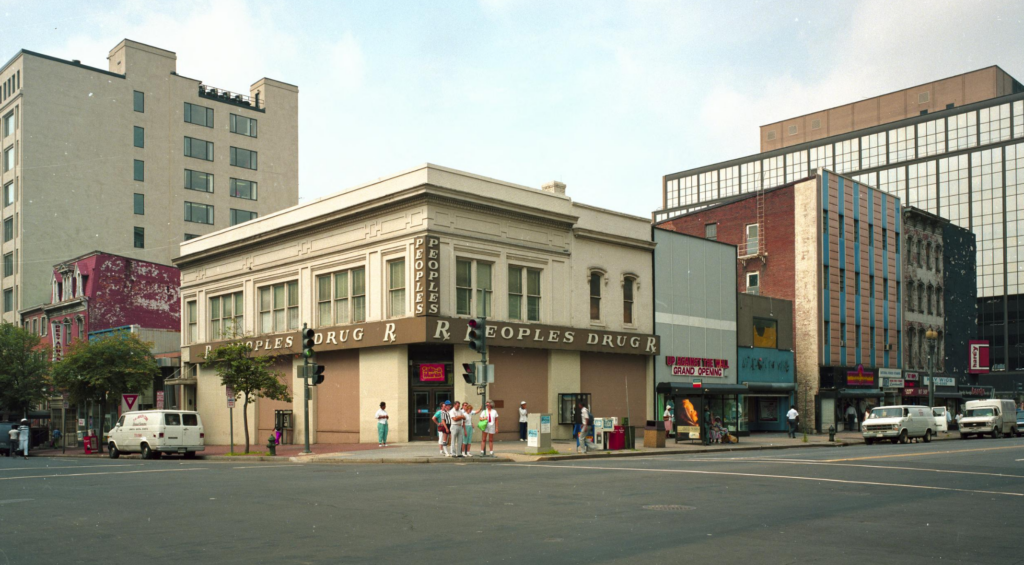
Peoples Drug was DC's beloved pharmacy chain for over 80 years. From its first store at 824 7th St. NW in 1905 to CVS's acquisition in 1990, here's the full history.
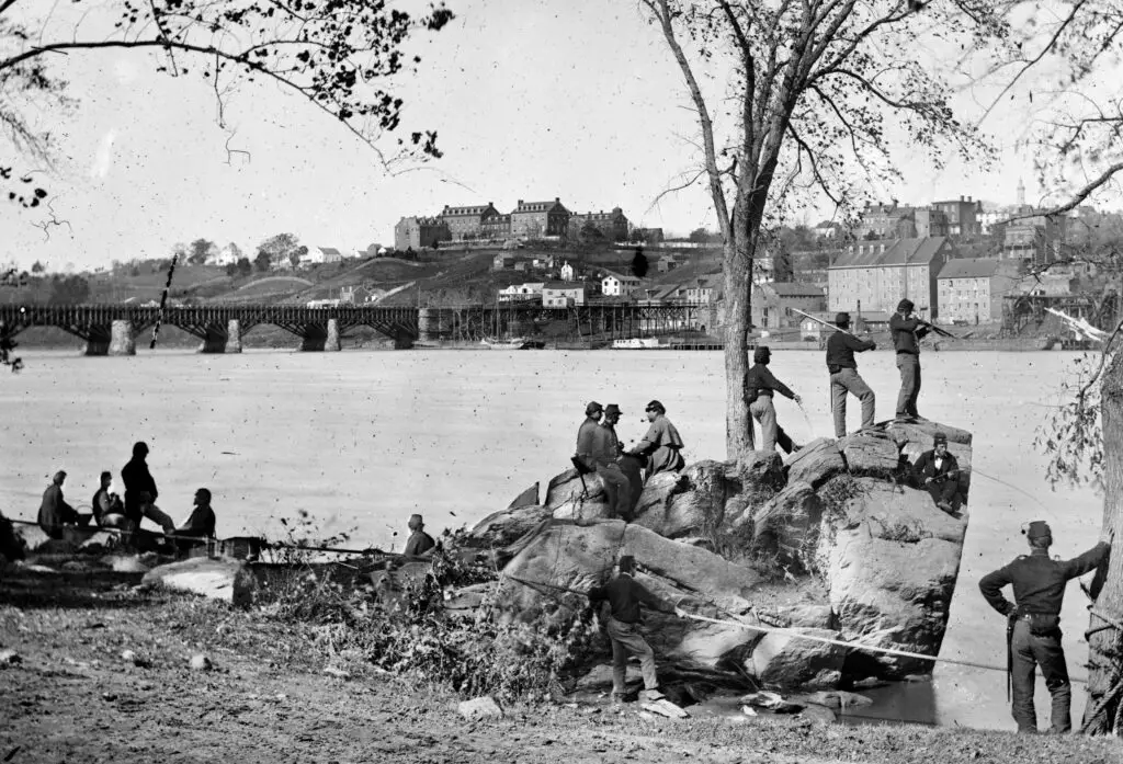
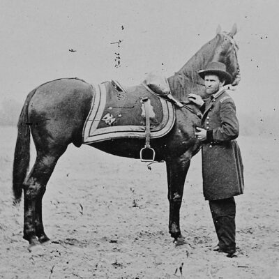
Take a rare look at Union soldiers guarding the Potomac River in Washington, DC in 1861. Georgetown University is visible in the background. Photo by George Barnard.
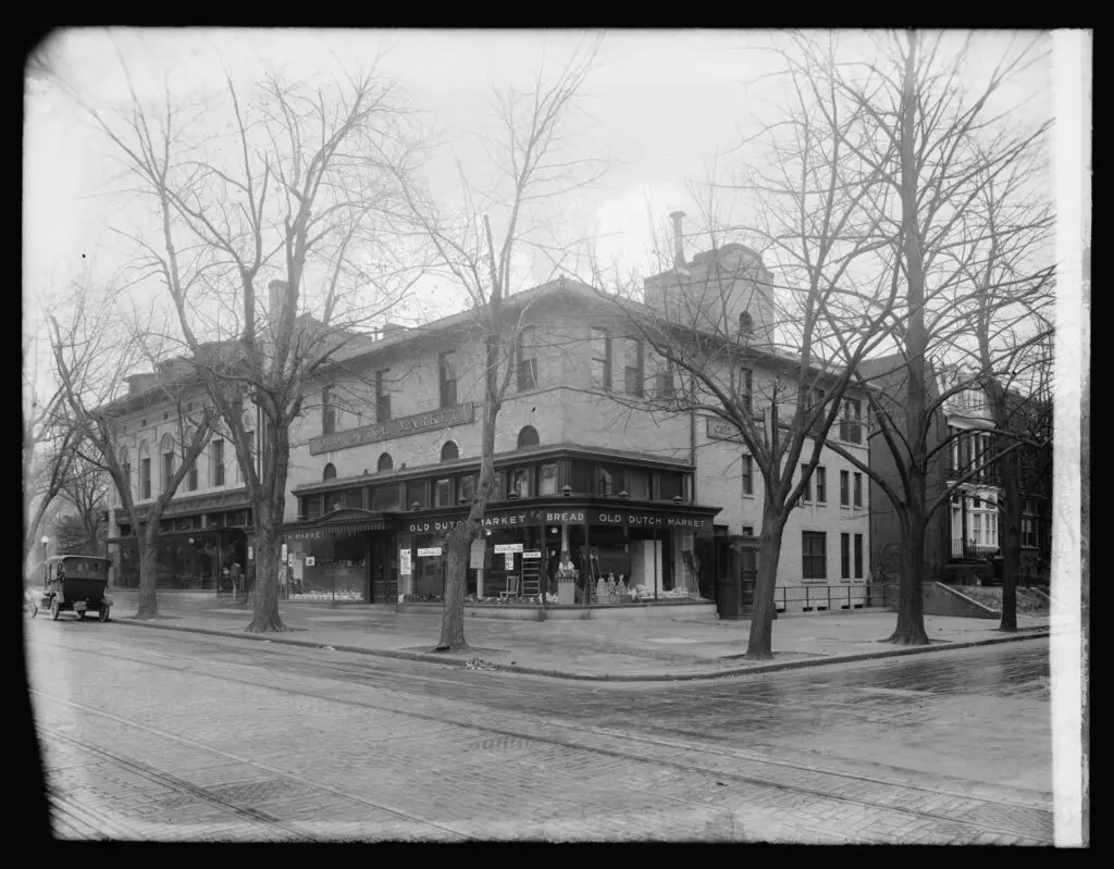
The Old Dutch Market at Dupont Circle is now occupied by CVS. It was a thriving business in DC through the 1920s. See their launch ad and learn more about what happened to them.
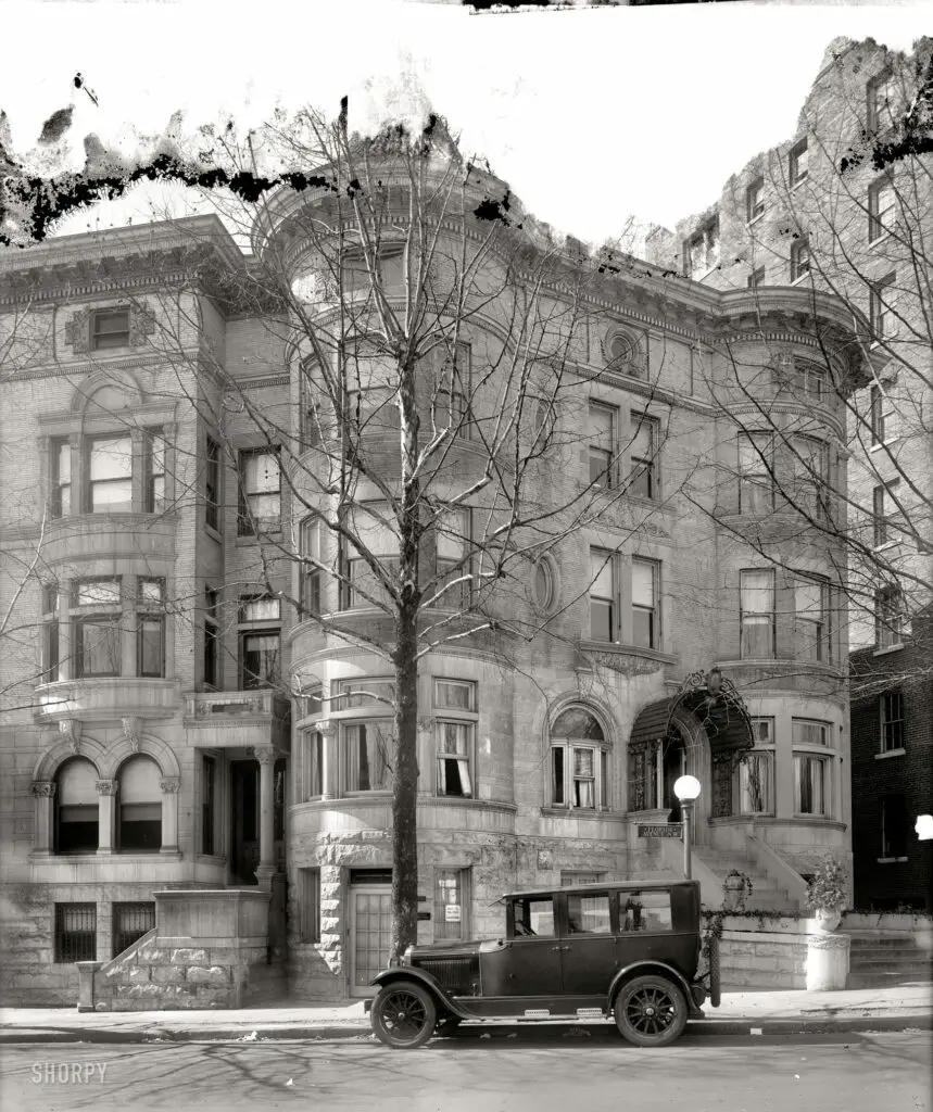
Get a glimpse of the beautiful Russia House building in Washington D.C, from a 1925 photo to how it looks today on Google Street View. Learn more about this majestic building!
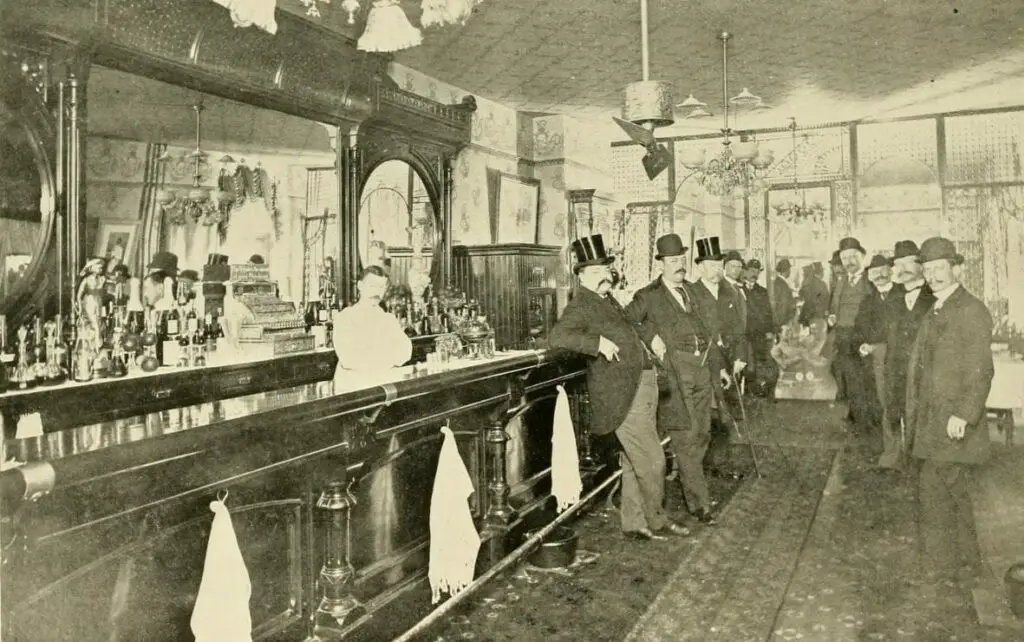
Join us as we explore the lost history of Warwick's Saloon, formerly located at 13th and Penn in Washington, DC. We'll take a look at the bar, the billiard room, and the interesting story of a Secret Service raid.
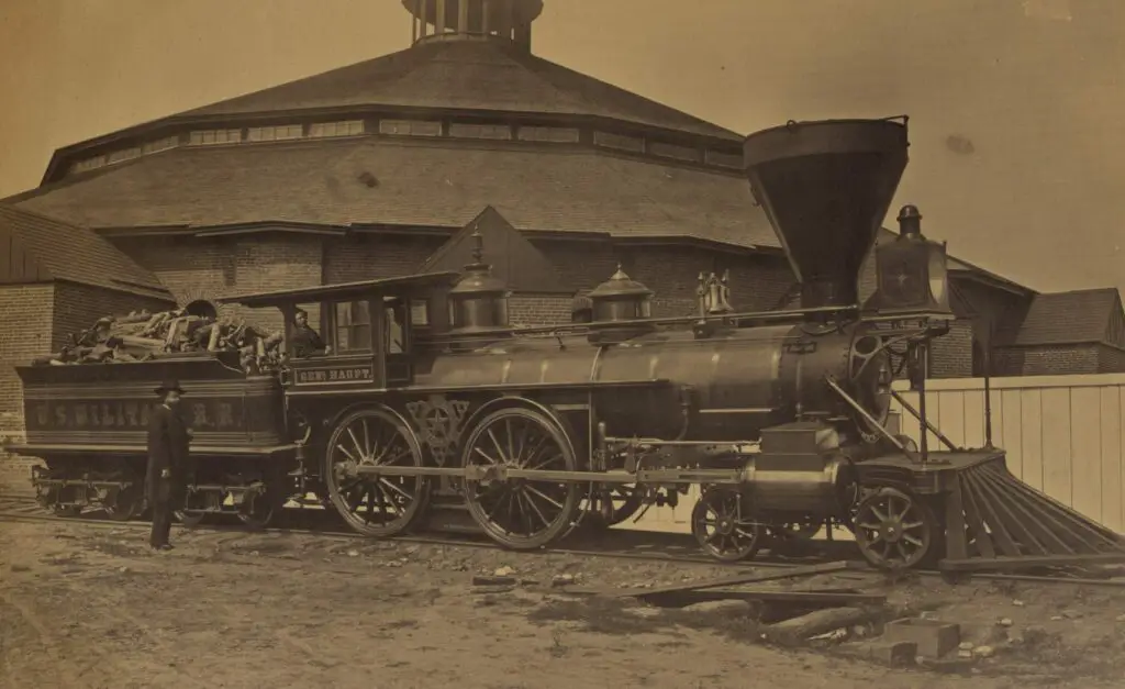
Take a look back in time with these beautiful photographs of the Alexandria Railroad Roundhouse during the Civil War. Click on the images for a larger, more detailed version. You won't be disappointed!
This is a sad story of a young man, John McCalip, who was drowned in the Potomac River in 1908, shortly before his wedding. Read more about his story and the tragedy that happened on the river.
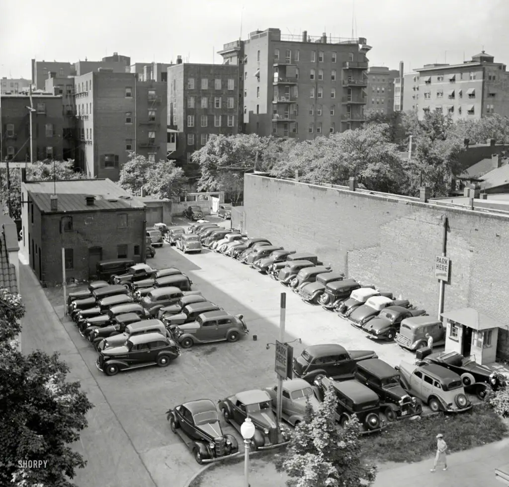
Hey GoDCers! Take a look at this photo from July 1937 of a parking lot in Washington, D.C. Think you know where it is? Share your thoughts in the comments below!
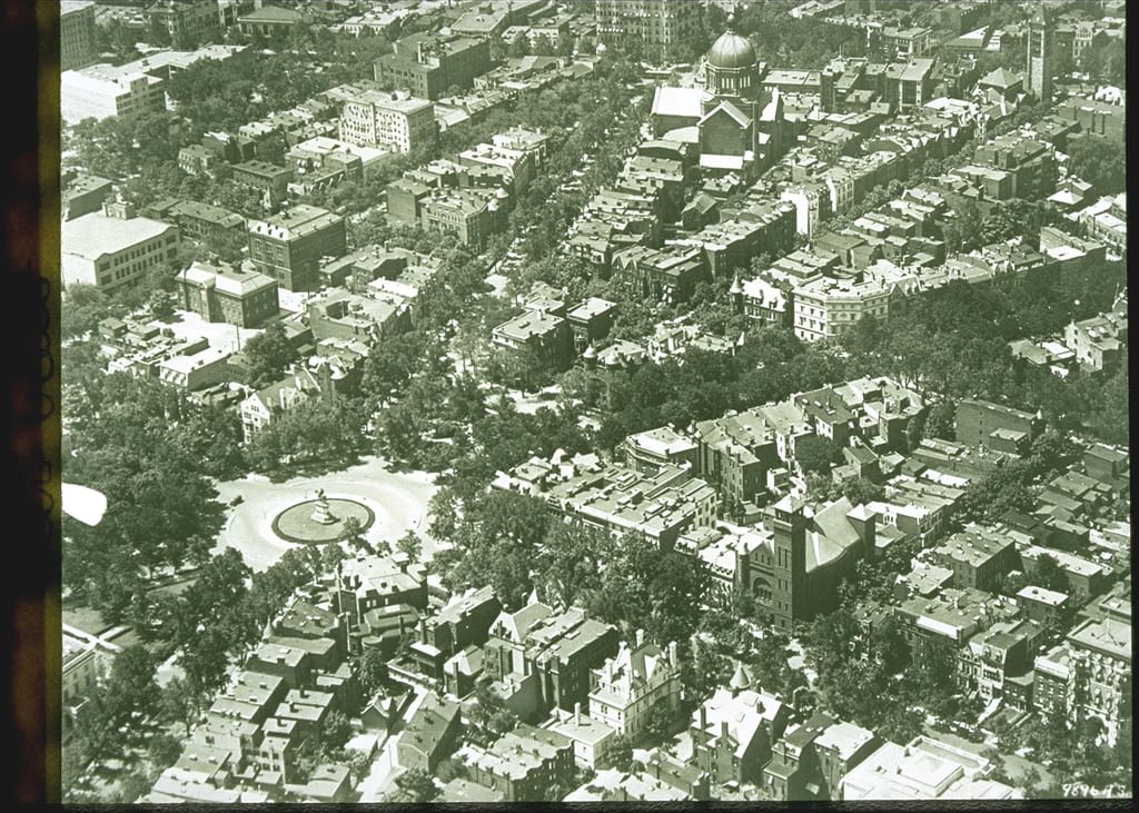
Take a journey through time and explore an old photo of Scott Circle from the Library of Congress. Learn more about the history of this area of Washington, DC and see what it looked like in the past.
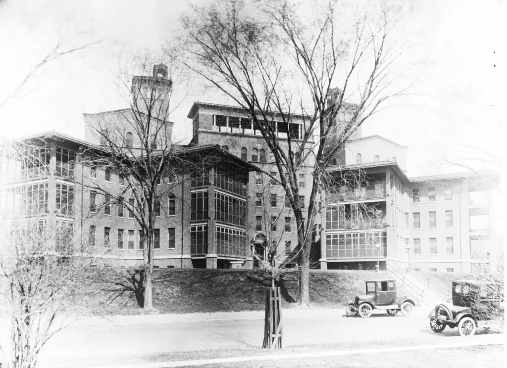
Take a look back in time and discover a photo of Columbia Hospital in Washington, DC, taken some time in the early 1920s. Courtesy of the Library of Congress.
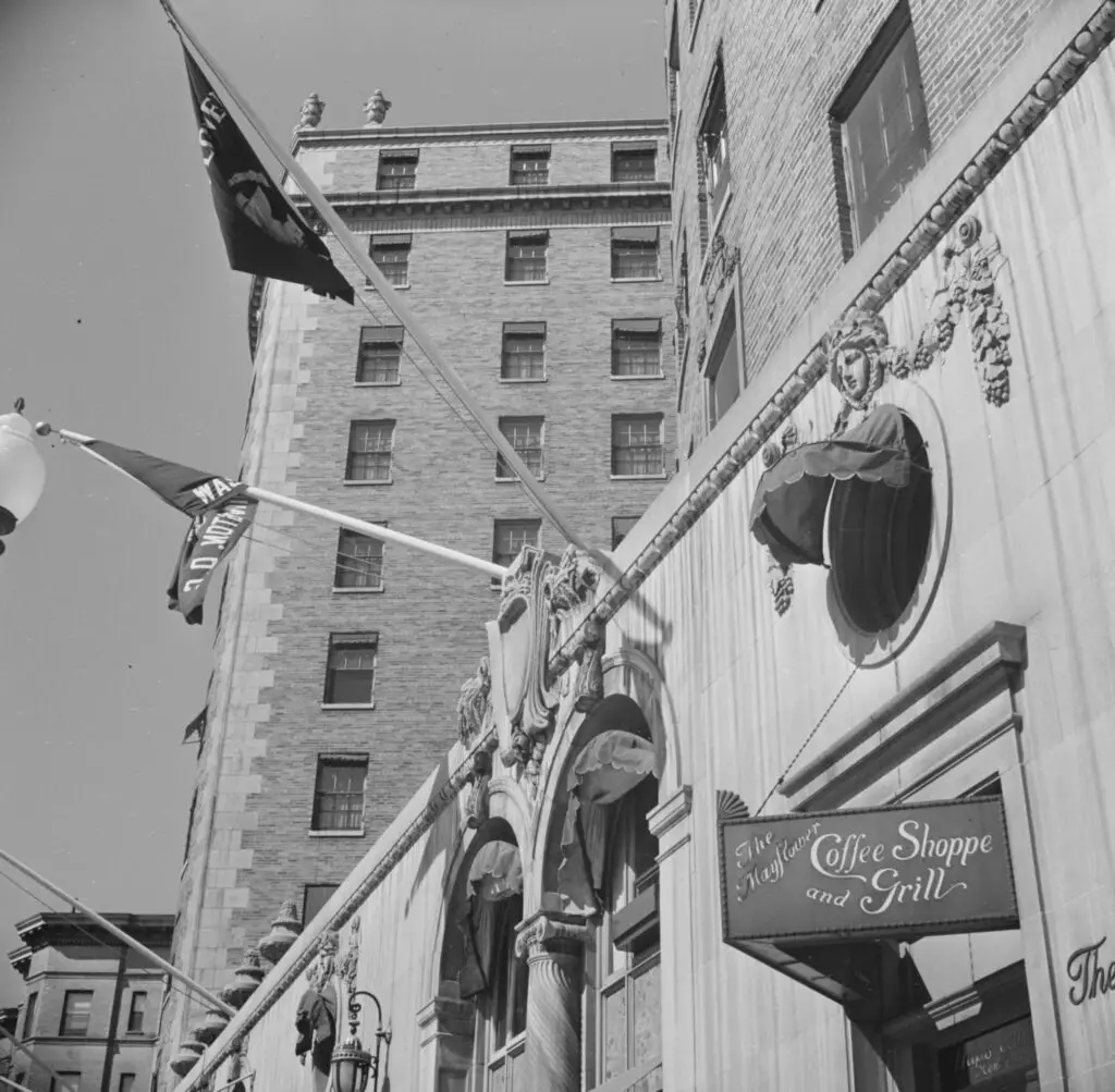
Take a look back at the 1930s Mayflower Coffee Shop and Grill in Washington, D.C., with a photo from the Library of Congress and an advertisement from The Washington Post.
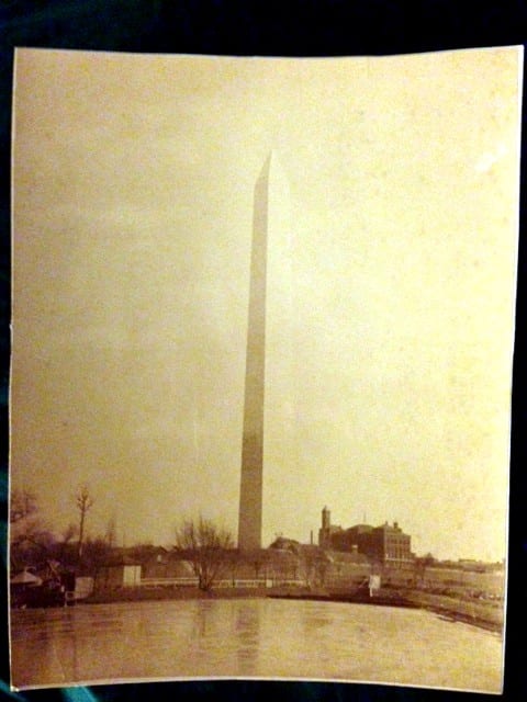
Can you help our community member Ken date this photo of the Washington Monument from the 1920s? He's guessing sometime in the 1920s but maybe someone out there can offer a more precise estimate.