How Sarah Josepha Hale Urged Abraham Lincoln to Establish a National Day of Thanksgiving
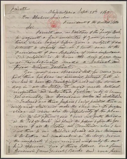
Learn how Sarah Josepha Hale wrote to Abraham Lincoln in 1863 and urged him to establish a national day of thanksgiving. Read the transcribed letter, Lincoln’s proclamation, and Obama’s 2013 Thanksgiving Proclamation.