Read the incredible story of Melvin Jones, five years old, who punctured his heart with scissors in 1925. Learn how his life was saved by a doctor and let this be a lesson to all children out there. Don't run with scissors!
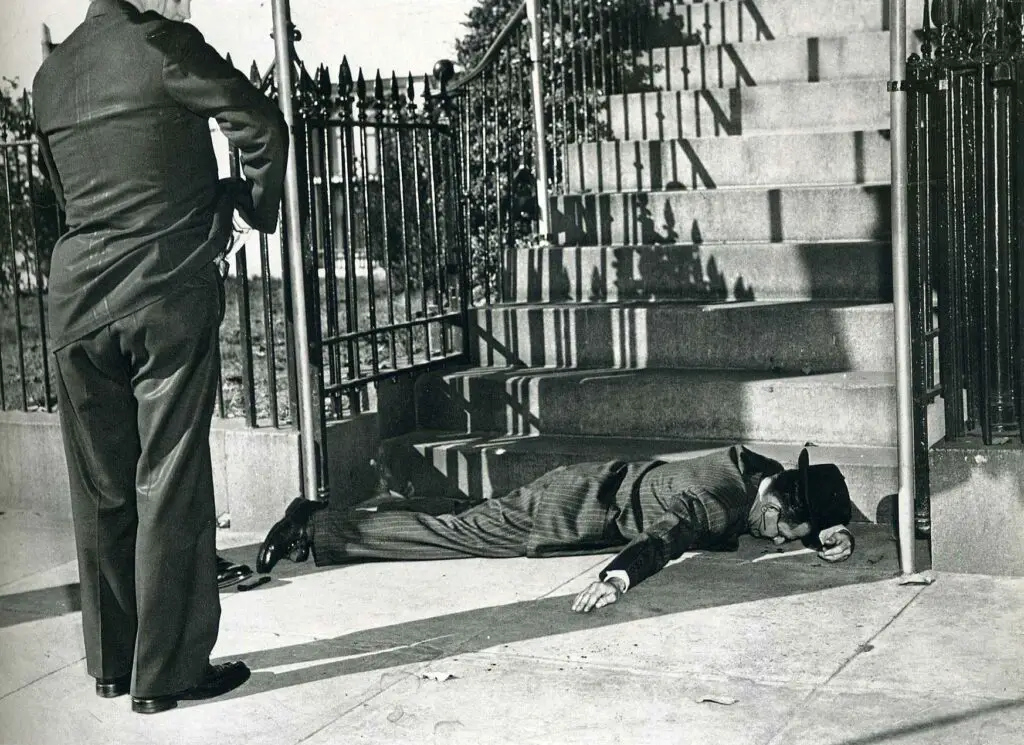
A brazen daylight assassination attempt against President Truman took place right on Pennsylvania Avenue with a shootout in front of Blair House. It was carried out by militant Puerto Rican pro-independence activists. White House Police officer Leslie Coffelt, was killed protecting the President.
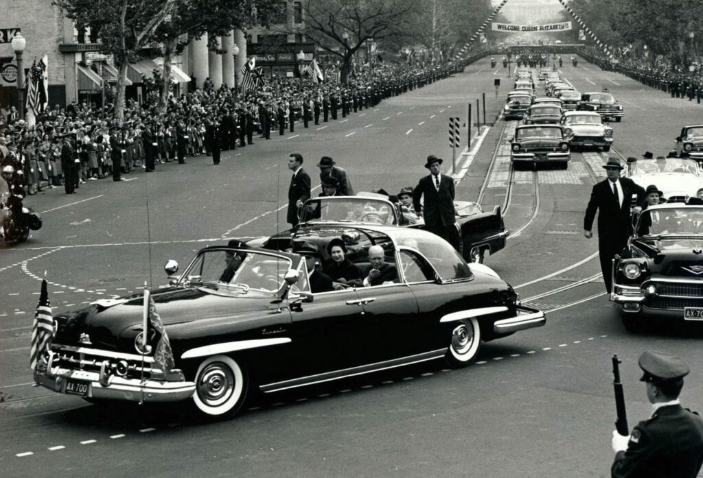
Relive a special moment in history with this wonderful old photo of President Eisenhower and Queen Elizabeth in a Lincoln Cosmopolitan in 1957. See the three photos taken that day here.
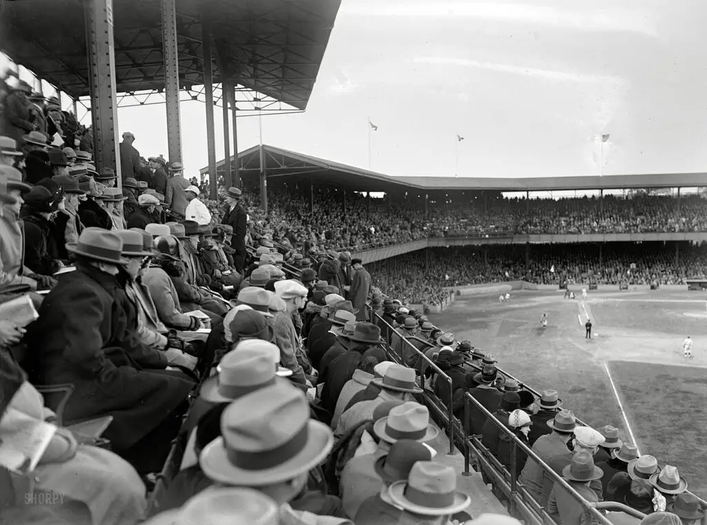
Take a look back at the 1925 World Series at Griffith Stadium with this photo and film footage. We were in the World Series that year, for the second year in a row. Unfortunately, we lost that year.
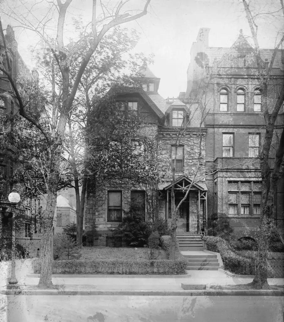
At 16th and K St. NW, there once sat a three story Victorian town home, the site of corrupt political dealings within the Harding administration, This is its story.
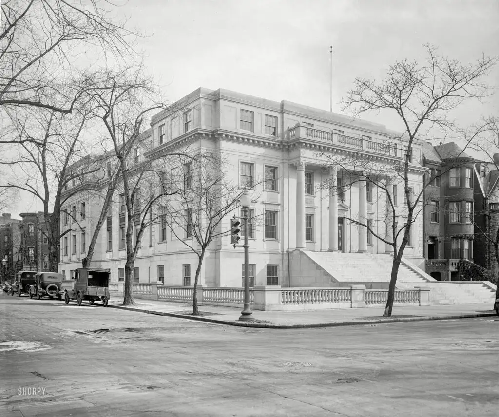
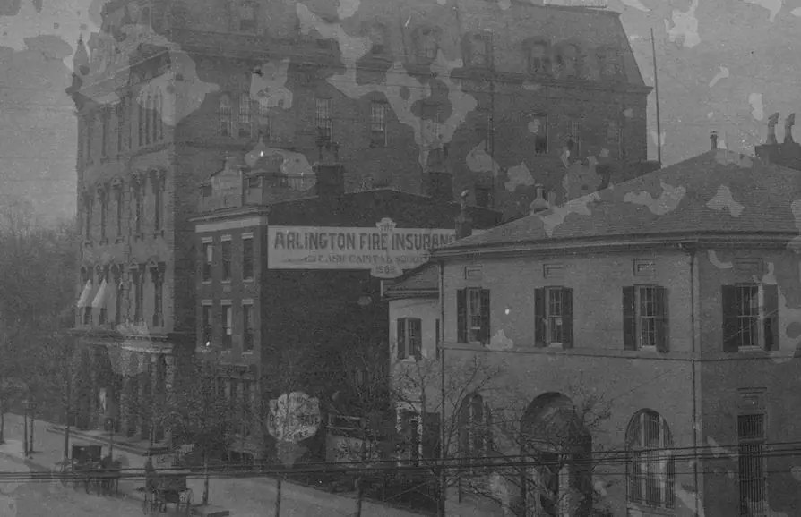
Take a look at this rare photograph of Riggs Bank and the Department of Justice in Washington, DC taken by Frances Benjamin Johnston. See the full image at the Library of Congress website.
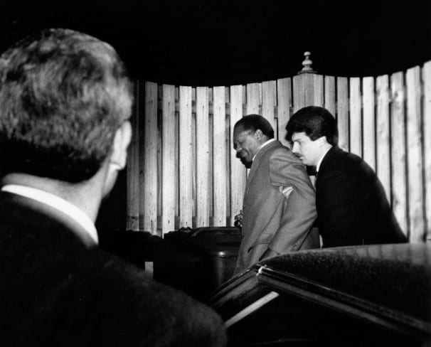
Sometimes the story behind the story is almost as sensational as the original news. Learn the amazing tale of Bill O'Leary and how he captured the infamous photo of Marion Barry in handcuffs outside his home in southeast DC.
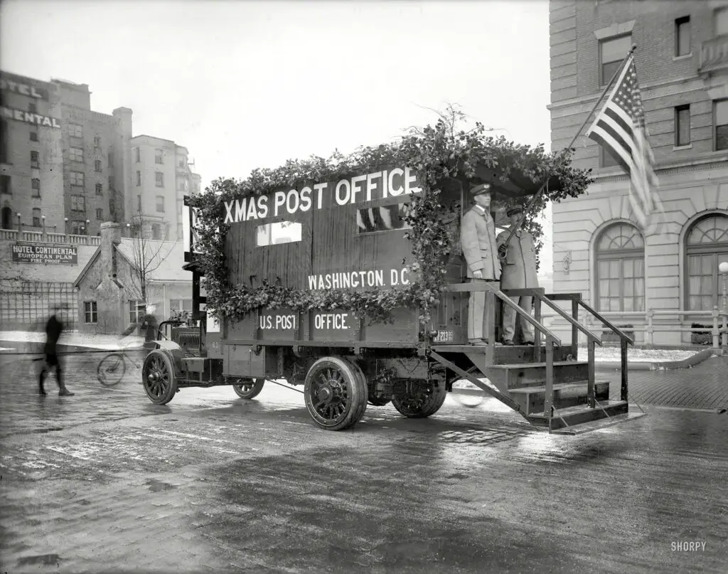
Check out this amazing old photo of a makeshift post office in Washington, DC, set up to handle overflow mail during the Christmas season in 1919. Deck the truck with boughs of holly!