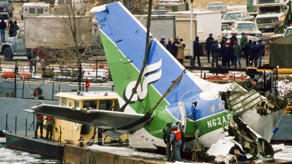
Explore the harrowing tale of Air Florida Flight 90's crash into the Potomac River during Washington D.C.'s 1982 blizzard. Uncover stories of tragedy, remarkable heroism, and the city's struggle amidst a day of unparalleled despair.
Take a journey back in time to 1964 with this photo of Rosslyn, DC, taken from Georgetown. Get a glimpse of what the city looked like over half a century ago.
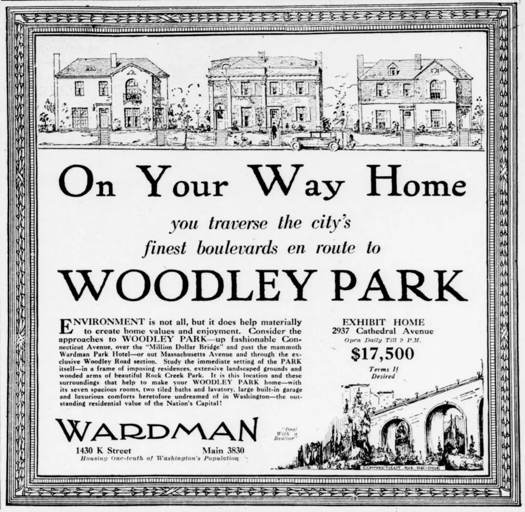
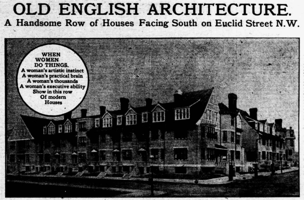
Harry Wardman was a prolific developer of Northwest in the 1920s. This ad from The Evening Star shows some of his homes on Cathedral Ave. in Woodley Park.
Take a look at an old building on 14th St. in Logan Circle, DC in 1942 and today. The US government froze sales of all new automobiles in January 1942, and this building was an automobile dealership at the time. See the photos and find out what's happening on the block today.
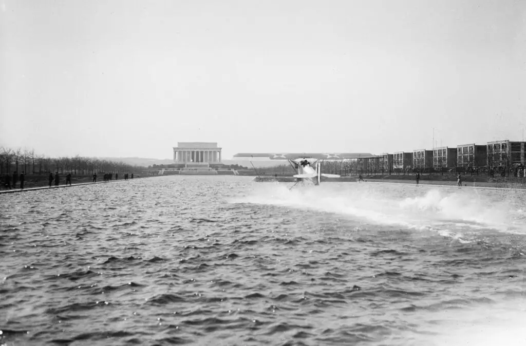
What an unbelievable photo from 1923! An amphibian aircraft sits on the reflecting pool in front of the Lincoln Memorial. See the amazing image and find out more about this unique and fascinating moment in history.
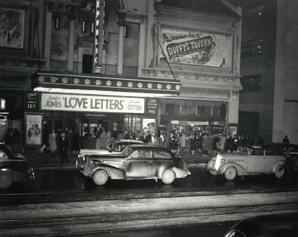
Take a look back at the Republic Theatre on the north side of the 1300 block of U St. Opened in 1921, it was unfortunately demolished in 1976 to make way for the new Metro. See a photo of the theater from 1945-46!
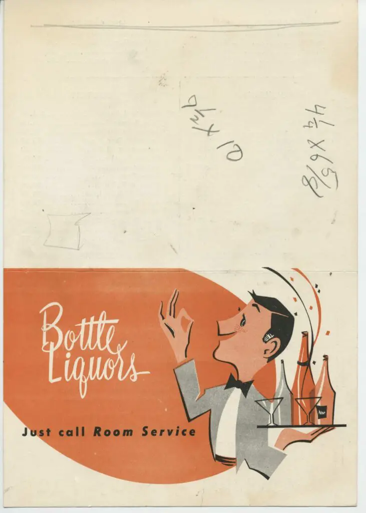
Uncovering a fascinating piece of DC history! Check out this old menu for the Willard Hotel's room service, dating back to the 1950s or 1960s. Learn more about this find at Discover DC History.
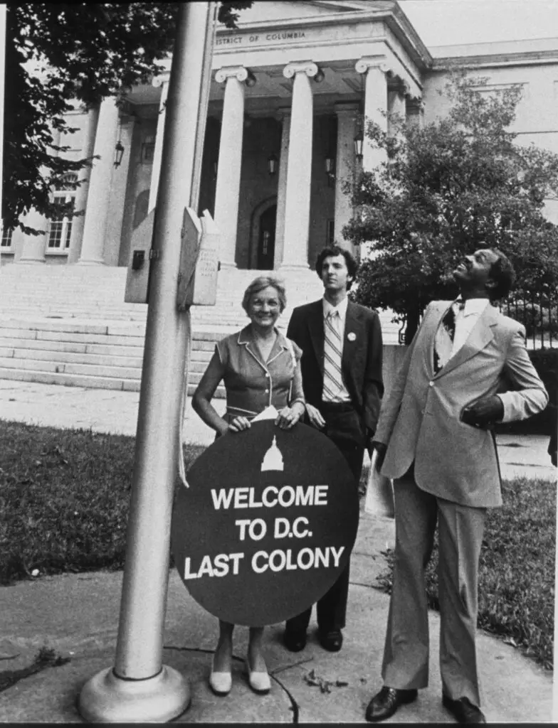
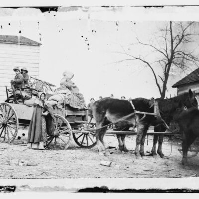
GoDCers, help solve the mystery! GoDCer Josh sent this photo in back in January and we're now getting around to posting it. Could you help identify the man in the middle? Add your comments below and help us solve the mystery!
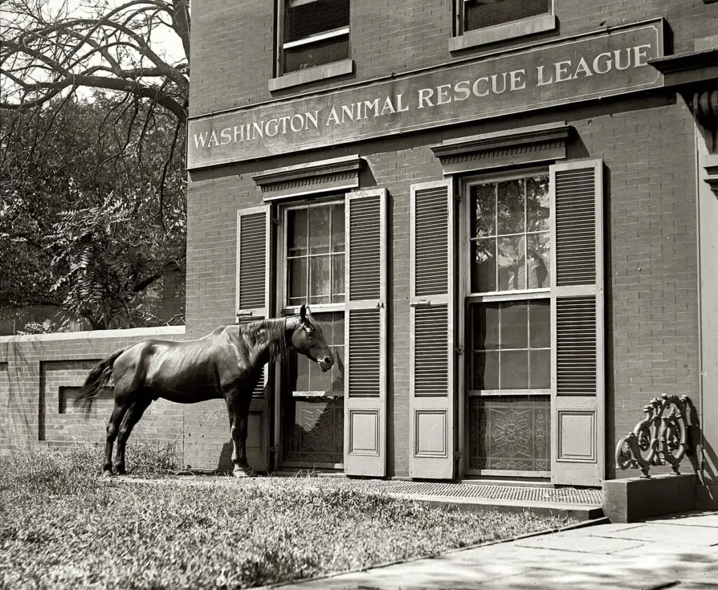
Learn about the Washington Animal Rescue League and how they have been helping animals for over 100 years. Learn how you can help with a donation today!
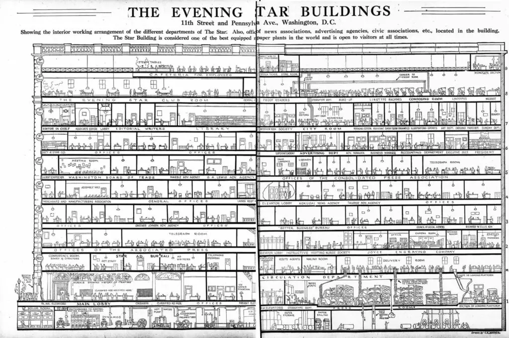
Check out this amazing cutaway drawing of the Evening Star Building at 11th and Pennsylvania Ave. NW. We posted a great photo of it some time ago, but this was something we had to share. The image was printed in the Evening Star on May 10th, 1922.
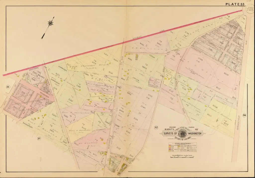
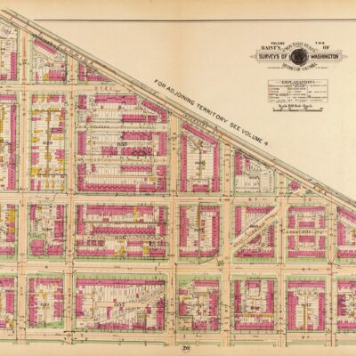
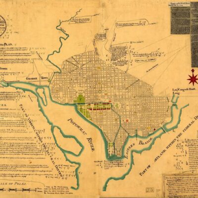
Explore a historic view of Chevy Chase, MD in 1907 with this map showing the area's rural landscape before development. It looks like the Shoemaker family owned quite a bit of land in the area back then.
Take a look at this photograph taken of the New York Avenue Presbyterian Church in Washington D.C. precisely at 10:55 a.m. Click for a larger, more detailed version.