dupontcircletunnels
Harrison Dyar: The Scientist Who Dug Secret Tunnels Under D.C.
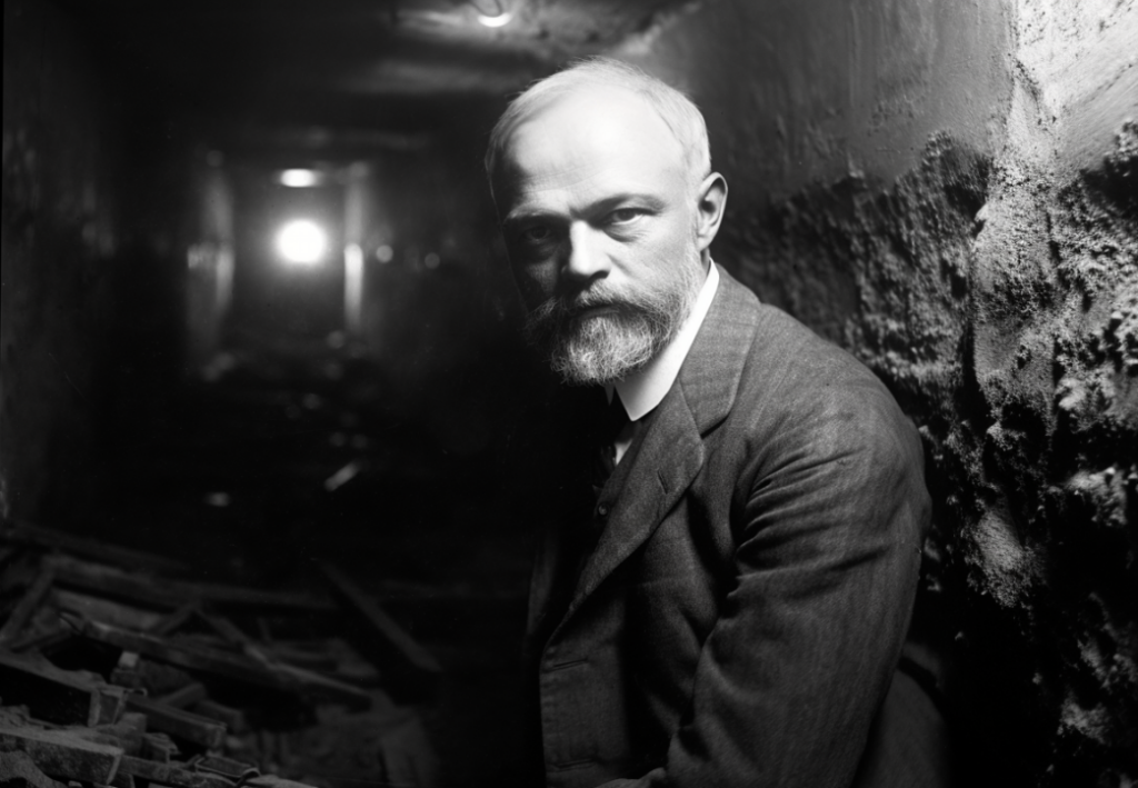
The peculiar tale of Harrison G. Dyar Jr., the brilliant entomologist who dug elaborate tunnels below Washington D.C. in secret for years until the underground network was accidentally exposed in 1924, sparking mystery.
Rosslyn City, the Brooklyn of Washington - 1889
Rosslyn City in 1889: The Vision of Becoming Washington's Brooklyn
Explore the 1889 ambition of Rosslyn City, touted as the "Brooklyn of Washington," and its emblematic journey of urban aspirations and challenges.
SHORPY-32438u
DCJCC in 1926
You're looking at a cool old photo from 1926, showing the DCJCC at 16th and Q St.
NASM-NASM-9A08196
Exploring the Aerial Views of National Airport in Arlington Before Pearl Harbor
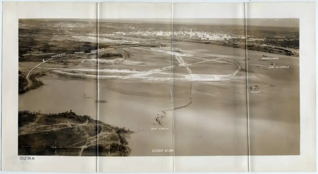
Explore the fascinating old image of the aerial view of National Airport in Arlington, Virginia before Pearl Harbor in 1941. Read more to discover this historic sight!
600 block of Independence Ave. SW in 1941
A Look at the Changing Landscape of Independence Ave. SW in DC
Take a look at the Federal Aviation Administration's headquarters on DC's Independence Ave. SW and compare it to what the block looked like in 1941 on the eve of World War II. See how the landscape has changed in this comparison.
Corner store at 4th and M Streets SW, northwest corner, looking up 4th Street toward L, 1100 block
A Look Back at Life in Southwest Washington in the 1950s
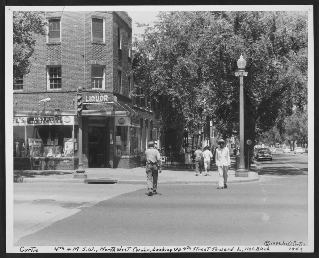
Take a look back at life in Southwest Washington in the 1950s with this photo of a corner store at 4th and M St. SW. See how the same corner looks today with a Google Maps embed.
Capito Dome under construction in 1860s
A Rare Look at the Capitol Dome Under Construction During the Civil War
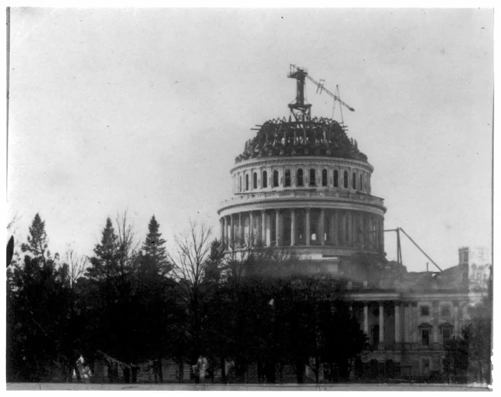
Take a look at this rare photo of the Capitol Dome under construction during the early days of the Civil War. View this amazing piece of American history captured in time.
1942. "Effect of gasoline shortage in Washington, D.C." Note the streetcar control tower. Photo by Albert Freeman, Office of War Information.
A Look Back: Washington D.C. During the 1942 Gas Shortage
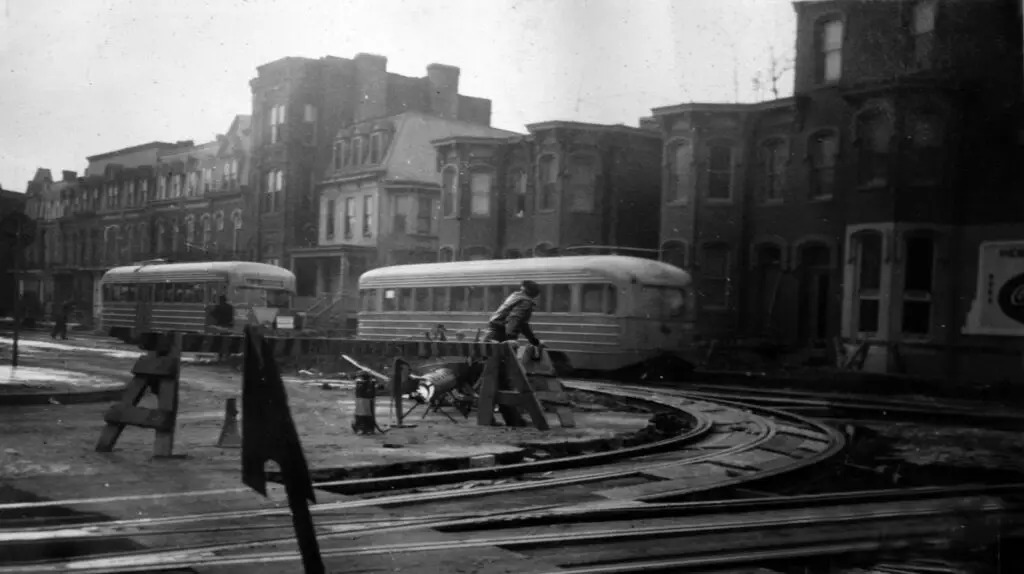
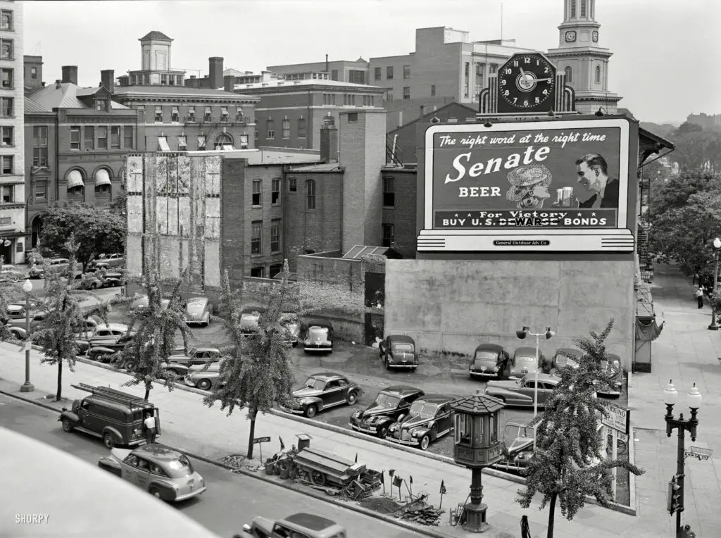
Explore a captivating 1942 photograph of Washington D.C. during a gasoline shortage, revealing the city's resilience and adaptation to wartime challenges through a focus on its streetcar control tower and altered transportation habits.
Who is the man in the middle?
Can GoDCers Help Us Identify the Man in the Middle? GoDCer Josh Sent This in Back in January
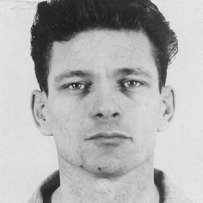
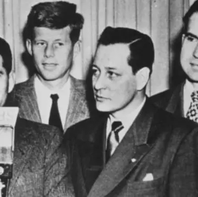
GoDCers, help solve the mystery! GoDCer Josh sent this photo in back in January and we're now getting around to posting it. Could you help identify the man in the middle? Add your comments below and help us solve the mystery!
AERIAL VIEW OF WEST/FRONT AND NORTH/SIDE FACADES, LOOKING SOUTHEAST (FROM LEFT TO RIGHT): VA-1272 Ball Building, 1437 N. Court House Road. VA-1273 Jesse Building, 1423-27 N. Court House Road. VA-1276 Jesse-Hosmer Building, 1419 N. Court House Road. VA-1275 Moncure (Adams, Porter, Radigan) Building, N. 1415 Court House Road. VA-1274 Rucker Building, N. 1403 Court House Road. - Lawyers' Row Block, North Court House Road between Fourteenth & Fifteenth Streets, Arlington, Arlington County, VA
A Trip Down Memory Lane - Exploring the "Lawyers' Row Block" in Arlington from the Early 1990s
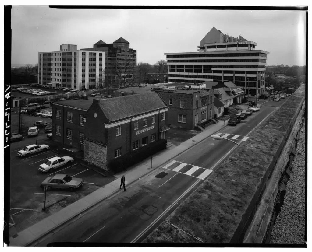
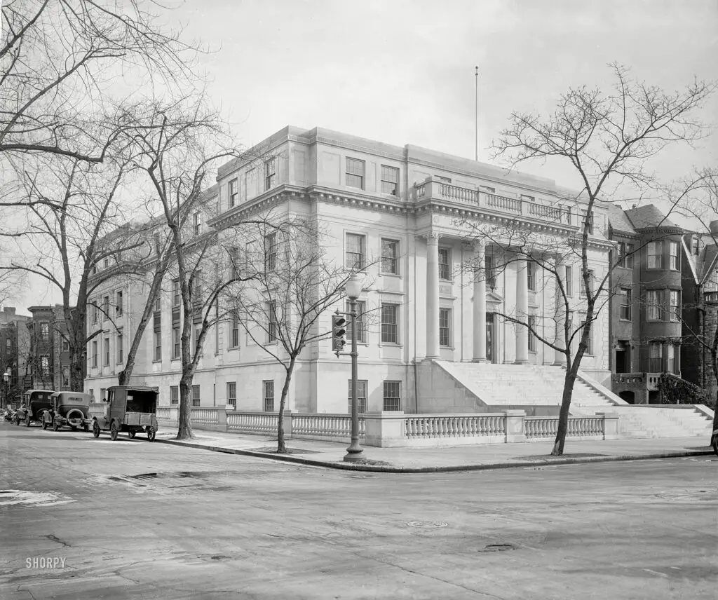
Take a virtual trip down memory lane and explore the "Lawyers' Row Block" in Arlington during the early 1990s. See how this area has changed from then to now with a comparison of images from the Library of Congress and Google Street View.
Interior view of Center Market showing the interior architecture of the market, a variety of stalls, blurred people, and signs reading "THIS MARKET OPEN EVERY WEEK DAY" and "LADIES' WAITING ROOM LADIES'... 7th St. WING TAKE ELEVATOR."
Exploring Center Market in Washington DC in 1910, Just Before the Mexican Revolution
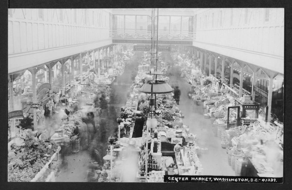
Take a look back in time to explore Center Market in Washington DC in 1910, just before the Mexican Revolution. See the interior architecture, stalls, and signs from over 100 years ago.
aerial view of Washington National and the Pentagon
Exploring Arlington: Aerial Photos of Washington National and the Pentagon, and Spout Run near Lee Highway and Dead Man's Hollow
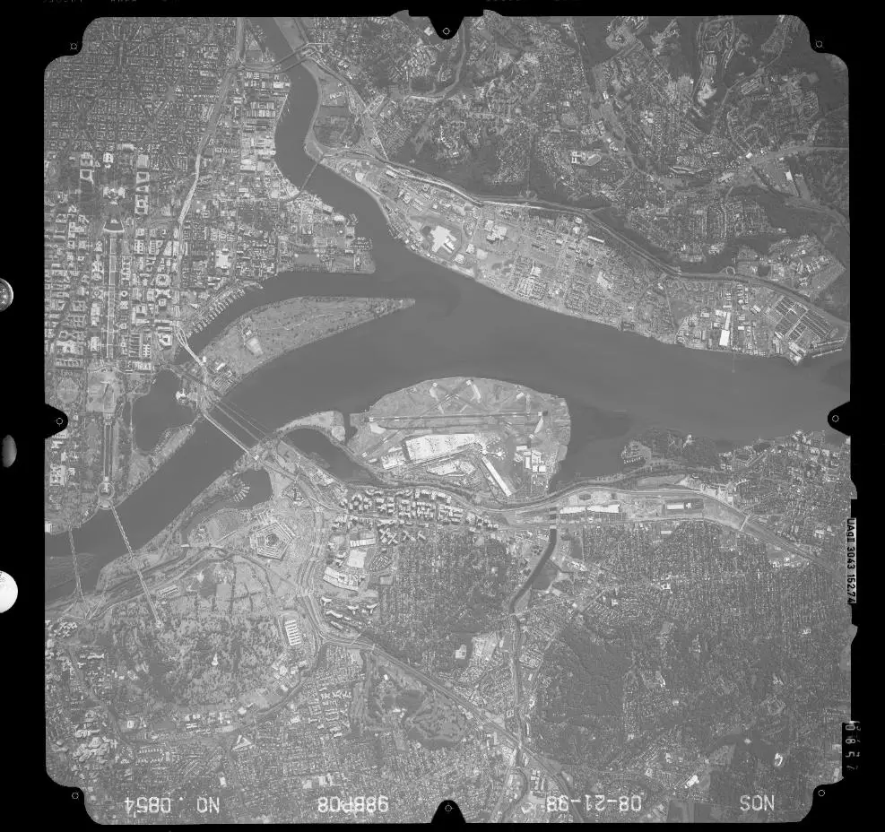
Explore Arlington, VA with two great photos sent in by GoDCer Ken. The first is an aerial photo around Washington National and the Pentagon. The second is Spout Run near Lee Highway and Dead Man's Hollow.
Maine Ave. SW 1865
A Look at Maine Ave. SW in 1865, Right Around the Time of President Lincoln's Assassination
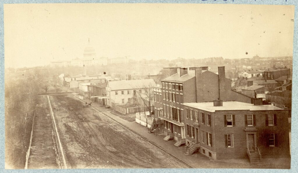
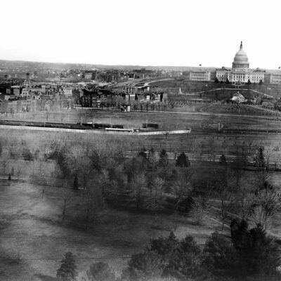
This photograph was taken in April 1865, right around the time of President Lincoln's assassination. You can see the unpaved roads of Maine Ave, SW and the Capitol Building in the background. Compare this to the view today via Google Street View!
Heurich Beer in the 1950s
The Trouble Two Teenagers Got Into in Chevy Chase in 1951
Discover the trouble two teenagers got into in Chevy Chase, Maryland in 1951. Read this article to find out more about the FBI and Montgomery County Police's involvement and the consequences of their actions.
"Past and present in locomotives. Eckington Yards, June 4, 1923." A closeup of the locomotive in the Baltimore & Ohio rail yard during the Masonic convention in Washington, D.C. The big engine wears the livery of "Boumi Temple," a Baltimore Shrine lodge. 5x7 glass negative.
Exploring the History of Washington D.C.'s Eckington Rail Yard
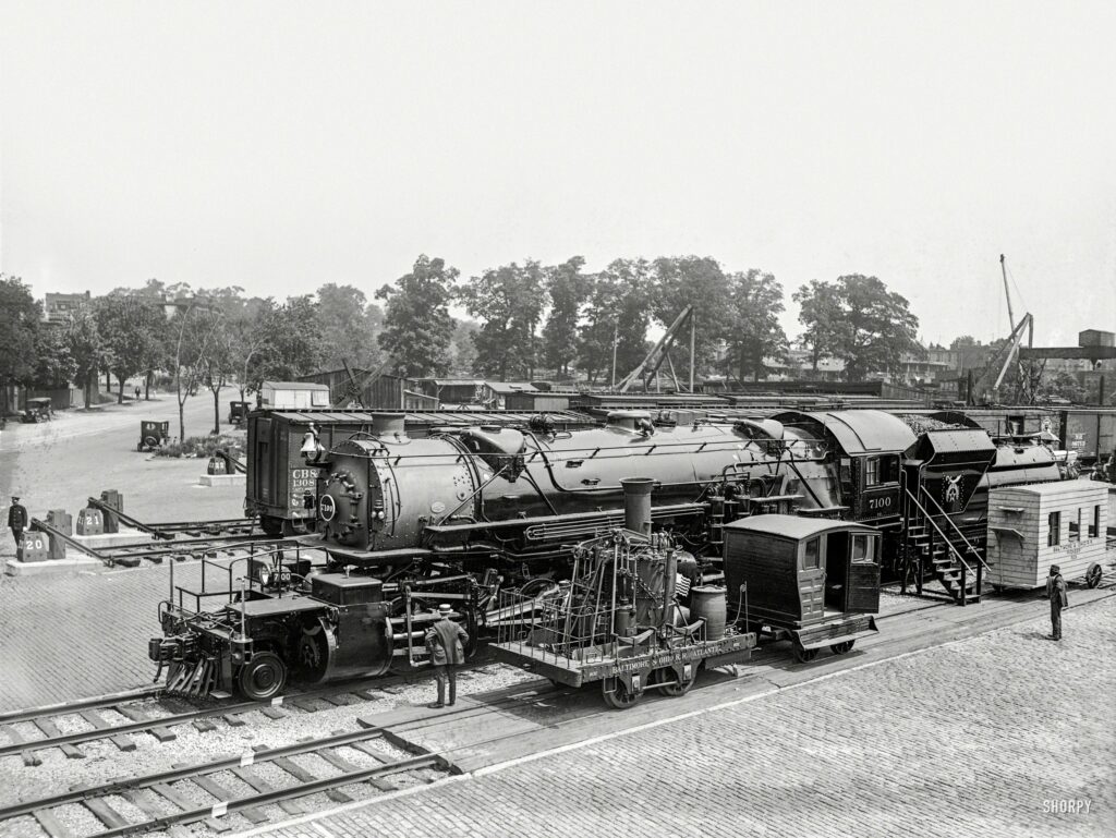
Take a look back at the history of Washington D.C.'s Eckington Rail Yard with rare photos from the 1920s, a map from 1919, and a modern comparison to the FedEx shipping center at the intersection of New York Ave. and Florida Ave.

Enjoy daily

Ghosts of DC stories.