
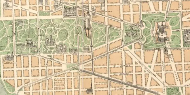
If you were heading to the nation’s capital in 1892 (not for the World’s Fair of course), a map like this would have been extremely helpful. Even now, though the streets are logically laid out in letters and numbers, people seem to be utterly confused by the diagonal state streets.
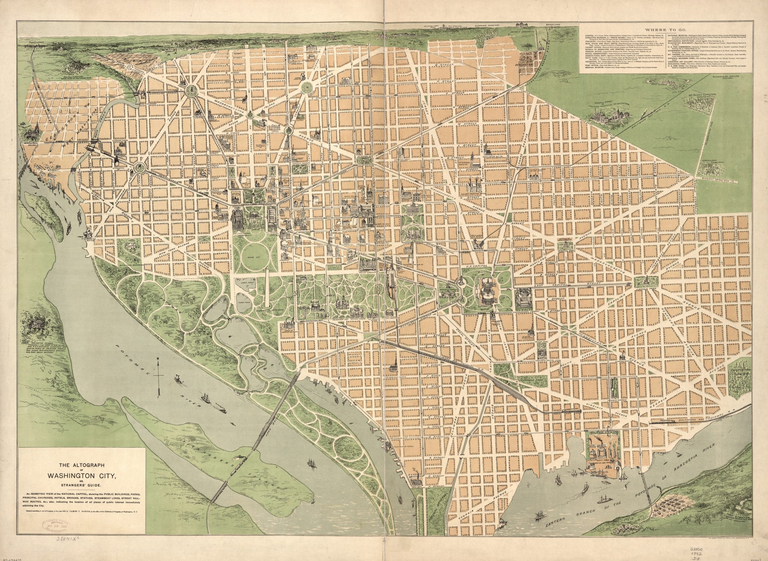
Source: Library of Congress
Click on the map for greater detail.
So was Logan Circle in a different location before they maybe Iowa Circle the new Logan Circle?
Iowa Circle was renamed (1930) in honor of John Logan who fought in the Civil War and was later Representative and Senator from Illinois who lived on the circle.
I should add that it seems in 1892 Sheridan Circle may have also named Logan at some point. But I don’t know if it was the same Logan or when all the changes were made.
Are those loops along the curbs supposed to represent trees? Like that the Bladensburg Duelling Grounds warrant a label, and what’s the Racetrack near Ivy city? Surely that’s not the wooden oval at Laurel (http://www.shorpy.com/node/6440)?
I’m sure the residents of Georgetown weren’t too happy that this map also referred to their town as “West Washington”
I love the bus route of the G8 continues unchanged to date!